4.1 Introduction
Nagpur district covers an area of 9,892 km2 which constitutes about 3.22 percent of the total area of the state of Maharashtra. Previously, the district was divided into five distinct areas, headquarters of which were located at Nagpur, Katol, Saoner, Ramtek and Umred. In May, 1981 the district was re-organised into fourteen different tehsils.
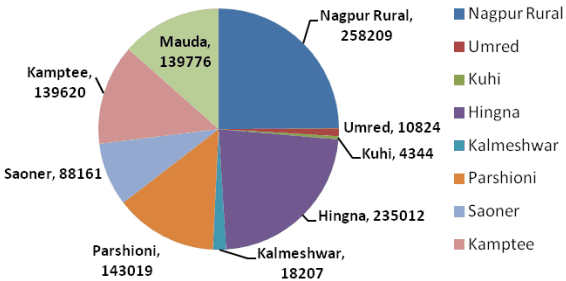
The NMA covers about 36 percent of the Nagpur District (9,892 km2) comprises of 726 villages under 9 tehsils (5 full tehsils – Nagpur Rural, Hingna, Kamptee, Parshioni, Mauda and 4 part tehsils – Saoner, Umred, Kalmeshwar and Kuhi). There are about 24 Census Towns in the NMA located in Hingna, Nagpur rural, Parshioni, Saoner, Mauda and Kamptee tehsils.