Chapter 2Introduction to the Nagpur Metropolitan Area
2.1 Project Area
2.1.1 Boundary and Extents
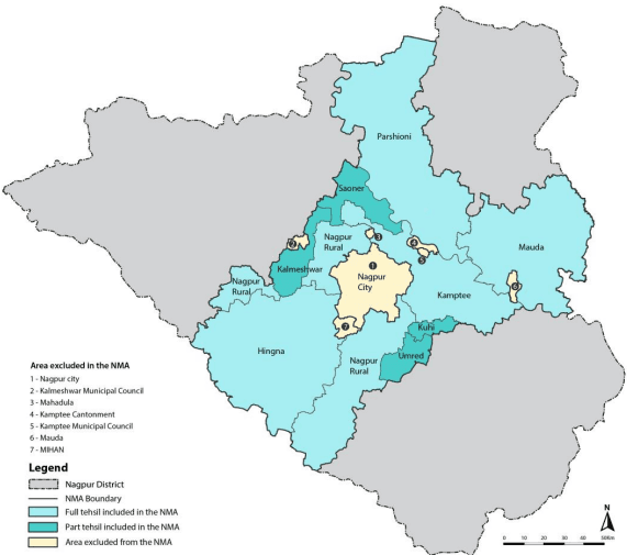
The Nagpur Metropolitan Area was notified on 2 3 r d July 1999. As per State government notification 726 villages were included in the NMA notified area1 under 9 tehsils (5 full tehsils – Nagpur Rural, Hingna, Kamptee, Parshioni, Mauda and 4 part tehsils – Saoner, Umred, Kalmeshwar and Kuhi), comprising of 726 villages of the Nagpur District. The total area as per the State Government notification is 3,577.70 km.
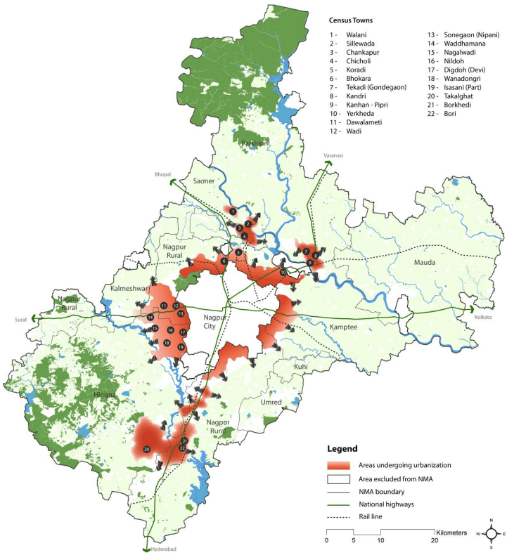
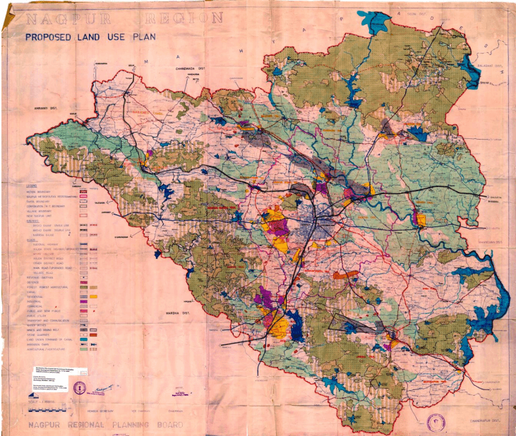
The NMA covers about 36 percent of the Nagpur District (9,892 km2) and is adjoined by Amravati and Wardha districts on the west, Bhandara District on the east and Chhinwada and Balaghat districts of Madhya Pradesh on its north-west. Figure- 2-1 illustrates the boundary and extents of the NMA.
Figure- 2-1 : Boundary and extents of the NMA
1 Government notification TPS 1699/1191/CR/80-99/UD-13, dated July 23, 1999
2-1
The areas managed by other planning authorities are excluded from the NMA area and are listed below:
Nagpur City area under Nagpur Municipal Corporation (NMC)
Multi-modal International Cargo Hub and Airport (MIHAN), for which Maharashtra Airport Development Company (MADC) is the planning authority
Industrial areas for which Maharashtra Industrial Development Corporation (MIDC) is the planning authority
Kamptee Cantonment area
Kamptee Town, for which Kamptee Municipal Council is the planning authority
Kalmeshwar Town, for which Kalmeshwar Municipal Council is the planning authority
2.1.2 Changes to the Extents and Area Notified as the NMA
Pursuant to the declaration of the NMA in 1999 the State Government issued another notification announcing changes to the boundary of the NMA notified area2. This was due to expansion of the notified area of NMC to include four villages Hudkeshwar Bhudruk and Narsala of the Nagpur Rural Tehsil; and upgrading villages Mauda of Mauda Tehsil and Mahadula of Kamptee Tehsil as Mauda Nagar Panchayat and Mahadula Nagar Panchayat respectively.
Furthermore, based on updated revenue information and latest village maps it was found that Kanhan and Pipri are not two separate villages but one single village with name Kanhan-Pipri (Parshioni Tehsil). Similarly, Warambha and Mahulvapi are not two separate villages but one single village with name Warambha (Kamptee Tehsil). On the other hand, Matkazari village of Umred Tehsil was divided into two separate villages of Matkazari and Kachimet.
The number of villages included the NMA have thus reduced from to 726 from 721. Hereafter all references to the total number of villages will be made to reflect this change. A list of these villages is given in Annexure 2.
The combined area of the 721 villages in the NMA amounts to 3,567.37 km2. This means that there is a difference of about 10 km2in the area given in the government notification and area as per the base map. Hereafter all references to the area will be made to reflect the actual measured area of the base map mentioned above. Description of the method and processes employed for carrying out the base mapping exercise is given in Chapter 6, 6.2 of this report. Table 2-1 gives the number of villages in tehsils of the NMA.
Table 2-1Revised number of villages in tehsils included in the NMA
Number of
Area of Tehsil
% area of Tehsil
S. No.
Tehsil
Villages
(km<sup>2</sup>)
in NMA
1
Parshioni
127
762.25
21%
2
Hingna
164
641.07
18%
3
Nagpur (Rural)
162
393.52
11%
4
Mauda
123
815.19
23%
2 Government notification TPS 2413/405/CR-213/2013/UD-9, dated October 14, 2013
2-2
5
Kamptee
77
617.24
17%
6
Saoner (Part)
27
125.1
4%
7
Kalmeshwar (Part)
21
103.1
3%
8
Umred (Part)
13
75.1
2%
9
Kuhi (Part)
7
34.8
1%
Total
721
3567.37
100%
2.2Location and Regional Setting
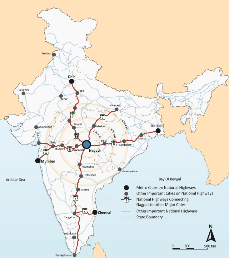
The NMA is located between the North Latitudes 20° 45’26”N and 21° 39’37”N and East Longitudes 78°41’16”E and 79°34’38”E, in eastern Maharashtra (see ).
Nagpur is one of the largest cities in central India and the third largest city in Maharashtra after Mumbai and Pune. It is also the winter capital of the state of Maharashtra. With a district population of over 4.6 million (as per Census 2011), it is the ninth largest urban agglomeration in India. Nagpur has historically been a major commercial and political centre of Vidarbha Region and continues to be so even today. Its location as the geographical centre of the country is physically established by the Zero Mile Marker. This geographic significance of the city endows it with huge logistics related potential.
2-3
Figure 2-2 : Regional setting
2-4
2.3History of Evolution of the Metropolis
2.3.1 Overview
The overall Nagpur region is rich in illustrations of dynamic history and economic development. It is the aim here to take the physical and historical records to illustrate the interrelationships between economic development, social changes and the physical environment in the evolution of the overall metropolis.
The NMA includes peri-urban areas of Nagpur city, industrial suburbs of Hingna and Butibori, and the surrounding rural villages. The City of Nagpur, although a separate jurisdiction in terms of planning and development activities, is the main urban centre and the economic and cultural magnet for all the communities of the NMA. In order to obtain a holistic view of the evolution of the metropolitan area it is vital to gain insight into the sequence of development of Nagpur spanning across the past three centuries. This chapter provides a brief chronicle of the history of development of Nagpur City and the urban growth of the suburban communities which are now the primary growth areas of the NMA.
2.3.6Organised Industrial Development Activity and Growth around City Limits
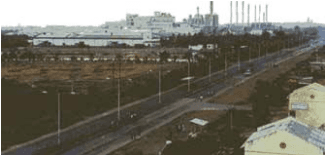
The site for the first MIDC industrial estate in Nagpur was identified between Howrah-Bombay national highway and Nagpur-Hingna road in the western outskirts (about 14 km) of the Nagpur city. The site abutted the existing Ordnance Factory. This industrial area which primarily houses engineering units was established in 1962. Following this several industrial units sprang up on the Nagpur-Hingna road outside the MIDC industrial estate and so did residential development supporting the worker community of Hingna. The villages around MIDC Hingna are some of the most densely populated within the NMA at present.
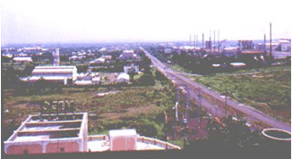
The MIDC operates six ‘five star industrial estates’ in Maharashtra, of which one is located at Butibori in Nagpur Rural tehsil. At the time of its establishment in 1992, this was one of the largest industrial areas in Asia. The industrial development in Butibori has triggered growth within the surrounding villages in the past two decades.
The importance of Nagpur as the geographical centre of India, with major highways passing through the city has influenced the development of logistics industry. The Multi‐modal International Cargo Hub and Airport (MIHAN) project undertaken by the GoM in 2002, symbolises the potential of this area in the logistics sector. This development which is currently partly operational covers a total area of about 4,354 hectare on the southern boundary of Nagpur City. While the extents of MIHAN are under purview of a separate planning authority MADC, substantial real estate development activity is being generated in areas surrounding it which are part of the NMA.
Hingna MIDC area (Source: Nagpur District Gazeteer)
Butibori Industrial Estate (Source: Nagpur District Gazeteer)
2.3.4Development of the Modern City and Establishment of NIT – Colonial Period
With its growing significance as logistical centre and as the capital of the Central and Berar Province, the British planned systematic expansion of the City. With the aim to execute and manage new development schemes for the needs of the growing population, the NIT was established in 1937 through the NIT Act, 1936.
Sir Pattrick Geddes, who was also engaged earlier to provide planning consultancy for Bombay, and S.V Lancaster were commissioned for preparing a plan for Nagpur as a ‘garden city’. The plan provided for a controlled expansion of Nagpur. For a city divided by railway lines, the plan provided a city centre each for the areas east and west of the railway. Mahal area, situated on the east of the rail line was retained as a commercial centre for the old city and a new centre was built on the western side for the newly planned areas, thus resulting in Nagpur being referred to as ‘twin city’ during the colonial period. Central Avenue road was the key transport connection between the old and new areas. Variety Square was the junction of east, west, north and south trunk routes and was also an important point connecting the eastern and western parts of the ‘twin city’. In 1939 the Civil Station Expansion Scheme which spread over 1200 hectare (3,000 acres) was the first layout sanctioned for execution by the NIT.
Industrial growth during this period included agro, ginning and pressing units, and timber processing units drawing raw materials from the surrounding districts of the Central and Berar province and other surrounding provinces. In the 1931 Census, over 1,900 ginning and pressing units were present within the City alone. Agroprocessing units sourced the produce grown in parts of Nagpur district and nearby districts of present Madhya Pradesh. The saw mills and furniture units attracted timber from Chandrapur and Bhandara districts and parts of Madhya Pradesh. Nagpur thus served as a regional economic centre in central India. Figure 2-4 illustrates spatial growth of Nagpur from the 17th century up to colonial period.
2.3.2Genesis of Nagpur – Pre-colonial Period
In the year 1702, the Gond king ‘Bakht Buland Shah’ found Nagpur by joining 12 villages on the banks of the river Nag, formerly known as Rajapur Barasa or Barasa.
In the year 1706, the very first efforts to employ systematic town planning for Nagpur were carried out by Chand Sultan, son of Bakht Buland Shah. With a view to move the capital of his kingdom from Deogarh to Nagpur, Chand Sultan constructed the ‘Killa Palace’ fortified with a wall of about 3 km in circumference. This area became the central core to be eventually known as the old city precinct or ‘Mahal’. The natural water reservoirs such as the Telangkhedi Lake, Ambazari Lake were developed for water storage along with recreational spaces such as the Telangkhedi garden and Maharajbaug. (Nagpur District Gazetteer)
After the death of Chand Sultan the city was subsequently ruled by the Marathas for a brief period. Under Maratha rule, the Mahal area was further strengthened as a commercial/trade centre which expanded to include the Itwari area. Sitabuldi Fort was constructed at the outskirts of the fortified city. Multiple tanks, reservoirs and gardens were also constructed in and around the market town, one of them being Shukrawari Talav to manage water supply in such hot and dry climate.
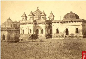
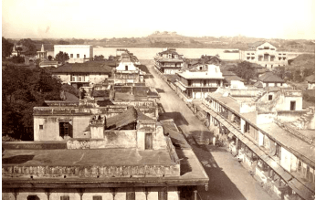
Mahal Area, Source: British Library
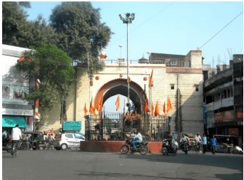
Gandhi Gate in Mahal area (2013), Source: Halcrow
2-5
2.3.5Centre for Defence and Industries - Post-independence Period
After independence, the Central Province was named as Madhya Pradesh with Nagpur as its capital. Since the reorganisation of states in 1956, the city became part of Maharashtra and is referred as the second capital of the state.
Nagpur’s significance with regard to defence establishments in the pre-independence period has continued thereafter. While Sitabuldi fort is headquarters of Indian Army’s 118th battalion, Nagpur also serves as the headquarters of the Indian Air Force Maintenance Command and is home to the Gajraj transport planes of the Indian Air Force. The Indian Army ordinance factory is also located in the City. Kamptee Cantonment, apart from serving as a centre for Indian Army’s Brigade, houses training school for cadets, the Institute of Military Law and other institutes such as the National Civil Defence College.
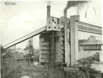
The post-Independence period witnessed substantial industrialisation. The MIDC decided to establish an industrial area in Nagpur in the year of its inception (1962). This was recognition of Nagpur’s position as a regional hub. Major initiatives to tap the mineral resources in Vidarbha were also taken in the post-independence period. The Khaparkheda thermal power station, established in 1950, is the oldest state owned thermal power station and one of the earliest power stations in India. Western Coal Fields Ltd was established in 1956 with an aim to utilize the availability of ample coal reserves around Nagpur. Thereafter in 1964, another thermal power station was established in Koradi situated on the northern outskirts of the City. The Ordnance Factory at Ambazari was established on the western outskirts around year 1966. This period thus marked the beginning of medium to large scale organised industrial development in and around Nagpur. Figure 2-5 illustrates the spatial growth of the City in the post-independence period.
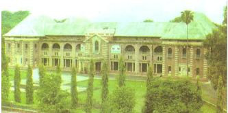
Vidhan Bhavan, (old building) Nagpur (Source: Nagpur District Gazeteer)
2.3.7Census Towns and Growing Urban Areas in the NMA
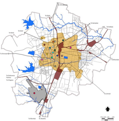
There are about 24 Census Towns5in the NMA located in Hingna, Nagpur rural, Parshioni, Saoner, Mauda and Kamptee tehsils. These towns are generally located along the fringe areas on the north and west of Nagpur city and have witnessed the pressures of urbanization in the recent years. It is important to note that while these towns primarily support residential areas, development has also taken place beyond their limits as illustrated in Figure 2-6.
As described earlier, past few decades have seen several initiatives for industrial development in areas surrounding Nagpur. The two large MIDC industrial estates in Hingna and Butibori have triggered urban development in the south and west of Nagpur city along NH-6 and NH-7. The relatively recent development of MIHAN has spawned a number of residential and commercial projects south of the city on NH-7. Some growth is also observed towards north-east between the City and Kamptee town. Construction of the Outer Ring Road has aided the prospects for new developments to be located on all sides of the city.
Broadly it is observed that the employment hubs of Hingna in the west and MIHAN and Butibori in the south influence the overall spread of urbanization in the NMA towards the southern and western corridors. In particular certain areas in the south and west have witnessed substantial growth in the past few years. These include Besa Beltarodi, Kapsi Khurd and Waddhamna.
2.3.8Forests and rural farmlands
A significant portion of the NMA is under protected and reserved forests (about 15 percent) which includes parts of two protected areas – Pench National Park in the north and Bor Wildlife Sanctuary in the southwest. The growing pressures of urbanization poses significant threat on the rich biodiversity of the area.
Over 65 percent land in the NMA undergoes farming activities and a large proportion of farmlands especially in the north eastern part fall under irrigation command areas. The data on Non Agricultural Permissions granted in the past decade indicates that large tracts of agricultural land are being rapidly converted to urban uses. This indicates that there is an urgent need to manage future growth in a manner that is not detrimental to rich natural heritage of the NMA.
5 As defined by the Census of India, Census Towns are areas which have minimum population of 5,000, atleast 75 percent of the male population engaged in non-agricultural pursuits and density of population of atleast 400 persons/km2.
2-13
Figure 2-6 : Census towns and growing urban areas in the NMA
2-14
2.4Past Planning Efforts
2.4.1 Overview
The areas within the present NMA have undergone planning activities in the past, the most crucial being the District Regional Plan 1991-2011 which demarcated specific future growth centres. Prior to this, a Regional Plan (1971-1991) was prepared for an area of about 10 km outside the city limits. An overview of these plans and the Development Plan for Nagpur City is covered in this chapter.
2.4.2 Development Plan for Nagpur City
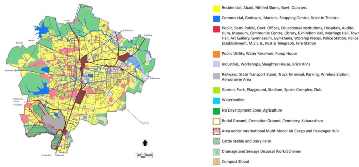
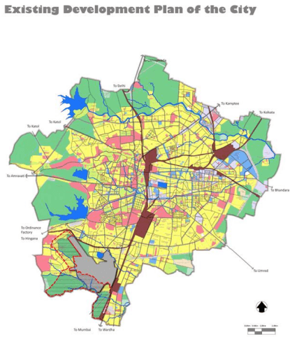
Being the only planning and development agency in Nagpur established even before independence, NIT has been responsible for planning and execution of development schemes. So far, it has executed about 45 development schemes in all covering over 55 percent of the City’s area. While the development schemes are micro-level area layouts with allocations for open spaces and infrastructure, the organisation also took up large scale planning by preparing the first master plan for the overall city limits in 1946. The Nagpur Municipal Corporation (NMC) was formed in 1948 with a primary responsibility of the upkeep and maintenance of civic amenities, while NIT retained the powers of a planning authority. After the resolution of the MRTP Act, 1966, NIT prepared a Draft Development Plan for Nagpur as per the provisions of the Act. That was published in 1972 and republished in 1974. Thereafter NIT also prepared a Revised Draft DP 1986-2011 that was published in the Government Gazette in 1989. This was sanctioned by the GoM in 2000. This development plan is currently in force and is due for a revision (See Figure 2-7).
Recently the GoM has passed a resolution empowering the NMC as a planning authority for areas under its jurisdiction – this includes the municipal limits of Nagpur City except certain areas that come under the purview of NIT. Consequently the task of preparation of the revised development plan has now been transferred from NIT to NMC.
Figure 2-7 : Development plan 1986-2011 for Nagpur city
Graphic for illustrative purposes only
2-15
2.4.3 Regional Plan 1971-1991
Shortly after the enactment of the MRTP Act, 1966 the Nagpur Metropolitan Region was constituted by the GoM in 1967. The extents of the erstwhile Nagpur Metropolitan Region covered a total area of about 1,520 km and included the Municipal Corporation limits (with area as 217.53 km), 1 Cantonment Board of Kamptee (area 15.10 km) and 2 Municipal Towns of Kamptee and Kalmeshwar along with 262 villages. A Regional Planning Board was constituted for the preparation of a long term perspective plan that was sanctioned in 1976.
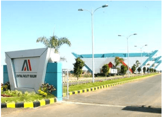
Central facility building at MIHAN (Photo Credit Saurabh Jaiswal; Source: www.wikimapia.org)
2-12
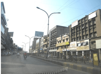
View of Central Avenue road (2013) (Source: Halcrow)
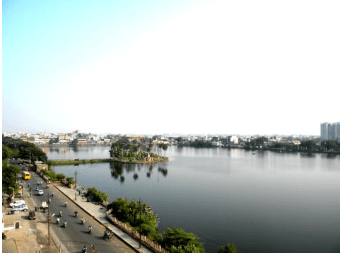
New Shukrawari Lake (2013) (Source: Halcrow)
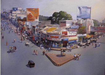
Artist’s impression of Variety Square, Nagpur
(Image credit: Bijay Biswaal. Original Painting; Oil on Canvas by Bijay Biswaal;)
2-8
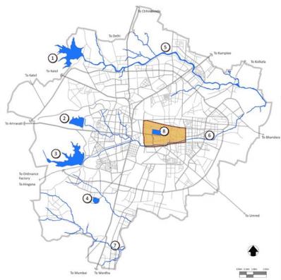
Figure 2-4: Expansion of Nagpur under Gond, Bhonsale and Colonial Rule
Expansion of Nagpur Under the Gond Rule
Gorewada Tank 2 Futala Tank 3 Ambajhari Tank 4 Sonegaon Tank 5 Pioli River 6 Nag River Pora River 8 Gandhi Sagar Tank / Jumma Tank
Expansion of Nagpur Under the Bhonsale Rule
Jaripatka Neighbourhood due to Indora Military Camp Mominpura (Muslim Neighbourhood of weavers & petty Industries) Mangalwari, Somwari, Bastarwari, Neighbourhood of the Kunbies (Cultivators) Gosaipura, MarwaripuraNeighbourhood of Marwaris, Jains,Bohras, Banjaras (Retail & Wholesale Business) Indora Military Camp of Bhonsale's Motibaug, Lasksharibaug (Royal Gardens)
Koshtipura (Neighbourhood of weavers) New Royal Palace (East of Old Palace) Telankhedi, Royal garden & Recreation Place Chitnavispura, Rigvedi Brahmin Neighbourhood Sakkardara Military Camp Sitabuldi Military Camp Ajni Neighbourhood due to Sitabuldi Military Camp
Expansion of Nagpur Under the Colonial Rule
Expansion of Nagpur under the Bhonsale Rule (1743-1854)
Aerodrome - British Air Transport Service Dharampeth - Commercial Area Nagpur University Campus - 1923 Sitabuldi Fort - Administration Zone - 1861 Bazonbaug-Resettlement due to Plague- 1899 Pachpauli-Resettlement due to Plague- 1911 Empress Mill- 1877 Civil Lines-Residential Zone- 1875 Nagpur Improvement Trust- 1936 Bagadganj-Resettlement due to Plague- 1899
Expansion of Nagpur under the Gond Rule (1636-1743)
Seminary Hills - British Residence O Sadar - Commercial Area for the British Takli - British Military Camp - 1851 Hislop College - 1861 Byramji Town - 1917 Nagpur Municipal Authority- 1854 Chhaoni- Transit Camp due to Plague- 1899 O Sitabuldi Suburb - British Army Personnel's- 1854 Dhantoli - Transit camp due to plague - 1920 Railway Line
Fortified City with 6 major gates
Major Thoroughfares: 1) Jumma Street (East-West) 2) Budhwari Street (North-South) 3) Aditwari Street (North-South)
Residential Structure: 1) Kings and Nobles in the Fort to the East 2) Commoners to the West outside the Fort
Commercial area comprised of the Gachipaga open air market
Surroundings of the Jumma Tank comprised the Public Space
Water Supply was from the Jumma Tank
The palace formed the centre for a radial street pattern
Residential Structure: 1) Community based Neighbourhoods 2) Hierarchy of Neighbourhoods based on occupation and caste system 3) Concentration of High Caste near King's palace and low caste towards the fringes
Itwari bazaar was the major commercial activity
Chandani Chowk was established for the Durbar and Temples, Ghats and Akhara's were established at the Nag River bank for common people
Military camps were the major growth centres
Mixed Land-Use of House+Shop+Cottage Industry was the prominent building typology
Expansion of Nagpur under the Colonial Rule (1854-1947)
The civil station (Sitabuldi Fort) formed the nucleus of the settlement.
Residential Structure: 1) New British settlement on the west side of the old Maratha city along the Western highland 2) Well defined land-use pattern 3) Housing development in the form of colonies for security reasons
Sadar bazaar, Temple bazaar & Gora bazaar exclusively for the British.
Maharaja Baug was developed for recreation.
Street pattern was suitable for Automobiles.
Empress Mill, Model mill & the printing industry was located in the East of the old city.
Railway line was the dividing edge between the New & Old city in the West & East.
2-9
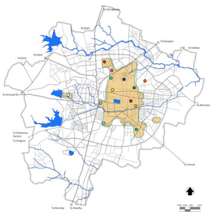
Figure 2-5: Expansion of Nagpur in the post-independence period
Expansion of Nagpur Post-Independence
Wadi - Informal Transport Terminal
New University Campus - 1960-70
Gorewada - Water Supply Reservoir for the city from Kanhan & Pench river Major Wholesale Commercial Area serving the region
MIDC Hingana - First Planned Industrial Area Civil Lines - Administrative zone & Major Public buildings
Sitabuldi - Major retail commercial area & New City Centre
Administration: 1) Civil Lines area continued to serve as the Administrative zone
Post Independence Expansion of Nagpur City (1947 - 1976)
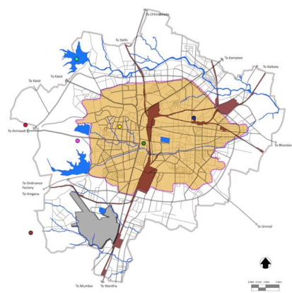
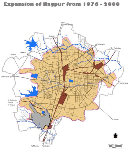
Expansion of Nagpur from 1976 - 2000
Residential: 1) Low rise low density development
Commercial: 1) Sitabuldi emerges as a retail market 2) Itwari continues as a wholesale market
In the period from 1976 to 2000, the Nagpur Improvement Trust took up the initiative of building new transport connectivity and also implemented new layouts to promote residential development in the fringe areas.
Post Independence Expansion of Nagpur City (1976 - 2000)
Consequently the inner ring road was constructed for efficient traffic movement along the periphery of the city.
Industrial: 1) MIDC Hingana developed as a new Industrial area
Nagpur Improvement Trust also initiated policy deccisions such as the Gunthewari act under which the 572 layout scheme was proposed in order to regularize unauthorized layouts which further led to the expansion of the city.
Public, Semi-Public, Govt. Offices, Educational Institutions, Hospitals, Auditorium, Museum, Community Centre, Library, Exhibition Hall, Marriage Hall, Town Hall, Art Gallery, Gymnasium, Gymkhana, Worship Places, Police Station, Police Establishment, M.S.E.B., Post & Telegraph, Fire Station
This period saw a phenomenal growth in industrialisation with over 7,700 permanent and temporary small scale units comprising engineering units, chemical units and printing units (by the year 1983). Over 65 percent of the total units were forest or agro based. These industries provided employment to around 40,000 people. In this period, MIDC acquired 750 hectare land to revamp the industrial area and developed proper road and water infrastructure.
Looking at this regional growth, Nagpur Metropolitan Regional Plan put forward a few key proposals as mentioned below:
Identified New Towns for development– New Nagpur on Amravati Road (population 6.48 lakh) and at Kanhan Pimpri (population 2 lakh)
Identified industrial areas of 8sqkm within the city and 13.8s km2 outside the city limits in Kamptee-Kanhan, Hingna-Ambazari, Koradi, Kalmeshwar and in other seven smaller towns. It recognised new emerging industrial centres at Butibori on south, Mouda on east, Parsheoni in north and Saoner to north-west
Extensive green areas and regional parks/ recreation areas and afforestation was proposed in the catchment area of Ambazari and Gorewada and development of recreational centres at the confluence of Kanhan and Pench river, Koradi-area around Koradi temple and Wana lake
Residential area allocation
Transportation proposals:
o construction of bypass roads (northern portion of ring road)
o bypass on NH-7 for Kamptee and Kanhan towns with a major bridge on river Kanhan, near village Sihora
o road connection to Amravati road and Hingna road at Wadhamana
o bypass to Nagpur Katol road at Kalmeshwar along with the southern side of the town
o broad gauge link between Kalmana and Ajni railway stations
Proposals of the Metropolitan Regional Plan 1991 fell short of the desired outcomes mainly owing to implementation related issues:
The Regional Planning Board was constituted to only prepare the Plan; however an agency was not appointed to oversee its unified implementation, resulting in its eventual neglect
Inadequate funding for implementing the proposals led to very slow implementation of key transport proposals such as the by-pass roads and intermittent progress of other proposals
2-16
Delay in land acquisition at Kanhan for industrial purpose and for other road projects and inadequate concerted efforts due to rapid growth of slum, hutment colonies and unauthorised constructions, mainly along the existing roads
A few proposals such as the location of small and medium size industries were at undesirable locations (Source: Chapter 3, Part II Nagpur Regional Plan 1991-2011)
2.4.4 Regional Plan 1991-2011
One of the key lessons learnt from the Nagpur Metropolitan Regional Plan 1971-1991 and other places in the State by planners in Maharashtra was the realisation that the problems of cities have implications to their hinterlands and hence planning of much larger areas was essential. With a view to coordinate resources and economic planning with land use planning, physical extents of the ‘regional planning’ exercise that was initially being done for metropolitan cities was later expanded to cover the administrative districts in the State. (Chapter 1 and 2, Part I Nagpur Regional Plan 1991-2011)
Critical planning issues observed in Nagpur city and the surrounding region during this period included:
A higher than anticipated growth in the population leading to housing shortage and increase in slums
Shortcomings in new townships and residential developments to cater to the increasing load of industrial workers close to Hingna and Wadi, which led to unauthorised construction
An increase in two wheelers and other motor vehicles without much of an increase in road capacities
Water shortage, poor infrastructure development, and poor tourism infrastructure
Nagpur District was hence notified as the ‘Nagpur Region’ for the preparation of a Regional Plan (RP) as per the provisions of the MRTP Act, 1966 and accordingly, a Regional Planning Board was constituted in 1992 to undertake this exercise. The Nagpur Regional Plan 1991-2011 (See Figure 2-8) sanctioned by the GoM in 2000 is currently under force and due for a revision.
Broadly the Nagpur Regional Plan (1991-2011) divides the entire region in to a hierarchy of settlements to promote decentralisation and to shift focus of development and population from the Nagpur urban agglomeration to the potential growth nodes:
Main Regional Metropolitan Growth Centre (Nagpur City) that has an influence on not only the district but also the surrounding revenue districts
Regional Urban Growth Centre, that can be potentially developed as a self-sufficient town with population of about 6-7 lakhs
Growth Centre (urban and rural), areas with considerable urbanisation and economic activities are identified as urban or rural growth centres
Sub-growth Centre, are central villages that support larger population and have a relatively larger influence area than others are classified as sub-growth centres
Central Village , are all upgraded villages that have public amenities such as a secondary school, Jr. college, weekly market, bus-stop, police station (junior), co-operative bank and a sub-post office and are centrally located while also supporting relatively large populations are termed as Central Villages.
2-17
Upgraded Village and Villages, are all villages that have public amenities such as a secondary school, police outpost, primary health sub-centre, co-operative bank and a sub-post office.
Figure 2-8 provides a snapshot of the Regional Plan 2011.Provisions of this Plan are considered in the preparation of the current Development Plan for the NMA. A brief synopsis of the proposals is given in Annexure 3.
Figure 2-8 : Regional plan 1991-2011
2-18
2.3.3Capital of the Central and Berar Province – Colonial Period
The British took over power from the Marathas after winning the battle of Sitabuldi in the year 1817. From 1853 to 1861, the Nagpur Province which consisted of the present Nagpur region (Chhindwara, and Chhatisgarh) came under the administration of a commissioner of the British central government, with Nagpur as its capital. This region came to be known as the Central Province.
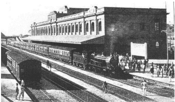
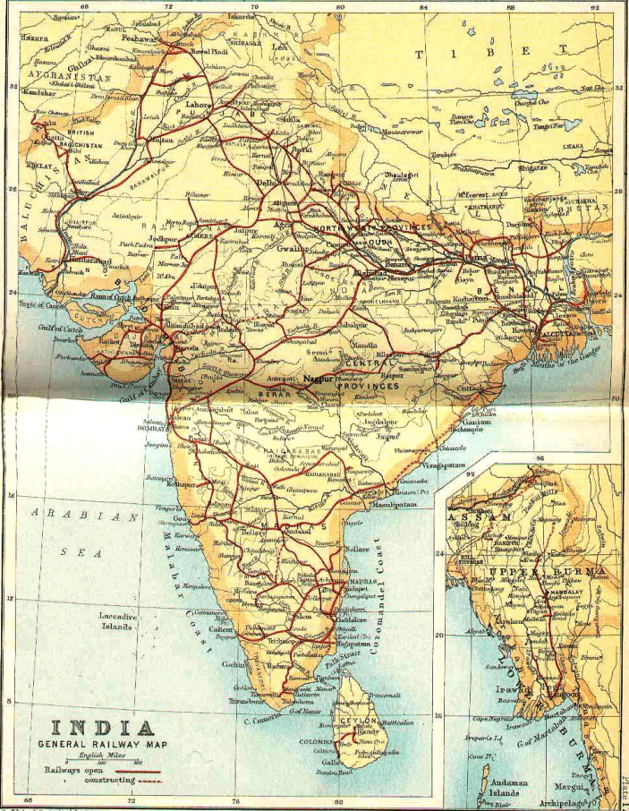
The significance of the central location of Nagpur and its benefit as a logistics hub was explored by the British during this period. With the Great Indian Peninsular (GIP) railway’s new route constructed between Bombay and Nagpur, by year 1870 the City was connected with Delhi, Madras and Calcutta with Sitabuldi Fort as its main junction. The construction of new rail transport routes thus led to the growth of Nagpur as an important place counted with Bombay, Calcutta, Delhi and Madras in British India. Equidistant from all the four major cities Nagpur thus grew in its significance not only as the capital of the Central Province but as an administrative centre for India as a whole.
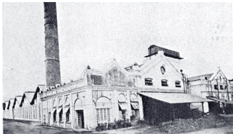
The new connectivity and the late industrial revolution in India led to establishment of textile mills. Ample cotton supply from Vidarbha ensured Nagpur had access to natural resources required to grow further. The Tata group started the country's first textile mill at Nagpur, formerly known as Central India Spinning and Weaving Company Ltd. The company was popularly known as "Empress Mills" as it was inaugurated on January 1, 1877, the day queen Victoria was proclaimed Empress of India. The establishment of Empress Mills laid the foundation of textile industry in the district.
With the addition of Berar region in 1903, Nagpur became the capital of the Central and Berar province in British India.
Urbanized areas in the NMA are peri-urban areas of Nagpur City, outgrowths of industrial areas and Census Towns which are spatially spread-out across different locations. The need for servicing such areas with civic administration functions arose much before NIT was notified as the SPA. Hence essential core services are currently being provided by other agencies that have powers and functions that are over and above the powers and functions related to development planning. These agencies primarily include Maharashtra Jeevan Pradhikaran (MJP) for construction of water supply schemes, and their operations and maintenance in certain locations, gram panchayats, Zilla Parishad (ZP), and NMC.
The governance function of NIT is largely confined to ensuring conformity with the Development Control Regulations. However in case of certain layouts and schemes that are implemented by NIT, the agency performs core civic functions such as water supply with the support of MJP and construction of roads with the support of the Public Works Department (PWD).
Table 2-2 summarises the key civic functions and agencies that are currently responsible for civic administration.