At present the predominant established industrial areas are MIHAN and MIDC industrial estates in Butibori, Hingna. Hingna, Umred and Kalmeshwar are other important industrial centres. It has been observed worldwide that clustering industrial activities results in better efficiencies for infrastructure provision and better opportunities for developing synergies between industries. Areas with proximity to established work centers and along transportation corridors are most suited for locating land for future employment centers and urban development. Thus majority growth will mainly occur close to employment centers – MIHAN, Butibori, Hingna; areas located close to the city within the Outer Ring Road; and along main transportation corridors – Wardha Road (NH-7), Amravati Road and Bhandara Road (NH-6).
Clusters of villages located in the target growth areas are demarcated into physical planning units termed as ‘Urban Sectors’. About 60,500 ha land is covered by 10 Urban Sectors however the entire area is not required to be allocated for active urban uses. Over 70% (about 12 lakh) of the total projected population of 17 lakhs is expected to be located in urban areas and remaining in rural areas.
While some increase in rural population will be accounted towards natural increase within individual villages majority growth will be located in ‘Rural Centers’. 12 villages with established regional connectivity to enable forward and backward linkages to the City and surrounding rural communities have been identified using empirical modelling. These are distributed equitably across the NMA.
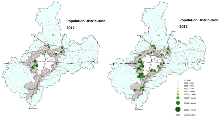
Figure 4: Population distribution