Creation of a sustainable, physical and social environment for improving quality of life is very important to consider while preparing a Master plan. The almost unprecedented scale and speed of urbanisation in Kochi has resulted in enormous pressures on the physical environment with a severe adverse impact in terms of pollution. The city's environment can essentially be seen in terms of two components of urban management- the environment per se, or the habitat, and services management. The former pertains to the natural features and resources including the elements of air and noise, water (water bodies-river, lakes, drains and ponds and ground water) and land with reference to open spaces, green areas and other surface and sub-surface conditions. The latter is related to the built environment and includes the environmental infrastructure - water supply, sewerage, solid waste disposal and the transportation network, which is dealt with in detail in the previous chapters.
Sea level-rise, increased precipitation and flooding makes Kochi vulnerable in terms of its near coastal location and network of backwaters. The reduction of green cover in the city, diminishing mangroves, disappearance of wetlands, reclamation of water channels and lakes are the most prominent reason for Kerala floods of 2018. Therefore, the prime focus of development in Kochi needs to be environment management and conservation of urban forests, wetlands and water edge-management along with tackling of urban heat and heat island formation. With major developments in the city, there is a need to strike a balance between development and environment.
Natural Resources
Natural Resource Conservation includes management of water (surface and ground), air and noise. The environmental quality of an area depends up on the ambient air quality and water quality which influence the quality of life of the inhabitants.
21.1.1 Climate
21.1.1.1 Precipitation
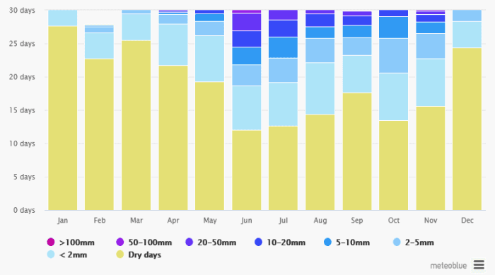
Ernakulam district has wet monsoon type of climate. The district experiences heavy rainfall during southwest monsoon season followed by northeast monsoon. During the other months the rainfall is considerably less. March, April and May are the hottest months. December to February is the coldest months. The district receives on an average 3359.2mm of rainfall annually. The annual rainfall ranges from 3233 to 3456 mm at different places of the district. The rainfall is less in the western part of the district and gradually increases towards the east.
Kochi Municipal Corporation
ENVIRONMENT
Maximum rainfall is received around Neriamangalam area in the eastern part where the normal annual rainfall is found to be 5883 mm. While Kochi, which is in the western part receives around 3233 mm rainfall annually. South-west monsoon season contributes nearly 67.4% of total rainfall of the year, followed by the north-east monsoon which contributes nearly 16.6% and the balance of 16% is received during the month of January to May as summer showers (Source Ground water information booklet, Ernakulam 2013)Extreme rainfall events have become a recent occurrence which affects the general agriculture pattern and capacity of existing drainage system causing flash floods in Kochi
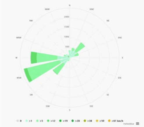
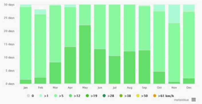
The wind speed ranges from 6.7 to 10.9 km/hour with mean speed of 9.1 km/hour, which is high during the period from March to September. The major wind flow direction is from South West – West to North East and East direction.
Westerlies carry pollutants towards eastern direction and Easterlies which are weak or absent during night accumulates pollutants at the source.
• During SW monsoon the pollutants are removed with scrubbing effect
550
Obnoxious industries causing air pollution are not recommended in the western coastal area.
Kochi Municipal Corporation
ENVIRONMENT
Figure 21:2 Wind Rose Diagram (annual) Source: meteoblue.com
Figure 21:3 Annual Variation of Wind speed Source: meteoblue.com
Kochi Municipal Corporation
ENVIRONMENT
As per the data from Cochin port trust, the wave climate is governed by the South West monsoon when wave action can be strong with prevailing wave direction from north-west to south-west. Deep water (15m) wave observation in the past indicate the significant wave heights of 4m, 2m and 1 m at the water depths of 10m, 5m and 2m respectively, the predominant wave direction being west. Wave action inside the harbour is insignificant because of narrow entrance between Cochin Gut and Fort Cochin and the configuration of the land. Generally calm conditions prevail throughout the year except during the times of extreme wind action. Therefore wind and wave energy are not suitable options for developing non-conventional energy.
21.1.1.3Temperature
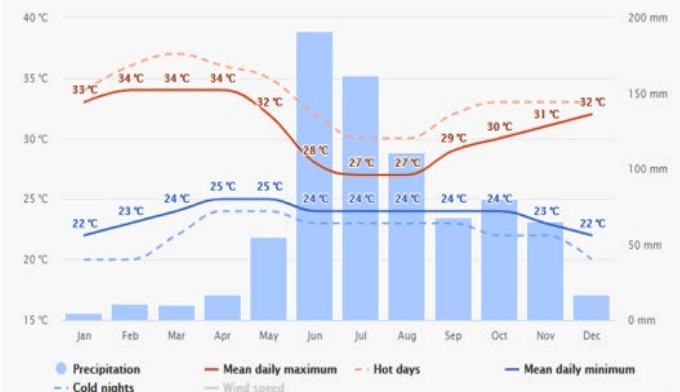
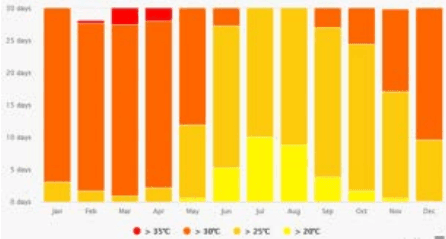
The mean monthly maximum temperature ranges from 28.1 to 3 1 . 4 ° C and the minimum ranges from 23.2 to 2 6 ° C , The maximum temperature occurs during March and April months and the minimum temperature occurs during December and January months. The humidity ranges from 68 to 89% during morning hours and 64 to 87% during evening hours. The maximum humidity is observed during May to October months.
Figure 21:4 Annual temperature variation with precipitation Source: meteoblue.com
552
Sunshine hours range from 4.3 to 9.7 hours/day. Maximum sunshine is during the month of February. The months of June to August record the minimum sunshine due to the cloudy sky. Generally good sunshine hours are recorded in the months of November to May.
Kochi Municipal Corporation
ENVIRONMENT
Figure 21:5 Temperature variation in Cochin city over an year Source: www.meteoblue.com
21.1.1.4Kochi as a potential heat island
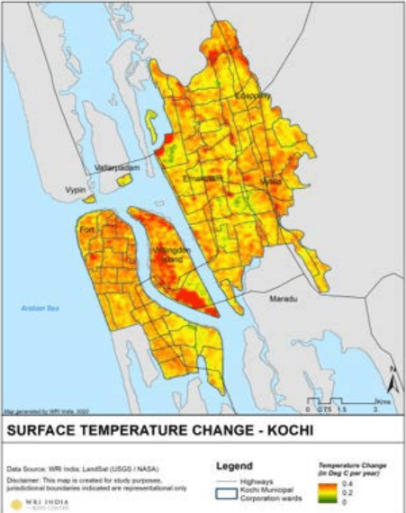
Figure 21:6 Land Surface Temperature Source : WRI, India
Kochi Municipal Corporation
ENVIRONMENT
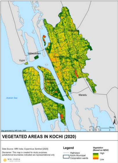
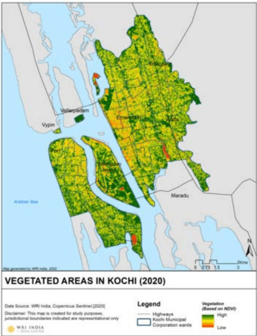
Figure 21:6and Figure 21:7show surface temperature change in Kochi and the corresponding vegetation cover (image source: Raj Palaniswamy, WRI India). An inverse correlation can be seen within the map where the surface temperature change throughout the year is high in urban and industrial areas whereas low in green patches. Urban areas can increase heat within the city with large paved and impermeable surfaces, thermal mass in buildings, lack of vegetation, waste heat from mechanical air conditioning and changes in climate. The future of Cochin city calls for an adaptation of sustainable green infrastructure wherever possible within the corporation area.
Figure 21:7 Vegetated Areas in Kochi
Source: WRI , India
21.1.2Topography and Geology
The district is divisible into three physiographic zones as (i) the coastal plains in the west, the midland region in the east and the steep to very steep hills in the easternmost part. The coastal plain is a low lying area, with a maximum elevation of around 10m towards the eastern part, characterised by backwater bodies, marshy lands, sandy flats and alluvial plains, which
Kochi Municipal Corporation
ENVIRONMENT
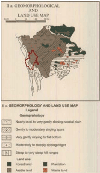
are liable for flooding during the monsoon. The midland region has a rolling topography with low hills and narrow valleys. The hills are generally covered with laterite or lateritic soils and the valleys are alleviated. The region has a very gentle to moderate slope from east to west. The easternmost part is a rugged terrain with steep sloped hills and small summits. It actually forms the foothills of the Western Ghats. Elevation of this terrain is generally more that 300m above mean sea level. As the area is covered by forest soil, thick forest and cultivation of cash crops like rubber and pepper can be seen in the area(District survey report, Ernakulam District, Kerala State, Department of Mining and Geology, November 2016). Majority of the Cochin Corporation falls within the coastal plains. While considering the hydro-geological condition of the Cochin corporation area, majority falls under coastal alluvium zone which forms a potential aquifer. Dug wells are possible here with an average yield of 15 m3/day. It is suitable for filter point wells wherever saturated thickness exceeds 5m. The zone is underlain by tertiary sediments with brackish water (Ground water information Booklet of Ernakulam District 2013).
Figure 21:8 Geomorphological and Land use map
Source: District Resource Map, Thiruvananthapuram, Geological survey of Indi
Kochi Municipal Corporation
ENVIRONMENT
Figure 21:9 Geology and Minerals map, Source: District Resource Map, Thiruvananthapuram, Geological survey of India
Kochi Municipal Corporation
ENVIRONMENT
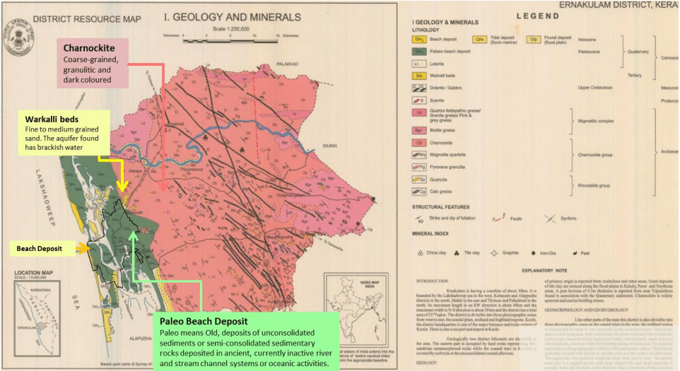
Geologically two distinct litho units are discernible in the area. The eastern part is occupied by hard rocks representing Precambrian metamorphosed rocks while the coastal tract in the west is covered by soft rock or the unconsolidated coastal alluvium. Major part of the district is occupied by charnockite and moigmatite groups of rocks of Precambrian age. The charnockite group is composed of pyroxene granulite, magnetite quartzite andcharnockite. Charnockite, which is very widely distributed, is coarse-grained, granulitic and dark coloured. Calc-gneiss and quartzite of khondalitegroup are the oldest rocks of the areaand they are seen within the charnockites.
Patchy outcrops of Warkalli beds, consisting of pebble bed, grit, friable sandstone and variegated clay is seen in the western part around Edappalli, Kalamaserry areas. Both the Warkalli beds as well as the basement rocks are subjected to intense lateritisation, which is confined to the midland region only. The coastal tract is covered by Quaternary sediments like beach sand, palaeo-beach ridge deposits (sand), flood plain deposits (sand, silt, clay) and tidal deposits (clay, mud).
Within the Corporation boundary, the major geological formations are Paleo beach deposit Paleo that means Old, deposits of unconsolidated sediments or semi-consolidated sedimentary rocks deposited in ancient, currently inactive river and stream channel systems or oceanic activities and beach deposits which are relatively new deposits.
21.1.2.1 Slope and Elevation
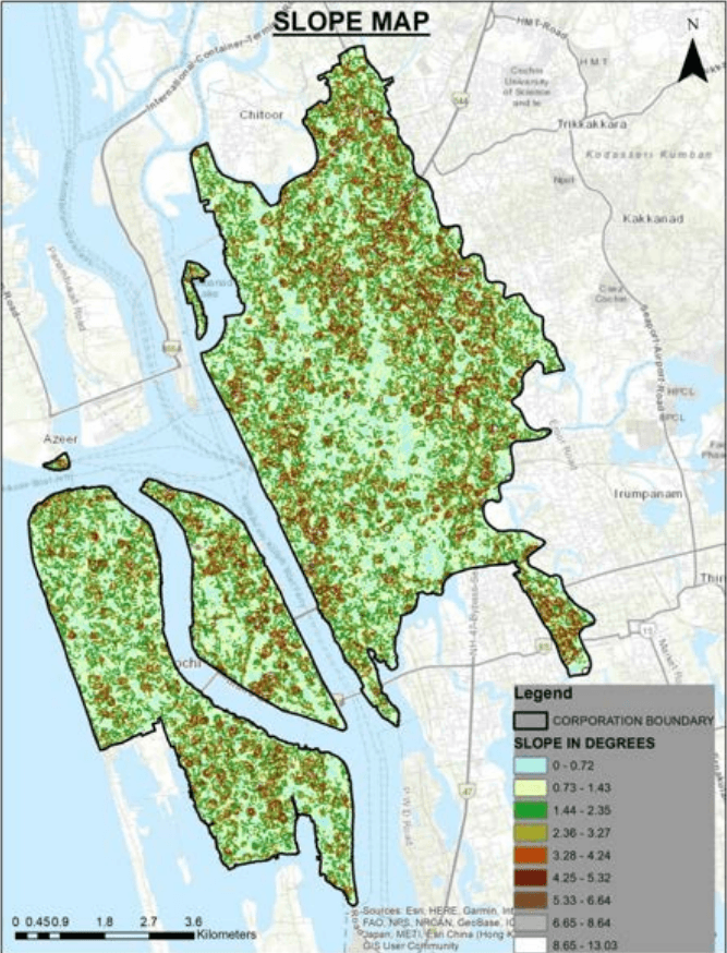
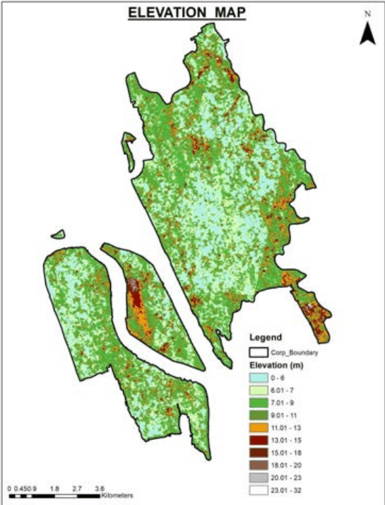
Kochi has a coast line of 48 Km. The topography of Kochi is almost flat. The average altitude towards the eastern fringes is about 7.5 m above M.S.L but towards west most part of the city is only about 1.00 m – 1.25 m above M.S.L. The whole of the land slopes gradually from east to west. . Kochi is characterized by sand bars running in north – south direction with almost flat terrain in the central city area with the tidal canals in between. The main canals are navigable for small and medium crafts. The secondary canals used to serve as natural drainage canals in the city for flood waters. In the absence of sufficient wide drains and because of the general flatness of the terrain, the city is facing acute drainage problems. (Source: Feasibility study on Development of canals in Kochi - Kerala Shipping and Inland navigation Corporation Limited (KSINC).
Kochi Municipal Corporation
ENVIRONMENT
Figure 21:10: Slope map of Kochi City area Source: generated through DEM
Kochi Municipal Corporation
ENVIRONMENT
Figure 21:11 Elevation map of Kochi City Source: generated through DEM
21.1.2.2 Soil
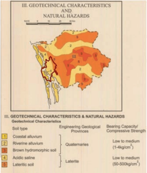
On the basis of morphological features and physico-chemical properties, the soils of the district are classified as Lateritic, Hydromorphic saline, Brown hydromorphic, Riverinealluvium and Coastal alluvium. Lateritic soil is the most predominant soil type of the district. In Muvattupuzha, Kothamangalam, Kunnathunadu and parts of Aluvataluks, lateritic soil is found. These soils are well drained, low in organic matter and plant nutrients.The major crops grown are coconut, tapioca, rubber, areacanut, pepper, cashew and spices. Small
Kochi Municipal Corporation
ENVIRONMENT
patches of hydromorphic saline soil are encountered in the coastal tracts of the district in Kanayannur and Cochin taluk. The tidal backwaters contribute to the salinity of the soil. Coconut is grown in these soils. Brown hydromorphic soil is the second most prevalent soil type of the district and they are encountered in valley bottoms. The soil is enriched in claycontent and plant nutrients. The soil is suited for paddy cultivation.Riverine alluvium is restricted to the banks of rivers andtheir tributaries. They are composed of sandy toclayey loam and are enriched in plant nutrients. It is suited for a large variety of crops like coconut, paddy arecanut, pepper, vegetables etc. In Cochin taluk and the western parts of Paravur and Aluvataluk coastal alluvium is encountered and is composed of sand and clay .The tidal backwaters contribute to the salinity of the and coconut is commonly grown in these soils. (Source: Ground water information Booklet of Ernakulam District 2013). Within the Kochi Corporation area acidic saline and coastal alluvium soil types are majorly found.
Figure 21:12 Soil types in Ernakulam district
Source: District Resource Map, Thiruvananthapuram, Geological survey of India
Kochi Municipal Corporation
ENVIRONMENT
Table 211 Soil types in Ernakulum district
Type
Location
Productivity
Coastal alluvium
Cochin taluk and the western parts of Paravur and Aluva
Composed of sand and clay .The tidal backwaters contribute to the salinity of the and coconut , Ideal for Pokkali cultivation & coconuts
Riverine alluvium
Banks of rivers and their tributaries.
sandy to clayey loam and are enriched in plant nutrients. It is suited for a large variety of crops like coconut, paddy arecanut, pepper, vegetables
21.1.2.3 Ground Water
Groundwater is one of the major sources for water supply. In Kochi, ground water contributes a substantial quantity of water supply. Especially in Corporation area, groundwater is largely being used as drinking water resources. Rapid urbanisation leading to reduction in recharge of aquifers, Water logging along the western border of the city bordering the back water lagoons during the rainy season, Brackish quality of groundwater along tidal inlets, Anthropogenic pollution, water demand by industrial and domestic sectors, put stress on groundwater resources in periods of summer, and excessive withdrawal from the sub soil aquifers, have been mainly responsible for decline in groundwater levels. Kochi located in the western part of the District receives a rainfall of 3233 mm annually. However, recharge of ground water gets limited due to the decreasing availability of permeable surfaces owing to urbanisation, and the runoff getting diverted into the canals or storm water drains that convey the water into the Arabian sea. Even though the city is receiving very good rainfall of about 3233 mm annually it is paradoxical that acute water scarcity is felt in certain areas.
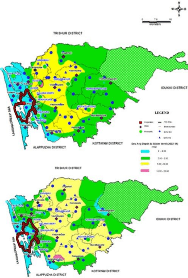
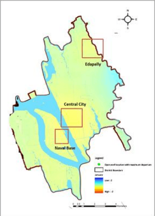
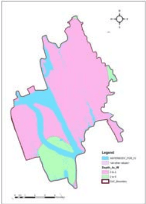
The ground water in Kochi occurs in confined and semi-confined conditions. Kochi corporation area lies in the Coastal Plains wherein the water level is shallow and restricted to less than 2mbgl.The Vypin Island along the coastal parts is one such area where the water scarcity is very acute during summer months. The Vypin Island with an area of 67 Sq.km is highly populated. The major problem here is the limited top sand layer and at places its hydraulic continuity with tidal backwater rendering it saline during summer months. In the southern parts of the district, in the top layer sand, the quality is brackish. In these areas, rainwater harvesting with modification of the aquifer will help to improve the aquifer condition and its water quality. Also, the long term water level trend in Vypin is showing a declining trend in water level due to which it is classified as critical. The average depth to water level is 0-2 m closer to the coastal area and 2-4 m further away from it during pre-monsoon season and 0-2m during post monsoon season in the corporation area. (Ground water booklet for Ernakulam district 2013)Clayey plastic soil in the corporation area does not offer much scope for water retention for ground water recharge leading to excess runoff and less recharge.
Kochi Municipal Corporation
ENVIRONMENT
Figure 21:13 Post monsoon and Pre monsoon ground water levels Source: Ground water booklet for Ernakulam 2013
Kochi Municipal Corporation
ENVIRONMENT
21.1.3Hydrology
21.1.3.1 Surface Water
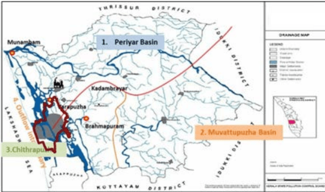
The surface water resources in Ernakulam District are basically comprised of the river Periyar, river Muvattupuzha, their tributaries, drains/Canals and the lakes / ponds.
Figure 21:16 Drainage map of Ernakulum district, Source: Kerala State Pollution Control Board
The major natural features and eco-systems of Ernakulam are the river Periyar and the MuvattupuzhaRiver, together with a network of streams / drains that empty into the river, and the Western Ghats. Both of these are in a state of considerable degradation, and it is of vital importance to conserve and rejuvenate these ecosystems. This has regional bearing; therefore, surrounding states also have to contribute towards their conservation and rejuvenation. A combination of canals and lakes act as the major drainage system of Cochin City protecting the city from storm surges, coastal fluctuations and floods. The city also has several ponds which plays a major role as micro collection points for water drainage in the locality, most of which are disappearing due to lack of documentation and monitoring.
River Periyar
The Periyar River is 244 km in length and the longest river of Kerala and drains an area of 5,398 sq.km. It rises at the forest land Sivagiri peak 80 km south of Devikulam at an elevation of 2,438m above MSL and traverses the steep mountainous terrain before it is joined by the Mullaiyar, 16 km downstream. The river then turns west and continues to flow in the direction
Kochi Municipal Corporation
ENVIRONMENT
for about 16 km in a sandy bed. After a winding course of about 13 km, the river reaches Vandiperiyar and passes through a second narrow gorge below which the Perumthura joins it. Further down, it is joined by six tributaries of which the important tributary Edmala joins the Periyar. Passing Malayattur and thereafter taking a meandering course, the river reaches Alwaye where it divides itself into two branches. The upper branch joins the Chalakudi River at Punthenvelikara and then expands into a broad sheet of water at Munambham. Further downstream at Aluva, the river bifurcates into two: the Marthandavarma and the Mangalapuzha branches. The Mangalapuzha branch joins Chalakkudy river and empties into the Lakshadweep sea at Munambam, and the Marthandavarma branch flows southwards, through the Udhyogamandal area and joins the Kochi backwater system (part of Vembanad Lake) at Varapuzha. The most industrialized zone of Periyar lies between Angamaly and Kochi, with over 50 large and medium scale industries. The Edayar branch of Periyar caters to the needs of these industries. Periyar River is the main drinking water source of Kochi Corporation, Aluva and Paravoor towns and a lot of Panchayaths like Kadamakudy, Puthencruz etc.
River Muvattupuzha
The river drains anarea of 1554 sqkmand passes through Kottayam and Ernakulamdistricts.Kothamangalamriver,Kaliyarriver andThodupuzhayar river join at Muvattupuzha forming the Muvattupuzha river.
River Chithrapuzha
Kadambrayar joins Chithrapuzha at Brahmapuram where the solid waste processing plant of the Corporation is located.Kadambrayar has 18 subways and a few canals and streams and Chithrapuzha has 16 small perennials, nine canals and streams.
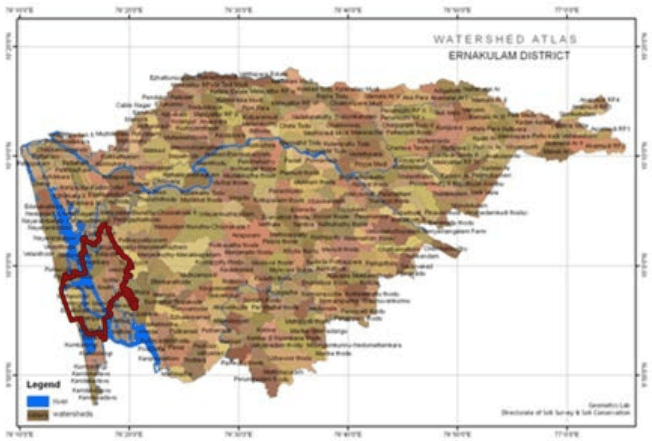
Watershed:
Watershed of any river, canal, pond backwater etc. means the area that drains into that single water body. Almost entire district of Ernakulam falls under the Periyar and Muvattupuzha river basin and is also drained by the Chithrapuzha river all being west flowing rivers. The district comprises of 258 micro watersheds with an overall area of 305830 ha. Several micro watersheds are found of the river basins with along with those falling into the watershed perimeter of backwaters within the periphery of Corporation area.
Watershed programmes have in operation in Kerala since the early 1970s. Command Area Development Programmes, Western Ghats Development programme (WGDP), National Watershed Development Programme for Rain fed Agriculture (NWDPRA), HARIYALI, RIDF, IWDP etc. have in operation in the State. NABARD assisted watershed projects are also taken up. The departmental schemes and the Panchayat schemes utilizing
Kochi Municipal Corporation
ENVIRONMENT
the State funds also run parallel to the centrally aided programmes.Integrated Watershed Management Programme is a centrally sponsored scheme under the Ministry of Land Resources, Department of Rural Development, and Government of India. In Kerala the scheme is implemented through Department of Rural Development. All the watershed development programmes like IWDP, Hariyali, NWDPRA etc. are now under one watershed development programme viz., IWMP, following the new Common Guidelines published by GoI.
As per the State Perspective and Strategic Plan (SPSP) Kerala State, Local Self Government Department, Government of Kerala several factors like poverty, percentage of SC/ST population, wages, farming activities, ground water status, moisture content, drinking water, degraded land, productivity potential, contiguity to other developed watersheds, cluster approach in the plains in the hills etc. are chosen to shortlist the watersheds which require immediate intervention.
Watershed areas within the corporation boundary like Palluruthy, parts of Vypin and Edapally, Vytilla has been considered in the pre IWMP stage. Majority of the corporation area does not qualify for watershed treatment as per the guidelines of IWMP. No area has been chosen from within the Corporation boundary for future water shed projects under IWMP.
Figure 21:17 Water shed Atlas
Source: Soil survey &Soil conservation department, Govt of Kerala
Kochi Municipal Corporation
ENVIRONMENT
21.1.3.2 Canal System
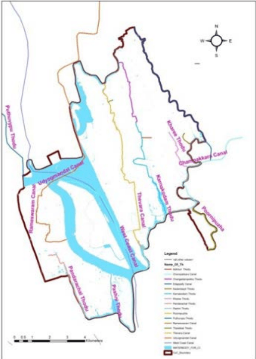
The city sits within a complex estuarine system comprising Lake Vembanad and the many rivers flowing into the lake, including the Periyar and Muvattupuzha rivers. This water sheet, consisting of canals, backwaters, rivers, etc., accounts for a sizable proportion of the land.The water system and its ecology is critical for the city’s natural drainage, flood protection and protection from storm surges (mangroves) and also to its traditional local economy that depends on its resources (e.g., fishing and coir industry)(Source: The Role of Waterways in Promoting Urban Resilience: The Case of Kochi City, Zeba Aziz Indro Ray Sandeep Paul, May 2018, Indian Council For Research on International Economic Relations).The canal holds the potential for an efficient sustainable route for transport; however the present condition does not help the cause.
Issues
The inter-woven canal network of Kochi and suburbs, which once brought fame for easy transportation at low cost, has, of late became a nuisance to the dwellers of the area as the same canals are receptacles of filth, silt, dirt, waste and many other assorted debris.
There are several slums and other houses situated on either side of the canals. All wastes, including night soil from these slums, nearby houses and waste materials from shops, market, etc. are directly deposited in the canals.
The canals in the Fort Kochi zone are the most polluted. Similar situations but with varying degree were noticed in other zones also. The conditions in the mainland area were found to be comparatively better.
Flooding has been one of major problems faced by Kochi. The geography of Kochi contributes greatly to this problem. Kochi is crisscrossed by a network of canals that were earlier used for navigation purposes. Today, these canals have been turned into waste water drains. The canals show high level of pollution, clogging due to weeds, disposal of plastics and other wastes, encroachment and filling of many reaches, finally resulting in floods during the monsoon season. This also is the main reason for one of the most nagging problem of mosquito menace.
The major problems noticed with respect to the canal system in Kochi Corporation are:
Indiscriminate disposal of solid wastes (including plastics, bottles etc.) into the canals at many locations and the direct discharge of untreated waste water from the houses (including slums) located on the banks pose the biggest threat to community health and smooth functioning of the canal system.
Kochi Municipal Corporation
ENVIRONMENT
• Absence of protection walls leads to siltation and weed growth in most of the canals.
Encroachment is seen in many places with huts/houses built after filling the banks of canals, resulting in reduction in width. In many places culverts and bridges across the canals have been constructed with reduced waterway causing flow obstruction.
The invert levels at the exit of many of the lateral drains that discharge water into the canal are lower than the low tide level in the backwaters. Such submerged outlets prevent positive flow and even water back-up during high tides and increase siltation.
21.1.3.3 Tidal effects
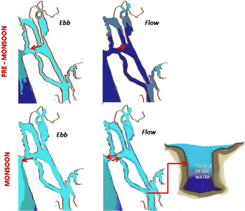
Kochi experiences semi diurnal tides. The tidal levels as per Naval Hydrographic Chart No.2004 are as follows. (Data from Cochin Port Trust). Two successive high and low waters appear each day. ‘Ebb’ is the tidal phase during which the water level is falling and ‘Flow’ the tidal phase during which the water level is rising. During ebb freshwater is discharged from estuary into the sea and during flow the sea water penetrates deep into the estuary. However during monsoons, as more freshwater is being rushed into the estuary and during ebb the freshwater cannot escape fast enough into the sea. During ‘flow’ condition Sea water rushes into the estuary, with more and more fresh water escaping into the sea leaving behind a tongue of sea water at the bottom and fresh water at the top, both quite distinct.( Source: Tidal Cycle And The Environmental Features Of Cochin Backwater (A Tropical Estuary) S. Z. Qasim And C. K. Gopinathan, Biological Oceanography Division, National Institute Of Oceanography, Ernakulam, Cochin-11, South India).
Figure 21:20 Tidal effects in Kochi
Source: generated from Cochin port trust tidal data, Tidal Cycle And The Environmental Features Of Cochin Backwater (A Tropical Estuary) S. Z. Qasim And C. K. Gopinathan, Biological Oceanography Division, National Institute Of Oceanography, Ernakulam, Cochin-11, South India
The tidal affected estuarine area which has a mix of saline and fresh water comprises of a unique and diverse ecosystem in itself. Kochi comprises of interwoven network of tidal canals and backwaters into which the city is primarily drained. During summer months when the outflow into this water body reduces, there is an increased backflow of saline water into the tidal canals from the sea and backwaters rendering the soil to be saline. The predicted sea
571
Kochi Municipal Corporation
ENVIRONMENT
level rise as part of global warming can increase the reach of these tidal waters into the land further reducing the soil productivity by increasing salinity
Table 212 Tidal Levels
Mean Higher High Water Level
+ 1.2m
Mean Lower High Water Level
+ 0.8 m
Mean Sea Level
+ 0.6 m
Mean Higher Low Water Level
+ 0.6 m
Mean Lower Low Water Level
+ 0.3 m
Source: Cochin Port Trust.
21.1.1.1 Hydrodynamics
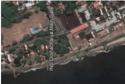
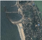
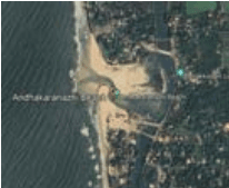
Erosion is predominant in the Chellanam Coast with moderate accretion towards North of the coastal belt. The trapping of the sediments by the groynes placed at INS Dronacharya suggests that the longshore sediment transport pattern is towards north. The South side of Chellanam Harbour tacit the accretion process, which again suggests the littoral drift pattern towards North. The construction of Harbour at south Chellanam obstructed the northward sediment transport at the south of the coastal belt and making Chellanam coast a sediment deprived area.
It has been observed that lot of sediments are deposited near Andhakaranazhi south of Chellanam. The northward transport of sediments is blocked by the fishing harbour disturbing the natural sediment balance. Furthermore, sediment transported to the Cochin Sea mouth (port inlet channel) is continuously dredged away affecting the natural course of beach development along this coastal stretch. To tackle the erosion and coastal surges in Chellanam and southern area, the wetlands at the south of Palluruthy area needs to be retained. (Source: Restoration of Chellanam Panchayat Interim Report submitted to the Hon’ble Minister for Fisheries, Culture and Youth Affairs Government of Kerala by KUFOS)
Figure 21:21 Google Image of INS Dronacharya, Chellanam fishing harbour, Andhakaranazhi beach
Kochi Municipal Corporation
ENVIRONMENT
21.1.4Natural assets
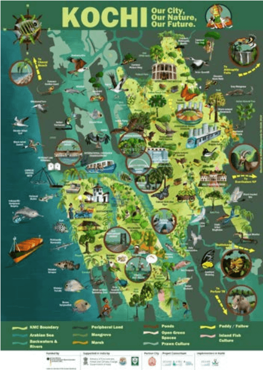
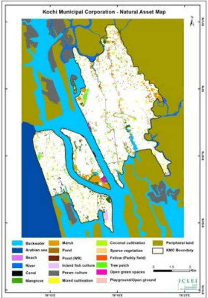
The coastal region, Vembanad backwaters, estuary, mangroves, wetlands, fresh water ponds, Pokkalipaddy fields, other mixed cultivation, home gardens and public open spaces are the major biodiversity habitats of Kochi city. Figure 21-25 shows natural assets illustration of Kochi .
Figure 21:22 Natural assets Illustration Source: ICLEI SA(city Biodiversity Index study for KMC 2020)
Kochi Municipal Corporation
ENVIRONMENT
Table 213 Area wise distribution of Natural assets in Corporation Boundary
Sl. No.
Land Class
Area in ha
1
Backwater (inland)
82
2
Beach
13
3
Canal
34
4
Coconut cultivation
38
5
Fallow (Paddy field)
85
6
Inland fish culture
45
7
Mangrove
119
8
Marsh
289
9
Mixed cultivation
234
10
Open Green Spaces
34
11
Parking ground
11
12
Playground
79
13
Pond
6
14
Pond (Wetland Remnant)
32
15
Prawn culture
27
16
River
122
17
Sparse vegetation
106
18
Tree patch
199
Total
1,555
16% of the area of Kochi Municipal Corporation area is Natural assets.
Administration of Biodiversity assets
Source: City Biodiversity Index study-Kochi-2020, ICLEI
574
Kochi Municipal Corporation
ENVIRONMENT
Flora:
The flora of this district is tropical. The heavy rainfall combined with moderatetemperature and fertile soil support luxuriant vegetation. Many of the common plantsendemic to Kerala are found in the coastal area which forms the low land region. Coconutis extensively cultivated here. The abundant backwater system adjoining coasts have vast areas of ‘Pokkali’ paddy fields, which are subject to inundation, and movement of water in accordance with the ebb and flow of the tides. This condition is favourable for the growth of large and varied fish population and wading birds and water birds.
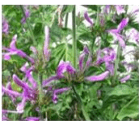
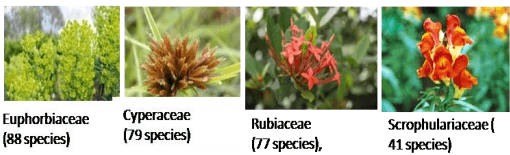
An inventory of the flora of the Ernakulam district was prepared by Sunil et al. (2015). A total of 1,706 species belonging to 158 families and 866 genera have been documented during the study period 2012–2015. Poaceae is the largest family comprising 161 species followed by Papilionaceae (94 species), Euphorbiaceae (88 species), Cyperaceae (79 species), Rubiaceae (77 species), Acanthaceae (65 species), Asteraceae (54 species), Orchidaceae (47 species), Scrophulariaceae (41 species) and Convolvulaceae (34 species). Out of these 306 species are endemic to either the Western Ghats or Peninsular India and 108 species find a place in the IUCN Red List. 35 species of wild relatives of cultivated crops like piper, rice, ginger, nutmeg have been documented.
A total of 56 invasive alien species belonging to 27 families and 48 genera have been documented. Ernakulam district is also rich in wetland plant species including mangroves and coastal species. Out of the 16 true mangroves of Kerala, 14 are found in the Ernakulam. In Mangalavanam, the total number of plant species reported was 25 including four species of true mangroves. The vegetation of the Mangalavanam is dominated by Avicenniaofficinalis, RhizophoramucronataandAcanthus ilicifolius. (Source ; City Biodiversity Index study for KMC by ICLEI South Asia).Common vegetation in the region includes Launaea, Cyperus, Ipomoea, PortulacaHydrocotyle,Spinifex, Lippia, Moniera, Cynodon, Digitaria etc.Mangrove formations are also common. Few of the several commonIndigenous trees found within the corporation are listed below.
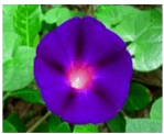
Convolvulaceae (34 species)
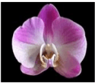
Orchidaceous (47 species),
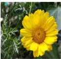
Asteraceae (54 species)
Acanthaceae (65 specils)
Kochi Municipal Corporation
ENVIRONMENT
Figure 21:23 Common flora in Kochi Corporation Source: City Biodiversity Index study-Kochi-2020, ICLEI.
Figure 21:24 Vegetated areas in Kochi Source: WRI, India
Kochi Municipal Corporation
ENVIRONMENT
Table 21-4 shows the list of common trees seen in Kochi
Table 214 List of Common trees within Corporation area
Common Name
Scientific name
Local name
Red bead tree
Adenantherapavonina
Manchadi
Tree of heaven
Ailanthus excelsa
Matti
Rain Tree
Albiziasaman
Mazhamaram
Wild jack
Artocarpushirsutus
Anjili
Neem
Azadirachtaindica
Aryaveppu
Bidi Leaf
Bauhinia racemosa
Mandaram
Dividivi plant
Caesalpiniacoriaria
Dividivi
Sappan wood
Caesalpiniasappan
Chappangam
Elephant palm
Caryotaurens
Aanapana
Amaltas
Cassia fistula
Kanikonna
Cinnamon
Cinnamomumverum
Karuvapatta
Fiddlewood
Citharexylumspinosum
Parijatham
Gajanimma
Citrus pennivesiculata
Naragam
Coconut
Cocosnucifera
Thengu
GulMohur,
Delonixregia
Poomaram
Giant Indian Fig
Ficusauriculata
Atthi
Banyan tree
Ficusbenghalensis
Peraal
Weeping Fig
Ficusbenjamina
Vellal
Gular Fig
Ficusracemosa
Atthi-al
Peepal tree
Ficusreligiosa
Arayal
Pride of India
Lagerstroemia speciosa
Manimaruthu
Illipe Butter Tree
Madhucaneriifolia
Iluppa
Mango tree
Mangiferaindica
Mavu
Indian Cork Tree
Millingtoniahortensis
Akasaveppu
Indian gooseberry
Phyllanthusemblica
Nelli
Cemetery tree
Polyalthialongifolia
Aranamaram
Sita Asoka tree
Saracaasoca
Ashokam
Source: Data from Mangalavanam, Plant Handbook of Subhashpark, Kochi Municipal Corporation
Kochi Municipal Corporation
ENVIRONMENT
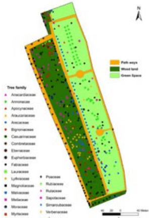
Several of the parks in the corporation area are rich in vegetative cover having wide variety of trees (both endemic and exotic) and are rich in herb and shrub diversity along with rich insect and avifaunal diversity.
Figure 21:25 Map of Tree families in Subash park,
Source: Plant Handbook of Subhashpark, Kochi Municipal Corporation
578
Sacred groves
Although two of the largest sacred groves in the state, the Irigolkavu and Aruvikalkavuis located in Ernakulam district, most of the smaller sacred groves in Kochi Corporation is either privately owned or owned by temple authorities. Despite their ecological significance, belief in the sacrosanct is the only thing that kept the sacred groves protected so far. But with natural degradation and developmental pressures these sacred groves are facing threat of extinction.
Brown hydromorphic soil
Encountered in valley bottoms
Enriched in clay content and plant nutrients. The soil is suited for paddy cultivation
Hydromorphic saline soil (acid saline)
Coastal tracts of the district in Kanayannur and Cochin taluk
The tidal backwaters contribute to the salinity of the soil. Coconut is grown in these soils.
Lateritic
Muvattupuzha, Kothamangalam, Kunnathunadu and parts of Aluvataluk
These soils are well drained, low in organic matter and plant nutrients. The major crops grown are coconut, tapioca, rubber, areca nut, pepper, cashew and spices
The key aspects of the soil in Cochin Corporation are;
➢ Tidal backwaters contribute to the salinity of the soil reducing the general productivity for crops but otherwise suitable for coconut and pokkali rice farming (farming technique with seasonal alteration of rice crops and fish farming)
Kochi Municipal Corporation
ENVIRONMENT
562
➢ Backflow from the backwaters into the tidal canals in summer months also increase the salinity content
➢ Clayey plastic soil can be disastrous during tremors and filling up of marsh lands and backwaters can be hazardous to be controlled.
➢ The high clay content in the soil reduces the permeability leading to increase in the runoff and less ground water recharge.
Figure 21:15 Average Ground Water depth level Source: CGWB
Kochi Municipal Corporation
ENVIRONMENT
Many railway crossings with culverts and bridges have inadequate vent-ways causing water back-up and preventing navigation (country boats).
The blockage in the canals makes the water become stagnant resulting in foul smell and mosquito breeding in many areas in the city. At times, water tops the banks and inundates the nearby areas.
The result of water quality analysis revealed high degree of pollution in the canals. The analysed parameters such as turbidity, pH, conductivity etc. exceed the permissible limits for any class. The high levels of faecal coliform may infiltrate into the nearby wells and seriously affect the health of the residents in these areas.
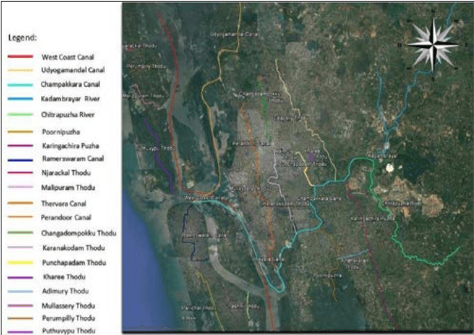
Figure 21:18 Important water bodies in KCR
Source: Study of Conservation/ Development of Paddy/ wetland area in the KCR, 2017
Kochi Municipal Corporation
ENVIRONMENT
Figure 21:19 Major Canals passing within the Kochi Corporation Boundary Source: Land use survey - 2020
Ponds/wells
As per the information received from fisheries department there are 3 major private ponds covering a total area of 0.04 Ha and 15 temple ponds covering an area of 0.428 Ha within the city. However smaller ponds which will be the key runoff point may be found within the corporation boundary under the ownership of private parties which is yet to be documented and provided with conservation status.
Kochi Municipal Corporation
ENVIRONMENT
Vertebrate study in Mangalavanam reported (SACON 2004)- 74 species of vertebrates
2 species of amphibians
5 species of reptiles
• 5 mammals
398 birds (dominant)-62 species
• 20 species of fish
Vembanadlake(Ramsar site) houses economically important fish species are found in the lake such as cichilids,cyprinids, mullets, cat fish, crustaceans such as penaeids and crabs. (Asha,2004)
80 species of fin fishes,
5 species of penaeid shrimps
• 3 species of palaemonid prawns
2 species of crabs
Home gardens also act as a good reservoir of biodiversity. One study in the nearby panchayats recorded 56 species of plants in 168 surveyed home gardens (Sankaret al., 2000) At Puthuvypeen(MULT EIA study- 2015) the following were sighted
50 species of fish species
• 8 species of prawn
• 4 species of crab
2 species of clams
2 species of amphibians
• 9 species of reptiles
• 43 bird and 9 mammalian species
Kochi Municipal Corporation
ENVIRONMENT
Figure 21:26Migratory ducks of Mangalavanam , Olive Ridley Turtle which used to nest in the beaches of Kochi (now scarcely found), butterflies and snakes found in Kochi (Source: City Biodiversity Index study, EIA MULT 2015, Study of tree species in Subash park (CHED & ICLEI), iNaturalist – Kochi Checklist (https://www.inaturalist.org/check\_lists/13680-Kochi-Check-List), www.ebird.org)
21.1.4.1Areas of Ecological importance
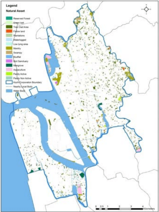
Figure 21:27 Natural assets map of Kochi corporation Source: City Biodiversity Index study for Kochi corporation 2020
Kochi Municipal Corporation
ENVIRONMENT
The map above has been developed for City Biodiveristy Index 2020 at the Kochi corporation. With reference to the above map and in accordance with the existing landuse map available the following natural asset map has been generated for Kochi city.
Figure 21:28 Natural assets map
Source: Land use survey - 2020
Fauna and Avifauna
Rich variety of fauna and avifauna are segregated to the forest areas that lie outside the corporation area along the mid and highlands. The corporation area however supports common animals and birds that are domesticated to the urban environment like cattle, dogs, cats, elephants, monkeys, parrot etc. The Mangalavanam bird sanctuary is located within the corporation area with a rich variety of avian population. Several bird species like Large
Kochi Municipal Corporation
ENVIRONMENT
Cormorant, Indian Darter, Cattle Egret, Indian Pond Heron, Smaller (Median) Egret, Night Heron, Brahminy Kite, Wood Sandpiper, White breasted Waterhen, Stork billed Kingfisher, Lesser Whistling Teal etc. are found to be common here (Source: The Mangalavanam Bird Sanctuary/Mangrove area, Ernakulum Kerala – A brief report submitted to Kerala Forest Department, PA Azeez ,Bhupathy, Salim Ali Centre of Ornithology and Natural History).
An Invertebrate study in Thevarareported (Abin and Samson, 2015).
• 44 species of butterfly
• 10 dragon fly species
49 species of spider
Vertebrate study in Thevarareported
• 44 species of fishes
• 4 species of amphibians
14 species of reptiles
57 species of birds
10 species of mammals
An Invertebrate study in Mangalavanamreported(Azeez and Bhupathy 2006)
• 17 species of butterfly
• 51 species of spider
21.1.4.2Mangrove areas
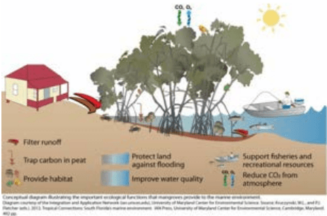
Mangrove forests are characterized by trees, shrubs and vines that thrive in brackish water (water of varying salinity) and are often found around river estuaries (where freshwater from rivers meet the oceans). Mangroves support an ecosystem that is comprised of plants, animals
Kochi Municipal Corporation
ENVIRONMENT
and micro-organisms which are adapted to life in the dynamic environment of the tropical inter-tidal zone. These ecosystems are important environmentally and economically.
Figure 21:29 Functions of Mangroves (schematic)
Mangrove trees can reach a height of up to 45m, producing dense, closed canopy forests that can support up to 80 different plant species; mangrove soils and waters support an abundance of permanent residents in addition to several migratory and juvenile organisms, including economically important species of fish. These Ecosystems are highly productive but extremely sensitive and fragile. Mangroves help in the production of detritus, organic matter, recycling of nutrients, and thus enrich the coastal waters and support benthos population of sea. Moreover thick expanse of mangrove wetlands is crucial preventing coastal flood and sea water upsurge thereby helping considerably in disaster management.