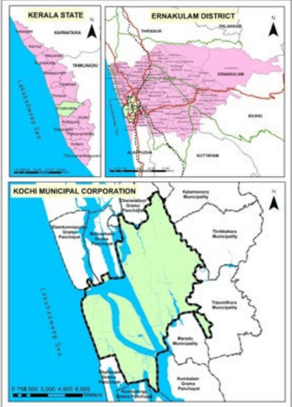
Being a coastal district, Kochi city lies within the low land regions of the State. The average altitude towards the eastern fringes is about 7.5 m above MSL and towards the west the altitude is less than one metre on an average. The elevation map of Kochi Corporation area is shown in Figure 3.2. Maximum elevation of 12 – 14 m is seen in the eastern fringes of the corporation area. The whole of the land slopes gradually from east to west. Kochi has about 8 km of seacoast making the Cochin Harbour, a major natural harbour.
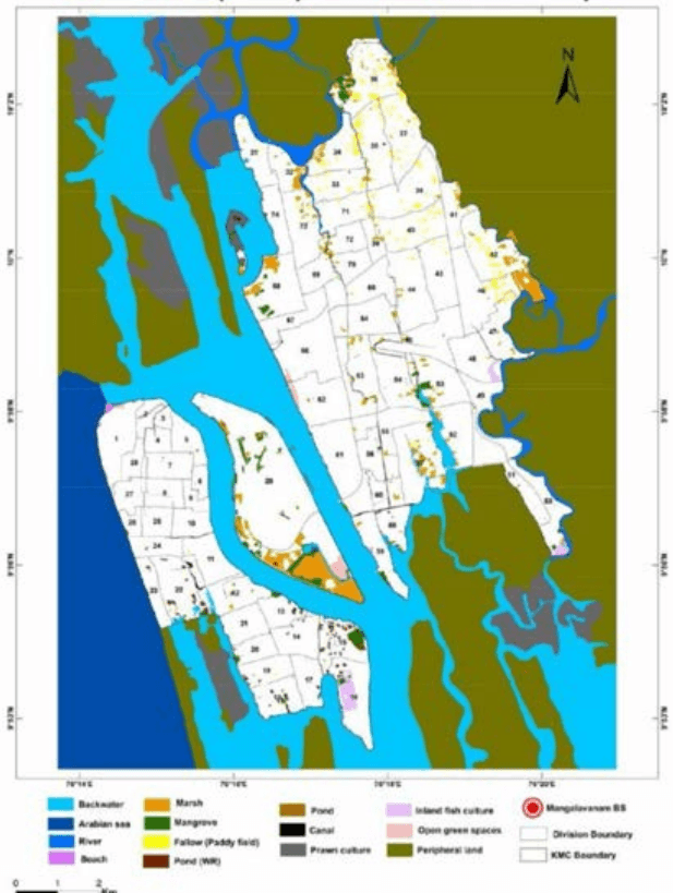
The backwaters around Kochi are dotted with small islands, the main ones being Willingdon Island, Vypeen, Thanthonni Thuruth, Ponjikkara (Bolgatty Island), Vallarpadam, Kumbalam, and Cheranellur etc. Most of these islands are very small, varying in extent from 8 sq. km to less than 3 sq. km. The backwaters of Kochi are part of Vembanad lake system.
Kochi is embedded in a complex network of rivers, tidal creeks, backwaters, lakes and the sea which are vital to supporting the city’s coastal communities in addition to being effective channels that can drain off water in the event of extreme rainfall. The drainage canals of Kochi
Kochi Municipal Corporation
PROFILE OF THE CITY
were earlier part of an extensive network of transportation system were goods and logistics were transported through water.
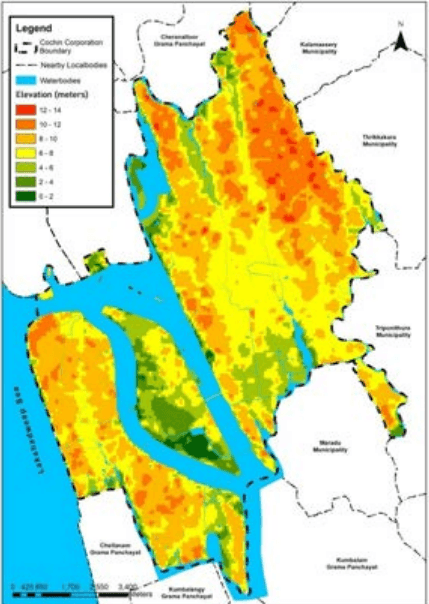
Figure 3:2 Elevation map of Kochi Corporation Area Source: Generated from DEM
The northern parts of Kochi corporation area are drained by Periyar watershed while the southern areas are included in Muvattupuzha water shed. Chittur puzha which is part of the Periyar river system passes through the Northern borders of the corporation area. The Edappally thodu which forms part of Chitrappuzha drains the Eastern and South Eastern areas of Corporation and forms the Eastern boundary. The Chithrapuzha and the Vembanad Lake mainly drain the southern portion of the mainland. The Chithrapuzha originates from the eastern hills and joins Vembanad Lake. The Champakkara Canal forms the Southern boundary
30
Kochi Municipal Corporation
PROFILE OF THE CITY
of the mainland and forms part of Vembanad backwaters. An ecologically sensitive area, the Mangalavanam Bird Sanctuary is located in the heart of the city. It has a wide range of mangrove species and is a nesting area for several migratory birds.
On the basis of morphological features and physiochemical properties, the soils of the district are classified as Lateritic, Hydromorphic saline, Brown hydromorphic, Riverine alluvium and Coastal alluvium.
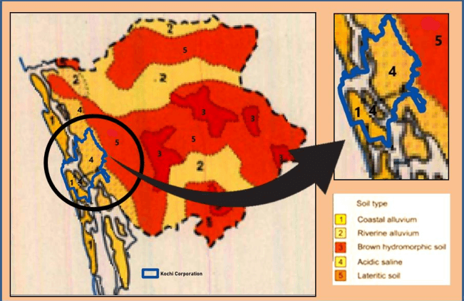
Figure 3:3 Map showing Soil types of Kochi Corporation Area Source: District resource maps- EKM, CESS
Small patches of hydromorphic saline soil are encountered in the coastal tracts of the district in Kanayannur and Cochin taluk. The tidal backwaters contribute to the salinity of the soil. Coconut is grown in these soils. Within the Kochi Corporation area, coastal alluvium and acidic saline soil types are majorly found.