Inventory details of major corridors within Kochi city were compiled from field surveys which included information on length of road, width of carriageway, road furniture and land use aspects. The homogenous sections with their hierarchical pattern are shown in figure below.
Kochi Municipal Corporation
TRANSPORTATION
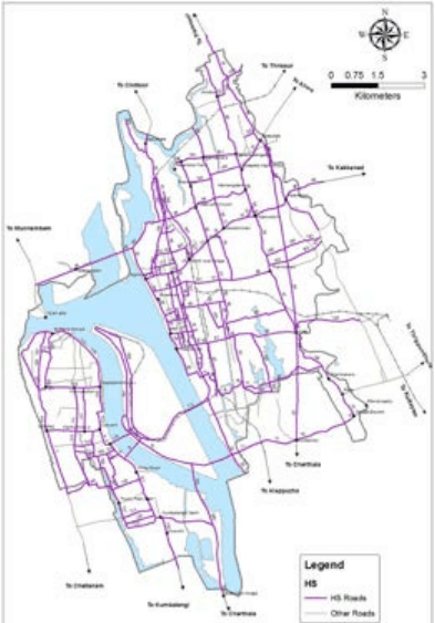
Figure 8:3Homogenous Sections and the Heirarchical Pattern of Roads in Kochi City Source: NATPAC study report, 2019
It can be observed that a total of 213km of roads were studied for road inventory, out of which only 18% of the roads had four lane road width and rest had either two or intermediate lanes. Only 35% of the roads in the city had footpath on at least one side of the road. The remaining roads were not observed to have a footpath on either side. From the inventory survey, 65% of the roads were found to be served with public transport bus services.
A total of 46km of roads can be classified as arterial roads which constituted 22% of all studied roads. Major arterial roads included NH 66, MG road, SA road and Vyppin road and NH 966 B from Kochi port to Thrippunithura via Kundanoor. About 16% of roads can be classified as sub-arterial roads which consist of SH66 from Chellanam to Kochi Port, Kaloor-Kadavanthara road, Marine Driver road, Chittoor road, Palarivattam – Kakkanad road, Thoppumpady – Mattancherry road etc.
Kochi Municipal Corporation
TRANSPORTATION