Vacant land comprises those areas which were not assigned any specific use at the time of the survey, but indicated land development and conversion to an urban use in the near future, and were under private ownership. Vacant lands covered around 638.48 Ha and contributed 6.73% of the municipal area and are present in all Divisions. The concentration of the land use is shown in below.
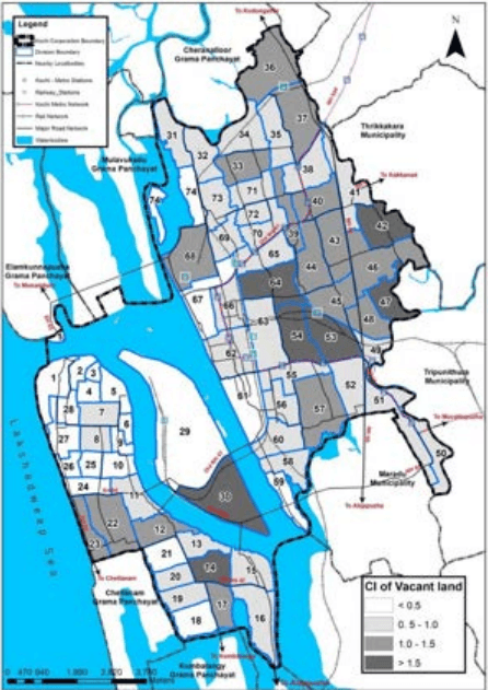
Figure 6:22 Concentration Index of Vacant Land Use Source : LSGD (Planning)
The concentration is highest in and around the Divisions having high concentration of urban uses like commercial, public, semi-public, etc. This indicates that these urban uses are likely to spread to these vacant lands in near future or provide potential for high density residential
Kochi Municipal Corporation
LAND USE
use for the nearby land uses. Some of the vacant lands were found among developing residential areas, indicating plot development activities for residential purposes. The Divisions with maximum concentration are 30, 42, 47, 53, 54, and 64.
6.2.22 Wetlands Land Use
The Wet land areas occupy 189.68 Ha which occupy 2 % of the municipal area. The concentration index of the land use is shown below.
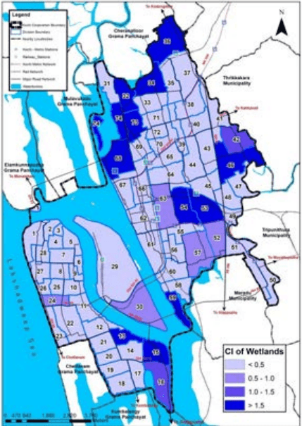
Figure 6:23 Concentration Index of Wetland Land Use Source : LSGD (Planning)
As shown in Figure 6:23 Concentration Index of Wetland Land Use, the land use is concentrated in Division-42, Division-41 Padivattom, Division-35 Ponnekara, Division-48 Ponnuruni East, Division-57 Kadavantra and Division-50 Chambakkara.
Kochi Municipal Corporation
LAND USE