Kochi with its wealth of historical associations and its unique setting reflects the eclecticism of Kerala. It is one of India’s important ports and a major Naval Base.Its high order of advancement in social services as well as trade and commerce, along with tremendous development potential to add impetus to the economic development of the State make Kochi one of the priority cities in the State. Growing at an unprecedented pace, the city needs to be able to integrate its elegant past as well as the modern developments into an organic whole, which demands a purposeful transformation of the socio-economic, natural and built environment. The city will be a prime mover and nerve centre of ideas and actions. This needs a co-ordinated and integrated approach amongst several agencies involved with urban services and development along with a participatory planning process at local levels.
The Structure Plan for Central City, Kochi, 2001, the plan in operation, guided the local government in their respective development actions within the central city region. However, the supporting infrastructure and urban services provision has not yet matched the expectations. The problems faced by the city from its early stages, like transportation bottlenecks, inadequacy of urban services, unsynchronized land uses and functions, weak industrial base, flooding, etc. still persist. The Development Plan for Kochi city region (2031) is also under preparation but for a fast growing city like Kochi the state of affairs has deviated a lot from these plan proposals also.
The city experiences rapid growth and doesn’t have any comprehensive spatial planning schemes. Though there are 21 sanctioned Town Planning Schemes for the city centre, most
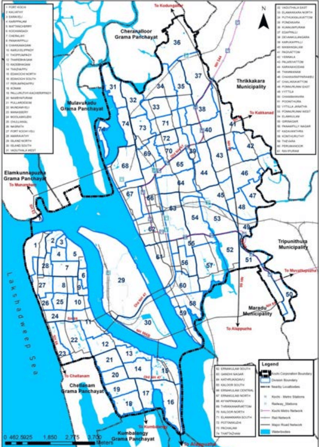
Kochi Municipal Corporation
of them have reached their horizon period. The absence of a scientific framework for development leads to environmental decay and inefficient use of land and other resources. The insufficiency of road widths and the need for improvement of transportation infrastructure is highly felt as the town faces regular traffic congestion during peak hours. The spatial constraints put up by the unregulated growth, blocks the economic development. It is important that the urban growth is regulated in a scientific and sustainable manner, to ensure a good quality of life in the city.
Anticipating the future development needs, it is envisaged that a GIS-based Master plan for the City of Kochi need to be prepared under AMRUT. When a major intervention by the Ministry of Urban Development, Government of India happened in 2005 with the schemefor urban reforms backed infrastructure development, the Municipal Corporation of Kochi prepared a City Development Plan (CDP) to be used as a basic document to prioritise the infrastructure developments in the city. However, certain basic issues like land use planning etc. were not part of this document since the intention was different. CDP has been an input for this Master Plan, like the earlier Structure Plan for the Central City, Kochi – 2001 which was used as a reference document for preparation of CDP.