408
The area drains are the drains which discharge the storm water and sullage from a neighbourhood to secondary drain. The city has large network of area drains, which act as major storm water receivers. The area drains are absent in many of the areas especially in areas with urban proliferation. These drains need immediate attention. These are the primary cause for water logging in the various neighbourhoods in the city. In the traffic and transportation study conducted for the City Development plan reveals that 87.5% of the roads network had drainage facility. However, only 8% of these roads were having covered drainage.
| Sl. No. | Description of item | Quantity (Km) |
| Kochi Corporation | ||
| 1 | Total length of the primary canal | 77 |
| 2 | Total length of the natural and manmade secondary drains | 222 |
| 3 | Total length of area drains | 740 |
Source: Irrigation Division - Ernakulam, Kochi Municipal Corporation
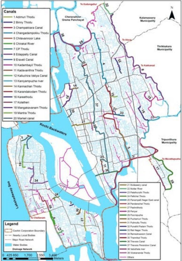
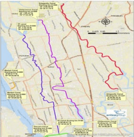
Above mentioned eighteen major canals traverse through the Corporation area serving as primary or arterial drains. These canals discharge into the back waters. The secondary drains join the arterial canals that discharge the storm and sullage coming from tertiary drains of the Corporation area. The total length of secondary drains is approximately 222 km. At present, total length of area drains is 740 km within Corporation of Kochi.
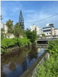
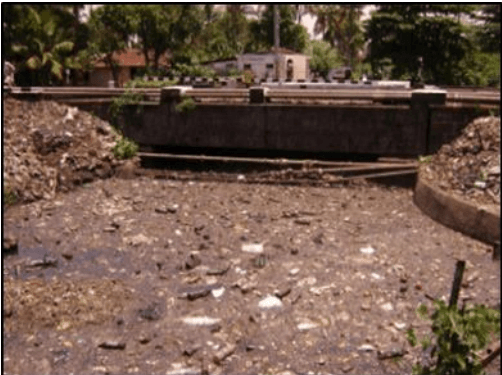
Actual Capacity of these drains cannot be calculated due to heavy silt deposition, discharge of solid wastes and growth of vegetation. Figure 12:2 shows the condition of the drains as given in City Sanitation Plan, 2011. As per the sample study of city sanitation plan, 2011, 45% of the drains are clogged and 53% of the drains are moderately clogged and the remaining of them is maintained well. 80% of the drains in the Corporation area are inadequate to carry the discharge during peak flow due to inadequate capacity in certain culverts and bottle necks.
Kochi Municipal Corporation
DRAINAGE
Also, missing links in the existing drainage networks, irregular/ inadequate maintenance of existing canals and storm water drains act as constraints leading to inefficiency of drains.
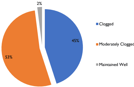
Figure 12:2 Condition of the drains
Source: City Sanitation Plan, 2011
After Operation Break Through (OBT), which was aimed at renovating and removing the blockage of the canal and backwater mouths, small canals etc, the conditions of drains have gradually improved. The project was implemented in two stages. In the first phase, the drains in the city were renovated to avoid flooding and in the second phase, the kayal mouths were concentrated to remove the obstruction. Now, the third phase of OBT is under way.
Backwaters and Water Bodies
Drains and canal networks in Kochi are inextricably linked to the Vembanad Lake and backwaters, which form part of a long chain of lakes and canals with its northern boundary at Azheekodu and southern boundary at Thaneermukam bund (Figure 12:3). The total area of the Backwater is about 157sq.km (from Survey of India toposheet, 1981) with depth ranging from 2m to 8m. Two rivers, Periyar and Muvattupuzha discharge into these backwaters. Their ecological importance stems from the following:
Kochi Municipal Corporation
DRAINAGE
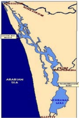
Figure 12:3 Backwaters of Kochi
Source: www.nccr.gov.in
➢ The salinity gradient in Kochi Backwaters supports diverse species of flora and fauna, according to their tolerance for saline environment.
➢ This tropical estuary, with high productivity acts as a nursery ground for species of marine estuarine fin-fishes
➢ The low-lying swamps and tidal creeks dominated by sparse patches of mangroves provide shelter to juveniles of many species.
➢ The areas of the backwaters with fine sediments and organic matter supports fauna.
➢ The changes in the hydrology of backwaters controlled by the seas play an important role in regulating the migrant fauna of the estuary.
Major threats to Kochi Backwaters and related concerns include massive reclamation for development, creation of hydraulic barrier bunds that impact natural flushing in the canal systems, and disposal, pollution due to coconut husk retting, industrial pollution from the Eloor - Kalamassery belt and over-exploitation of fish and other resources.
410
Storm water Drainage System
The city has a separate storm water drainage network but lacks a sewerage network. So grey water and black water is also discharged in to the canals and drains. According to census 2011, 87.41% of the Household wastewater outlets in the Corporation area are connected to storm
Kochi Municipal Corporation
DRAINAGE
drainage. The high water table, tidal effect and malfunctioning of septic tanks all aggravates the issues related to drainage.
| Indicator | Kochi Municipal Corporation | Kerala (State) |
|---|---|---|
| % of Household wastewater outlet connected to drainage | 87.41 | 54.55 |
Source: Household amenities and assets, Census of India 2011
Major locations where the storm water mixes with sewer water includes Fort Kochi-Mattancherry, Thoppumpadi – Palluruthy – Edakochi, Vaduthala – Pachalam, Kaloor – Kathirikkadavu, Edappally – Palarivattom, Thammanam – Karanakodam, Padivattom, Pipeline – Vyttila, Vyttila – Petta, Vyttila – Vennala, Vyttila – Thykoodam and Thevara – Konthuruthy. The major reasons can be attributed to absence of sewerage system, inadequate capacity of septic tank and poor condition of septic tanks. Table 12:4 provides comparative information of service levels with respect to the service level bench marks prescribed by MoUD and sustainable standards for service levels under the National Mission on Sustainable Habitat (NMSH) for Corporation of Kochi. Coverage of storm water drainage network in the city is only 68% when compared to the sustainable standards.
| Indicators | Sustainable standard | Black (Caution for improvement) | Red (Immediate action for improvement) | Present Status |
|---|---|---|---|---|
| Coverage of Storm water drainage network | 100% | <75% | <50% | 68% |
| Incidence of sewerage mixing in the drains | 0% | <25% | <50% | 40% |
| Incidence of water logging | 0% | <25% | <50% | 62Nos |
Source: CSP, CDP and municipal registers
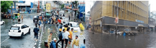
Out of the total length of the drain length, 1400km of drains are required to be up graded and covered. 38km of the drains have been covered and upgraded in 2016-17. Incidents of water logging in the city, varies according to the tidal effect and rain during monsoon, which are unpredictable due to climate change.