3.2.1 Location
Kochi city is located in Ernakulam district, between 7 6 ° 4 ° and 7 6 ° 2 1 ° East longitude and 9 0 52’ and 1 0 ° North Latitude. The district is bounded on the north by Thrissur district, on the east by Idukki district and on the south by Kottayam and Alappuzha districts. It is bounded on the west by Arabian Sea. The town is 83 km south of Thrissur town, 53 km and 62 km north of Alappuzha and Kottayam towns.
The city is bounded by Elamkunnappuzha, Mulavukad, Kadamakudy and Cheranalloor panchayats on the north, Eloor, Kalamasserry,Thrikkakkara and Thripunithura municipalities on the east and Maradu municipality and Chellanam panchayat on the south. The Lakshadweep Sea envelops the city all along the western boundary. It lies barely 2 meters above sea level. This is the second most important port city in the western coast of India and is the commercial capital of the State.
Kochi Municipal Corporation
PROFILE OF THE CITY
Some of the other nearest towns are North Paravur (33km), Aluva (27 km), Angamaly (25 kms), Perumbavoor (41 km), Kothamangalam (55km), Muvattupuzha (42km), Piravom (34 kms), Vaikom (38km) and Cherthala (32 km).
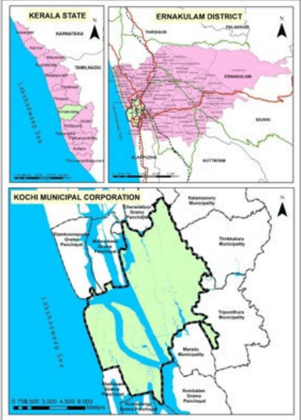
Figure 3:1 Location of Kochi City Source: LSGD(Planning)