Pabal Growth Centre is proposed to serve the north-eastern part of PMR between the Pune- Nashik Road (NH-60) and Pune- Ahmednagar Road (NH-753F). The Growth Centre serves 24 villages under its catchment, falling under Shirur taluka. The main intention for the growth centre is to provide for tertiary level amenities
The total area of the Growth Centre is 3959.82 ha. According to Census 2011, the population of Pabal village was 8224 while the population of its catchment was 58940.
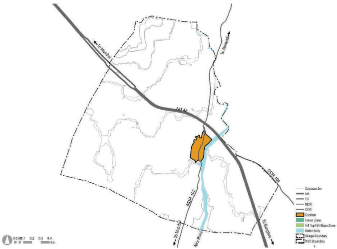
Pabal is located on the north-eastern side of PMR along the SH 117, SH 129 and SH 103 within Shirur taluka. Khed- Ranajangaon GC forms western arm while Chakan GC,Alandi GC and Wagholi GC form the south-western arm of the total catchment area of Pabal Growth Centre.Shikrapur GC forms the southern edge of the catchment. The approximate distance of the Growth Centre from PMC is 40 km. It is situated at the crossroads of SH-117, SH-103, and SH-129. SH-117 connects the Growth Centre to Shikrapur Growth Centre and Khed-Rajgurunagar. Further, SH-103 connects the RGC to Alandi GC. State Highways provides strong regional connectivity to Pabal RGC. VR-22, VR-10, and VR-7 converge at PabalGaothan, creating a radial pattern.
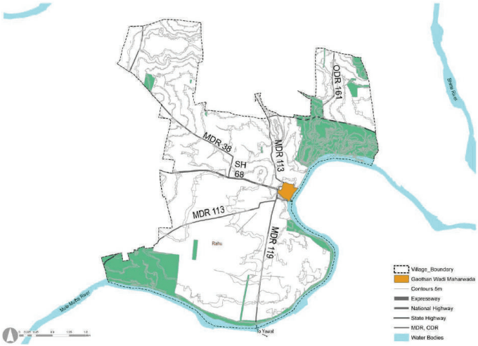
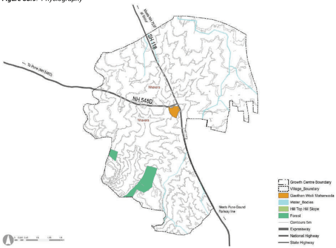
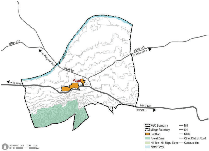
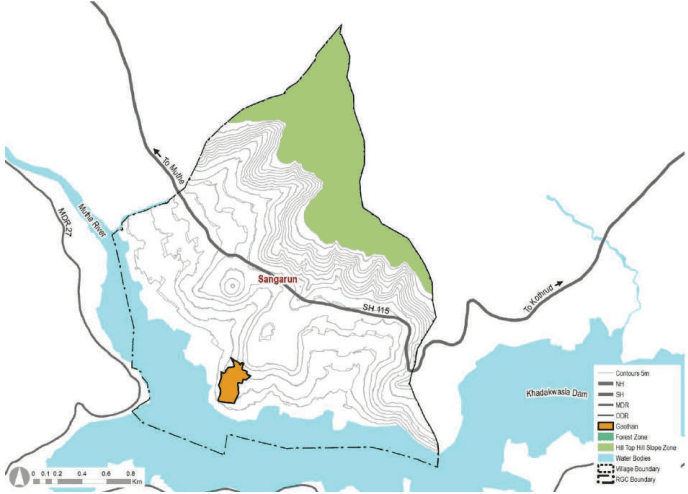
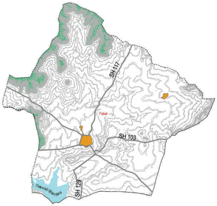
The Growth Centre is located over a larger basin of the Bhima River. Tithewadi Bhandara Dam is built on Vel River which is located 2.5 km away from the Pabal Gaothan. The area is located comparatively on flat terrain, with its terrain gradually sloping towards the south.
Figure 38.1: Physiography
Expressway National Highway State Highway MDR, ODR Village Boundary Water Bodies Hill Top Hill Slope Forest
Chapter 38:Rural Growth Centres
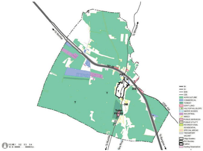
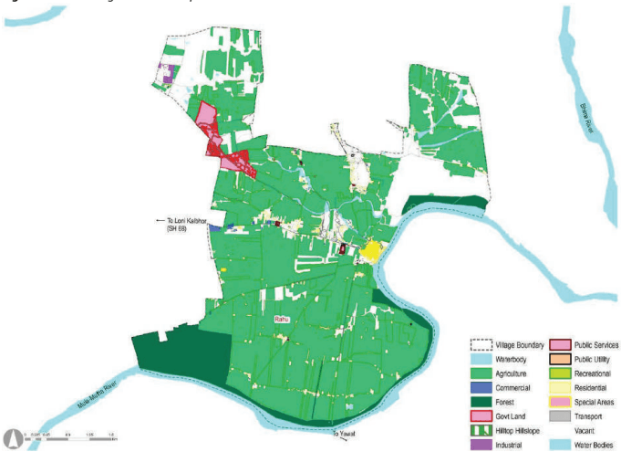
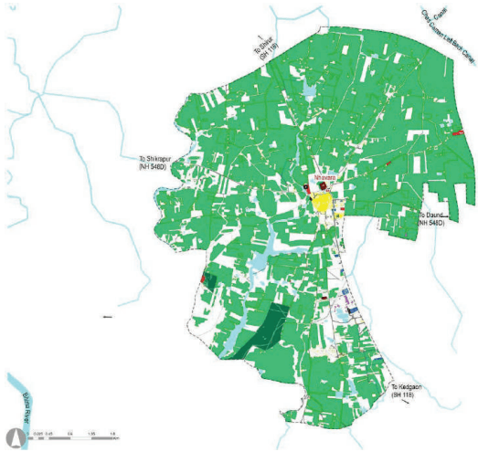
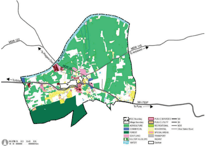
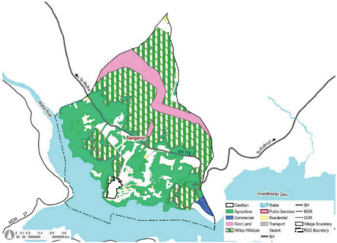
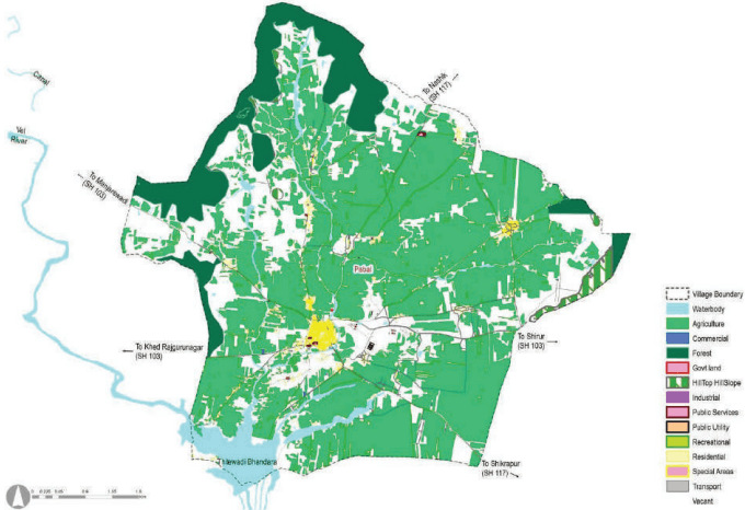
Agriculture use is predominant in the Growth Centre. 41.95 Ha of residential development is observed surrounding the gaothan and along SH-103, SH-117 and SH 129.Residential area merely covers 1% of the total land and supporting landuse such as commercial, PSPs and utilities collectively measures of 0.19 %.Vacant land occupies 1095.31 Ha of area and is observed near forest land and in the central part. Natural features constitute about 16.29 % of the land, with a major proportion of forest land and water bodies .Forest land is mostly in the northeastern and western part.
Public and semi-public zone occupy 4.25 Ha of area, all aligning SH-103. Public facilities such as 11 schools, colleges, electric sub-station and 2 primary health care facilities are present surrounding the gaothan. Special Economic Zone was proposed in the northern part with area 307.2 ha for boosting the economy of the region.
Figure 38.2: Existing Land Use Map
| Landuse Category | Area (ha) | Proportion of Total Devel-oped Area (%) | Proportion of Total Area (%) |
|---|---|---|---|
| Residential | 41.95 | 37.16 | 1.07 |
| Commercial | 1.90 | 1.68 | 0.05 |
| Industrial | 0.33 | 0.29 | 0.01 |
| Public- Semi Public | 4.25 | 3.76 | 0.11 |
| Garden, Playground and Recreation | 0.02 | 0.02 | 0.00 |
| Public Utility | 1.13 | 1.00 | 0.03 |
| Transportation | 63.13 | 55.92 | 1.61 |
| Govt land | 0.19 | 0.17 | 0.00 |
| Total Developed area | 112.90 | 100.00 2.88 |
|---|---|---|
| Agriculture | 2069.54 | 52.86 |
| Water bodies | 183.87 | 4.70 |
| Vacant land | 1095.31 | 27.98 |
| Forest | 410.57 | 10.49 |
| Hill top Hill slope | 43.08 | 1.10 |
| Total Undeveloped area | 3802.37 | 97.12 |
| Total area | 3915.27 | 100.00 |
Proposed role and strategies:
Pabal Growth Centre is proposed to cover the north-eastern rural villages of PMR. As per the delineation criteria, the village is accessed by a state highway SH-103, SH 129 and SH-117, the central location of the village within two urban arms along NH-60 and NH-753F. This village has a population higher than the region’s average population per village ie>2000 ppl, and mainly it forms the administrative center (headquarter of a circle level as per revenue department).
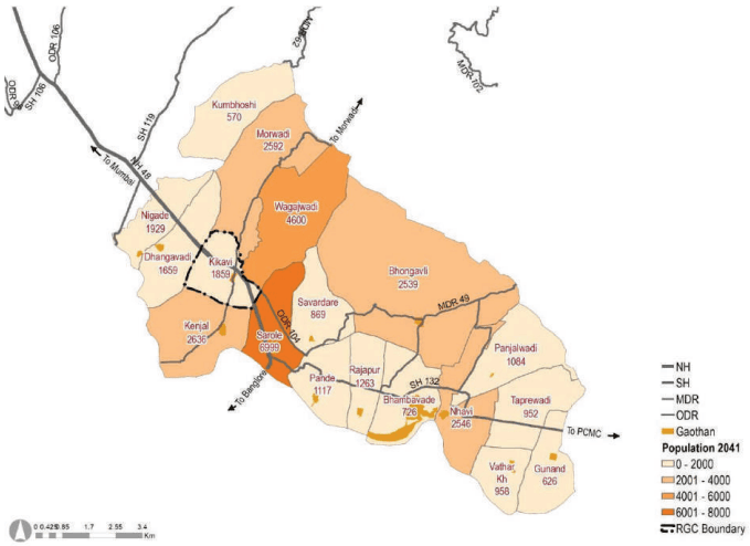
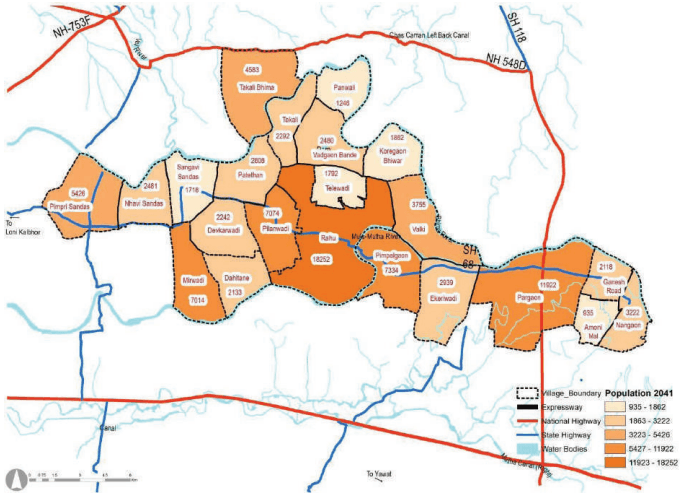
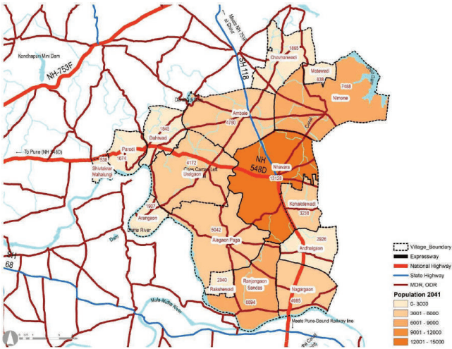
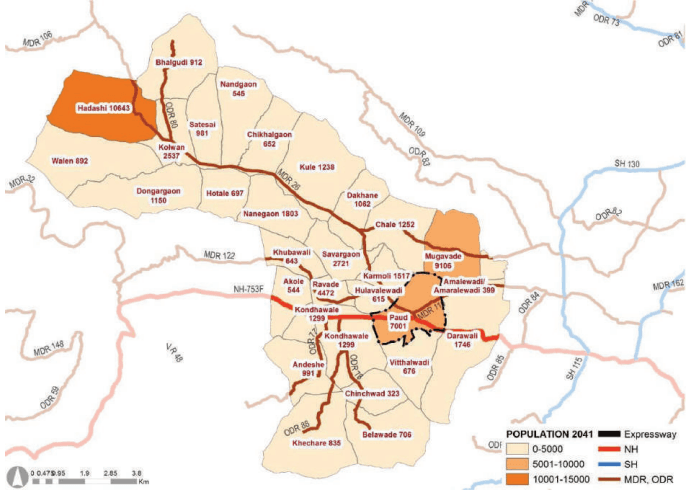
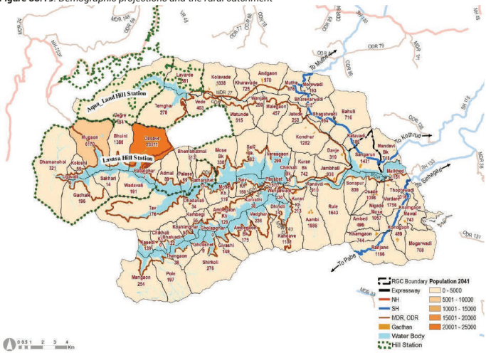
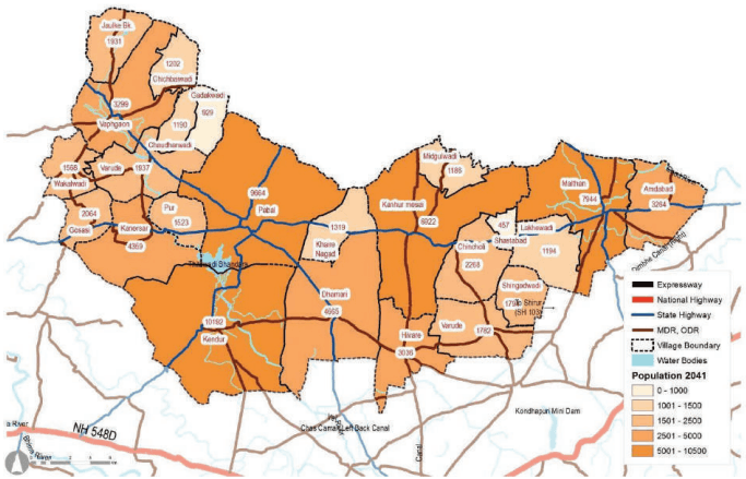
The projected population for 2041 for Pabal village is 9,664 while that of the catchment which includes 24 villages is 75,689. Amenities are proposed based on a projected population of 2031 which 9,267 for the village and 70,689 for the catchment. The following map shows the distribution of the projected 2041 population.
Figure 38.3: Demographic projections and the rural catchment
Chapter 38:Rural Growth Centres
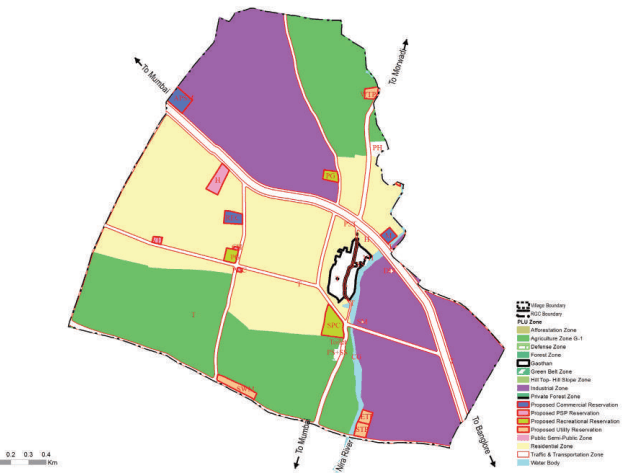
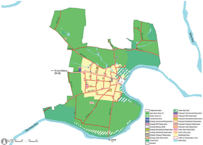
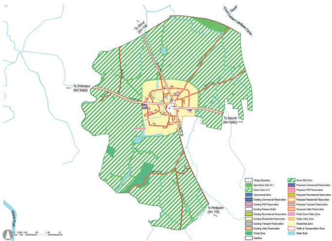
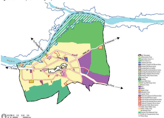
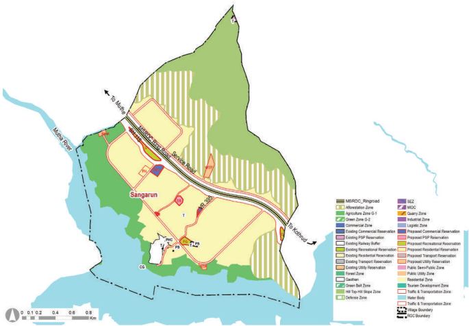
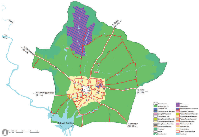
The proposed zoning would guide and determine the optimal and efficient land use for the next 20 years. The proposed zoning plan is an output of existing land use and physical conditions analysis, gaothan expansion boundaries, local knowledge of the place, and deployment of five planning goals and allied physical planning strategies. The proposed zoning area statement is presented in the below table.
Following strategies elaborate the zoning plan for the Growth Centre:
-
Residential Zone: The total residential zone of 278.6 ha is proposed accommodating 9664 population. Density of this growth center is 75 pph. radial residential expansion of 0.5 km is provided along SH-103 and SH-117 to accommodate future population.
-
Agriculture Zone: To promote agriculture, maximum area 65.78 % is proposed for agriculture.
-
Water-body zone: Tithewadi Bhandara Dam edges the south western part of Growth centre, with streams aligning in north-south direction. The tributaries originating from this village meets Vel river in the south. The total area under its blue line is 183.87 ha and that of the entire green belt proposed is 6.6 ha.
-
Green Belt/ Forest/ Hill top hill slope: The forests and hill top hill slope form the green segments. The area under HTHS and Forest is 43.08 ha and 410.57 ha respectively.
-
Proposed Amenities: For future development a large portion of government land is used for proposing amenities. The key reservations proposed here are the Rural empowerment centre, Agro market, multipurpose ground which acts as helipad, sports complex, town park and cultural centre. A shopping Centre is also proposed adjoining the Agro market. Health care facilities like hospital and vertinary hospital are proposed too.
-
Proposed Utilities: Fire Station is proposed closed to SH 103 for better accessibility in case of emergency. There are existing 2 cremation grounds. STP is proposed along SH 129 near Tithewadi Bhandara dam.WTP is proposed over an area of 0.18 ha. SWM site provided over an area of 1.58 ha.
Figure 38.9: Proposed Zoning Map
| Land use category | Area (ha) | Proportion of Tota oped Area (%) | l Devel- Proportion of Total Area(%) |
|---|---|---|---|
| Residential | 278.67 | 36.36% | 7.11% |
| Gaothan | 15.33 | 2.00% | 0.39% |
| Commercial | 4.89 | 0.64% | 0.12% |
| Industrial | 0 | 0.00% | 0.00% |
| Public semi Public | 11.4 | 1.49% | 0.29% |
| Public Utility | 2.38 | 0.31% | 0.06% |
| Transport | 150.33 | 19.62% | 3.84% |
| SEZ | 303.38 | 39.59% | 7.74% |
| Total Developed Area | 766.38 | 100.00% | 19.56% |
| Agriculture Zone G-1 | 2493.56 | 63.63% | |
| Green Belt Zone | 6.22 | 0.16% | |
| Hilltop Hillslope Zone | 1.89 | 0.05% | |
| Recreational | 7.81 | 0.20% | |
| Forest Zone | 482.86 | 12.32% | |
| Water Body | 159.89 | 4.08% | |
| Total Non-Developable Area | 3152.23 | 80.44% | |
| Total | 3918.61 | 100.00% |