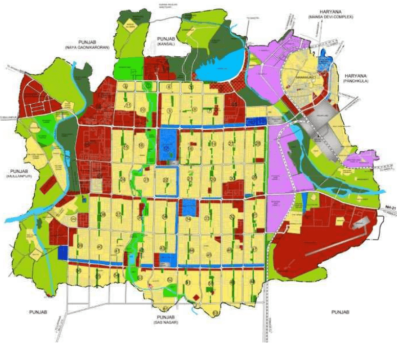
Based on detailed studies, in depth analysis and looking at the future growth and development of the Chandigarh, Proposed Landuse Plan for the Chandigarh Union Territory has been evolved. While evolving this landuse plan, care has been taken to preserve the sectors which have already been planned and the landuses which have already been defined in the planning of the sectors.
Accordingly, no change is proposed in the landuse already defined in the sectors falling in Phase I, Phase II and Phase III with the exception of change of landuse from ‘Residential’ to ‘Institutional/Residential for institutions’ in sectors 50, 51, 52 and 53 in the land vacated from relocating slums. This change is proposed to meet the requirement of additional institutional area within the city.
The changes already made in the area falling in Phase I, II and III including the setting up of Rock Garden, Memory Park, Sports Complex in Sector I etc. have been made an integral part of the Landuse Plan.
13.2Existing Landuse Plan
Landuse for the city of Chandigarh was defined by the Plan prepared by Le Corbusier. Based on the CIAM (Congress International de Architecture Modern) principles of the Functional City which focused on segregation of four major functions i.e. Living (the residential sectors), Working (the Capitol Complex, commercial/institutional buildings along Madhya Marg, Jan Marg, City Centre), Care of Body and Spirit (the Leisure Valley, open spaces and sector greens) and Circulation (the network of roads, the 7Vs).
The total area proposed to be covered in the Master Plan is the entire area of 28169.61 acres comprising of Chandigarh Union Territory .The area includes both the area falling under the Phase I ,Phase II and Phase III sectors besides the area under the periphery. Considering the pattern of development followed in Chandigarh, the Existing Landuse Plan is being detailed out in two parts. Part I comprises of planned development included in the original plan (Phase I & II) and the subsequent developments made as part of the extended sectoral grid (Phase III ). The remaining landuse of the area falling in the periphery is being detailed out separately keeping in view the nature and context of development.
In Phase I and II, out of the 46 sectors in the sectoral grid falling within the first and the second phase of the original plan, 39 sectors are Residential whereas the remaining seven sectors namely sectors I, I2, I4, I7, 26(part), 34(Part), 43(part) are predominantly Institutional and Commercial housing the Capitol Complex, PGI/PEC, Panjab University, City Centre and Sub City Centres respectively. The Industrial Area, the Sukhna Lake, and Golf Range/Club have also been considered as part of the sectoral grid of Phase I and II. Phase III sectors (remaining parts of sectors 48 to 56, 61 and 63) falling in Chandigarh UT have been earmarked as Residential sectors. These sectors also include the belts reserved as Commercial/ Institutional along the Vikas Marg now proposed for mix landuse.
The details of areas falling under different phases and periphery are as under:
CATEGORY
SECTORS
AREA in (acres)
PERCENTAGE
Phase I
1 TO 30 *
9398.83
33.37
Phase II
31 TO 47**
5158.76
18.31
Phase III
48 TO 56 (PART)
1870.54
6.64
TOTAL
16427.73
58.32
Remaining area of periphery
11741.88
41.68
Grand total
28170.00
- Includes the area of Industrial Area Phase I, Sukhna Lake, Golf Range.
- Includes the area under Industrial Phase II .
Out of the total area covered by the Master Plan, 58.32 % (16428.13 acres) falls under the area covered by the planned development whereas remaining area of 41.68% (11741.88 acre) falls in the periphery. Within the area falling under the planned sectors, Phase I has largest area comprising of 1/3rd of the area of the Master Plan whereas Phase II and Phase III has 1/4th of the total area of the Master Plan and remaining area falls in the periphery.
The area in the periphery comprising village abadis, agricultural land and the area where planned and unplanned development has taken place works out to be 11741.87 acres. As explained above, the existing landuse analysis has been carried out in two parts i.e. Area falling within the Sectoral Grid (Phase i, II & III) and Area outside the Sectoral Grid (Periphery).
13.3 EXISTING LANDUSE
Area falling within the Sectoral Grid (Phase I, II and III)
The existing landuse has been analysed in terms of different components i.e. Residential, Commercial, Traffic & Transportation, Industries, Public / Semi Public etc. Refer Table I, II & III. Looking at the above tables in Phase I, largest proportion of land has been allocated to the Residential component (42.69%) whereas Public and Semi Public have approximately same kind of area. The area under the Commercial component is placed at 4.73% whereas Traffic and Transportation occupies around 8% of the Total Area of Phase I. The above proportions of the areas have been worked out based on taking the entire area of residential sectors as the residential component. If the residential component is further detailed out, the proportions under residential will go down, whereas area under commercial, traffic, public and semi public, recreational shall accordingly go up. The detailed Landuse of Sectors falling in Phase I has been given in Annexure I. Each sector has a different pattern of Landuse as detailed out in the Table.
In case of Phase II, the proportion of Residential component is much higher i.e. 67.08 %, similarly, Commercial component is also higher than Phase I. The variation in landuse in this phase is due to the fact that Phase I was planned as low density sectors whereas the Phase II sectors were proposed to house larger population and were planned as high density neighbourhoods with smaller sized plots and ground coverage. As stated above, if the analysis of the sectors is carried out for different landuses, the proportion of Residential component will go down whereas the remaining component will go higher. The details of Landuse of Individual Sectors falling in Phase II is given in Annexure II. Considering the fact that Phase III development is largely guided by group housing, excluding the planning of individual plots, the proportion of Residential component has been found to be much higher. Residential area occupies (3)/(4) of the total area of Phase III. however, the area calculations is again based on taking the sectors as residential landuse without going into the details of various components included in the sector planning. Accordingly, the area under different uses will get rationalised once that analysis is included in different land uses. The detail Landuse of individual sectors falling in Phase III is given in Annexure III.
Landuse Within Remaining Area of UT Periphery
A perusal of the periphery area in the UT indicates that large chunks of land in the periphery have already been acquired for accommodating new land uses.
While developing area in the periphery, the existing road network with few upgradations has been used as the basis for providing accessibility to the pockets and developing these areas without a comprehensive road network. The landuse analysis of the existing development has been carried out for the area falling in the periphery and is detailed in Table IV & V
Out of the Total Area of 11741.88 acres, Residential component covers approx. 1/6th of the total areas. Commercial component accounts for 2.736%, Traffic and Transportation 5%, Industries 4.5%. In addition, area under Defense Use is placed at 13.4% which is close to the Residential component. Other Uses in the periphery area include Public /Semi Public, Recreational and Public Utilities. 19% of the Total Periphery Area is under Forest whereas the Agricultural component accounts for 21.67%.
Chapter 13Land Use
13.1 Introduction
The original Plan of Chandigarh was prepared six decades ago to meet the requirements of the Administrative City for a population of five lakhs. The 70 sq.km area acquired for the development of the first two phases (Sectors 1 to 47) of Chandigarh had clearly defined land use zones based on the CIAM principles of Living, Working, Care of Body and Spirit and Circulation planned within the modulor sectoral grid.
The residential sectors are based on the concept of self sufficient neighbourhoods each having schools, shops for daily needs, community centres and neighbourhood parks.
City and the Periphery
Chandigarh was planned as a stand alone city surrounded by a controlled rural belt around it to nourish it. Although, the city has largely developed as per the original plan and its clearly defined land uses, the controlled periphery even within the UT of Chandigarh has been completely transformed due to re-organisation, majority of the area of the periphery has gone to the state of Punjab (73%), State of Haryana has 24% of the area of the periphery whereas remaining 3% is with the Chandigarh. Accordingly, the area available under periphery with the Chandigarh has been reduced considerably in the post 1966 re-organisation. Over a period of time, large number of developments have been taken up in the periphery, these developments are both of planned and unplanned nature. With these developments, the city has been extended towards the East, South and West to accommodate new requirements without any comprehensive plan. New residential, institutional and other uses have been added both within and outside the sectoral grid. The establishment of the IT park, rehabilitation colonies for unauthorized settlements, Sarangpur Institutional area, Botanical Garden, Milkmen Colony-Dhanas, Dumping Ground for solid waste etc towards the east and west has entailed overstepping of the natural boundaries of the Patiali Ki Rao and the Sukhna Choe.
Considering the development already taken up within the area comprising of the periphery, the same is now proposed to be included as part of the Chandigarh Master Plan 2031 with the exception of the unauthorized constructions raised in violation of Periphery Act. Thus the present landuse plan will define the area covered under Phase I (Sector 1 to 30), Phase-II (Sector 31 to 47) and Phase-III (Sector 48 to 56) besides the area of the periphery.
Expansion of the City beyond the original plan to accommodate additional landuses
Detailed stocktaking of the existing situation within UT's periphery indicates that developments beyond the planned sectoral grid have been irregular dictated more by the availability of land for acquisition and the existing link roads rather than any planning framework. The neighbourhood concept of the city's sectoral grid is conspicuous by its absence in the periphery area.
Chandigarh Villages
The site selected for setting up capital city of Chandigarh included number of villages and their settlements. Different strategies were adopted with regard to villages while evolving the Plan of Chandigarh. For the first phase sectors I to 30, it was decided that all the villages falling within the sectoral grid shall be acquired including the abadi area and the villages will be rehabilitated at an appropriate location. Accordingly all the villages were removed and the villagers were rehabilitated in the Pipliwala and Mariwala rehabilitation colonies which were developed adjacent to Manimajra and within the periphery control area. With regard to four villages falling within the sectoral grid of Phase-II, the agricultural land was acquired but the abadi area were left intact. Accordingly, the abadi of 4 villages Attawa, Butrela and Badheri were adjusted within Sector 42 and Burail in Sector 45 as part of the sector planning.
Two villages namely Kajheri and Palsora which form part of the Phase-III sectors are also proposed to be made integral part of sector planning without acquiring the area under abadi/ Lal Dora except the area under unauthorized/ unregulated constructions raised in violation of the Periphery Act.
The Abadi areas of villages which were adjusted within the sectoral grid of the second and third phase and those in the periphery, have undergone tremendous change from pure residential areas to serving as backend centers for the city's commercial areas lacking in warehousing facilities, providing dormitory accommodation to migrants and the lower income strata unable to afford the high rentals within the main city. Guest houses and godowns are other land uses which have come up within and around the villages.
Existing Development Pattern
Despite Chandigarh being a planned city, it has not been able to avoid un-planned developments. Due to non-provision of low cost housing and services for labour in the original plan, unauthorized settlements have surfaced which are being rehabilitated partly within the sectoral grid but mostly in the peripheral areas. Similarly, informal commercial sector has emerged in a big way since even the booths which are the smallest category of commercial establishments were unaffordable by the migrants/service sector. The Chandigarh Administration planned day care markets and rehri markets adjoining the neighbourhood commercial centres to meet the needs of informal commercial sector. Over a period of time, different areas of the city have also been allotted on temporary basis to meet exigencies /or address the new requirements till such time proper arrangements for the same are made.
13.5Proposed Landuse Within Remaining Area of Periphery
As already explained above, the landuse already defined in the sectors falling within the sectoral grid is proposed to be kept within the existing defined frame work of planning and development. However, considering the decisions already taken by the Administration and in order to meet the future requirements of the city in terms of Rehabilitation of Slums, Amenities, Institutions, Para Military Forces, Defense, Warehousing, Transportation, Bulk Material Market etc. the area available in the Periphery is proposed to be planned and developed to meet these requirements. While defining the future growth and development, care has been taken to integrate these areas with the existing frame work of urban development in order to ensure that the total development falls within well defined framework based on the principle of integration. Accordingly, the Road Network within the periphery has been redefined and integrated with the existing system of traffic and transportation of the city in order to ensure smooth flow and rationalise the traffic within the entire area falling under the Union Territory. Further in order to improve the environs and safeguard the identity of the city, a Green Belt is proposed to be created wherever feasible and desirable. Forest Cover is further proposed to be increased by bringing more area under afforestation in the shape of developing a Wild Life Corridor for linking the Sukhna Wild Life Sanctuary with the Sukhna Lake Forest besides promoting afforestation/green along the Sukhna Choe and Patiali Ki Rao which are proposed as Eco Sensitive Areas.
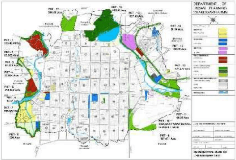
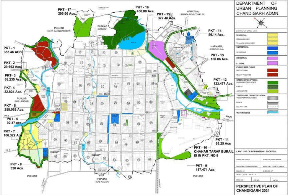
The proposed development in the periphery has been defined in 17 distinct pockets having a total area of 2987.92 acres and the broad landuse for each pocket has been defined. However, each pocket would require to be planned after detailed studies and analysis with appropriate development controls defined to regulate the development within these pockets. Each pocket has been detailed separately in terms of its landuse, traffic and transportation etc. keeping in view its location, environs and its context with the city and development in the neighbouring towns.
An area to the tune of 673.86 acres has been kept for Agriculture in order to make sure that entire periphery is not subjected to urbanisation and to ensure that no urbanisation is permitted on the North of the Capitol Complex based on the Edict of Chandigarh.
The proposed landuse plan for the area falling in the periphery is given in Plan 6.
As already explained that area falling outside Phase I, II and III have been divided into 17 distinct pockets as shown in the Proposed Landuse Plan. Detailed planning and Development Proposals including their Landuse have been worked out and are detailed below:
PLAN 6 PERSPECTIVE PLAN OF CHANDIGARH
Pocket 1 (Refer Table VII)
This pocket measuring approximately 353.46 acres is located on the North West of the city along the Chandigarh-Mullanpur Road near the Interstate Boundary with Punjab. This forms the un-acquired part of the Sarangpur Institutional Area. Only 434 acres of this site has been acquired so far of which some has been allotted/developed for setting up of the Indian Reserve Battalion and the Chandigarh Armed Police and some for Educational Sites and Service Stations etc.
From the perspective of the Chandigarh Master Plan 2031 as a whole, given the fait accompli of land acquisition, infrastructure development and allotment of land to some educational institutions in the Sarangpur Area, the area must be maintained as an Institutional Area. The sites which have already been allotted shall be used for the approved purposes.
The remaining acquired land or to be acquired land in the Sarangpur Institutional Area will be primarily used for the Panjab University and the PGI (in addition to the land designated as institutional/residential for institutions in southern sectors) (Sector 50, 51, 52 and 53 etc. that is land vacated from relocating slums) being the institutes of eminence. Some land may be used for other institutional purposes as may be decided by the Administration.
For development of the Film City, land can be provided in the unacquired portion of Sarangpur Institutional Area (Pocket 1).
• Development parameters for Pocket 1
The area shall be developed as Institutional Area with low density and low rise buildings in view of the natural scenic beauty of the area with the backdrop of the Shivalik Hills. Along the U.T./Punjab boundary 30 mtrs. wide plantation shall be undertaken within the U.T. to segregate the area from the land uses on the Punjab side.
POCKET I
• Road network
In view of the circular configuration of the road network and sewerage system in the acquired part of the Sarangpur Institutional Area, the same configuration is planned for the un-acquired part of Pocket I. Since this is a stand alone pocket and only accessible from defined entries, traffic other than that destined for the area shall not enter it. The width of internal roads in the area should thus be reduced to 35 meters.
The existing road to Mata Jayanti Devi Temple through this pocket should be retained since this is used by large number of followers from this region.
• Land near the UT/Punjab border shall be reserved for an elevated metro station along the metro route.
- Area of land immediately adjoining Khuda Lahora and Jassu villages shall be reserved for developing social and physical infrastructure and to meet the residential requirements of the villages in accordance with the Development Plans proposed to be prepared after examining ground realities. Development of the villages shall be regulated by the Village Byelaws.
Chandigarh Master Plan - 2031
POCKET 2
POCKET 5 (Refer Table VII)
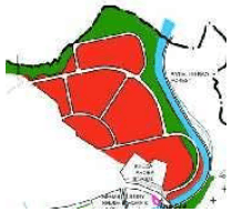
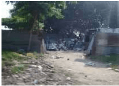
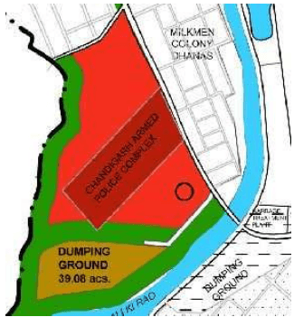
This pocket of 258.062 acres has the Chandigarh Armed Police Housing Complex in its centre. The Landuse of this area shall be institutional with low density and low rise buildings to maintain a green ambience in the periphery. A site for dumping ground has also been proposed in this area.
To protect the Patiali-ki-Rao and the neighbouring area from pollution, the dumping site shall be surrounded by a green buffer on all sides. . A 60 ft. wide road branching off from the existing road running along Patiali-ki-Rao is proposed to provide direct access to the dumping ground.
POCKET 5
POCKET 5
Since the site proposed for the dumping ground is not an ideal site in view of its nearness to developed areas and closeness to the Patiali-ki-Rao, and in the absence of an appropriate alternative, the Chandigarh Administrative has requested the Punjab Government to provide alternative land within the state
POCKET NO.6
POCKET 2 (Refer Table VII)
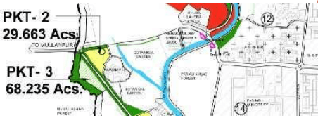
29.663 acres of agricultural land to the north of the Sarangpur Village has direct access from Chandigarh Mullanpur Road via PGI and via Dakshin Marg. This pocket is reserved for future expansion of the village and for essential community facilities for residents.
Unauthorized marble trade which has sprung in the area shall be relocated in the area proposed for Warehousing in village Daria and in the New Bulk Material Area proposed adjoining Pocket 8 south of the Wholesale Grain, Fruit and Vegetable Market, Sector 39. This would facilitate the construction activity of proposed projects concentrated in Maloya and the third phase sectors.
A Green Belt of 30 mts. width along the Chandigarh-Mullanpur Road extending towards the Botanical Garden shall be developed to enhance the entry to the city from the Punjab side.
No building shall be permitted to have direct access from the Chandigarh –Mullanpur Road.
POCKET 3 (Refer Table VII)
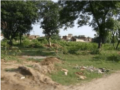
This pocket of 68.235 acres is located next to the entry to the UT from Mullanpur, abutting the interstate boundary with Punjab. The Landuse of this pocket shall be reserved for future unforeseen requirements of the UT. A green belt 30 mts. wide shall be developed/provided along the Dhanas road and the interstate boundary.
POCKET 4 (Refer Table VII)
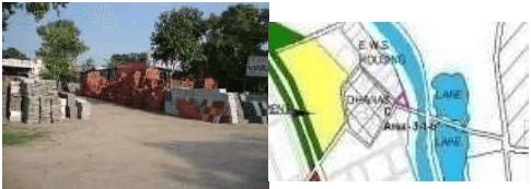
This pocket of 32.824 acres falls along the extension of Dakshin Marg and adjoins Village Dhanas. It is reserved for low density residential use and the future requirements of Dhanas village. A Comprehensive Development Plan integrating existing development of the village with the proposed extension shall be prepared which shall address the gaps in social and physical infrastructure and open spaces etc.
Landuse –
• In view of the existing rehabilitation colony, this pocket is proposed to be developed for middle income, high density group housing.
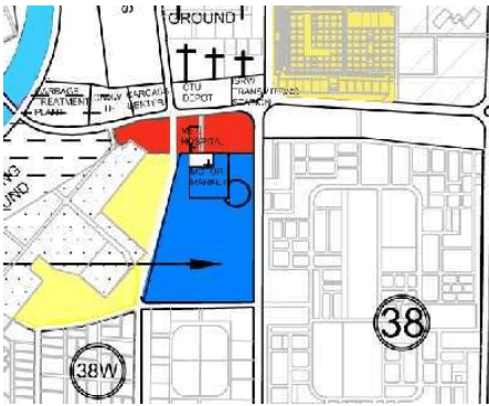
- The area across the proposed road (from extension of Dakshin Marg upto sector dividing road of 38 West) is proposed to be utilized for commercial activities including a marriage palace.
- To provide better accessibility and to segregate the residential area it is proposed to extend the road dividing Pocket A & B of 38-West to meet extension of Dakshin Marg. A pocket along extension of Dakshin Marg has been proposed as Institutional in continuity with the existing Institutional Area on Dakshin Marg.
Note: The ancillary social infrastructure including community centers recreational & educational health institutions and local level shopping facilities shall be provided as per Neighbourhood Concept and sites for social and physical infrastructure of the town.
Pocket 7 (Refer Table VII)
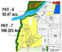
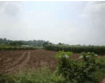
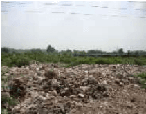
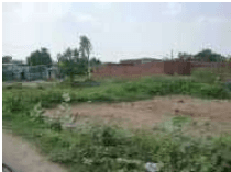
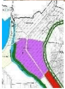
Measuring 166.322 acres, this pocket surrounds Village Maloya and the Rehabilitation Colony Maloya and abuts the Interstate Boundary with Punjab. The site for a Second Grain Market adjoins this pocket.
The proposed Landuse for the rest of the land is Residential. Besides augmenting the housing stock for rehabilitation, the physical and social infrastructure of Dadu Majra and Maloya villages will also be augmented.
A Comprehensive Plan for the area around the villages needs to be prepared after conducting detailed surveys and analysis. Chandigarh Administration has already acquired 162 acres for the Rehabilitation Scheme Maloya-I adjoining the inter-state boundary and another 66 acre for the Rehabilitation Scheme Maloya-II. The planning of the two schemes is at an advanced stage and its execution is to be undertaken by the Chandigarh Housing Board. Since most of this pocket is already committed for the above rehabilitation schemes, Residential Use is proposed as the landuse for the remaining scattered patches.
With a view to provide better connectivity to the proposed large high density residential development it is proposed to extend the Vikas Marg and road cutting across Maloya-I to complete the loop. The matter will need to be taken up with the Municipal Corporation for proper alignment.
Allied infrastructure such as bus stands need to be integrated. While the new areas to be developed will have commensurate social infrastructure, the deficit in facilities in the existing villages and colonies needs to be made up.
In keeping with the concept of a continuous green belt defining the UT's boundary, this pocket shall have a 30m wide Green Belt along the Interstate Boundary. That will also deal with the objection of the Punjab Government towards the Economically Weaker Sections (EWS) housing and rehabilitation colonies being located next to the Interstate Boundary.
POCKET 8 (Refer Table VII)
Measuring 320 acres ,this pocket lies to the west of Sector-56 and abuts the Interstate Boundary with Punjab.
Land use –
• 45 acres for a Transport Area to be developed by Chandigarh Administration or its undertakings.
- The Municipal Corporation's proposal for a Sewerage Treatment Plant for the developments in the western periphery, across Patiali-ki-Rao has also been incorporated in the planned land use. While carrying out detailed planning of the area it shall be ensured that a sufficient green buffer shall be provided along the boundaries of the site.
• Gawala/Kumhars Colony is already existing near the interstate boundary which shall be retained.
- With a view to provide better connectivity to the proposed large high density residential development, a 100 feet wide road has been proposed between Vikas Marg via Maloya Rehabilitation Colony and existing road along Patiali ki Rao Choe, which is also to be strengthened upto Madhya Marg to serve as an alternative link/bypass for the traffic coming from the western periphery.
• The remaining area of the 320 acres has been proposed as reserved for future requirements.
- Apart from the above, the Bulk Material Market, Warehousing and Transport Area has been proposed abutting the V3 road leading to Mohali.
- The site measuring 74.55 acres for the Second Grain, Fruit And Vegetable Market is also earmarked across the road adjoining the Water Works. The infrastructure of roads, sewerage, water supply, electricity along with an auction platform has already been developed at site.
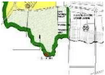
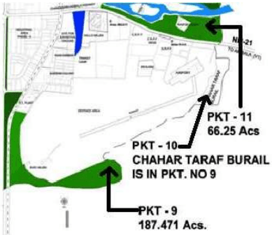
13.5.9Pocket 9 & 10
Measuring 187.471 acres this pocket lies opposite Sector 48 adjoining the railway line and the airport. Since this area has no linkage with the main city combined with the restrictions on landuse due to proximity to the Defense Land, it is proposed to retain this area as a Green/Open. Embankment of the railway track on the east of Sector 47 and Sector 48 shall be suitably landscaped to protect it from erosion.
POCKET NO.9
POCKET NO.11
POCKET 10 (Refer Table VII)
This pocket also abuts the Airport Area and the interstate boundary with the state of Punjab. The pocket has no independent approach.
The land use for this pocket has also been proposed as green/open space and shall be developed subject to air funnel/ defence restrictions and confirmation of the interstate boundary and area by revenue authorities. However, on reconfirmation of boundaries, it has been confirmed by the revenue authorities that this is not a separate pocket and its area is part of Pocket 9.
POCKET 11 (Refer Table VII)
Measuring 66.25 acres this pockets lies along the Chandigarh-Ambala stretch of NH-21, surrounding Raipur Khurd village.
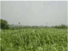
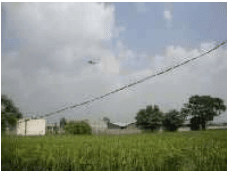
Since this pocket falls at the entry to the city, the permitted landuse is green/open space with uses like agriculture, natural farming with promotion of local agro bio-diversity/indigenous crops, horticulture, orchards, plant nursery, green houses, floriculture, dairy farm, fishery, poultry, etc. subject to obtaining prior approval from the competent authority of Chandigarh Administration.
Large scale unauthorized and hazardous development which have taken place in the pocket needs to be strictly controlled /and checked. A comprehensive development plan for Riapur Khurd village and the developments outside it shall be prepared after conducting and analyzing ground surveys. The development regulations of the villages shall also be strictly enforced.
The extended Abadi should remain away from the main road as well as the Sukhna Choe.
No effluent discharge/pollution of the Sukhna Choe is to be permitted and the area notified as an Eco-Sensitive Zone.
POCKET NO.12
POCKET 12 (Refer Table VII)
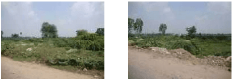
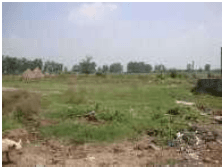
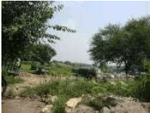
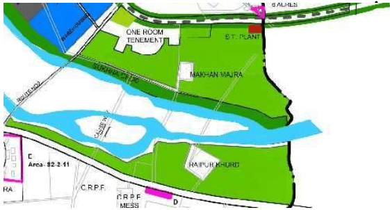
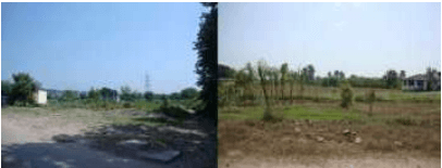
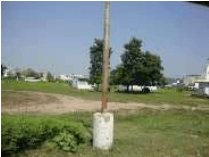
- This pocket of 123.477 acres abuts the Chandigarh-Ambala Road on one side and the interstate boundary with Punjab on another. The railway line and Route No.2 also pass by its side. A small village Makhan Majra, a housing colony of one room tenements and a sewerage treatment plant fall within the pocket.
• A Green buffer of 100 ft. width is proposed along the railway line.
Land use - the permitted landuse for this pocket shall be green/open spaces with uses like agriculture, natural farming with promotion of local agro bio-diversity/indigenous crops, horticulture, orchards, plant nursery, green houses, floriculture, dairy farm, fishery, poultry, etc. subject to obtaining prior approval from the competent authority of Chandigarh Administration.
POCKET 13 (Refer Table VII)
• Measuring 160.06 acres this pocket lies in the close vicinity of the railway station and Village Daria
- Landuse -Due to its proximity to the railway station the land use of this pocket shall be Commercial and Warehousing. Having a warehousing zone adjacent to the railway station is desirable from economic and functional point of view which is evident from the large number of warehouses already existing in the area. Many residential buildings within the abadi deh of Village Daria have been converted into warehouses/godowns. A large number of un-authorized godowns have also come up around the village.
Approximately 97.06 acres of land has been allocated for Warehousing and another 45 acres are proposed for the Transport Area. About 18 acres is proposed for Green.
POCKET 13
At present about 300 companies are operating their transport business from different part of Chandigarh i.e. Transport Area, Timber Market, Industrial Area, Manimajra, Motor Market and Daria. The present Transport area has only 28 plots where other transport companies have rented space for operating their business. No plots have been carved out since 1966 when the transport area was set up.
The Chandigarh Transport Association has demanded that an ultra modern transport complex catering for 2000 trucks on 75 acres of land with facilities for workers and labour is required for loading and unloading of goods etc.
Therefore, another pocket of 45 acres are being proposed for Transport Nagar and as brought out earlier another Transport Area is also being planned close to the Grain Market and the Bulk Market in the new Sector-56 West carved out on the western end of the city.
The matter was further deliberated in 75 th Master Plan Committee meeting held on 22.08.2012 wherein it was felt that the facilities like transport etc. are the basic requirements for the Bulk Material Market, Grain Market or other markets which are serving the region. It was also discussed that the present site of transport area should not be shifted as the same is required due to its proximity to Railway Station, Timber Market, Second Grain Fruit and Vegetable Market. However, additional sites can be proposed which should be preferably near the Industrial Area/Bulk Material Markets.
POCKET 15 (Refer Table IV)
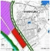
The Chandigarh Administration had initiated the process of acquiring land for Phase-III of the Rajiv Gandhi Chandigarh Technology Park. The land adjoins Phase I & II of the IT Park and is close to Manimajra, railway line and the Sukhna Choe. The 200 ft. wide road connecting the IT Park to the railway crossing cuts through the land.
Land use - The landuse of the pocket is proposed as IT for expansion/ continuity of existing IT complex under Phase I & II with provision of ancillary and other related uses. In view of the eco sensitive nature of the area and extensive tree covered, the same needs detailed planning to ensure their preservation.
The Development Plan for the area needs to be comprehensively worked out to ensure its proper integration with the already developed IT Park Phase-I and Phase-II.
A Green belt 30 mts. Wide has been proposed along the railway line and 100 mts. wide along the Sukhna Choe.
POCKET 16 (Refer Table VII)
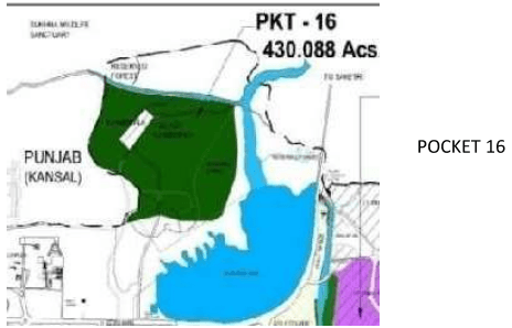
• Measuring 450 acres this pocket lies in Kaimbwala Village in the north-eastern part of the city adjoining the inter-state boundary with Punjab and on the upper end of the Sukhna Lake. This area is important from the urban design perspective and the Edict of Chandigarh which recommends a no construction zone north of the Capitol Complex. It is also close to the Sukhna Wildlife Sanctuary and falls within the proposed eco-sensitive zone. The area has a mild hilly terrain below the Shivalik Hills forming the natural backdrop of Chandigarh.
• The area is also a part of the catchment area of Sukhna Lake.
- Chandigarh Forest Department plans to acquire this land to create a Wildlife Corridor linking the Sukhna Wildlife Sanctuary with the Lake Reserve Forest.
- To ensure that the development activities are in sync with the environmental considerations of the Sukhna Wildlife Sanctuary, and the urban design of the city, the Kaimbwala Village is proposed as an eco-sensitive village with specific regulations which will be more stringent than the rules applicable to other villages of Chandigarh plan of which has been prepared by the Chandigarh Administration. The basic aim and objective of establishment of Wildlife Corridor is as follows:-
• To provide connectivity of Sukhna Wild Life Sanctuary and Lake Reserve Forest so that animals from Lake Reserve Forest can move freely to Sukhna Wild Life Sanctuary and vice – versa. At present, the Lake Reserve Forest is separated by Sukhna Wild Life Sanctuary by roads and agricultural lands.
- The Lake Reserve Forest area is prone to fire hazards especially in summer, due to which wild animals like Sambhar stray into the city area and also onto the roads. In case the Wildlife Corridor is established, the wild animals can in case of such fire hazards and other such emergencies. move into Sukhna Wild Life Sanctuary area
• Areas on the North of the Capitol Complex falling in the States of Punjab and Haryana
The North of the Capitol Complex is highly sensitive area from the environmental and urban design considerations of the city of Chandigarh. Though the area does not fall within the jurisdiction of Chandigarh and as such the Chandigarh Administration has no statutory mechanism by way of which it can restrict any development in the neighbouring states. However in view of the importance of safeguarding the interest of the city, the matter has been taken up with the coordination committee and in the inter-state meetings to ensure that the developments being carried out/proposed as
POCKET 17
per the Development Plan, Nayagaon. Shree Mata Mansa Devi Complex adjoining the Sukhna Lake do not in any way mar the inherent characteristic of the town and its original concepts. The state Governments have appreciated the concerns of the Chandigarh Administration and have assured to make necessary amendments in the development controls so that no high rise construction comes up in the area. The Government of India has also taken serious note of the same and while approving the report of the Expert Heritage Committee has recommended that the matter should be addressed through an interstate regional plan.
The detailed recommendations have been highlighted in Chapter-20 on Chandigarh's Heritage.
Detail of Land Use
RESIDENTIAL URBAN VILLAGES VILLAGES IN PERIPHERY
COMMERCIAL WHOLESALE
INDUSTRIAL I.T. PARK
PUBLIC/ SEMI PUBLIC INSTITUTIONAL EDUCATIONAL HEALTH FACILITIES SPORTS FACILITIES CREMATION GROUND CULTURAL FACILITIES PUBLIC UTILITES
GREEN / OPEN SPACES ORGANISED OPEN SPA FOREST AGRICULTURE
TRAFFIC AND TRANSPORTATION TRANSPORTATION NODES ROADS RAILWAY LINE
WATER BODIES
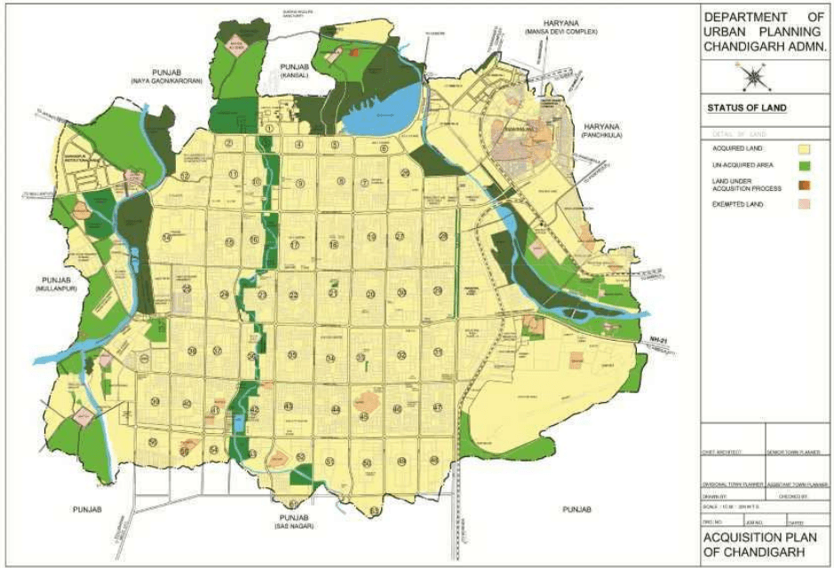
PLAN 5 ACQUISITION PLAN OF CHANDIGARH
土
DEPARTMENT OF URBAN PLANNING CHANDIGARH ADMN.
STATUS OF LAND
DETAIL OF LAND
ACQUIRED LAND
UN-ACQUIRED AREA
LAND UNDER ACQUISITION PROCESS
EXEMPTED LAND
PLAN 6 PERSPECTIVE PLAN OF CHANDIGARH
6. HOUSING IN CHANDIGARH
土
Provision of good quality housing was central to Chandigarh’s planning objective of offering “all amenities to the poorest of the poor to lead a dignified life”. Initially, two main categories of housing were planned in the city - public and private. Subsidized rental public housing for government employees of all categories was built by the government in the early years. In the case of private housing, residential plots varying in size from 125 sq. yds. to 4000 sq. yds. were made available at cost price to individual buyers for building their own houses.
Table Vi-showing Land Use in Proposed Prockets
Sr. No.
Pockets
Proposed zones
Location
Area (in Acres)
Land use
Remarks
1.
1.
Sarangpur
353.46
Institutional
Phase-ii of Sarnagpur institutional Area
2.
2.
Near Sarangpur Villages
29.663
Residential
Expansion of Sarangpur Village
3.
3.
Across Sarangpur Village
68.235
Reserved
Land for future use.
4.
4.
Near Dhanas Village
32.824
Residential
Expansion of Dhanas Village
5.
5.
Opposite Milkman Colony Dhanas
258.062
Institutional
-
5. (I)
5. (a)
Opposite milkmen colony Dhanas
-
Public utilities
Dumping Ground.
6.
6.
Above West of Sector 38
92.47
Commercial
Marriage Palaces and other commercial activities
7.
7.
Maloya
166.322
Residential
Rehabilitation of slum-dwellers and general housing.
8.
8.
Maloya
320
Reserved
Land for future use
9.
9.
Behind Defence area
187.47
Green
Green Buffer
10.
10.
-
0
-
The area of this site is part of pocket 9 as per latest confirmation by revenue department.
11.
11.
Along Chandigarh Ambala Road
66.25
Green/Open Spaces
Agriculture, natural farming with promotion of local agro bio-diversity/indigenous crops, garden centres, horticulture, orchards, plant nursery, green house related to nursery, floriculture, livestock rearing/diary form, sericulture, fishery, poultry, bee keeping.
6.1Government Housing
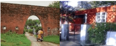
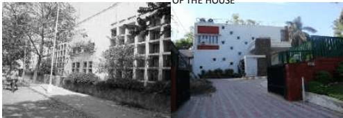
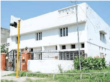
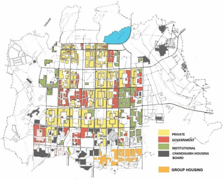
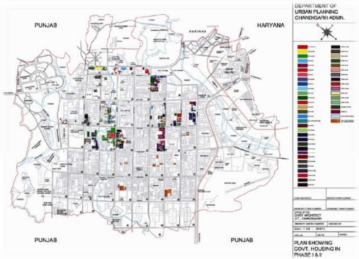
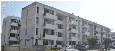
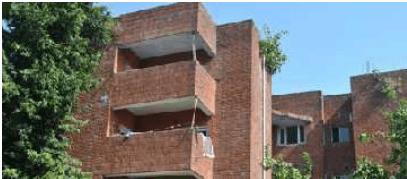
Government housing in the city was initially divided into 13 categories ranging from house for the Chief Minister to the lowest paid class-IV employee. In addition hostels and flats for members of the Legislature were also planned. Plot sizes for government housing ranged from 37.5 sq. yds. to 4000 sq. yds. Most government houses in Phase I were single or double storeyed. Housing in Phase II has much higher density with the largest plot size restricted to 1000 sq. yd. and a large part of it consisting of four storeyed flats. In addition, 800 ‘cheap houses’ were built for poorer non-government workers - the tonga driver, laundrymen, sweepers, and cobblers and later sold to them at nominal prices. Most government houses in the first phase were designed by the expatriate team of architects – Pierre Jeanneret, Maxwell Fry and Jane Drew assisted by a team of young Indian architects. A lot of attention was given to making their design suitable for local climate within severe economic constraints while using local building materials. A plan showing the location of Government housing is at PLAN H 6.2.
Institutional Housing
In addition to government housing, institutional housing has been built by parastatal and/or autonomous bodies such as Panjab University, PGI, IMTACH, CSIO, defence establishments and Survey of India, for their employees. In the early years, 620 housing units for industrial workers were also built by the government in sectors 29 and 30 adjoining the industrial area.
AN ARCHED ENTRY TO A GOVERNMENT HOUSING CLUSTER
LOWER CATEGORY SINGLE STOREYED HOUSING. EACH HOUSE HAS COURTYARD IN THE FRONT AND REAR OF THE HOUSE
GOVERNMENT HOUSING DESIGNED BY PIERRE JEANNERET, MAXWELL FRY AND JANE DREW CELEBRATE VISUAL ORDER AS DESIGN DISCRETION.
6.3Private Housing
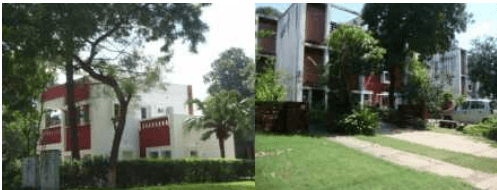
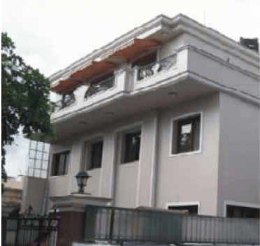
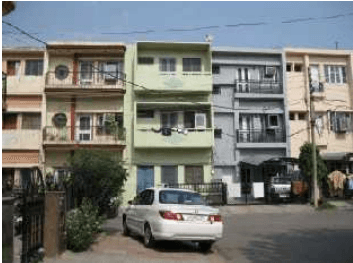
Nearly one - third of the private plots have an area of one kanal or above. These account for over two- thirds of the total area allocated for private residential plots in the original master plan. The first phase of the city had low density with residential plots ranging from 5 marla to 8 kanal. The second phase has much higher density with a switch mostly to three to four storey flats with the largest plot size being 2 kanals. About 70% of housing in the city was to be built privately.
PRIVATE HOUSING SECTOR 19 CHANDIGARH
PRIVATE HOUSING SECTOR 18 CHANDIGARH
MIDDLE CLASS PRIVATE HOUSING SECTOR 22 CHANDIGARH
6.4 Co-op Housing Societies
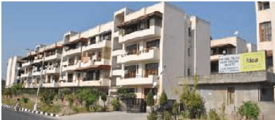
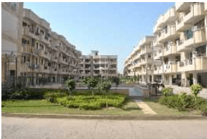
The southern sectors, including the ones in Phase III of the city are being developed as a high density area. Various Co-operative Housing Societies and Chandigarh Housing Board have been allotted land in these sectors for construction of HIG, MIG, LIG and EWS flats.
6.5 Cheap Houses
A special category of low cost houses was built in sectors 15, 19, 20 and 24 for low income non-government workers during the 1950s and 60s and their ownership transferred to the allottees on payment of nominal charges. Initially built as single storied units, additional floors have been added to them by the owners over time.
POCKET 6 (Refer Table VII)
This pocket measures 92.47 acres and falls in Sector-38(W) opposite CTU Workshop and adjoins the Veterinary Hospital.
POCKET 4
POCKET 7
POCKET 8
POCKET NO.14
POCKET NO.15
POCKET NO.15
POCKET 14 (Refer Table VII)
This pocket of 56.14 acres abuts the Chandigarh-Kalka Road and lies along the 200 ft. wide road leading to the Rajiv Gandhi Chandigarh Technology Park.
Landuse --The landuse of the said pocket has been proposed as Public/Semi Public/Institutional. The pocket can be used for augmenting the health infrastructure for the area in and around the area of Manimajra, village Mauli Jagran and rehabilitation colonies etc. which presently lack in adequate city level health facilities.
POCKET . 17 (Refer Table VII)
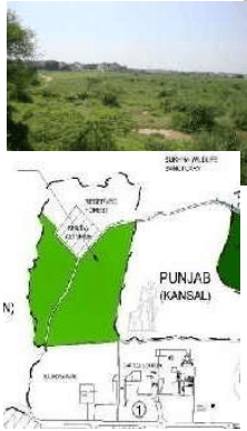
- This Pocket of 296.66 acres is located at the foothills of the Shivalik Hills to the north of the city and is bound by the interstate boundary with Punjab. The site is has a semi-hilly terrain. Village Khuda Alisher falls in the Pocket.
- Like Pocket 16, this pocket is also close to the Sukhna Wild Life Sanctuary and a small part of it falls within the catchment area of the Sukhna Lake.
- The area is also very important from the urban design perspective for preserving the Shivalik Hills as the natural backdrop of the city. Moreover, the Hon'ble High Court of the Punjab and Haryana has ordered a complete ban on construction activity in the area.
- The landuse of the pocket has been proposed as Green/Open Spaces with uses like agriculture, natural farming with promotion of local agro bio-diversity/indigenous crops, horticulture, orchards, plant nursery, green houses, floriculture, dairy farm, fishery, poultry, etc. subject to obtaining prior approval from the competent authority of Chandigarh Administration and fulfillment of stipulations for the proposed Eco-Sensitive Zone around the Wild Life Sanctuary.
To ensure that the development activities are in sync with the environmental considerations of the Sukhna Wildlife Sanctuary, and the urban design of the city, the Kaimbwala Village is proposed as an eco-sensitive village with specific regulations which will be more stringent than the rules applicable to other villages of Chandigarh plan of which has been prepared by the Chandigarh Administration.
No construction activity can however be permitted due to the ban on the construction activity in the area.
12.
12.
Between route No.2 & U.T.Boundary
123.477
Green/Open Spaces
Agriculture, natural farming with promotion of local agro bio-diversity/indigenous crops, garden centres, horticulture, orchards, plant nursery, green house related to nursery, floriculture, livestock rearing/diary form, sericulture, fishery, poultry, bee keeping.
13.
13.
Abutting route No.2
160.06
Commercial
Ware housing.
14.
14.
Abutting Chd.-Kalka road
56.14
Institutional
Low density and low rise building.
15.
15.
Area between I.T. park Ph-II & route No.III leading to Manimajra
327.48
Industrial (I.T. & I.T.E.S.)
Low density and low rise building.
16.
16.
Behing lake, surrounding area of Village Kaimbwala.
450
Forest
To acquire for wildlife corridor
17.
17.
Behind Rajindra Park surrounding area of Village Khuda Ali Sher
296.66
Geen/Open spaces
Agriculture, natural farming with promotion of local agro bio-diversity/indigenous crops, garden centres, horticulture, orchards, plant nursery, green house related to nursery, floriculture, livestock rearing/diary form, sericulture, fishery, poultry, bee keeping.
Total
2987.92
Table VII -LAND USE OF 17 POCKETS IN MASTER PLAN
S.No.
Pocket No.
Area of Pocket (in acres)
Residential
Commercial
Traffic & Transportation
Industrial / IT Park
Public/ Semi Public
recreational
Agriculture
Public Utilities
Forest
Reserved
1
1
353.46
251.72
101.74
2
2
29.663
20.893
8.74
3
3
68.235
21.96
46.275
4
4
32.824
26.2
6
5
5
258.062
132.122
86.86
39.08
6
6
92.47
26.5
44.4
6.57
15
7
7
166.322
121.102
45.22
8
8
320
57.44
262.56
9
9
187.471
187.471
10
10
0
0
11
11
66.25
66.25
12
12
123.477
123.477
13
13
160.06
97.06
45
18
14
14
56.14
56.14
15
15
327.48
283.56
43.92
16
16
450
450
17
17
296.66
296.66
Total
2987.92
194.695
141.46
51.57
283.56
454.982
389.88
673.858
39.08
450
308.835
DISTRIBUTION OF LANDUSES IN CHANDIGARH
EXISTING (Area in acres)
S. No.
Sector
Total Area (in acres)
Residential
Comm.
Transport
Indl./IT Park
Pub/Semi Pub
Recreational
agriculture
Public Utilities
Railway land
Defence
Forest
Reserved
Vacant land
1
Phase-I, Sector 1 to 30, Sec 26E, Indl. Area-I, Sukhna Lake, Golf Range/Club.
9398.83
4012.7
444.49
747.95
516.74
1812.92
1850.33
-
13.7
-
-
2
Phase-II, Sector 31 to 47, West of Sec 38, Indl. Area-II
5158.76
3460.26
433.52
514.23
272.08
372.18
72.19
-
34.3
-
-
-
3
Phase-III, Sector 48 to 56 and part of 61 and 63
1870.54
1371.31
140.51
161.66
-
92.41
81.28
-
23.37
-
-
-
4
Periphery
11741.87
1827.89
321.21
622.26
537.68
691.28
424.67
230.96
316.29
1573.00
**2113.97
*3082.67
5
Total
28170
10672.16
1339.73
2046.10
1326.50
2968.79
2428.47
-
302.33
316.29
1573.00
2113.97
3082.67
6
Percentage
100
37.88
4.76
7.26
4.71
10.54
8.62
-
1.07
1.12
4.52
7.50
10.94
* 3082.67 acres of vacant land includes 40.10 acres acquired land in shahpur, 56.14 acres in manimajra. ** Out of 2113.97 acres of forest land, 1888.24 acres has been intimated by forest deptt. and rest of the 225.73 acres of land has been scaled out from the guide map of chandigarh which is the part of the sukhna wildlife sanctuary within the boundary of chandigarh. The area of forest in pocket no 16 has been revised from 430.088 acres to 450 acres as per information given by Deptt. of forest and Wild life, U.T., Chandigarh Vide memo o FOR/14/639, dated 06-06-2014. The area of 113.98 acres of land in 7 pockets which are unacquired & supplied by theoffice of Deputy Commissioner, UT., Chandigarh at latter stage. The total area of the 17 pockets area 2987.92 acres.
DISTRIBUTION OF LANDUSES IN CHANDIGARH (PROPOSED) Area in acres
7
Proposed in Master Plan 17 pockets
3101.9
194.695
141.46
51.57
283.56
454.982
389.88
673.858
39.08
-
-
450
308.835
113.979
8
Percentage
11.25
0.76
0.31
0.18
1
2.52
1.38
1.52
-
-
1.39
1.05
9
Grand Total(5+7)
28170
10866.85
1481.19
2097.67
1610.06
3423.77
2818.35
672.89
341.41
316.29
1573
2563.97
308.83
113.98
10
Percentage(6+8)
100
38.64
5.07
7.44
5.72
13.82
10.00
2.95
1.21
1.12
4.52
8.89
1.05
-
11
Total area in Sq.Km.
114.00
44.00
6.00
8.49
6.52
13.86
11.41
3.37
1.38
1.28
1.20
10.38
1.19
-
PLAN 3 EXISTING LAND USE
土
INSTITUTIONAL HOUSING AT THE PANJAB UNIVERSITY. SEVEN CATEGORY OF HOUSING (WITH PEONS IN A TYPE PROGRESSING TO THE HIGHER ACADEMICIANS IN LARGER G TYPE )
PLAN H6.1 --HOUSING IN CHANDIGARH
土
Plan H6.2: Location of Government Housing
Sectors with high concentration of Government Housing
The mandate of Chandigarh Housing Board (CHB) is to build affordable, reasonably priced dwelling units for different socioeconomic categories of the city’s residents. The detail of dwellings provided year-wise by CHB is at ANNEXURE-H.1 The board was established in 1976 by extending the Haryana Housing Board Act of 1971 to the Union Territory. The board also undertakes construction of commercial units and other schemes for Chandigarh Administration and other organizations. CHB is also the nodal agency for implementing the administration’s schemes for rehabilitating the residents of unauthorized settlements in the city.
The list of housing schemes by CHB is at ANNEXURE-H.2 & ANNEXURE-H.2(A). Out of these, nearly 42.5% comprising of all the sites and services and most of the EWS units have been provided under different rehabilitation schemes exclusively for the residents of unauthorized settlements. Units in rehabilitation colonies are generally allotted on a hire purchase or license basis with ownership rights being granted only after completing 20 years of stay.
Chandigarh Housing Board has also constructed houses for the poor under schemes like Valmiki Ambedkar Awas Yojna (VAMBAY) and more recently under Jawahar Lal Nehru Urban Renewal Mission (JNNURM).
Prior to creation of the Housing Board, Chandigarh Administration had rehabilitated approximately 12,000 households from unauthorized colonies itself.
CHANDIGARH HOUSING BOARD HOUSING
CHANDIGARH POLICE HOUSING SOCIETY
IAS OFFICERS HOUSES
6.6Provision of Students/working Women’s Hostels
Although Chandigarh already has Young Women Christian Association (YWCA), Young Men Christian Association (YMCA), working women’s hostels together with students’ hostels for various colleges and the university, their availability is inadequate for the increasing demand for such accommodation. The dearth of hostel accommodation, results in outstation students opting for Paying Guest accommodation/hired accommodation in the city/villages. Feedback indicates that despite the deficit within the city to meet the city’s own requirement, the limited hostel facilities are often used by the premier institutes of the neighbouring states which lack in adequate facilities.
6.7Residential Accommodations Through Paying Guest Scheme
Through orders dated 05.09.2006, the Chandigarh Administration permitted the use of residential buildings for paying guest accommodation. The minimum area of the house for paying guest accommodation has been fixed as 10 marla with a condition that portion of the house has to be used by the owner. No extra/new kitchen is allowed and a minimum of 50 sq. ft. is to be provided for each paying guest has to be 50 sq. ft. with provision of toilets at one W.C. for five persons. The norms are being violated much to the disadvantage of the residents of the neighbourhood, who complain of the rowdy environs, parking problems and disturbance throughout the day and night. The students too are left free, unattended and unchecked which is detrimental to the society at large.
COOPERATIVE HOUSING SOCIETIES IN THIRD PHASE SECTORS
STUDENTS/WORKING WOMEN’S HOSTELS IN PANJAB UNIVERSITY
Housing in Unauthorised Settlements
One of the biggest problems of planned urban development is that it is preceded by unplanned settlements of construction labour and other service providers needed for undertaking the planned development. Despite being a totally planned new city the emergence of non-plan settlements and services was an inevitable outcome of the non-integration of socio-economic planning in implementation of the Chandigarh Plan and the virtual absence of holistic housing and employment policies. Recently a policy has been adopted to make it mandatory that all new large housing projects must make at least 15% provision for EWS housing.
Shortage of low cost housing also resulted in villages in the periphery becoming concentrations for lower income urban residents.
The initial unauthorized settlements were located near the Capitol Complex and other areas where city development work was started. Resettlement in peripheral sites with allotment of serviced plots and one room tenements was first undertaken in the mid-1970s mostly on land acquired in villages surrounding the master plan area. Some resettlement was undertaken in the southern sectors. Most of the present unauthorized settlements are located in the southern and eastern parts of the UT. As per a biometric survey undertaken by the Estate Office in 2006, the number of households considered eligible for rehabilitation living in the 18 unauthorized settlements was 23974. The details of unauthorized settlements as per Census 2011 are given in ANNEXURE H.3.
Various rehabilitation schemes for residents of unauthorized settlements have been provided as under:
Efforts have been made to provide all basic facilities to the residents of rehabilitation settlements. But major drawback of these resettlements colonies can be summarized as additional encroachment and violation of building bye-laws.
Cramped for space, many households have built additional rooms or toilets and even additional floors (in the case of those provided independent sites). In spite of that, Chandigarh’s Sites and Services Scheme in Dadu Majra won a national prize from HUDCO in 1979. More recently, Chandigarh was given a national award under JNNURM for setting aside the maximum area for slum rehabilitation. The Slum Rehabs are provided with 2 bed-room Houses in order to maintain a healthy lifestyle and better living conditions.