4.1 Location, Extent and Physiography
Physical Setting
The Union Territory of Chandigarh is located near the foothills of the Shivalik Range in the north-western region of the country and lies between 30 degree 39’ N and 30 degree 49’ N latitude and 75 degree 41’ E and 76 degree 51’ E longitude.
It has a geographical area of 114 sq. km. The territory is also the state capital of Punjab and Haryana.
Chandigarh has a cold dry winter, hot summer and sub tropical monsoon.
The average annual rainfall ranges between 700-1200 mm. The annual temperature varies between 1 degree c to 45 degree c. Winds are generally light and blow from North West to South East direction with the exception of the Easterly to South Easterly winds which blow for some days during the summer season.
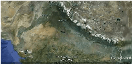
Source – Google Earth
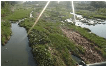
The site selected for the new capital is bound by the two seasonal rivulets of the Patiali Ki Rao and the Sukhna Choe on its eastern and western sides. It has a natural slope from the NE to NW facilitating drainage .
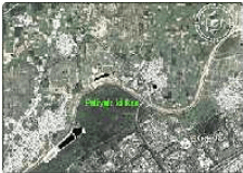
Source – Google Earth
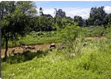
PATIALI KI RAO
Source – Google Earth
Geohydrology
The groundwater in Chandigarh area is present in multilayered aquifers under unconfined and confined conditions. The sand and gravel layers in between clay beds are the main water bearing horizons. The groundwater occurs under unconfined condition down to about 80 m depth in Manimajra area. In other areas, the semi-confined state prevails upto 20-30 m depth. The depth of the shallow aquifer system is less than 30m below the ground level, whereas the deeper aquifer system ranges from 0-45 m below the ground level (CGWB, 2002). Groundwater contour map for shallow aquifers indicates that the groundwater table is above 5 m in the east west part and the water table deepens in the east and north direction.
Seismic Characteristics of the Site
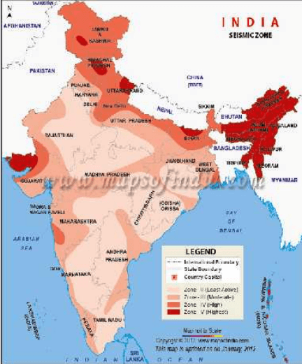
Chandigarh lies in Zone-IV of the Seismic Zonation Map (2002) of India. The Union Territory is located on Indo-Gangetic Alluvium, very near to the active tectonic zone. The Himalayan Frontal Thrust (HFT) passes from the northern boundary of the Union Territory. Along this thrust, the sediments of the Indo-Gangetic Alluvium come in juxtaposition with the Shivalik rocks. The Union Territory, located just south of the Himalayan Frontal Belt, has been included in Seismic Zone IV of the Seismic Zonation Map (BIS, 2002), and, in the last one century, has experienced severe to moderate ground shaking during the 1905 Kangra, 1975 Kinnaur, 2001 Uttarkashi and 2005 Kashmir earthquakes.
The Geological Survey of India, Northern Region has brought out an elaborate report on “Seismic Microzonation of Chandigarh Urban Complex”, which was released on 18th February 2008. The studies indicate the following :
-
The seismic tectonic status of the area reveals that Chandigarh is broadly associated with seismic intensity of VIII on MSK scale and has been categorized in High Hazard Zone.
-
The predominant frequency map suggests that taller structures, particularly of 10 or higher storeys, would experience much greater resonance and, therefore, are likely to have maximum damage under the influence of large earthquakes. Short structures are likely to get away without any pronounced resonance effect and, therefore, are relatively safer.
-
The above findings caution that the design and construction of structures, particularly the high rise ones, should strictly adhere to the Seismic Codes.
Source – Internet website
The fault lines near the Himalayas have been named 'Chandigarh fault‘ and 'Pinjore fault line' because they are located in these regions,, "It is because these fault lines are active that Chandigarh is prone to tremors.
4.2 Sukhna Lake
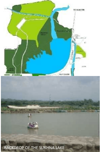
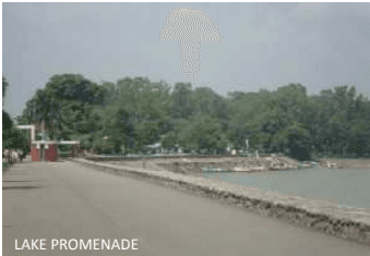
Sukhna Lake in Chandigarh having an area of 3 sq km India is an artificial lake at the foothills of the Himalayas, the Shivalik Hills and forms part of the Capitol Parc designed by Le Corbusier. This rainfed lake was created in 1958 by damming the Sukhna Choe, a seasonal stream coming down from the Shivalik Hills and was a gift to Chandigarh citizens for enjoyment of peace and tranquillity. The area was declared as a ‘Silence Zone’ in 2002 .
SUKHNA LAKE & RESERVED FOREST
BACKDROP OF THE SUKHNA LAKE
The Catchment area of the lake falls to the north of the lake in the states of Punjab, Haryana and the UT Chandigarh. The Sukhna Lake is facing problem of high siltation, drying and weed growth and pollution. The measures which have been taken for preventing the same and recommendations for future have been dealt in detail in the Chapter on Ecology and Environment.
LAKE PROMENADE
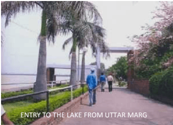
ENTRY TO THE LAKE FROM UTTAR MARG
URBAN DESIGN
Visionaries of the original plan
Chandigarh Master Plan – 2031
4.3
THE ORIGINAL CHANDIGARH PLAN :HOLISTIC APPROACH TO DESIGN
土
A holistic approach was adopted for the planning of Chandigarh which combined with the farsightedness, vision and enthusiasm of the leaders have together contributed to the making of a city a social organism and a work of art. These interactive-interdependent disciplines are:
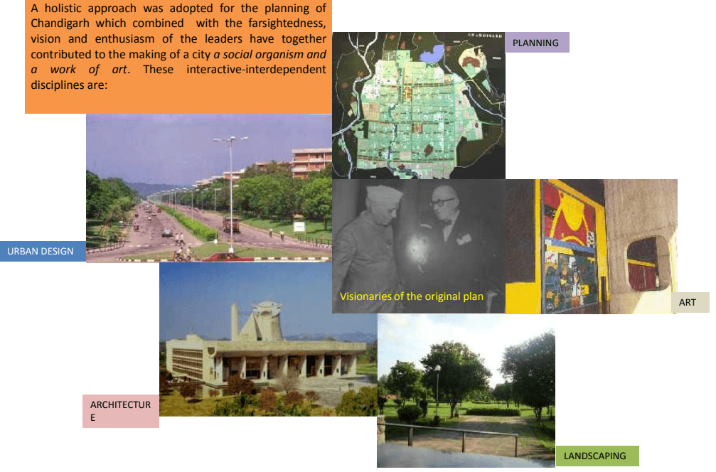
4.4 The Original Chandigarh Plan : Planning
The Chandigarh Plan
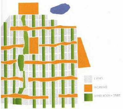
Chandigarh was planned as an Administrative Town for a population of 5 lakhs and built in two phases: Sectors 1 to 30 which formed the First Phase, and Sectors 31 to 47 constituting the Second Phase of its development. The City was planned on the principles of CIAM (Congress Internationaux d’ Architecture Moderne) Theories defining four major city-functions i.e. Living, Working, Care of Body & Spirit, and Circulation.
Le Corbusier conceived the Master Plan of Chandigarh as analogous to Human Body in terms of Head (the Capitol Complex, Sector 1), Heart (the City Centre, Sector 17), Lungs (the Leisure Valley, innumerable open spaces, and sector-greens), the Intellect (the cultural and educational institutions), the Circulatory System (the network of roads, the 7Vs) and the Industrial Area.
FIG 1 THE FOUR MAJOR FUNCTIONS BASED ON CIAM THEORIES
Sketch courtesy – Prof. Vikram Aditya, University of Washington, USA
Working Areas – The Capitol Complex Sector 17, commercial belts along Jan Marg, Madhya Marg, Himalaya Marg , Udyog Path, Dakshin Marg.
Living - the Sectors
Care of body and spirit – Leisure Valley, Sukhna Lake, parks, green belts, cultural belts and the educational belts
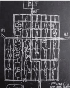
Circulation – the 7v network of roads on a modular grid iron pattern .
V 3
土
4.5 Salient Features of the Chandigarh Plan
The function of Living occupies primary place and has been organised into a cellular system of sectors based on the concept of a neighbourhood unit. Each sector (with the exception of sectors 1 to 6, 12, 14, 17, and 26) has a size of 800m x 1200m which was determined on the parameter of providing all amenities i.e. shops, schools, health centres and places of recreation and worship within a 10-minute walking distance of the residents. The originally planned population of a sector varied between 3000 and 20,000 depending upon the size of plots, the topography of the area, and the urbandesign considerations. Every sector is introvert in character and permits only four vehicular entries into its interior to provide a tranquil and serene environment conducive to the enrichment of life.
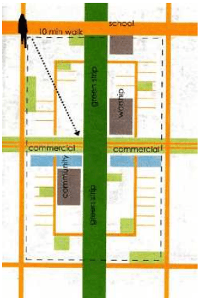
Sector size - 800m x 1200 m determined by maximum 10 minute walking distance from facilities
Introvert planning with sealing walls along main roads so as not to be disturbed by the fast vehicular traffic outside
Emphasis on family life and community living
Schools along green belts safe for children, dispensaries, shopping, community centres, centrally located in 10 minutes walk and bus stops on main road within walking distance.
Parks within 300m
Meandering profile of the V4/V5 to enable slow carriageways
Comfortable vehicular and pedestrian access right to the doorstep of the house Inter-sectoral connectivity along NS green belts.
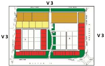
SECTOR 2 IN THE NORTHERN REGIONAL BELT
SECTOR SIZE DETERMINED BY WALKING DISTANCE
Sketch courtesy – Prof. Vikram Aditya, University of Washington, USA
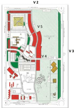
SECTOR 10 - STANDARDISED SECTOR SIZEV 2
Green City Concept
Planned as a Green City with abundance of open spaces, Chandigarh ensures that every dwelling has its adequate share of three elements of Sun, Space and Verdure. Location of green belt was in north south direction to link all sectors with the Shivalik range of hills / mountains.
Concept of 7VS
A well-defined hierarchy of Circulation based on Le Corbusier’s V7s road-system designed to lead traffic into the city and to distribute it right uptill the dwelling unit. Marg refers to the important avenues (V2), while Paths were referred to less important streets (V3).