As per GSDA regulations, all the wells are recommended to be protected without refilling and kept free of encroachment. In case of development, mandatory open space shall be kept around a well with necessary human safety provisions.
-
Prohibit the encroachment on wells.
-
No cesspool shall be used or made within 100 feet of any well as per U-DCPR.
-
Ensure the unhindered flow of rainwater into wells for effective groundwater recharge
-
Ensure that mandatory open space shall be kept around the well in case of developed areas with necessary standard provisions for human safety.
Reducing vulnerability and mitigating disasters: Drought
Drought is a creeping disaster. Its onset is difficult to demarcate, and so is its end. Delay in the arrival of monsoon, failure of monsoon, irregular and scanty rainfall during Kharif, falling of groundwater level, drying of wells and reservoirs and deficit in paddy plantation indicate the onset of drought. Generally, it is non-structural and, therefore, difficult to quantify on an immediate basis. Its spatial extent like that of floods denotes its severity.
The fall in groundwater level, less food production, less fodder for animals, migration of labourers, and water crisis determine its long-term impact. Its impacts like those of floods are cumulative and its continuance over a period or season magnifies the impact manifold.
Drought, unlike other hazards, does not cause any structural damages. The typical effects include loss of crop, livestock, timber, fishery production, food shortage, dehydration, loss of life, increased poverty etc. In fact, the impacts of drought are generally categorized as economic, environmental and social.
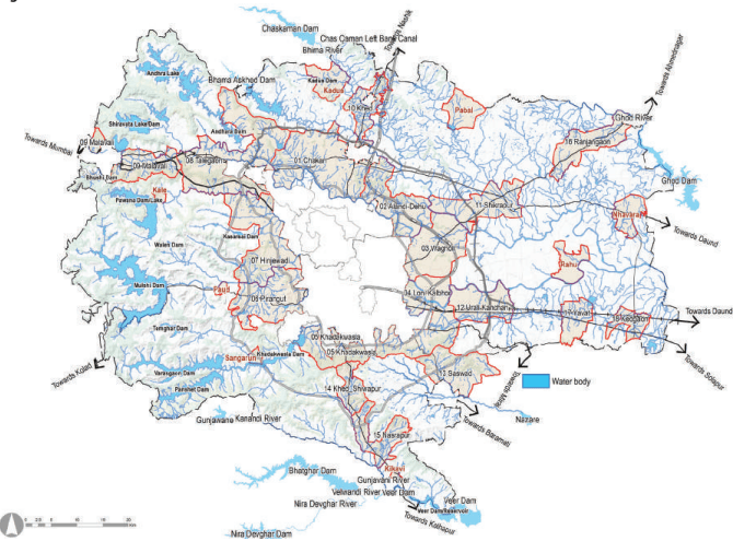
All primary and secondary streams are protected, maintaining the water ecology. All water bodies, ponds, percolation tanks and reservoirs are protected, increasing groundwater recharge. Rainwater harvesting is promoted in urban areas as per DCPR. Irrigated agriculture lands are protected through the G2 zone in command areas, as explained below Green Canvas of PMR. Site for agro market produce is reserved, providing for storage of food grains.
Figure 15.1: Blue Ribbons
15.3 Conserving Green Ribbon: Water Ecology Conservation and Management
Green belts along river banks and green spaces between the building line and banks of primary and secondary order streams/nalas form a contiguous network. Since the Green belt is protected, it will help maintain the water ecology creating a Green Ribbon network. The streams and vegetation for the longitudinal corridors connect ridges of these mountains and hills to the water area, helping the wildlife. Following are the actions taken to create this Green Ribbon: