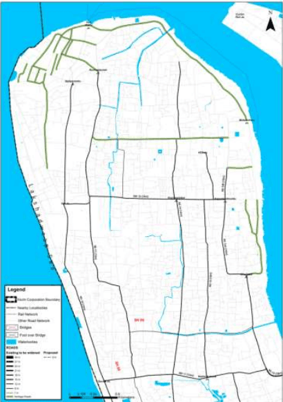
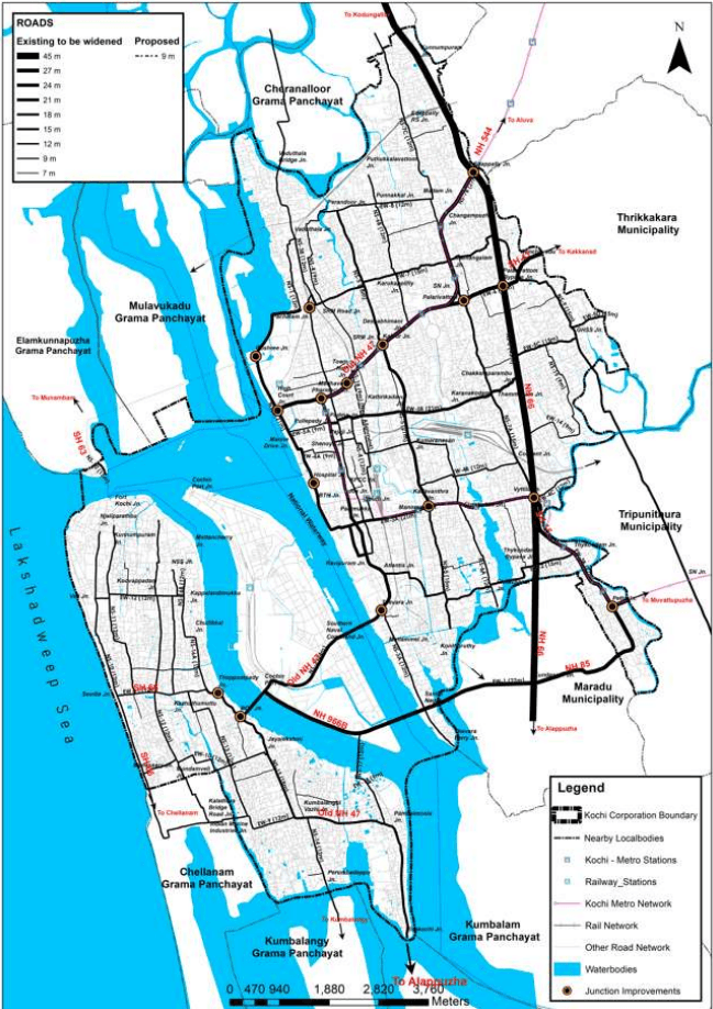
For increased accessibility and to improve efficiency of the public transport system within the city it is imperative to augment the existing public transportation system. Network integration will be key to develop a need-responsive public transport system. The various networks of different public transport system need to complement one another and be planned in such a way that they harmoniously operate as one. Integrated network planning and route rationalization shall be planned with UMTA as the nodal agency and executed by concerned agencies in a coordinated manner. Public Transport facilities within the city are offered through various modes of rail, road and water.
Kochi metro
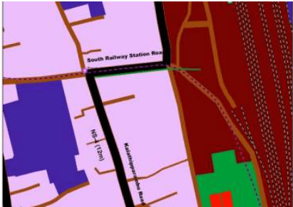
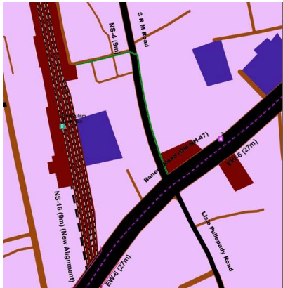
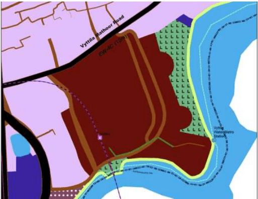
The second phase of Kochi metro, the Metro line is proposed to be extended to Kakkanad Infopark. Phase II comprises an 11.2 km extension of the existing metro line from Jawaharlal Nehru International Stadium to Infopark via Kakkanad. Two Metro stations of the Phase II falls within the planning area.
Bus Transport System
The bus system needs to be leveraged to provide high quality road based public transport system and provide accessibility to high density residential areas located particularly in the peripheral areas of the planning area. The system should be designed to also act as a feeder system for both water-based and rail based metro systems.
Route Rationalization and Fleet Augmentation
The bus routes within the city needs to be planned and integrated with other modes of public transport. The system should also cover all major production and attraction areas within the city as well provide connectivity to residential areas. Overlapping of routes, bunching of buses, higher frequencies and low patronization of public transport are some of the issues faced by this system. There is a need to update the route and schedules and formulate a route rationalization plan. The plan may be formulated after detailed study with UMTA as the nodal agency and with concerned authorities and stakeholders.
Bus Terminals
Terminals are important elements of the bus system. They provide the interface between the system and the users, as well as non-users. They need to be conveniently located, universally accessible, sensitively designed and efficiently managed. The system of operation proposed for bus transport is based on a set of five major terminals and seven miniterminals within Kochi City. The location of the proposed terminals are given in figure below.
The location proposed for new major terminals within the city are
- Karikkamuri
The locations proposed for mini-Bus Terminals within the city are;
-
Vaduthala
-
Puthukkalavattam
Kochi Municipal Corporation
TRANSPORTATION
-
Chilavannoor
-
Konthuruthy
-
Edakochi
-
Perumpadapppu
-
High Court
Bus Shelters and Bus Bays
To ensure seamless bus transportation system and to avoid interference with the existing traffic flow, it is paramount to provide the necessary supporting infrastructure such as bus shelters and bus bays. Bus bays and shelters needs to be provided on all roads with bus accessibility/ routes after detailed study and site identification. The design of bus bays and bus shelter must be as per standards. At intersections, bus stops or shelters should not be located too close to the junction and can only be provided as per standards. Bus Bays are proposed at two locations within the planning area. The proposed sites include at Thevara and Mattancherry.
Water Transport Services
The Kochi Water Metro Project is a waterbus project which includes 16 routes 17 jetties and 22 minor jetties based on a study conducted by UMTC and KMRL on Inland Water Transport in Kochi. It also includes revival of jetties with modern facilities to enhance the travel experience as well as the safety of the passengers. It also includes integration of jetties with other services and other transport modes. The proposed project recommends fifteen (15) identified routes connecting thirty eight (38) terminals across ten (10) island communities across 78.2 km channel length and 2 boatyards. KMRL is proposing to take up development of 7 additional terminals (Info Park (3 no.s), Vaduthala, Njarackal, Mulavukad View Point and Embarkation jetty) as a social initiative. The proposed routes along with the proposed new jetties are shown in the figure below.
In addition to the water metro project, as part of Integrated Urban Regeneration and Water Transport System (IURWTS) for Kochi city, KSINC and KMRL are developing three major canals in Kochi city and ensuring navigation through the canals. Inland jetties have been proposed along the canals to enable canal navigation and canal tourism. The following canals measuring about 34km are taken up for the project
-
Thevara – Perandoor canal (11.25km)
-
Edappally canal (11.23km)
268
3. Chilavannoor canal (11.02km)
By utilizing the existing water metro infrastructure and to utilize it as a part of the tourism sector, a Hop-On Hop-Off Ferry System is envisioned for the city. Tourists can get on any designated ‘Hop-On’ Ferry Station, see the extensive backwater system that is synonymous to Kochi along a pre-determined route and ‘Hop-Off’ at any other designated ferry station.
TRANSPORTATION
The project is intended to boost the synergy between tourism and transport. To facilitate the project, additional jetties proposed include :
Menaka Jetty
• Thopumpady Jetty • KIC Jetty
Foreshore Road Jetty
Cochin Harbour Jetty
• SH College Jetty
Warehouse Jetty
Palluruthy Jetty
COPT Avenue Jetty
Inland Water Transport Routes
The proposed inland transport routes are tentative. The routes may be finalized at a later stage through detailed survey and studies.
IPT are hired/shared modes of transport that may serve as feeders to the trunk public transport systems or as an alternative to private transport use. IPT includes cycle rickshaws, auto-rickshaws, e-rickshaws, minibuses etc. The IPT system in Kochi is to be organized to be first and last mile connectors to the trunk transport systems of bus & metro ,which is the key to increasing patronage for public transportation system. In areas with low public transport accessibility, the share of IPT is to be strengthened to increase coverage & accessibility.
Road and Water Transport Terminal Design
All transit terminals/ water jetties of any mode be it road or water are to be designed as universally accessible with sensitive design and efficient system of management. The terminals must be shaded or have covered waiting areas with proper seating, amenities for the passengers and the like.
Other components that need to be included are :
Parking areas for the type of transit mode
Boarding and alighting bays
Terminal Building
Covered waiting areas
Kiosks
Multi-Modal integration with other modes and integration of non-contiguous land parcels through skywalks etc.
Passenger amenities
Placemaking and public spaces
• MLCP’s or Park and Ride facilities at terminals catering to a large footfall.
The envisioned public transport plan for the city is shown below
TRANSPORTATION
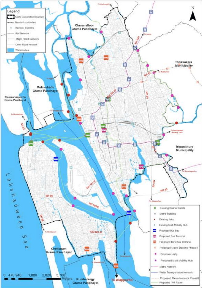
Figure 33:29 Public Transport Plan
Source: Generated by LSGD (Planning)
Kochi Municipal Corporation
TRANSPORTATION
Multi-Modal Integration
Multi-Modal Integration helps facilitate seamless and efficient mobility for a user through the entire journey. Network Integration amongst various modes is key to achieving this seamless connectivity. Development of Multi-Modal Hubs is thus an important aspect. There exists a number of transit nodes in Kochi with multiple modes located at that particular location. The identified location proposed to be developed as Multi-Modal Hubs (MMH) are given below
-
Vyttila (water, rail & road based)
-
Ernakulam Jetty (water & road based)
-
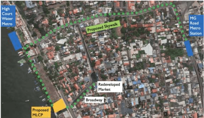
High Court (water & road based with connectivity to nearby rail-based metro services through skywalk)
-
Vypin (water & road based)
Multi-modal integration is also to be applied to Fort Kochi. Presently the bus terminal is located in proximity to the RoRo Terminal that connects the island to Vypin. The water metro station is also proposed in proximity to the RoRo terminal. Despite the terminals being physically separated, the integration can be made possible through defined walkways, bicycle stands and covered waiting spaces.
Other than the above identified location, Multi-Modal Integration is a concept that can be applied at other transit locations. UMTA shall be responsible for bringing together all concerned stakeholders to undertake coordinated planning and execution of these projects. A joint layout plan can be formulated to ensure seamless integration. In cases of non-contiguous land parcels separated by a physical barrier, integration of buildings or stations with connectors such as skywalks etc. is to be done, provided adequate clearances are maintained. First and last mile connectivity should be a major focus in the development of these hubs.
Plans for multi-modal integration including cycling and pedestrian facilities are to be prepared and executed by respective transit agencies for all new transport terminals and for retrofitting existing terminals.The following minimum facilities are to be provided for MMI:
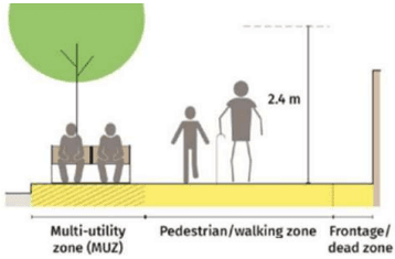
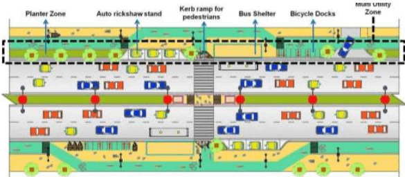
Within 100 m of every alighting point – provisions of pedestrian spill over plaza, Multi-Utility Zones, vending zones, bicycle docking stations
Provision of Bus stops, IPT services / stand, pick-up and drop-off points within a 3- minute walking radius from alighting point.
271
Provision of parking facilities based on adjoining land use or ‘park and ride’ facilities and provision of public amenities such as comfort stations etc.
Technology based interventions can further be explored to facilitate MMI. The Kochi 1 Smart Card and Kochi 1 App can be expanded to facilitate MMI. The app can cover real-time information on available route choices, available modes, their fare, frequency etc. the Kochi 1 card can be considered to cover all major modes like railways, bus & metro along with IPT services. Incentives and fare subsidies can be provided to users who move from one mode to another.
Junction Improvements
Many of the intersections in Kochi city have peak hour traffic volume in excess of saturation capacity, warranting grade-separated facilities like flyovers or underpasses. However, as a short-term measure, these junctions need to be properly designed with signalization. Most of the intersections along the MG road, Bannerji road, Shanmugham road and SA road are not properly designed and do not have channelizers and other regulatory devices. As a first priority, these junctions need to be designed for smooth flow of traffic by utilizing the available space and with minimum land acquisition. Junction Improvement essentially involves the combination of the following:
❖ Closure of medians at certain intersections
❖ Prohibition of free right turns
❖ Provision of adequate sight distance
❖ Providing adequate corner radii
❖ Providing sufficient turning radii
❖ Flaring approaches towards intersections
❖ Providing channelizers/division islands
❖ Providing pedestrian and cyclist crossing facilities
❖ Bus stops near junctions to be re-located
❖ Providing signs/lane-markings/lighting
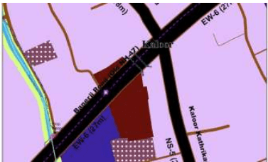
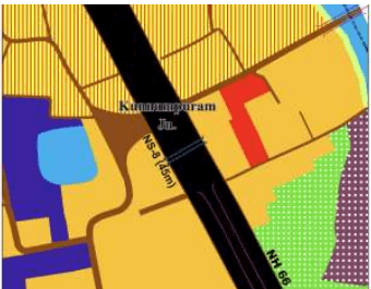
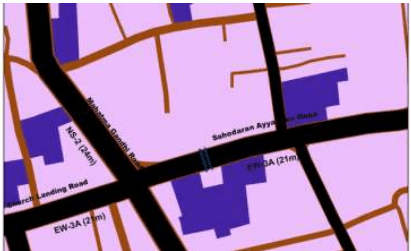
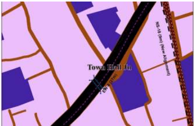
The junctions, which need redesign, are listed below and is shown in the figure below.
• High Court Jn.
Pachalam Jn.
Madhava Pharmacy Jn.
Thevara Jn.
• Hospital Jn.
• Goshree Jn.
Town Hall Jn.
Kadavanthara Jn.
Kaloor Jn.
• Vytilla Jn.
Palarivattom Jn.
• Pettta Jn.
Palarivattom Bypass Jn.
BOT Bridge Jn.
Edapally Jn.
• Thoppumpady Jn.
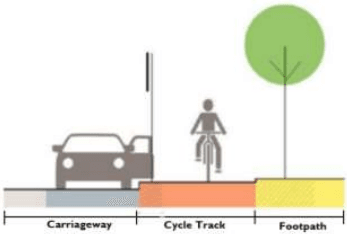
Junctions coming along the dedicated cycle tracks should be designed accordingly with priority to the cyclists. Pedestrians should be given priority at all the junctions. Intersection
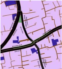
improvements are recommended to facilitate the movement of public transport and safe movement and crossing of pedestrians at junctions. In addition to the redesign of the above-mentioned junctions, to facilitate seamless traffic flow at junctions formed by roads with proposed/existing ROW of 10 m and above, a splay with respect to the width of the road with a minimum of 10x10m to be provided. The splay provided will create an additional space for the free left turning of vehicles.
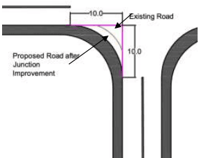
Figure 33:30 Typical Diagram of provision of 10x10 Splay
TRANSPORTATION
All junctions must be redesigned in a phased manner. A typical diagram of the difference for the provision of a splay at an intersection is shown above.