On the basis of the projected volume of traffic and alternative network development schemes considered for the city, a network improvement and road development plan has been formulated. By the year of 2040, a modern urban road network will have to be completed, which will be rationally structured in both function and structure, and backboned by the urban expressways (arterial roads) and main roads (sub-arterial roads).Priority was given to the development of some key urban expressways (arterial roads), main roads (sub-arterial roads), minor roads (collector roads) and branch roads(local roads), the re-design of some key intersections and the elimination of the bottle necks in the road network.
It is proposed to restore the grid iron pattern within the city by widening the major travel corridors and establishing new linkages both in the north-south and east-west corridors and
238
TRANSPORTATION
also leaves scope for the development of ring and radial type road network outside the city, to enhance the network connectivity.
Chapter 33Proposed Traffic and Transportation Plan
33.1 Introduction
Transport is fundamental to supporting economic growth, creating jobs and connecting people to essential services. The sector plays an important role to sustainable development. Formulation of a long-term transportation plan is the key to solving the issues that pertain with the sector in Kochi. With new infrastructure and development schemes in and around the city coupled with traffic projections will help in evaluating the shortfall in the pattern of road network and shortfalls in ensuring connectivity. The strategies that are formulated for the sector to address these shortfalls are:
• Development of an effective road network strategy at a regional and city level.
• Integration of Land Use and Transport sectors through concepts like Transit Oriented Development (TOD) etc.
Reducing dependency on private vehicles and congestion caused by it through placing increased importance on Non-Motorised Transport, shared mobility and improving the efficiency of existing public transport facilities.
Make Kochi walkable and cyclable by retrofitting existing and proposed roads to be “Healthy & Green Streets” by ensuring equitable distribution of road space to create an urban environment that is healthy & liveable.
Ensuring Multi-Modal Integration as a key principle to be followed at all transit stations.
Ensuring seamless movement on roads through junction improvement schemes and grade-separated facilities.
• Management of parking in Kochi
Provide emphasis on traffic movement within the city and delineate efficient traffic engineering strategies
Formulation of a Freight management plan
• Incorporation of technology for various uses such as smart parking, real-time traffic management etc.
Proposed Road Network Development Strategy
Various transport related problems facing the city along with the development plans for the city prepared by various agencies have been taken into account while formulating the long term network development strategy for the city. The traffic problems of the city are the inter-mixture of various problems where the solution could not be found at the level of individual problems.
Proposed Road Network Hierarchical Pattern
Based on the evaluation of the future year traffic loadings on the base year network, alternative network development schemes have been formulated to reduce the traffic loadings on routes where the traffic volume exceeded the capacity. All committed road
TRANSPORTATION
development schemes and the proposed land use development plan for the city were taken into account while formulating the alternative network development plans. As a prerequisite for the urban network development plan for the city, the roads in the urban area have to be classified into different types according to the functional hierarchy of these roads. Four different types of hierarchical order have been assigned for the roads in Kochi City and the details are given below:
Arterial roads:
Roads, which are expected to carry a large proportion of regional and intra-urban movement, characterized by long trip lengths and a desire for fast and uninterrupted transit have been classified as arterial road. The right of way of such roads will be between 50 and 60 meters and an average travel speed of 50 to 60 kmph is maintained. To ensure uninterrupted movement along the arterial roads, in discriminate access from the abutting land use needs to be controlled for which separate service lanes on either side of the main carriageway would be provided. The intersections resulting on such roads will have to be grade separated and designed to ensure the smooth and faster operation of traffic.
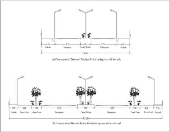
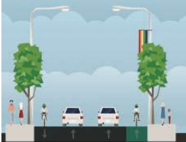
Figure 33:1 Typical Cross-section of arterial road proposed for Kochi
Two typical cross-sections of arterial roads are proposed for Kochi City. The first type of arterial road has a six lane divided carriage way with a median of 5 m in an ROW of 45 m. The cross section includes 10.5 m carriageway on either side of a median of 5m. Green verge of 3m, service road of 4 m and footpath of 2.5m are provided on either side of the arterial road. The second type of arterial road has a four lane divided carriageway with a median of 3 m in an ROW of 27m. On either side of the median, there is a carriageway of width 7.5m and footpath of 4.5 m.
Kochi Municipal Corporation
TRANSPORTATION
Sub-Arterial Roads
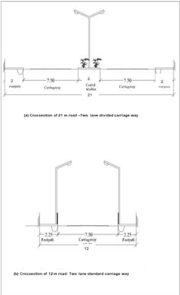
Sub-arterials are second in hierarchy of urban roads. These roads serve as an intermediary between arterials and the lower hierarchy of roads. These roads also carry a significant amount of traffic, which has fairly long trip lengths. In the normal conditions, service roads are not considered essential but limited access control by regulatory measures is essential. The intersections can be controlled by the provision of channelisers and divided carriageway. The capacity of these intersections can be increased by automation and effective control. The desirable right-of-way of subarterial road is between 12 and 21 meters and the average journey speed is expected to be of the order of 30 to 40 kmph. These roads are required to connect the important city functions viz. work centers, market places and transport terminals with the residential areas both within the city and in suburbs. Four typical cross-sections of sub-arterial roads are proposed for Kochi City.
Figure 33:2 Typical cross-section of Sub-arterial road proposed for Kochi
Collector Roads
The collector roads function as a distributor and collector of traffic exiting from the subarterials or brought in through local roads. These are basically the first to aggregate the traffic. Since many local roads need to be connected on to a collector road, the necessity
Kochi Municipal Corporation
TRANSPORTATION
for numerous road junctions is inevitable. Because of this, the average journey speeds are comparatively low and in the range of 20 to 30km. per hour. Collector roads are designed to have a right-of-way of 8 to 12 meters where kerb side parking is allowed to a limited extent.
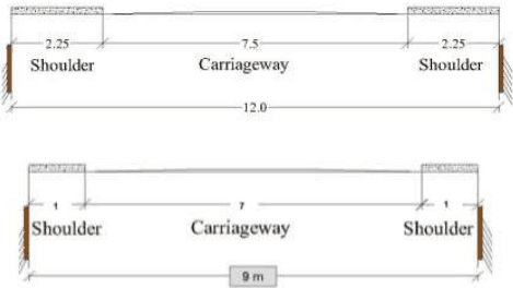
Two typical cross-sections of collector roads are proposed for Kochi City. The first type of collector road has a two lane carriage way in an ROW of 12m with a footpath of 2.25m on either side of carriageway of 7.5m. The second type of collector road is proposed in a ROW of 9m with a two-lane carriageway of 7 m with shoulder of 1 m on either side.
Figure 33:3 Typical Cross-section of collector road proposed for Kochi
Local Roads
Local roads or access roads are the last in the hierarchy of urban roads. These roads functionally serve as an access road from and to the collector roads. All the private roads leading in to abutting properties should generally be connected on to local roads. The traffic on these roads would generally be proportional to the number of private accesses on to these roads. In keeping with the low volume of traffic, the local roads are designed for a right of way of 7-9 meters. Right-of way of 7 m is proposed for select roads in Kochi City.
Ring Radial network for Kochi
Kochi city region is multinucleated with different nodes around the city. The transport infrastructure in the smaller nodes should ensure synergy between land use and transportation sector. Kochi City is the major node in the region. Aluva, Angamaly, Paravur, Perumbavoor, Thripunithura, Fort Kochi, Kakkanad are the minor nodes around Kochi City. In order to decongest the core city area and for efficient and equitable distribution of transport demand throughout the city, it is imperative to strengthen transportation network through Ring and Radial Roads which extends beyond the city limits.
Kochi city clearly explains a radial network development similar to any other port city. In Kochi, these major radials are either state/national highways, and are important mobility corridors. In addition there is a possibility to develop rings which bind these radial roads together providing a ring radial pattern for the road network.
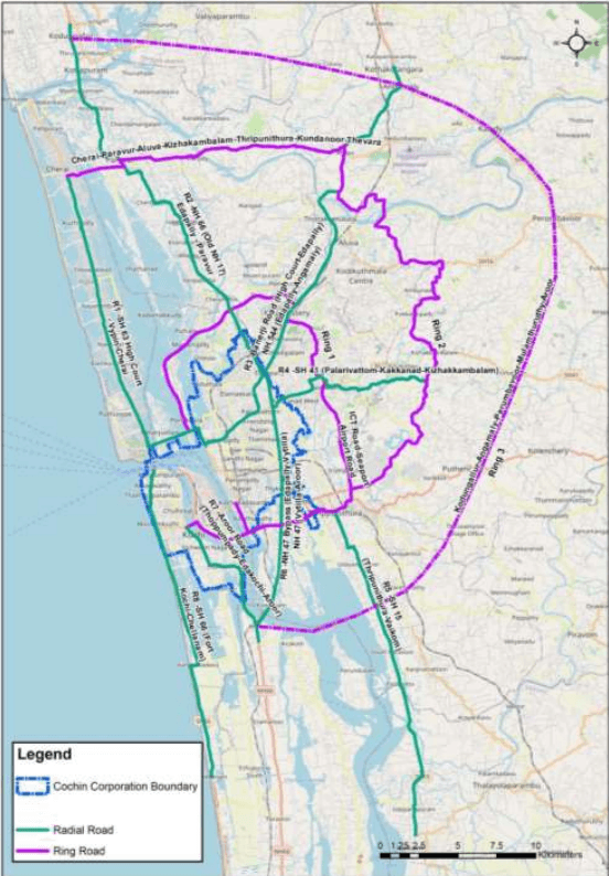
The inner ring road will start from Goshree Bridge at Vallarpadom, will take the International Container Terminal Road or NH 966A, intersect NH 47 and passes through Kalamaserry to Seaport Airport Road to intersect NH 49 at Thripunithura and to Kundanoor and finally to Thevara via Pandit Kurupana Road. The ring can be extended to Willingdon Island via NH 966B
Middle Ring Road:
The middle ring road will start from Cherai. It will take the Republic Road to Paravoor and will meet NH 47 near Aluva. The road will bypass Aluva by taking Kalady Aluva Road and further taking the extended Seaport Airport Road upto Aluva Munnar Road. Road will take Aluva-Pukkattupady Road and will meet at Kizhakambalam. From Kizhakambala, it will take SH 41 to Thripunithura and will meet Inner ring road at Thripunithura.
TRANSPORTATION
Figure 33:4 Proposed Ring and Radial network
Source: Generated by LSGD (Planning)
New outer ring road:
An outer ring road is proposed connecting Kodungalloor to Aroor via Angamaly, Kalady, Perumbavoor and Poothotta. This corridor can be considered as the spine of the region away from the city. The road connects the major low proximity towns around Kochi. The road can act as a bypass for the traffic moving from North to South or vice versa. The outer ring road will reduce the external-external trips coming to the city. The proposed outer ring road also connects all the major radials emerging out of the city and hence will also give
Kochi Municipal Corporation
TRANSPORTATION
an easy way of connectivity from one radial to another without coming to the city center. This will help in the decongestion of city center. The tentative alignment of outer ring road is shown in the figure above. Approximate length will be 75- 80km.The outer ring road can be a long term project and can be implemented in the last phase.
Grid iron pattern in Kochi
The central part of the Kochi city has been developed in a grid iron pattern with roads traversing in the North-South and East-West directions. It is proposed to restore the gridiron pattern within the city.
The widening of roads within the city are not envisioned just to make space for more private vehicles to traverse it, but rather it is envisioned to be utilized to restore the seamless flow of traffic through better junction designs, re-establishment of road hierarchies, provide public transport accessibility to areas with high residential density and to make Kochi walkable and cyclable. The details of the proposed roads are given below in table below.
North-south linkages (NS): A total of 19 north-south linkages measuring 117.09 km are proposed for development into arterial/sub-arterial standard by widening existing roads, developing missing links and constructing flyovers.
East-west linkages (EW): A total of 14 east-west linkages measuring 51.17 km are proposed for developing into arterial/sub-arterial standard by widening the existing roads, developing the missing links and constructing flyovers roads.
In addition to the above linkages, each grid formed through the North-South and East-West widened roads were assessed and the following public roads with a minimum ROW of 5 m is proposed to be widened to an ROW of 7m. The selected roads include:
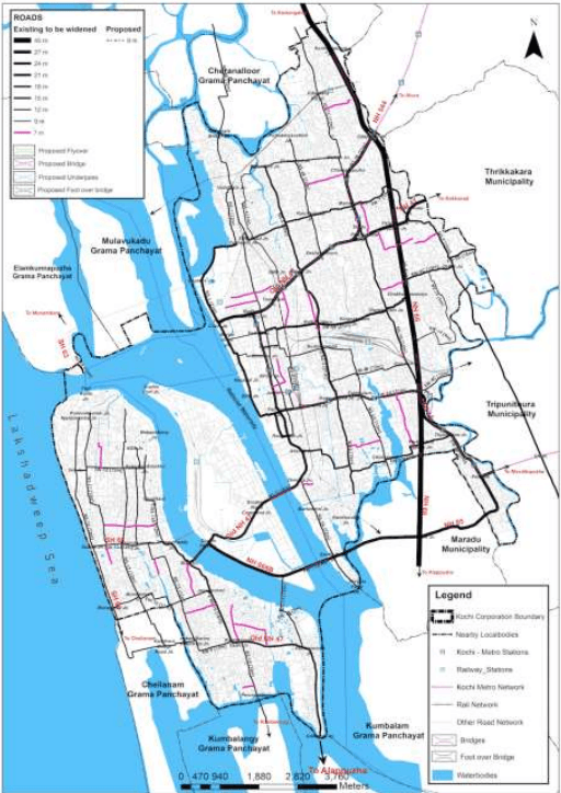
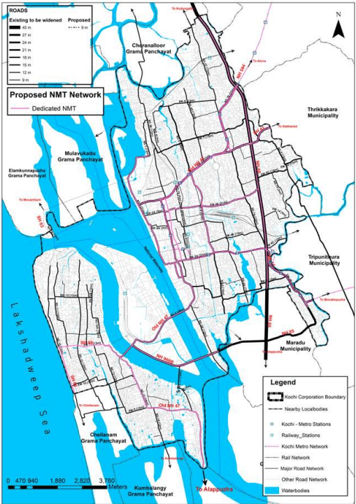
The identified roads are shown in the figure below. The proposed 7m ROW roads along with their alignments are reperesented in pink in the figure below.
b. Flyover connecting Civil Line Road and MKK Nair Road
252
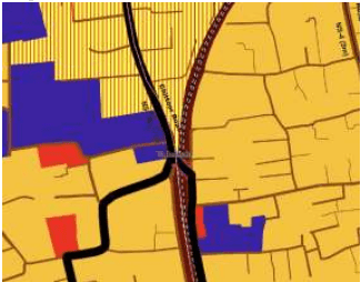
Presently, for vehicles to traverse from Banerji Road to Palarivattom Bypass/ Kakkanad/Vyttila, they need to take a U turn at SN Junction and enter Civil Line Road via Palarivattom Junction. Similarly, for vehicles traversing from Palarivattom Bypass/ Kakkanad / Vyttila to the city center, the vehicles have to enter MKK Nair Road (one way road) from Civil Line Road. This movement often creates congestion at SN Junction and Palarivattom Junction. The congestion experienced at SN Junction often spills over to Banerji Road upto JLN Stadium.
Figure 33:8 Proposed Flyover at Palarivattom (tentative alignment)
TRANSPORTATION
The proposed flyover is intended to provide direct connectivity for this movement and ease the congestion experienced at SN Junction and Palarivattom Junction. The design and details of the flyover is to be finalized after detailed survey and analysis.The tentative alignment for the connectivity is shown above.
Bridges and Rail Over Bridges
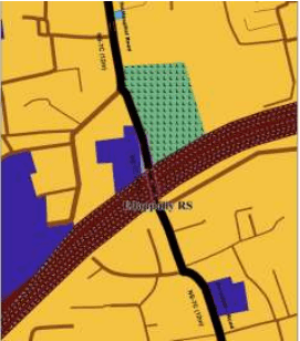
Adequate and properly maintained road infrastructure is always necessary to support smooth flow of passengers. Thiruvananthapuram –Thrissur railway line and Ernakulam-Alappuzha railway line pass through the center of Kochi city. These railway lines will intersect the proposed north-south and east-west linkages at many locations. These level crossings could pose major traffic hurdle free flow of traffic, due to the frequent closure of railway gates. To avoid such occurring, the following rails over bridges (ROB) / Overbridges are proposed at the identified locations.
Vathuruthy ROB along old NH 47
Vaduthala ROB along Chittoor road
Figure 33:9 Proposed ROB at Vaduthala
Ponekkara ROB ,near Amritha Hospital along Ponekkara road
Figure 33:10 Proposed ROB at Ponekkara
TRANSPORTATION
Over bridge to connect new road linkage to cross perandoor canal
Figure 33:11 Proposed Over Bridge across Perandoor Canal
Atlantis ROB, along Kizhuvana road.
Figure 33:12 Proposed ROB at Atlantis
Coastal Highway
The Coastal Highway project is a 624 km, 15 metre-wide highway traversing nine districts from Thiruvanathapuram to Kasargod. It is built by Kerala Road Fund Board (KRFB) and National Highways Authority of India (NHAI). The roads within the planning area that fall under the purview of the project are:
SH 66
K.J. Herschel Road
• SH 63 at Vypin
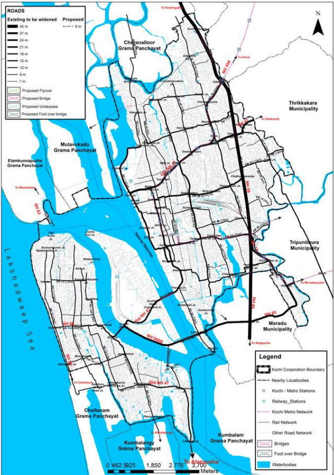
The proposed road development plan along with bridges and crossings for the planning area is shown below in the figure below.
TRANSPORTATION
Figure 33:13 Proposed Road Development Plan Source: Generated by LSGD (Planning)
Kochi Municipal Corporation
TRANSPORTATION
Non-Motorized Transport Plan
Non-motorized Transport is a major foothold when it comes to implementing a sustainable mobility plan for Kochi city. Kochi’s potential with its almost level terrain needs to be leveraged for people to choose NMT options over private vehicles. The main strategy is to transform Kochi into a walkable and cyclable city through the development of NMT corridors that are comfortable, universally accessible and safe.
Proposed NMT Corridors in Kochi
The existing road network need to be strengthened to provide safe pedestrian and cycling networks for both short and long distances. The corridors should encourage walking/ cycling as one of the preffered modes for travel for both destination and recreational purposes. The development of NMT corridors is envisioned to be provided within the planning area in three main categories as given below.
Category 1 – Only NMT corridors.
Figure 33:14 Conceptual Diagram of NMT only corridors
Category 2 – NMT provisions with dedicated space for either walking or cycling or both. This category includes dedicated NMT routes
Figure 33:15 Conceptual Diagram of Dedicated NMT Streets
256
Category 3 – NMT provisions within shared traffic conditions. These corridors will h h bi l h h i i h i d ffi f l l ave t e cyc e users s are t e carr ageway w t m xe tra c o ower vo umes.
Category 1: NMT only streets identified within the planning area is River Road in Fort Kochi. In these streets only pedestrians and cyclists will be permitted in the corridor. The other identified road stretches listed below are NMT only streets with time restrictions
❖ River Road – NMT Only
❖ Broadway (with time restrictions)
❖ Basin Road (with time restrictions)
TRANSPORTATION
❖ Jew Town Road (with time restrictions)
❖ Identified Heritage Roads – Burger Street, Princess Street, Rose ST, Quiros St, (with time restrictions)
Category 2 or Dedicated NMT routes are demarcated with designated footpaths and cycle tracks. The minimum clear width and the provision of these elements are dependent on the right of way of the particular roads. Dedicated NMT corridors are delineated on the basis of the existing and/or proposed ROW of the roads within the city. The ideal clear width of the corridor as per the ROW of the roads is given below.
Table 333 Proposed NMT Standards
ROW
Type of NMT corridor
Clear Walking space in Footpath
Cycle Tracks
Broad Changes Required
18m and above
Dedicated NMT
1.8 m
1.8 m
Retrofitting of streets to provide dedicated space for NMT, safe at-grade pedestrian crossings at regular intervals, signages
12m -18m
Dedicated or Shared NMT
1.8 m
Dedicated / Painted Cycle Tracks
9m - 12m
Shared NMT
1.8m
Shared space
Traffic Calming measures, Lane markings
Less than 9m
Shared NMT
1.8m
Shared space
One-sided footpath can be considered,Traffic calming measures , lane markings
The width of the cycle track can be changed on basis of land availability and feasibility. In such instances, the minimum width of the cycle tracks to be provided is 1.2 m. For roads with ROW less than 9m, one-sided clear walking space can also be considered. For roads having proposed/existing ROW of 18m and above, it is proposed to be retrofitted as Dedicated NMT corridors. Some of the identified roads with such provisions are:
❖ MG Road
❖ P. Madhavan Nair Road
❖ Church Landing Road
❖ Foreshore Road
❖ Park Avenue Road
❖ Shanmugham Road
❖ Abraham Madamakel Road
❖ Goshree Chathiyath Road
❖ Bannerji Road
❖ Sahodaran Ayappan Road (SA Road)
❖ National Highways (NH 66, NH 966B, NH 85) within city limits
❖ Old NH 47 within city limits
❖ State Highways (SH 15, SH 41) that falls within city limits
Kochi Municipal Corporation
TRANSPORTATION
❖ Civil Line Road
❖ Kaloor-Kadavanthara Road
❖ Thammanam Pullepady Road
❖ Nandanath Kochako Road
Other roads with (ROW less than 18m) identified to be retrofitted as dedicated NMT corridors are
❖ SH 66 ( within city limits)
258
❖ Chittoor Road ( from Banerji Road to SA Road)
Figure 33:16 Proposed Dedicated NMT Corridors
Source: Generated by LSGD (Planning)
Roads having proposed/existing ROW between 12 m and 18m on the basis of adjoining land uses and feasibility, the roads can be provided with NMT facilities either as shared or
TRANSPORTATION
dedicated. For roads having proposed/ existing ROW between 9m and 12 m it is proposed to provide these stretches as shared NMT with cycle tracks being provided along the carriageway with appropriate lane demarcation / markings & traffic calming measures. With roads having ROW lesser than 9m, owing to the space constraint, one-sided NMT facilities can be explored depending the feasibility.
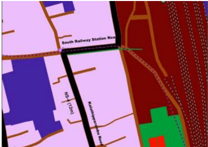
Multi-Modal Corridor connecting North and South Railway Station
The existing railway stations within the planning area namely Ernakulam North and Ernakulam South Railway stations are 2.5 km apart. For a passenger to move from one station to another, accessibility via road is through two major congested corridors in the city namely MG road and Banerji Road. The stations are also accessible via metro. In the existing scenario, a corridor of 2.5km connects the two stations. The corridors, along with the closest parallel roads are frequented by pedestrians, autorickshaws and bicycles.
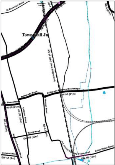
To ensure seamless surface connectivity through multi-modal integration and urban landscape improvement, a new road alignment of 9m ROW of length 1.64 km is proposed along the railway track connecting the two stations. The alignment starts from Mullassery Canal Road and terminates at North Railway Station.
243
The road will be at a proper clearance from the railway track and will be adapted to non-motorized transportation. Various spaces along the new road alignment can be identified and transformed into engaging spaces such as plazas and the like. The possibility of an elevated highway can also be explored.
Figure 33:6 New Road alignment connecting North & South Railway station
TRANSPORTATION
Table 331 Details of proposed North South Linkages in Kochi City
Sl. No
Connecting Nodes
Road Name
h t d i Wng ) (m it is x E
h t d i Wdes ) (m o p o r P
NS-01: Ravipuram on MG road to Vaduthala on Chittoor road via Fine Arts club, Marine Drive, Pachalam
1
Ravipuram Jn.
Pallimukku
R Madhavan Nair road
18
21
Street Design Guidelines
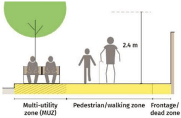
The roads within the city need to be designed and retrofitted to serve pedestrians and cyclists better. The footpath width is to be planned in three different zones below and shown in figure below.
Pedestrian walking zone or clear walking zone
• Frontage / buffer between property edge and pedestrian zone
• Multi-Utility Zone (MUZ)
Figure 33:17 Zones in footpath width
Source: IRC
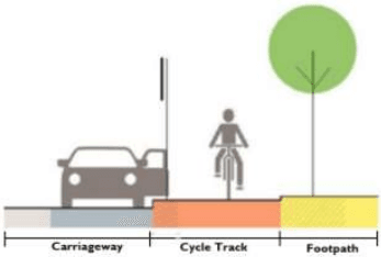
Cycle tracks are to be provided as either dedicated or shared spaces along the carriageway. The representative provision is shown below in figure.
Figure 33:18 Segregated Cycle Track
Source: IRC
259
All facilities and amenities listed should be barrier free and adhering to the standards for universal accessibility. The following components must be included in all new road
TRANSPORTATION
infrastructure and for the improvement of existing roads to make Kochi walkable and cyclable. The widths for each component will be subject to land availability and feasibility. The infrastructure components to be provided will vary on the basis of the road hierarchy. The components are:
1. Footpaths:
o Provision of unobstructed and continuous footpath on either side of all streets with ROW greater than 9m.
o For roads having ROW lesser than 9m, owing to the space costarint, provision of unobstructed & continuous footpath on one-side can be explored.
o Minimum width of clear walking space for all roads to be 1.8 m with clear height of 2.4m in addition to space for multi-utility zones/surface utilities/frontage zone.
o At areas with land uses attracting high pedestrian volume, width of footpath shall be wider than 1.8m as per requirement.
o To add a buffer/frontage zone between the clear walking space and the property edge, which shall be 1 m in addition to the footpath width in commercial areas and 0.5 m in residential areas.
2
Pallimukku
Fine Arts Club
Church Landing road
18
21
3
Fine Arts Club
BTH Jn.
Foreshore road
20
21
4
BTH Jn.
Hospital Jn.
Park Avenue road
21
21
5
Hospital Jn.
Canon Shed road
Park Avenue road
19
21
6
Canon Shed road
Marine Drive
Shanmugham road
20
21
7
Marine Drive
High Court Jn.
Shanmugham road
21
21
8
High Court Jn.
Goshree Jn.
Abraham Madamakkal Road
21-24
21
9
Goshree Jn.
Pachalam
Goshree Chathiyath Road
21
21
10
Pachalam
Vaduthala Jn.
Peter Correya-Pazhampilly Thomas road
8
12
NS-02: BOT Jn to Madhava Pharmacy via Thevara, MG road
1
BOT Jn.
Cochin Port Jn.
SH66
16
24
2
Cochin Port Jn
Thevara Jn.
Old NH 47
16
24
3
Thevara Jn.
Atlantis Jn.
Mahatma Gandhi road
21
24
4
Atlantis Jn.
Ravipuram Jn.
Mahatma Gandhi road
21
24
5
Ravipuram Jn.
Pallimukku Jn.
Mahatma Gandhi road
21
24
6
Pallimukku Jn.
Jos Jn.
Mahatma Gandhi road
21
24
7
Jos Jn.
KPCC Jn.
Mahatma Gandhi road
21
24
8
KPCC Jn.
Shenoys Jn.
Mahatma Gandhi road
21
24
9
Shenoys Jn.
Padma Jn.
Mahatma Gandhi road
21
24
10
Padma Jn.
Madhava Pharmacy Jn.
Mahatma Gandhi road
21
24
NS-03 A:Thevara Ferry to Thevara Jn
1
Thevara Ferry Jn.
Santhi Nagar Jn.
Thevara Ferry road
9
12
2
Santi Nagar Jn.
Mattammel Jn.
Pandit Karuppan road
8
12
Kochi Municipal Corporation
TRANSPORTATION
3
Mattammel Jn.
Thevara Jn.
Pandit Karuppan road
9
12
NS-03 B: Ravipuram to Vaduthala Bridge
1
Ravipuram Jn.
Sahodaran Ayyappan road
Ravipuram road
10-12
12
2
Sahodaran Ayyappan road
South Jn.
Chittoor road
11
12
3
South Jn.
Rajaji Jn.
Chittoor road
9
12
4
Rajaji Jn.
Pulleppady Jn.
Chittoor road
9
12
5
Pulleppady Jn.
Kacheripady Jn.
Chittoor road
10
12
6
Kacheripady Jn.
Pachalam Jn.
Chittoor road
8-10
12
7
Pachalam Jn.
Vaduthala Bridge Jn.
Chittoor road
9
12
NS-04: SA Road to Vaduthala via Valanjambalam, South RS, KSRTC Stand, SRM road
1
Sahodaran Ayyappan road
South Railway Station
Kalathiparambu road
7
12
2
South Railway Station
Mullasserry Canal road
Swami Vivekananda road
8
12
3
Mullasserry Canal road
Pullepady Railway Overbridge
Rajaji Road, C P Ummar Road
6-8
12
4
Town Hall Metro Station
SRM Road Jn.
SRM road
9
9
5
SRM Road Jn.
Perandoor padam area
NK Sreedharan road, Popular road, Swagatham road, Periyar Line road
8
9
NS-05: Konthuruthy to Perandoor via Kadavanthara, Kaloor, Pottakuzhy.
1
Kallupalam
Kadavanthara Jn.
KP Vallon road
8-10
15
2
Kadavanthara Jn.
Kumaranasan Jn.
Kaloor-Kadavanthara road
16
21
3
Kumaranasan Jn.
Kathrikadavu Jn.
Kaloor-Kadavanthara road
18
21
4
Kathrikadavu Jn.
Kaloor Jn.
Kaloor-Kadavanthara road
12-14
21
5
Kaloor Jn.
Perandoor Jn.
Perandoor road
8-10
18
NS-06 A: Chilavannur Ferry to Kumaranasan Jn
1
Chilavannur Ferry
Chilavannur Jn.
South Chilavannur road
7
12
2
Chilavannur Jn.
Elamkulam Jn.
Chilavannur road
7
12
3
Elamkulam Jn.
Kumaranasan Jn
Fathima Church road,
9
12
Kochi Municipal Corporation
TRANSPORTATION
Kumaranasan Road
NS-06 B : Desabhimani to Puthukalavattam
1
Deshabhimani Jn.
Karukappilly Jn.
Desabhimani road
8
12
2
Karukappilly Jn.
Punnakkal Jn
Desabhimani road
8
12
3
Punnakkal Jn
Puthukalavattam Jn.
Desabhimani road
7
12
NS-07 A: Vyttila on NH bypass to SN Jn. , Tripunithura
1
Northern side of Vyttila Jn. On NH 66
Convent Jn., Vyttila
Mahakavi Vailoppilli road
12
15
2
Convent Jn., Vyttila
Thammanam Jn.
Mahakavi Vailoppilli road
9
15
3
Thammanam Jn.
Palarivattom Jn.
Mahakavi Vailoppilli road
9
15
4
Palarivattam Jn.
SN Jn.
Palarivattom-Edapally Old Road
10
15
NS-07 B: St. Martin's Jn. On Bannerji road to Edapally
1
St. Martin's Jn.
Mamangalam Jn.
Bannerji road(Old NH 47)
26
27
2
Mamangalam Jn.
Changampuzha Jn.
Bannerji Road(Old NH 47)
24
27
3
Changampuzha Jn.
Edappally Jn.
Palarivattom-Edappally Road (Old NH 47)
25
27
4
Edapally Jn.
Eastern Municipal Boundary
NH 544 (Old NH 47)
21
45
NS-07 C:Changampuzha Jn to Cheranaloor Pallikavala
1
Changampuzha Jn.
Edappally RS Jn.
Ponekkara road
8
12
2
Edappally RS Jn.
Northern Municipal Boundary
Proposed Rail Overbridge, Amrita Hospital Road
7
12
NS-08: Kundannoor to Cheranalloor Jn via Edappally
1
Southern Municipal Boundary
Vyttila Jn.
NH 66
40
45
2
Vyttila Jn.
Chakkaraparambu Jn.
NH 66
42
45
3
Chakkaraparambu Jn.
Palarivattam Bypass Jn.
NH 66
38
45
4
Palarivattam Bypass Jn.
Edappally Jn.
NH 66
40-41
45
5
Edappally Jn.
Kunnumpuram Jn.
NH 66
15-35
45
6
Kunnumpuram Jn.
Northern Municipal
NH 66
12-15
45
Kochi Municipal Corporation
TRANSPORTATION
Boundary
NS-09: Arakkakadavu bridge to Anchumana on NH bypass via Alinchuvadu
1
Southern Municipal Boundary
Vennala GHSS Jn.
Vennala High school road
9
15
2
Vennala GHSS Jn.
Alinchuvadu Jn.
Vennala High school road
6-8
15
4
Alinchuvadu Jn.
Anchumana Jn.
Edapally - Thripunithura road
6
15
NS-10: Chellanam to Fort Kochi & Vypin via Saudia Jn, Veli
1
Southern Municipal Boundary, Manasserry
Saudia Jn.
SH 66
8
12
2
Saudia Jn.
Veli Jn.
K J Herschel road (Beach Road)
8
12
3
Veli Jn.
Njaliparambu Jn.
K B Jacob road
10
12
4
Fort Vypin Marina
Northern Municipal Boundary
SH 63
8-10
15
NS-11: SH 66 to Fort Kochi via Veli, Kunnumpuram
1
PT Jacob Road (SH66)
Rameshwaram Canal Road
S. Moolankuzhy Road
7
12
2
Rameshwaram Canal Road
Holy Cross Jn.
Nazareth Road
7
12
3
Holy Cross Jn.
Kunnumpuram Jn.
PJ Bappu Road,Kallumkulam Road, Veli Road, Amaravathi Road & T M Mohammed road
8-9
12
NS-12: Mundaveli Jn to Fort Kochi via Santhom Jn, Koovapadam Jn
1
Southern Municipal boundary
Mundamveli Jn.
Boundary road
8
12
2
Mundamveli Jn.
PT Jacob Road (SH66)
Mundamveli road
9
12
3
PT Jacob Road (SH66)
Koovapadam Jn.
AK Xavier road , Santogopalan road
8
12
4
Koovapadam Jn.
Palace Road
Town Hall road
10
12
5
Palace Road
Eeraveli road
Mohammed Abdul Rahman road
10
12
NS-13: Kalathara Rd to Mattancherry via Kazhuthumuthu, Parvana
EW-03 A: Pallimukku to Vyttila Jn. Via Kadavanthara, Elamkulam
1
Pallimukku
Manorama Jn.
Church Landing Road, Sahodaran Ayyappan road, South ROB
9-18
21
2
Manorama Jn.
Vyttila Jn.
Sahodaran Ayyappan road
18-19
21
EW-03 B: Vyttila Jn. to Petta Jn.
1
Vyttila Jn.
Thykkoodam Jn.
SH 15, Ettumanoor Ernakulam Road
14
27
2
Thykkoodam Jn.
Petta Jn.
SH 15, Ettumanoor Ernakulam Road
18
27
EW-04 -A: Govt. Guest House on Park Avenue road to Shenoys Jn.
1
Govt. Guest House
Shenoys Jn.
Press Club Road, Convent Road
6
9
EW-04 -B: Centre Square Mall on Mahatma Gandhi Road to Convent Jn. on
Kochi Municipal Corporation
TRANSPORTATION
Mahakavi Vailoppilli Road , Vyttila
1
Mahatma Gandhi Road (Centre Square Mall)
Rajaji Jn.
Rajaji Road
8
12
2
Rajaji Jn.
Kumaranasan Jn.
Rajaji Road, AL Jacob Railway Overbridge, Salim Rajan road
10
12
3
Kaloor-Kadavanthara Road
Convent Jn. , Vyttila
Subash Chandra Bose Road
8-11
12
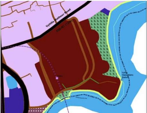
EW-04 -C: Vytilla Jn. To Corporation Boundary via Mobility hub
1
Vytilla Jn.
Eastern Municipal Boundary
Vyttila Mathoor road
10
12
EW-05 A: Marine drive on Shanmugam road to Padma Jn. On MG Road
1
Shanmugham road
Padma Jn.
Jew street
6
9
EW-05 B:Padma Jn on MG Road to Chakkaraparambu Jn. on NH 66
1
Padma Jn.
Pulleppady Railway Overbridge
Pulleppady road
7
21
2
Pulleppady Railway Overbridge
Thammanam Jn.
Thammanam Pulleppady road
8-10
21
3
Thammanam Jn.
Chakkaraparambu Jn.
Nandanathu Kochako road
7
21
EW-05 C:Puthiya road Jn. On NH 66 to Vennala GHSS Jn.
1
Puthiya Rd Jn. on NH 66
Vennala GHSS Jn.
Puthiya road
8
15
EW-05 D:Vennala .to Palachodu
1
Vennela High School Road
Eastern Municipal Boundary
Thuthiyoor road
9
15
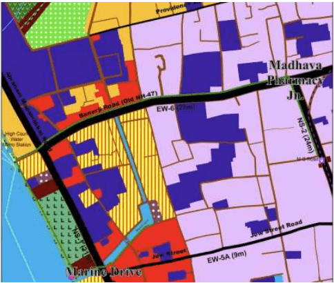
EW-06: High Court Jn. To Kakkanad on Seaport-Airport road via Kaloor, Palarivattam
1
High Court Jn.
Madhava Pharmacy Jn.
Bannerji road (Old NH-47)
15
27
2
Madhava Pharmacy Jn.
Palarivattam Jn.
Bannerji road (Old NH-47), MKK Nair Road
18-24
27
3
Palarivattam Jn.
Eastern Municipal Boundary.
Civil Line Road
10-15
27
EW-07: Pachalam to Anchumana on bypass via Chathiyathupally, Pachalam, and Mamangalam
1
Pachalam ROB
Perandoor Road
SRM Cross Road, Pottakuzhi road
8
15
2
Perandoor Road
Mamangalam Jn.
Pottakuzhi Mamangalam road
6
15
Kochi Municipal Corporation
TRANSPORTATION
3
Mamangalam
Anchumana Jn. on NH 66
Anjumana Temple road
6
15
EW-08: Vaduthala to Edapally via Perandoor, Punnakkal
1
Periyar line road
Perandoor Jn.
Proposed bridge, Edappally Ragavan Pillai Road
9
12
2
Perandoor Jn.
Madam Jn
Edappally Ragavan Pillai Road
8-9
12
EW-09: SH66 to Kacherippady Jn on Old NH-47 via Kalathara
1
Western Municipal Boundary
Indian Marine Industries Jn
Kalathara road
8
12
2
Indian Marine Industries Jn
Kacherippady Jn
MLA road
8
12
EW-10: Manasserry on Saudia-Chellanam road to Jayalekshmi Jn on Thoppumpady-Aroor road
1
Manasserry Jn .
Mundamveli Jn.
Mundamveli Pattarupadam road
8
12
2
Mundamveli Jn.
Jayalaxmi Jn.
Mundamveli Pattarupadam road, Water Land road,
8
12
EW-11: Saudia to Thoopumpady Jn (SH 66)
1
Saudia Jn.
Thoppumpady Jn
PT Jacob Road (SH 66)
7-9
12
EW-12: Kappalandimukku to Veli via Koovappadam
1
Veli Jn.
Kappalandimukku Jn
Manthara - Jawahar road
7-8
12
EW-14 : Ponnurunni Challikavattom Road
1
NH 66
Kuzhuveli Temple Rd (start)
Ponnurunni - Chalikkavattom road
6.5
9
EW-15 : Link Road 2
1
Kannangattu Rd
Indira Gandhi Rd
Link Road 2
4
9
Development of Grade Separated Road Infrastructure
As part of the proposed road network development plan, various grade-separated facilities have been proposed. These facilities include underpasses, flyovers at high traffic volume intersections, rail over bridges and bridges across water bodies.
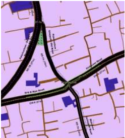
Proposed Underpass at Edapally Junction
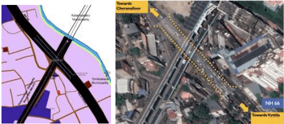
Edapally Junction is a junction that has a peak hour traffic volume of above 10,000 PCUs. To ensure seamless movement of vehicles at Edapally Junction, it is proposed to provide an underpass. The underpass is intended to provide free movement between Cheranalloor to
Kochi Municipal Corporation
TRANSPORTATION
Vyttila. The design of the underpass can be done after detailed survey and analysis. The tentative alignment is shown below.
Figure 33:7 Proposed Underpass at Edapally Jn.
Proposed Flyovers
Flyovers are proposed at two locations in the city which are given below
a. Flyover at Vyttila Junction connecting Sahodaran Ayappan Road and SH 15: To resolve the issues faced at Vyttila Jn. A flyover connecting the two roads namely Sahodaran Ayappan Road (SA Rd) and SH 16 is proposed. The details and design of the flyover is to be finalized after detailed survey and analysis. The flyover can be implemented through the Local Area Plan envisioned for the area.
o Maximum kerb height shall not exceed 15 cm at all times with adequate cross slope for storm water runoff.
2. Cycle Tracks:
o Provision of unobstructed and continuous dedicated cycletrack on either side of all streets with ROW greater than 18m.
o Minimum width of dedicated cycletracks is 1.8m.
260
o On basis of land availability and feasibility for roads with ROW lesser than 18m, the minimum width of the cycle tracks to be provided is 1.2 m.
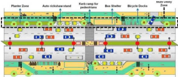
Multi-Utility Zones (MUZ): In addition to the clear walking space for pedestrians, footpaths must also accommodate spaces known as Multi-Utility Zones (MUZ).
o MUZ’s are recommended to accommodate on-street vendors, seating, signages, landscape, trees and other public utilities.
o Incorporating urban placemaking, public art and other elements can help in creating attractive spaces for street life and activity.
o MUZ’s shall also be designed to incorporate bus shelters, bike docking stations, IPT stands to enhance inter-modal shifts and ensure first and last mile connectivity near transit stations and along certain land uses.
o In roads having ROW of 12m and above, minimum width of 2 m is to be provided as MUZ in addition to the clear walking space for pedestrians (1.8m).
o In roads with ROW lesser than 12m, the width of the MUZ is to be determined depending on the feasibility. A minimum of 0.5 m is to be provided as MUZ in such cases.
TRANSPORTATION
A typical Multi-Utility zone sketch is shown below.
Figure 33:19 Typical Multi-UtilityZone with Details Source : KMRL
4. Pedestrian Convenience :
o Provision of street furniture such as seating, dust bins, public utilities, drinking water, water kiosks and the like at regular intervals along roads.
o Provision of public toilets and changing stations at regular intervals preferably in proximity to transit stations for easy access by pedestrians and commuters.
5. Lighting :
Provision of adequate street lighting at both pedestrian scale and for ambient illumination for carriageway to ensure safety and security
6. Climatic Comfort for all road users & Storm Water Management :
o Trees/plants to be an essential component of roads to provide shade to pedestrians/cyclists and to ensure climatic comfort.
o Decrease in impervious surfaces through provision of permeable paving/planting zones etc. to increase storm water infiltration,
o Provision of bioswales / detention ponds/ bio-filteration beds at adequate locations
Minimizing pedestrian/cyclist conflict with vehicles through provision of any of the following on basis of feasibility
261
o At grade tabletop crossings with traffic calming elements on carriageway to be provided as far as possible.
Grade-separated crossings such as through subways, foot over bridges etc . Pelican crossing system to be provided at major conflict points & near schools especially for elderly, people with disabilities and children. Pedestrian signals to be provided at other conflict points. This is preferred over gradeseparated crossings.
All new developments within TOD areas would be required to mandatorily prepare plans to ensure NMT provisions within the zones.
TRANSPORTATION
Grade-Seperated Pedestrian Facilities
Foot Over Bridges (FOB)
Foot over Bridges or FOBs hav been proposed at various locations within the city on the basis of the survey conducted on pedestrian movement. The following FOBs are proposed
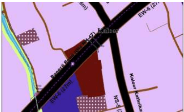
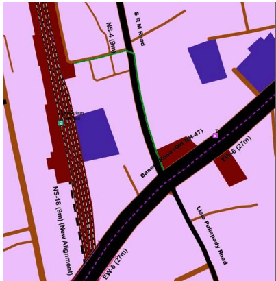
FOB at Kaloor
Figure 33:20 FOB at Kaloor
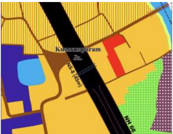
FOB at Kunnumpuram
Figure 33:21 FOB at Kunnumpuram
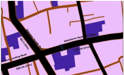
FOB at Pallimukku
Figure 33:22 FOB at Pallimukku
TRANSPORTATION
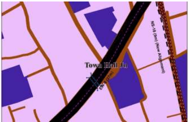
FOB at Town Hall JN.
Figure 33:23 FOB at Town Hall Jn
FOBs at NH 66
In addition to the above locations, FOBs are to be provided at regular intervals over the National Highway 66. As the highway is proposed to be widened to a six lane corridor making pedestrian crossing an issue, FOB are to be provided at appropriate locations depending on the direction of pedestrian movement.
Skywalks
To ensure seamless-multi modal shifts between transit stations and in accordance to the character of land uses, skywalks have been proposed at various locations. The skywalks are to be well-shaded, well-lit, visually transparent and provided with lifts/ escalators & tactile pavers to ensure universal accessibility. The sub-structure should not hinder the pedestrian movement on the footpath below. The details of the proposed skywalks are given below:
263
• Skywalk connecting South Railway Station and South Metro Station
A skywalk connecting the metro station to the nearby Railway station (250 m apart) is proposed. The skywalk can be built to ensure at-grade seamless connectivity to the railway station that is proposed to be redeveloped.
Figure 33:24 Proposed Skywalk between Ernakulam South Railway Station and South Metro Station
TRANSPORTATION
Skywalk connecting North Railway Station and Town Hall Metro Station: The proposed skywalk is to ensure seamless modal shift between the two transit terminals.
264
Figure 33:25 Proposed Skywalk connecting North Railway Station and Town Hall Metro Station
Skywalk connecting Vyttila Metro Station to Vyttila Water Metro Station The skywalk is proposed to ensure seamless modal shift ansd to reduce the pedestrian vehicle conflict within the Mobility Hub.
Figure 33:26 Proposed Skywalk between Vyttila Metro Station and Vyttila Water Metro Station
TRANSPORTATION
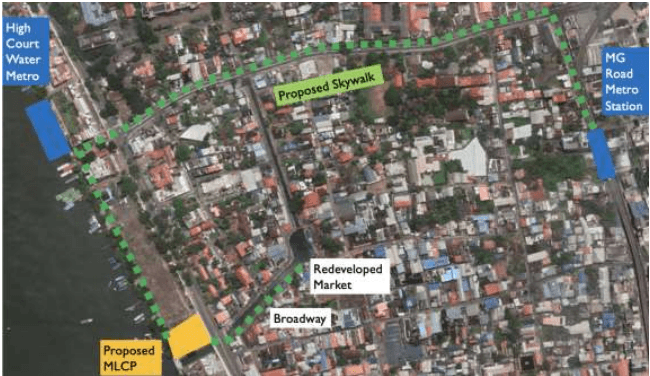
Skywalk connecting MG Road Metro Station – High Court Water Metro Station – Proposed MLCP at Marine Drive – Broadway- Ernakulam Market
A skywalk connecting MG road metro station and proposed High Court Multi-Modal Hub is proposed to ensure seamless modal shift. The skywalk is proposed to be extended to the proposed MLCP at Marine Drive to the redeveloped Ernakulam Market adjoining the Market canal. This loop is intended to provide a convenient form of movement for pedestrians and also to provide an aerial view of the backwaters.