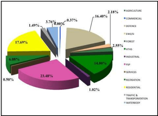
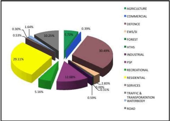
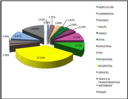
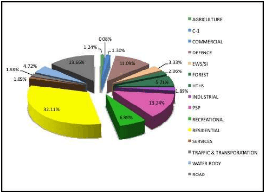
Preparation of a structure plan is an important step in the overall planning process and is necessary to serve as a broad guiding framework for formulating detailed proposals of the Draft Development Plan. A conceptual diagram serving as a framework for future development in the City is the Structure Plan. This principle suggests that development in existing urbanized areas and new extensions must be “structured” spatially and functionally to avoid unmanaged urban sprawl. Existing urban patterns must be strengthened through urban renewal and proposed development must be “continued” by selective extension of already developed areas. This will avoid new developments in distant outskirts that are not serviced by infrastructure and transportation.
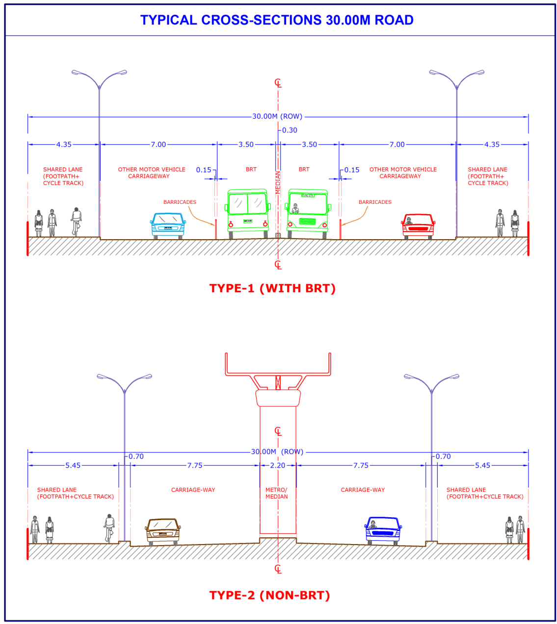
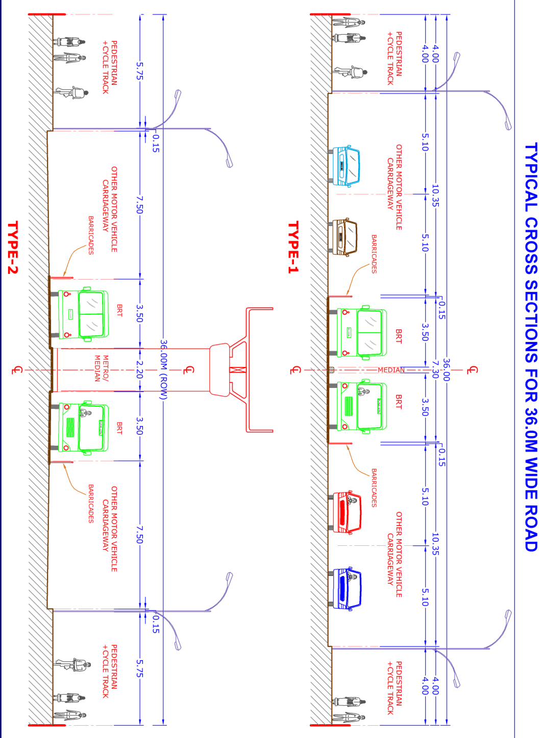
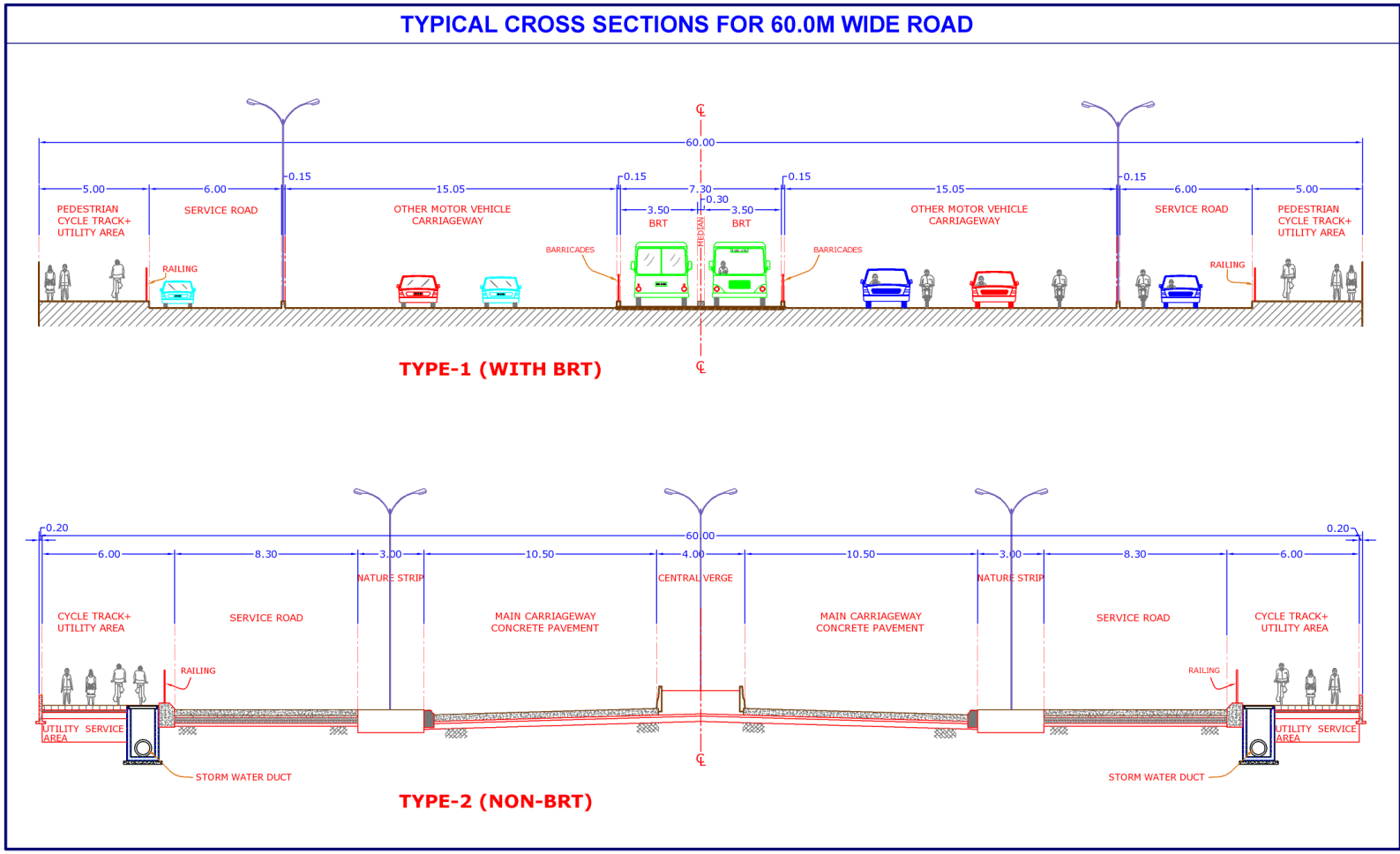
This plan includes broad land use zoning and major traffic-transportation network, connecting the various parts of the area to be planned. The broad road network includes important traffic corridors mainly highways, arterial and subarterial roads. In addition to the land use zoning and broad circulation pattern, the structure plan also envisages the direction in which sites will be reserved for public purposes.
The proposals of the structure plan for the present study are framed on the following lines:
Determination of the extent and physical form of future urbanisable area on the basis of the population projection, trend of development (as observed in the ELU survey).
Determination of proposed broad land-use zoning of the said urbanisable area.
Framing proposals with due considerations of the circulation pattern and other traffic-transportation requirements.
Establishment of planning standards/ norms for framing proposals inrespect of designation of sites for public amenities and in-respect of various other problems faced by the area.
The determination of future urbanisable area and its physical form, for the purpose of Structure Plan is mainly based on the parameters of projected population of the study (planning) area for the year 2027, planning constraints and guidelines.
In identifying the future urbanisable area on the basis of the projected population of 2027, the following constraints / guidelines have been considered.
Existing and committed major work centre
Physiography of the planning area.
• Availability of water supply.
• Availability of transportation facilities.
Availability of land for non-agricultural use and desirability /practicability of conversion of agricultural lands into non-agricultural lands.
Zoning of the sanctioned Regional Plan and the relevant guidelines spelt out therein.
Compactness of development so as to ensure maximum possible utilization of infrastructural facilities.
Structure Plan being a policy plan does not take into account detailed micro level considerations. The land-use zoning in respect of residential, industrial, commercial, public and semi-public, green-belts; no development zones have been delineated and broad policies have been framed in latter chapters. Considering all these points, the proposed land use has been prepared.
CHAPTER NO. 19
Broad Policies of the Development Plan