Following surveys were carried out for the purpose of preparation of Development Plan:_
-
Demographic survey
-
Socio-economic survey
-
Housing survey
-
Existing land use (ELU) survey
-
Traffic and transportation survey
Following studies were undertaken for the purpose of preparation of Development Plan:
Sustainable environmental assessment (SEA)
Following Data was collected
Educational facilities
Health facilities
Recreational facilities
Shopping facilities
• Industries
Utility Services (water supply, drainage, solid waste management, etc)
Climatology
Government Lands
• Slums
17.3.2 Surveys for preparation of Development Plan
17.3.2.1 Existing Land Use(ELU): - The work of carrying out the ELU survey was allotted to COEP. They have carried out physical survey of properties in the PMC old limit and submitted the details.
17.3.2.2 Demographic Projections: –PMC had allotted the work to Gokhale Institute of Politics and Economics, Pune (GIPE). They have studied the past trends of population growth from Census, compared the pace of growth of Pune city with other cities and submitted the demographic projections for the years 2017 and 2027.
17.3.2.3 Socio-Economic Survey: - PMC had awarded the work to carry out Socio-Economic survey in old PMC limit to Karve Inst. of Social Service (KINSS). A sample survey from selected slum and non-slum housing areas from all planning sectors in the old PMC limit has been carried out by KINSS. KINSS has given recommendations on the basis of finding of survey.
17.3.2.4 Housing Survey: - The work of carrying out Housing survey in old PMC limit was allotted to MASHAL. They have submitted the housing demand for year 2027, which states that 40% of city’s population is living in slum and it is a big challenge to provide affordable housing to future population and slum dwellers.
17.3.2.5. Traffic and Transportation Study: - Various studies have been carried out by traffic department, namely comprehensive mobility plan (CMP) by ILFS, detailed metro project by DMRC, …… Taking into consideration the previous studies and considering the various scenarios of the development plan, a cube model for future traffic and transportation scenario has been developed by IIT, Powai.
17.3.2. 6. Storm Water Drainage Master Plan : This work was entrusted to M/s. Primove, Pune. They identified 23 drainage basins within the city and defined the width of nallas based on runoff and catchment of basin.
17.3.2.7. Delineation of Hill Top Hill Slope boundaries : This work was entrusted to M/s. Monarch Surveyors Pvt. Ltd. Pune. They have submitted their georeferenced plan.
17.3.2.8. Total Station Survey for roads and reservations in 1987 DP: This work was entrusted to M/s. S S Surveyors Pvt. Ltd. Pune. They have submitted their georeferenced plan.
17.3.3.1. Education: - Pune is Cultural and Educational capital of Maharashtra and has many professional and other educational institutes. Education is very important and a basic amenity. For Primary education, the base year 2007 information (secondary data) has been collected from Sarva Shiksh Abhiyan office and concerned PMC department and analyzed. For secondary education, the source of information is Education department, Zilla Parishad, Pune and Education Dept, PMC. Locations for Primary and Secondary schools have been finalized suitably as per requirement.
17.3.3.2. Health: - This information has been collected from Indian Medical Association & Health Department, PMC. Also Existing Land Use survey gives us existing health facilities present in the city.
17.3.3.3. Recreational: - No separate survey for this aspect was carried out. Details have been obtained from existing land use survey.
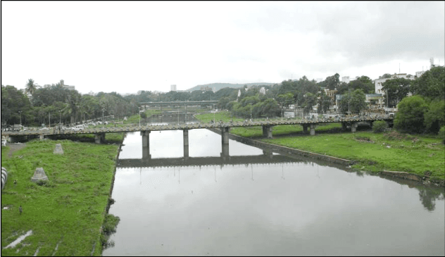
17.3.3.4. Flood Control :- Mula and Mutha are the two rivers flowing through the city. The State Government has issued directives to control development along the river banks vide circular no FDW 1089/243/89/CV(works) dt. 2/9/1989 The concept of blue line (Line representing highest flood level occurred in last 25 years) and red line (Line representing highest flood level occurred in last 100 years) is defined in the said GR. The task of demarcating blue line and red line was entrusted to Irrigation Department and their map is awaited.
17.3.3.5. Shopping facilities: - No separate survey for this aspect was carried out. Details have been obtained from existing land use survey.
17.3.3.6. Industrial: - No separate survey for this aspect was carried out. The information regarding industries in and aroud Pune was collected from Mahrattha Chamber of Commerce and Industries, Pune and industrial directory 2010.
17.3.3.7. Utility Services:- The important services are water supply, drainage, garbage disposal, disposal of industrial effluents, medical wastes, Information Technology waste, Power and Electrical Energy etc. The current services need to be examined and upgraded as per future needs. The data of these utility services have been collected from the respective department of PMC and various government agencies.
17.3.3.8. Climatology: - This data has been obtained from Metrological Department. it will be analyzed and policies for eco-friendly housing have been framed.
17.3.3.9. Government lands: - Information regarding various government lands such as forest, defence, irrigation, air force, has been collected from the respective departments.
17.3.3.10. Slums: - The data of existing slums within city has been collected from Existing Land Use Survey and the detailed survey carried our by M/s Mashal.