Bengaluru is located at latitude 1 2 ° 5 9 ′ 0 ′ ′ N and longitude 77° 35'0'' . It has two topological terrains, the one at the North Bangalore taluk and other being the South Bangalore taluk. The north taluk a level plateau and lies between 839-962 m above sea level. At the middle of it along the NNE to SSW runs the ridge, and the highest point at Doddabettahalli at 962 meters elevation. The topology of Bengaluru is flat except at this ridge. There are gentle slopes and valleys on either side of this ridge, forming low lying area which constitutes water tanks in varying sizes. The river Arkavathi flows through the north western part of the city. Its tributary is River Vrishabhavathi which rises at Basavanagudi. The south Bangalore terrain has uneven and undulating landscape with hills and valleys. The South Bangalore taluk has an uneven landscape with intermingling hills and valleys. The southern and western portions of the city consist of a topology of granite and gneissic masses. The eastern portion is a plane, with rare minor undulations. The BMA specifically, has the rock type that belongs to the Charkonite Group, Saugar group and the PGC. Figure 8-7 presents the Geology and Mineral Map of BMA.
Figure 8-7: Geology and Mineral Map of BMA
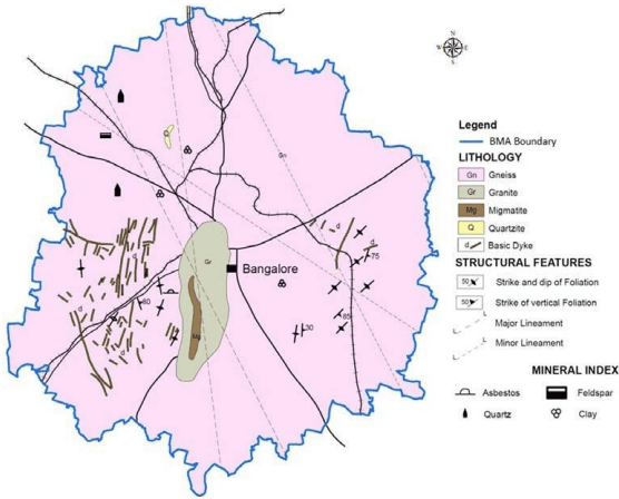
Source: District Resources Map, Geological Survey of India (2000)
Physiographic Character of BUD can be defined as plateau (as it is part of Mysore plateau) and undulating terrain. Rocky upland, plateau & flat topped hills at a general elevation of about 950 above mean sea level (amsl) defines the Geomorphology of BUD. The major part is sloping towards south and south east forming pediplains interspersed with hills all along the western part. The pediplains form the majority of BUD underlain by granites and gneisses with the highest elevation of
BANGALOE AUTHORITY ★
850 to 950 m amsl. The pediplain constitute low relief area having matured dissected rolling topography with erosional land slope covered by a layer of red loamy soil of varied thickness.
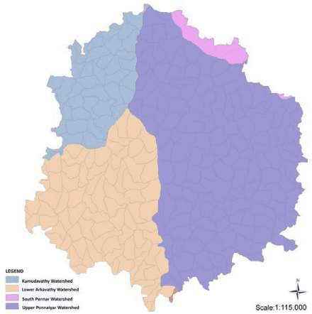
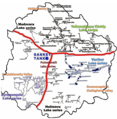
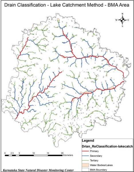
The major drainages are Cauvery and Ponniar basins. The River Cauvery flows at a distance of approximately 100 km from BUD with its tributaries of Arkavathi and Kumudavathi draining in BUD and BMA. Further, Kumudavathi, Palar and Pinakini, the tributaries of Pennar River flow in the NE part of BUD. The pediplains is dissected by streamlets flowing in southern direction. (Refer Figure 8-8)
Figure 8-8: Geomorphological Map of BMA
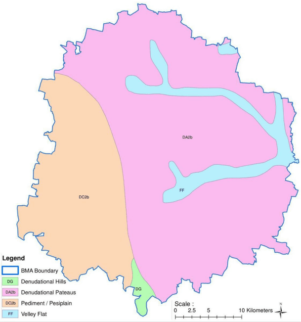
Source: District Resources Map, Geological Survey of India (2000)
8.2.1 Geo Technical Characteristics (Seismicity)
As per Final Report on Development of Probabilistic Seismic Hazard Map of India (PSHMI), by National Disaster Management Authority (NDMA), 2010, there are thirty two seismic zones of India (Refer Figure 8-9). Bengaluru city falls under Zone No. 29 called as Southern Craton. As per PHSMI report, Southern Craton has received 45 earthquakes and this zone has max potential of magnitude upto 6.8 Mw scale. Further, PHSMI report has carried out probabilistic analysis for 48 cities in India including Bengaluru by computing peak ground acceleration (PGA) over 500, 2500, 5000 and 10000 years. According to PHSMI report Bengaluru has relative seismic hazard at 0.02, 0.04, 0.05 and 0.06 PGA (g) respectively, which puts Bengaluru relatively the safest among the other cities.
Figure 8-9: Thirty Two Seismic Zones of India
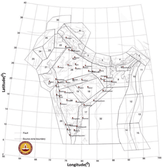
http://www.hpsdma.nic.in/Development%20of%20Probablistic%20Seismic%20Hazard%20Map%20of%20India.pdf,
BANGALOE AUTHORITY ★
The planning area is under the Seismic zone II making it least seismically active and low risk zone15. The geomorphological characteristics of granite and gneiss rock types along with the geotechnical characteristics of Seismic Zone II indicate that the planning area is conducive to vertical development such as high rises with adequate safety measure installed in high rise structures.
8.2.2 Topography & Contours
As part of preparation of RMP 2031, using high resolution satellite imagery, Digital Survey Model (DSM) map and Contour map of the planning area have been generated to study the topography. Figure 8-10 presents the DSM map for BMA, which clearly depicted that the central ridge runs along North-South of BMA and the major valley is sloping towards the East and the Vrishabhavathy Valley is along the SW of BMA. Figure 8-11 presents the Contour Map of BMA. The DSM and the Contour map can be utilised while proposing and planning infrastructure such as road and drainage system and for delineation of sensitive zones such as catchment and buffer areas of natural drainage and lakes.
Figure 8-10: Topography (Digital Surface Model) of BMA
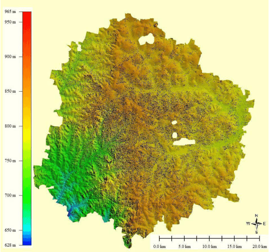
Source: Satellite Image (2012) and RMP 2031 Analysis, 2015
15 More details of the geotechnical characteristics and natural hazard is included in Part VIII-Report on Hazard & Vulnerability Survey and Assessment
Figure 8-11: Contour Map of BMA
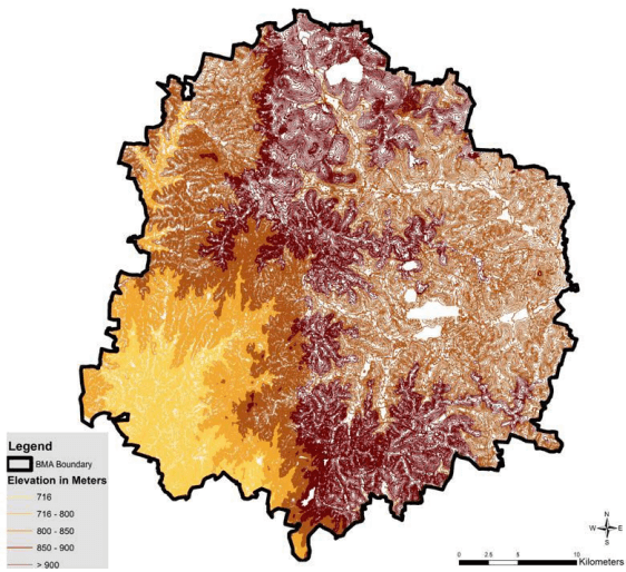
Source: Satellite Image (2012) and RMP 2031 Analysis 2015