4.1 Planning efforts in the past:
CIDCO being as NTDA, has acquired most of the lands for the development of a new town i.e. Navi Mumbai. CIDCO's sanctioned DP modified up to June 2021 is a Structural Plan showing the zoning of lands i.e. Residential, Commercial, Industrial, Regional Park, SEZ, NDZ, etc. In the present NMDP whole SPA area is in the Regional Park Zone.
Navi Mumbai Municipal Corporation (NMMC) recently, on 09 th August 2022, published the Draft Development Plan (DDP) for their area under section 26(1) of MR&TP 1966 Act, wherein villages from the Thane district of CIDCO SPA boundary are shown under Forest Land use.
4.2 Need for Preparation of Development Plan:
Development Plan indicates the manner in which the use of land shall be regulated and indicates the manner in which the development of land shall be carried out. It defines the use of land in terms of activities such as residential, commercial, industrial, agricultural, recreational, public utilities, physical and social infrastructure.
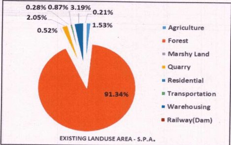
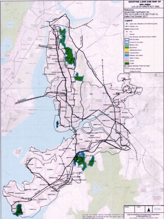
Preparing an Existing Land Use Survey (ELU) is the first mandatory step in formulating a Development Plan. ELU has been prepared by CIDCO for the SPA area.
4.3 Legal Formalities:
- CIDCO was appointed, as Special Planning Authority vide Government Notification dated 31st October 2017.
- CIDCO being SPA of this area, has declared its intention to prepare a Draft Development Plan for part of 16 Villages in CIDCO's jurisdiction vide Board resolution no. 12443 dated 05.08.2021 under section 23 (1) of the MR&TP Act 1966. The notice of said intention was published in Maharashtra Govt. Gazette on October 21-27, 2021.
- Joint Director, Town Planning Department, Konkan Division has approved the appointment of Senior Planner (DP) as Town Planning Officer(TPO), under section 24 of the “MR&TP Act 1966” for the SPA area in CIDCO’s Jurisdiction vide letter dated 23rd December 2021.

- It is mandatory to prepare a Development Plan (DP) within 3 years from the date of its appointment under Section 21 of the MR & TP Act, 1966. With due approvals, the
declaration of Intention for the Preparation of DP for this area was published in the Government Gazette on 21 st October 2021.
- As per section 25 of the MR & TP Act 1966, the Existing Land Use map shall be prepared within six months after the declaration of the intention. CIDCO vide letter dated 01st July 2022 requested the Government for an extension of six months i.e. up to 21st October 2022 for preparation of the Existing Land Use (ELU) map for the SPA area.
- The Government has granted permission for the extension time limit for preparation of ELU till 21st October 2022 vide letter JDTP/KD/DP Thane/extension/1309 dated 18th July 2022.
- After carrying out an Existing Land Use Survey, CIDCO has prepared an Existing Land Use (ELU) map under section 25 of the MR & TP Act 1966. After completion of ELU, CIDCO has been informed to the State Government vide letter dated 19th October 2022.
- CIDCO has prepared a Proposed Land Use for the SPA area and the same has been approved by the Board of Directors of the CIDCO for publication of Draft Development Plan (DDP) u/s 26 (1) of MRTP Act 1966 on dated 07th February 2024.
- CIDCO has prepared a Draft Development Plan (DDP) u/s 26(1) of MR & TP Act 1966 for inviting suggestions/objections from the public.
4.4 Consultation with stakeholders:
Under the provisions of MR & TP Act 1966, it is not mandatory to consult the stakeholders or nothing is mentioned about public consultation before publication of DP in the MR & TP Act 1966. Major lands fall in the hilly region and belong to the Forest Department, Govt. of Maharashtra.
4.5 Main Stages of Preparation of Development Plan:
4.5.1 Preparation of Base Map
Survey numbers and their areas falling in the SPA project are certified by the Lands Department of CIDCO. The georeferenced combined village plans are procured from a survey agency. For the Development Plan, a base map showing the boundaries of the project area within the jurisdiction of CIDCO is prepared. The village-wise combined map with Existing Land Use to a scale of 1:10,000 is prepared.
CICCO * CIP Industrial Development Corporation Limited Senior Planes (Development Plan) CIDCO CBD Batsup
4.5.2 Survey – Analysis and Findings
The Existing Land Use Map (ELU) is the basis for preparation of development plan, which is mandatory as per section 25 of MR & TP Act, 1966. This chapter presents making of the ELU of the SPA area and its survey methodology.
For the SPA area, Lidar Survey was carried out for all land pockets from Dighe of Thane district to Nagaon of Uran Taluka, Raigad District. The Drone survey has been carried out in 2022 and the same data has been analyzed.
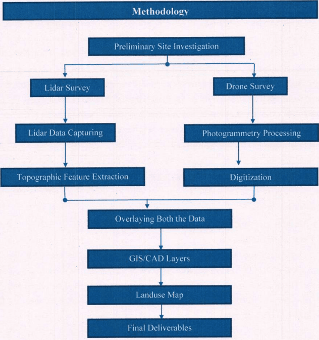
Figure 4-Methodology of Topographic and Existing land Use Survey for SPA area

<details> <summary>seal</summary>
ADE L 人 R A 美 </details>
4.5.3 Data Collection
For the purpose of preparation of Development Plan, CIDCO had procured Google images / satellite imagery. Forest land information is collected from Lands Department of CIDCO. The information regarding Government land, Forest Land and Private Land is downloaded from the website of Government of Maharashtra and same is verified with the Lands Department of CIDCO.
4.5.4 Primary Survey
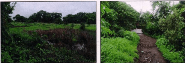
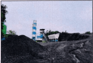
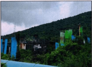
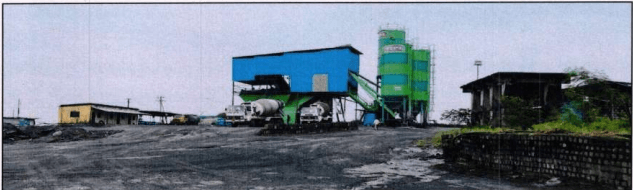
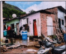
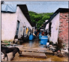
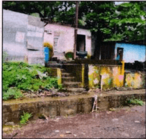
The survey team from Planning Department conducted the physical survey and took the photographs to understand the geography of the existing conditions of the SPA area.
4.5.5 LiDAR Data Processing
Contour lines are the most common method of showing relief and elevation on a standard topographic map. A contour line represents an imaginary line on the ground, above or below mean sea level. All points on the contour line are at the same elevation. The elevation represented by contour lines is the vertical distance above or below mean sea level. Digital Elevation Model (DEM) has been generated based on the filtered and edited LiDAR data / (bare earth) incorporating streams and break lines and points. The contours at 1-meter and 5-meter intervals have been derived from the DEM.