This page explains the categories listed in the supplied HMDA MDP 2031 sheet for Ghatkesar. It is a reading guide, not a parcel-specific zoning determination. Match the mapped hatch/fill and boundary to the full legend on the preceding map sheet, then verify against the official high-resolution plan and applicable orders.
HMDA MDP 2031 — FARUQNAGAR MANDAL MAP
| hmdaGrowing Global |
|---|
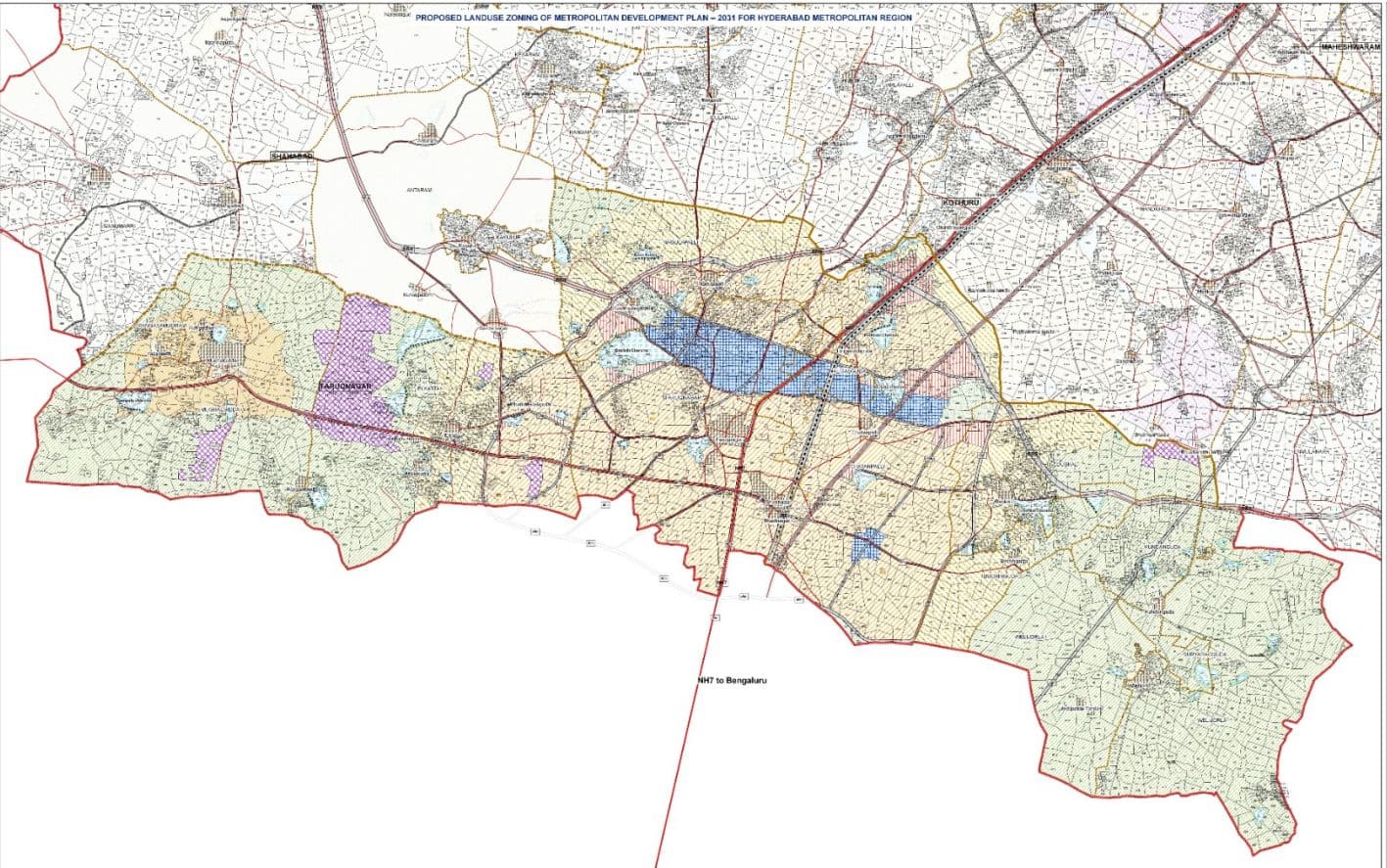
Proposed Landuse and Road Network for Faruqnagar Mandal Mahaboobnagar District
A BOWEE SY 2UVEEEI LE GO WS BO2, MALD U DE AIN D41D 2AC N:
Proposed Landuse Zoning I.residentialuse Zone
IVMANUFACTURING USE ZONE WCRK CENTERS
V.PUBLIC AND SEMIHPUBLIC USE ZONE PUBLIC, SEAIPUBLC RNCILTIES AND UTIUITIES UBE ZONE ANENTES
VIMULTIPLE USE ZONE MILTIPLE UBEZONE GENERALDEVELOPMENT PRCMOTION ZONE (GDPZ:
Vilrecreation and Open Space Use Zone
RECREANCNAL UBE Z0NE OPENSPACE BUFFER (AROUND FORESHORE OF WATERBODIES)?HIMRIXTH BACAR AFFORERTATION ZONE
Vii.water Bodies
WATER BODIES (RIVERS NALAE, EBERVOIRS ANDKLNTAR) IX.FOREST
X.SPECIAL RESERVATIONS EHIRITACE BUILCINGA AND PRIIOINOTA DEFENSE/MILITARY LANDS CIHERS
RALGATS FRALNAI SEATIONS BUS DEPOTS. PASSENDER /FREIGHTTERMINALS ARPCRIS
and Roda und c v
| 0 | 0.05 | 0.5 | 1 | 1.5 | 2 | 2.5 | 3 | 4 | W | E |
| SCALE 100,00 | S | |||||||||
Legend Explanation — Faruqnagar