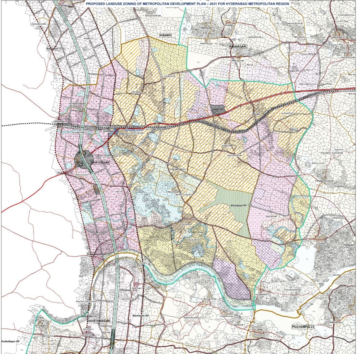
This page explains the categories listed in the supplied HMDA MDP 2031 sheet for Hatnura. It is a reading guide, not a parcel-specific zoning determination. Match the mapped hatch/fill and boundary to the full legend on the preceding map sheet, then verify against the official high-resolution plan and applicable orders.
| HYDERABAD METROPOLITAN DEVELOPMENT AUTHORITY (HMDA) | |
| Sheet no : 29Sheet size: 24" X 32" | |
HMDA MDP 2031 — GHATKESAR MANDAL MAP
| LEGENDREFERENCE | |
| HMDA BOUNDARY | NATIONAL HIGHWAYS |
| ERSTWHILE HUDA BOUNDARY | STATE HIGHWAYS |
| ERSTWHILE HADA BOUNDARY | OUTER RING ROAD |
| ORR GC BOUNDARY | MAJOR ROADS |
| DISTRICT BOUNDARY | RURAL ROADS |
| MANDAL BOUNDARY | KACHA ROADS |
| VILLAGE BOUNDARY | TANKBUND |
| CADASTRAL BOUNDARY | DRAINAGE LINE |
| RAILWAY LINE | |
| PROPOSED LANDUSE ZONINGI.RESIDENTIAL USE ZONE | |
| RESIDENTIAL USE ZONE-1 (R1) | |
| RESIDENTIAL USE ZONE-2 (R2) | |
| RESIDENTIAL USE ZONE-3 (R3) | |
| RESIDENTIAL USE ZONE-4 (R4) | |
| SETTLEMENTS | |
| II.PERI-URBAN USE ZONE | |
| PERI-URBAN USE ZONE | |
| III.COMERCIAL USE ZONE | |
| COMMERCIAL USE ZONE | |
| IV.MANUFACTURING USE ZONE | |
| MANUFACTURING USE ZONE | |
| WORK CENTERS | |
| V.PUBLIC AND SEMI-PUBLIC USE ZONE | |
| PUBLIC, SEMI-PUBLIC FACILITIES AND UTILITIES USE ZONE | |
| PUBLIC UTILITIES | |
| AMENITIES | |
| VI.MULTIPLE USE ZONE | |
| MULTIPLE USE ZONE | |
| SPECIAL DEVELOPMENT ZONE (MULTIPURPOSE USE ZONE) | |
| CENTRAL SQUARE | |
| GENERAL DEVELOPMENT PROMOTION ZONE (GDPZ) | |
| VII.RECREATION AND OPEN SPACE USE ZONE | |
| RECREATIONAL USE ZONE | |
| OPEN SPACE BUFFER (AROUND FORESHORE OF WATERBODIES) | |
| HIMAYATH SAGAR AFFORESTATION ZONE | |
| VIII.WATER BODIES | |
| WATER BODIES (RIVERS, NALAS, RESERVOIRS AND KUNTAS) | |
| IX.FOREST | |
| FOREST ZONE | |
| X.SPECIAL RESERVATIONS | |
| HERITAGE BUILDINGS AND PRECINCTS | |
| DEFENSE / MILITARY LANDS | |
| BIO CONSERVATION ZONE (AS PER G.O.MS. NO: 111, DATED 06-03-1996) | |
| OTHERS | |
| XI.CONSERVATION (AGRICULTURE) | |
| CONSERVATION USE ZONE | |
| XII.TRAFFIC AND TRANSPORTATION | |
| ROADS | |
| RAILWAYS / RAILWAY STATIONS | |
| BUS DEPOTS, PASSENGER / FREIGHT TERMINALS | |
| AIRPORTS | |

| Notes: Maps reflect proposed land use and not ownership of the land. Road width to be read and not to be measured. Administrative boundaries are as per village cadastral data, the relevant G.Os and notified Master Plans. Land use proposals and Zoning and Development Promotion Regulations are subjected to restrictions on development activities in FTI/HFL at water bodies & Shikhorn as per Revenue / Ingestion Department records and relevant Court Orders, if any. The "Open Space Use Zone - Suffer" along lakes, ponds, estreas, rivers and other water bodies shall be as per relevant G.Os whenever not specifically mentioned in the plan. Re respective Zoning & Development Promotion Regulations for the Notified Master Plans - HADA and OR/IGC are applicable unless stated otherwise in this plan & regulations. Permissions granted for residential, institutional and industrial use and layouts by HMDA, DTCP and APHC prior to the notification of this Master Plan will prove irrespective of the proposed general land use. Land cover calls for the extended area of HMDA is based on satellite imagery (2009) - LSS IV & CART/OSAT-1 Cadstral information provided in the base map is as per records made invisible by GSD, Survey and Land Records and other concerned departments. The academic boundaries and numbers should be read with revenue records and corrections if any shall be visited with the Metropolitan Commissioner, HMDA. Heritage buildings and precincts are subjected to the regulations prescribed by the relevant Notifications / Court Orders / G.O whenever not specifically mentioned in the plan. Change of Land Use notified by the Government in the notified Master Plans, notified immediately prior to notification of this plan, will previal over the Land Use proposed in this Plan. Outlying Road is a project under implementation and the alignment and junction details shown are indicative and shall be treated as per the project. The land use is being implemented on ground. Names of the locations are as per Survey of India records and are indicative. Local usage of the name / name in revenue records may be at slight variance. Justification of defense establishments shall be as per the records of concerned authorities. Forest boundaries shall be reckised as per the forest department records and shall prevail over the Master Plan proposals, in case of any discrepancy. |
|---|
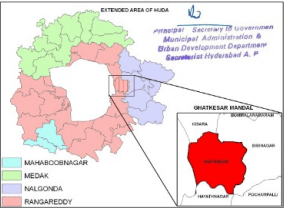
LOCATION MAP
Legend Explanation — Ghatkesar