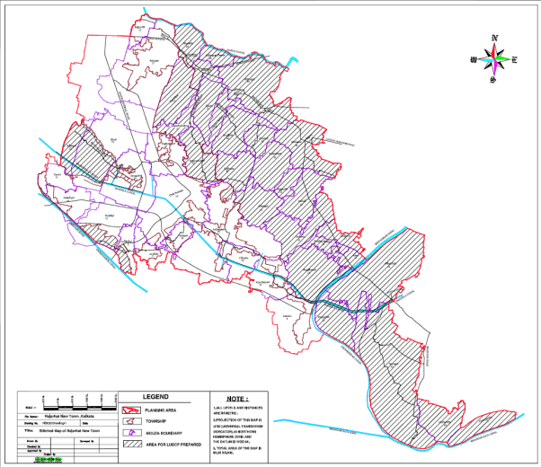
The West Bengal Town and Country Planning and Development Act, 1979, which has the statutory provisions to control unplanned development and undesirable spontaneous growth by imposing land use zoning regulation. Its only limitation is that it is not operational if the area is not notified as planning area under this act. The plans prepared by CMPO, APO or SPO during sixties and seventies of last century, had failed to achieve its desired goal due to lack of their statutory support, so this West Bengal Town and Country Planning and Development Act, 1979 was formulated and came in operation by repealing the then existing Calcutta Metropolitan Development Authority Act 1972, the Calcutta Metropolitan Planning Area (Use and Development of land Control Act, 1965 and the Durgapur (development use and control of building operations)Act 1959 with overriding effect (section 137) to provide an uniform act for the entire state.
Major functions of the authority
Town and country planning functions of both the Planning and Development Authority as stated under relevant section of West Bengal Town and Country Planning and Development Act, 1979 are
• Preparation of present land use map and land registers(LUMR)
• Control of development and use of Land through Land Use Development Control Plan
Prescription of uses of land within its area
The powers and function of WBHIDCO as stated under Relevant Section, West Bengal Town and Country (Planning & Development) Act, 1979 are ‐
1 To prepare Land Use Map;
2 To prepare and enforce an Intermediate Perspective Plan till such time the LUDCP is prepared, approved and enforced;
3 To prepare and enforce Land Use and Development Control Plan (LUCDP);
4 To prescribe use of land within its area;
5 To perform any other function which is supplemental, incidental or consequential to any of the functions aforesaid or which may be prescribed;
6 To co‐ordinate development activities of all departments and agencies of the state government or local authorities operating within the Planning Area:
7 To carry out or cause to be carried out such works as are contemplated in the Perspective plans;
8 To acquire, hold and manage such property, both moveable and immovable, as the Development Authority may deem necessary for the purpose of any of its activities and to lease, sell or otherwise transfer any property held by it;
9 To purchase by agreement or take on lease or under any form of tenancy, any land and to erect thereon such buildings and to carry out such operations as may be necessary for the purpose of carrying on its undertakings.
10 To enter into or perform such contracts as may be necessary for the purpose of its duties and for exercise of its powers under this Act;
11 To provide facilities for consignment, storage and delivery of goods
In exercise of the power conferred by the West Bengal Town & Country (Planning and Development) Act, 1979, the West Bengal Housing Infrastructure Development Corporation Limited (WBHIDCOLtd) hereby prepared the following Land Use & Development Control Plan (here in after referred to as LUDCP) for forty five(45) numbers of Mouzas of New Town planning Area and under
Section 36, 37 and 38 of the WBT&C&D Act, 1979, and proposes amendment of the existing LUDCP under Section 40 of the T & CP Act, 1979.
There are four numbers of part mouzas and forty one number of full mouzas.
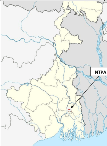
New town Planning Area
With reference to section 9 of West Bengal Town & Country (Planning and Development) Act, 1979 Planning Area of WBHIDCO was declared vide notification no1423/HG/NTP/1M‐1/98 dated 27.08.1999, 650‐111/1M‐1/98 dated22/11/06,392‐ H2/HG/NTP/3C‐2/2005 dated 21/07/2008. Under the same reference the planning area was constituted of erstwhile Bhangore Rajarhat Development Authority vide notification no 1081‐H2/3C‐2/2005 dated 13.12.2005
As the entire area came under the Planning Area of WBHIDCO, as per Notification No. 1021‐H2/1M‐
Map 1 Map of West Bengal showing the location of New Town Planning Area
14/2006 dated 01.08.2011 and total area was termed thereafter New Town Planning Area.
In exercise of the power conferred by the West Bengal Town & Country (Planning and Development) Act, 1979, the West Bengal Housing Infrastructure Development Corporation Limited (WBHIDCO) hereby prepares the following Land Use & Development Control Plan (here in after referred to as LUDCP) known as LUDCP for Mouzas stated in the table shown below and under Section 36, 37 and 38 of the T&CP Act, 1979, and proposes amendment of the existing LUDCP of Forty Five Mouza mentioned below under Section 40 of the T & CP Act, 1979.The Land use Map and register had already been prepared for the New Town Planning Area.
| Serial No. | Police Station, District | Mouzas(as per census 2011) covered by LUMR under the Notification | J L No |
| 11 | Rajarhat, North 24 Parganas Rajarhat, North 24 Parganas | Raigachi(Full) | 12 |
| 11 | Rajarhat, North 24 Parganas Rajarhat, North 24 Parganas | Recjuani(Full) | 13 |
| 11 | Rajarhat, North 24 Parganas Rajarhat, North 24 Parganas | Tarulia(Full) | 21 |
| 11 | Rajarhat, North 24 Parganas Rajarhat, North 24 Parganas | Sulangari(Full) | 22 |
| 11 | Rajarhat, North 24 Parganas Rajarhat, North 24 Parganas | Ghuni(Full) | 23 |
| 11 | Rajarhat, North 24 Parganas Rajarhat, North 24 Parganas | Jatragachhi(Full) | 24 |
| 11 | Rajarhat, North 24 Parganas Rajarhat, North 24 Parganas | Kadampukur(Full) |
Section 1 Short Title, Application & Commencement
-
This LUDCP may be called the Land Use & Development Control Plan for 48 Mouzas of North & South 24 Paraganas comprising of 93.9 sq km of land within the Planning Area of New Town, Kolkata.
-
This LUDCP shall apply to the above mentioned Mouzas of North & South 24 Paraganas as delineated in Chapter 2 of this LUDCP being a portion of the Planning Area declared under Notification No. 1423/HI/HG/NTP/IM01/98 date 27.08.1999
-
This LUDCP shall come into force on the date of its publication in the official gazette.
Section 2 Ludcp
i. In this LUDCP –
a) ‘The Act’ means the West Bengal Town & Country (Planning & Development) Act, 1979
b) ‘Predominant Use of Land’ means the use put to the land covering more than 60% of the total area in any land use zone (as per relevant section WBT&CP&D act, 1979.
c) ‘Present Land Use’ means the predominant use to which the land is put on the date of preparation of the Present Land Use Map.
ii. Words & expressions used but not defined in this LUDCP, shall have the same meanings as respectively assigned to them in the Act, the Rules & the Regulations made under the Act.
Section 2.1 A brief note on Town Ship within New Town Planning Area
Development of Township :‐ New Town
Background: Rules of business was changed in 1997, entrusting Housing Department for development of Rajarhat township comprising Rajarhat Police Station of North 24‐Pgs and erstwhile Bhangar Police Station of South 24‐Parganas) Series of studies were made and reports from experts including environment clearance on the Environment Impact Assessment were obtained.
With the objective of developing an eco‐friendly green dotted New Town, it was designed to develop the area in different phases. The area was initially divided into three Action Areas. At present Action Areas have been re‐aligned as follows.
Description of different area of Township of New Town
| Location | Action Area-I | Action Area-II | Action Area-III | CBD |
|---|---|---|---|---|
| Area in hectares | 677 | 1310 | 783 | 183 |
| Progress of infrastructure development | Almost complete | More than 50 % work completed. | Work in progress | Work in progress |
Besides an area of around 135 hectares is earmarked for setting up Water Treatment Plant and Garbage Disposal Centre.
Projected Population:
Total resident population 10 lacs and floating population 5 lacs
Environment Friendly Township:
Large Open Space, greeneries and water bodies: 50 % of the project area is left open for roads, drains, greeneries, water bodies etc. Total recorded water bodies in New Town project area was around 109 hectares. The authority has already created 113 hectares of water bodies. Around 251 hectares of water bodies are planned to be created in New town.
Land area developed 2388 Ha and Water supply, sewerage & drainage works havae been entrusted to PHE Department of Govt. of West Bengal
Roads and bridges: Infrastructure already developed.
-
6‐lane Bridge over Krisnpapur Canal
-
Major Arterial Road of 59 metre width and 10.75 Km long,
-
Bridge over Bagjola Canal on existing MAR alignment
-
2nd bridge over bagjola canal on North – South Corridor
-
Fly over on the MAR and VIP Road junction,
-
Bailey bridge over bagjola canal
-
Three small bridges over link canal.
9
Section 3 Background
In the pace of rapid urbanization and growing demand for housing and commercial spaces, the New Town, Kolkata was created in the eastern outskirts of Kolkata to serve the dual purposes of:
I. Establishing new business centre to reduce the mounting pressure on the existing Central Business Districts (CBD) and
II. Increasing housing stock supply by creating new residential units.
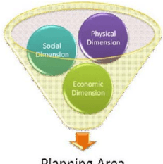
Fig 1 Planning Approach
The West Bengal Housing Infrastructure Development Corporation Ltd. (WBHIDCO), a wholly owned Govt. Company set up by the Govt. of West Bengal in 1999 is developing a New Town, very close to the City of Kolkata. Presently, these areas of the New Town have been filled and urbanization has spilled to the

adjoining areas in a haphazard manner. In order to bring about organized development in these surroundings as well as to cater to the pressure of development in the New Town area, adjoining 45 Mouzas had been notified to be included in the New Town Planning Area (NTPA) for preparation of LUDCP
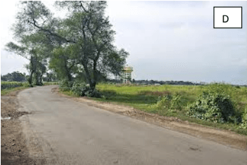
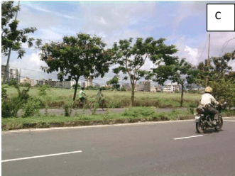
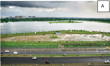
FIG 2 Pictures A, B, C, D showing the Present Condition of Land Use in New Town Planning Area Section 4: Objectives of the LUDCP for New Town Planning Area
Every new city built or planned should have a Vision for which the project aims for. The Vision of WBHIDCO for the New Town Planning Area (NTPA) Area is therefore “Preparation of LUDCP to guide planned development in the adjoining Area of New town”. The primary objectives for preparing this LUDCP are as follows: To coordinate land resources and economy with land use planning To achieve balanced development of the related areas