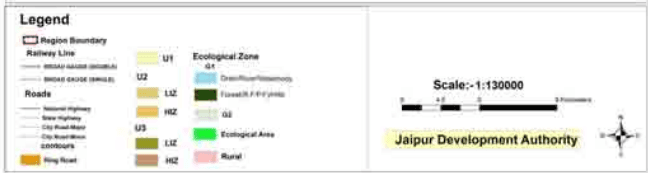
Volume-I outlined the existing profile and volume-II attends to the following with two front approaches
❖ Projections based on the existing studies
◆ Requirements spread and spatial distribution
The Master Development Plan-2025 covers all aspects of development including transportation, infrastructure (sewer, drainage, water and electricity), environmental protection, and land uses (residential, commercial, industrial, recreational, etc.). The Master Plan analyzes current demographic statistics and economic issues, factors to project growth scenarios, propose solutions that mitigate negative impacts of traffic, assess infrastructure capacity, and public service needs, and allocate land as needed to ensure adequate land availability and to be able to utilize them for both present and future needs of the residents.
Volume-I consist of existing profile of Jaipur district, Jaipur region and U1 area and the collected data has been used for analysis which would act as base for projections and proposals. Volume-I enumerate the following chapters:
Background
Jaipur District profile
Jaipur Region
Jaipur U1 area
Quality of Life
District level study and conclusions are given in Jaipur District Profile chapter of volume-1 while projection and proposals for Jaipur Region and U-1 area have been made separately give in volume -2. Planning proposal for Jaipur Region and U-1 area are based on background study of volume-1. volume-2 "Development Plan" is the second part of MDP-2025 which enumerates following :
Projections and proposals for Jaipur region
Proposals for U1 area
Quality of Life
Development Policies and plan implementation
Detail study has been made for projection and proposals in this volume. The following aspects cover for projection and proposals for Jaipur Region:
• Demography
• Demarcation of the development area
• Land Utilization
• Transportation
• Economy & Infrastructure
• Environment
• Urban Design
• Recreational
• Disaster Management
Projections have been made for population, infrastructure and land requirement for projected population.
Proposals for U1 area consist of planning policies and principles for land use plan-2025, land uses in Master plan-2025 and plan implementation.
The conclusion of Jaipur district study and analysis of existing Jaipur region and city profile of volume-I further carried out to arrive at the projected need of balanced development of Jaipur Region and U1 area of Jaipur.
1.1Demographic Projections
Population projection of Jaipur city (UA) has been done by various methods such as Arithmetic, Geometric, Least Square, Exponential, Newton Gregory, Straight line and Component methods. Further average projected population for Jaipur (UA) has been calculated for horizon year 2025 based on the average projected population figures arrived by the various methods. From the demographic study and trend analysis, the following projections for rest of the town and rural area in Jaipur District have been arrived through the least square method. The population projections would help in area allocation and planning infrastructure.
1.1.1 Population Projections of Jaipur Region and settlements for the Year 2025
Table 1-1Population projections-Jaipur region and settlements
Year
1991
2001
2011
2021
2025
Jaipur U.A.
1518235
2322575
3602000
5419208
6495000
Growth Rate
(49.56)
(52.98)
(55.06)
(50.44)
(49.64)
Development Nodes within the Region by 2025
Chomu
38523
50708
65583
82727
90250
Morija
9335
11363
14204
17755
19530
Jaitpura
4319
5679
7496
9895
11162
Anatpura
3802
5044
6658
8789
9913
Bagru
15509
22092
29842
39120
43243
Dahmi Kalan
3359
4442
6219
8706
10099
Bassi
15135
19888
26252
35924
41241
Kalwar
4411
6478
9525
13998
16798
Pachar
3414
4444
5777
7510
8411
Achrol
9295
12796
17658
24369
28073
Kukas
2216
2947
4244
6111
7186
Bhanpur Kalan
3662
4370
5244
6555
7342
Chonp
3602
4909
6799
9417
10867
Bagwara
3177
4190
5531
7301
8235
Jahota
4983
4996
6745
9105
10380
Jamwa Ramgarh
5815
6638
8231
10207
11186
Shivdaspura & Chandlai
6779
8837
9751
11028
11534
Kanota & Heerawala
6968
8838
9793
11158
11705
Watika
6537
8292
9237
10343
10785
Rest of the villages ^
313540
526864
590126
669027
700584
Population of 243 villages*
178755
Total
2161371
3044946
4445298
6416419
7561604
* - The population of these villages has been depicted for the year 1991 to arrive at the comparable population.
^ - 532 villages
It is thus projected that by the year 2025, the population of the Jaipur region would reach 75.62 lakhs. The growth rate assumed for the same has been reflected as under:
1.1.2 Projected Population Growth Trend of Jaipur region for the year 2025
The decadal growth rate of population is assumed to be 44.34% by 2021 and would be 44.61% by 2025. This is because Jaipur already exhibits a high growth rate looking the fast development of areas around it. Thus a high growth rate is anticipated for the future.
Table 1-2Population Growth trend of Jaipur Region
Year
Population
Decadal Growth Rate
1991
21.61
-
2001
30.45
+40.91%
2011
44.45
+45.98%
2021
64.16
+44.34%
2025
75.61
+44.61%
Table 1-3Projected Population of the Village of Jaipur region other than the Urban areas and the towns
Year
Population
Decadal Growth Rate
2001
526864
6.73%
2011
590126
12.01%
2021
669027
13.37%
2025
700584
11.79%
It is projected that by the year 2025, the decadal growth rate of the villages would go down to 11.79% by 2025 in comparison of current growth rate 12.01%. It is
due to the fact that population would be absorbed within the proposed urbanisable area of the city.
1.1.3 Projected Decadal Growth rate of Villages and Towns in Jaipur Region
Table 1-4Projected decadal growth rate of villages and towns in Jaipur Region
As per the above table, the major growth within the region would be that of the city itself followed by growth in the towns and then in the villages. Towns would show a relatively lower percentage of growth with migration towards the Jaipur city, as no major economic activities are existing or being developed in these towns.
Population projection for MDP -2025 is done based on guidelines and assumptions for allocation and planning of efficient physical and social infrastructure.
1.1.4 Projected Decadal Growth Rate of Settlements within the Jaipur Region
A detailed projection of the towns and settlements within the JDA region has been done. Projected population and decadal growth rate of the settlements within the JDA region by the year 2025 is given below:
Table 1-5Projected decadal growth rate of settlements within Jaipur Region
Name of Settlement
1981
D.G.R.
1991
D.G.R.
2001
D.G.R.
2025
D.G.R.*
Chomu
28822
+42.82
38523
+33.66
50708
+31.63
90250
+22.73
Morija
6539
+52.67
9335
+42.76
11363
+21.72
19530
+25.00
Jaitpura
2864
+27.69
4319
+50.80
5679
+31.49
11162
+32.00
Anatpura
2886
+34.48
3802
+31.74
5044
+32.67
9913
+32.00
Bagru
11077
+51.35
15509
+40.0
22092
+42.45
43243
+26.35
Dahmi Kalan
2385
+40.17
3359
+40.84
4442
+32.24
10099
+40.00
Pachar
3838
+28.28
3414
-11.05
4444
+30.17
8411
+30.00
Kalwar
3014
+33.54
4411
+46.35
6478
+46.86
16798
+50.00
Bassi
11131
+37.59
15135
+35.97
19888
+31.40
41241
+37.00
Achrol
7149
+35.37
9295
+30.02
12796
+37.67
28073
+38.00
Jamwa Ramgarh
6736
+23.85
5815
-13.67
6638
+14.15
11186
+23.98
Bhanpur Kalan
3602
1.3District Plan
1.3.1 Proposals drawn from the District Plan
The Jaipur District Plan summarizes and identifies the settlements of various levels for the year 2025. The settlements falling within the region have been identified. As per the District Plan the level of settlements identified are as follows:
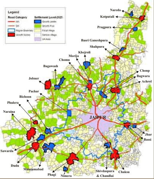
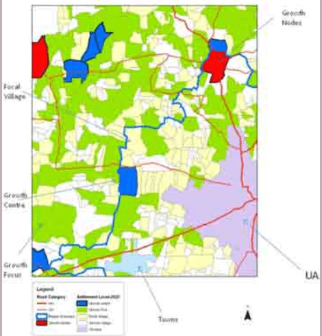
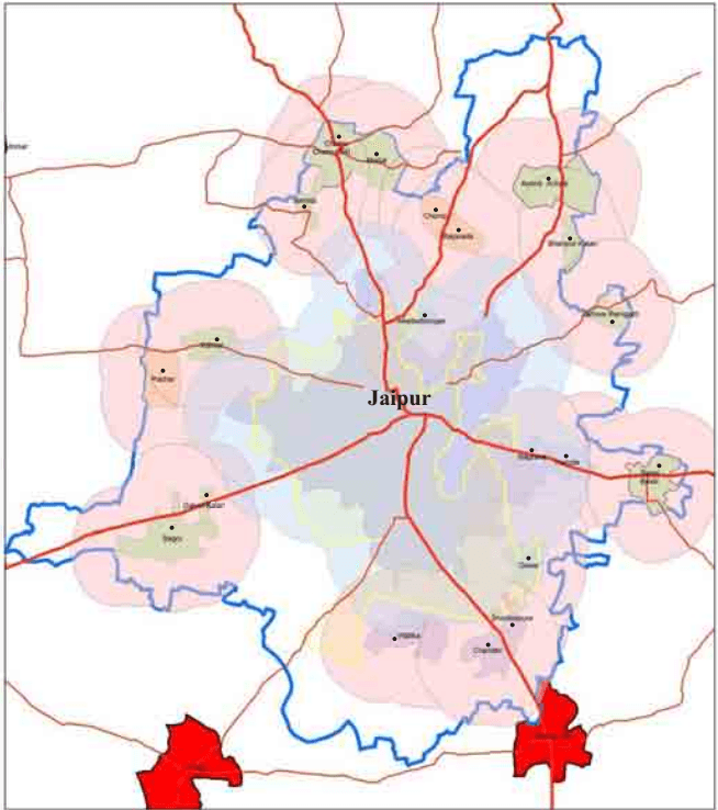
Map 1-1 Hierarchy of Settlements in Jaipur District
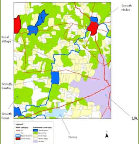
In the MDP-2025 there are 5 levels of settlement i.e., UA area, Growth Nodes, Growth centres, Growth Foci, Focal villages and Service villages
It is thus observed that as derived from the District Plan, the following settlements are identified in the Jaipur Region.
Achrol, Bassi, Chomu, Chaksu, Dudu, Phagi, Phulera, Shahpura etc.
Chonp, Bagwara, Bichoon, Morija, Mauzamabad, Shivdaspura & Chandlai etc.
1.4Settlements Classification
The existing scenario and level of urbanization and urban pattern reflect migration from nearby areas to Jaipur putting pressure on the existing infrastructure of the city. This phenomenon of regional migration affects the growth and leads to the policy failure. In order to set the corrected trend, it is proposed to develop settlement classification to meet the growing needs of urbanization in future and to ensure the balance development of the region with population assignment/nodal development.
On the line of District Plan the settlement classification for MDP 2025 is as follows. The villages have been assigned the settlement level based upon the potential of the village and their population. Villages having Population categories:-
• more than 10000 act as Satellite town
• 5001-10000 act as growth centre
• 1001-5000 act as growth foci
• 501 to 1000 as focal village and
• population less than 500 are service village
The classification has been given on the basis of concept of 'Growth Pole' theory introduced by Francis Perroux (1955). The projections of population, economic activities point that the Jaipur city and its region continuously play its primary role.
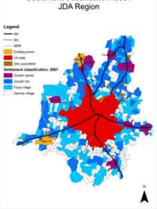
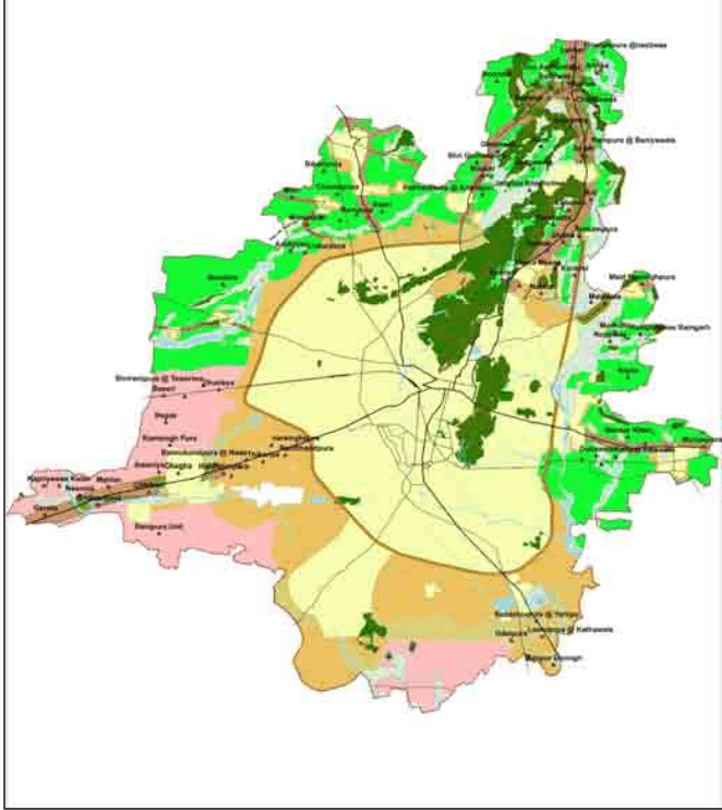
Map 1-2 Existing settlement classification of Jaipur Region -2001
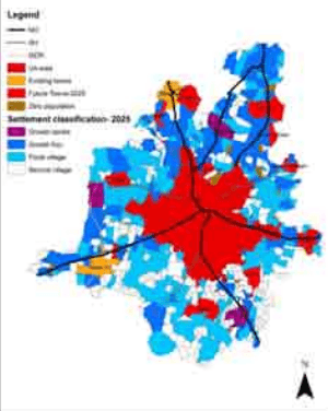
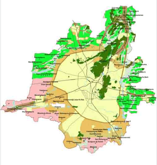
Map 1-3 Proposed Settlement Classification of Jaipur Region 2025
Settlement classification- 2001 JDA Region
Settlement classification- 2025 JDA Region
As per notifications there are total 721 villages. Out of which 168 villages were in urban area while rest of the 553 villages includes 14 villages for Future/satellite towns, 5 villages for Growth centers, 122 Growth foci, 163 focal villages and 249 Service villages.
Growth Centres
Growth Centers are defined as the settlements showing trend of economic and demographic growth over a period of time. An important attributing factor for its determination is Gross domestic product of the settlement which is proposed at 9%. These settlements shall be developed as growth centers by an inclusive approach with self sustainability.
Service Villages:
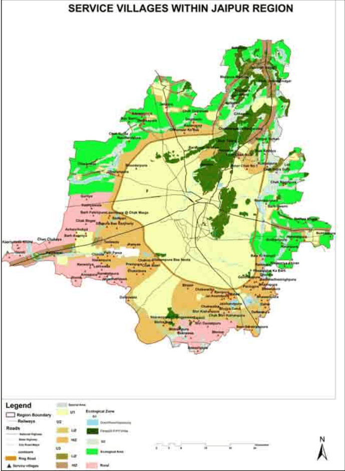
The rest of the villages are designated in this category. All the villages are provided a radius of 500 mt. around the existing settlement areas to attend to future growth of the settlements with mixed use development. The development controls are further detailed out for future development proposals within Urbanisable parcels.
Table 1-9Details of important settlement by the year 2025
Settlement Level
SI.
2025
2011 (*Satellite Towns, Inner Ring Towns)
To be designated as:
Towns
1
Chomu
Chomu*
Chomu and Morija would together form an Urban Agglomeration along with previously included Jaitpura and Anantpura
Morija
-
Jaitpura & Anantpura
2
Jahota
-
As this town lies at a distance of >5kms from Chomu, it is to be developed as an independent town.
3
Kalwar
-
As this town lies along the highway and has potential for future development along with the fact that currently a number of residential projects have come up in this town. It would thus be developed independently
4
Dahmi Kalan
-
As this town is close to Bagru, it is to be treated as an integral part of Bagru.
Bagru
Bagru
5
Watika
-
This would from part of the U-2 area and independent inputs are given.
6
Bassi
Bassi
This would continue to function as an independent town.
7
Kanota
Kanota
Kanota and Heerawala together would form part of detailed plan.
Heerawala
8
Jamwa Ramgarh
Jamwa Ramgarh
This would continue to be an independent town of the Region.
9
Achrol
Achrol
This would continue to be an independent town along the Delhi Highway.
10
Bhanpur Kalan
-
As this town is at least 2 kms away from the highway, there is little possibility that it would form a part of the Urban Agglomeration of Achrol. Hence it would be developed independently.
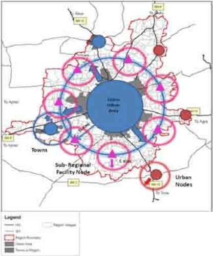
1.5Sub-Regional Facility
1.5.1 Concept for developing sub-Regional Facility Node:
Sub Region: The area beyond UA and between important transportation routes up to the Region Boundary
Sub- Regional Facility Centre
Settlements that
• Has a population of >3000
- Has basic facilities of PS, Dispensary
- Has intermediate level facilities
• Sr. Secondary School
• Hospital- 50 beds+ minor OT
- Postal Office-Telegram, Postal banking
• One government bank with ATM facility
• Govt. Office building- bills/electricity/water
• Credit Society
• One Link market
Map 1-5 Identification of sub-facility centres-Jaipur Region
First identify the level of settlements within these planning zones as per District Plan
Follow detailed analysis for each of these and apply rule of elimination.
Assign Sub-regional facility nodes as those areas which are effective strategically to service the areas around it for planned development
The Sub-regional facility nodes will be identified while doing zonal development plans. The development plans of the existing towns, future towns 2025 and growth centre shall each have one sub-regional facility centre.
1.6 Economy
1.6.1 Wholesale Markets:
New markets need to be proposed like the terminal markets, in other parts of the city. Some proposals has been made for grain market, Fruit and vegetable market, Timber market, Green peas market.
Table 1-10Proposals for Markets
SI
Type
Location
Area in acres
1
Grain Market (Anaj Mandi)
Kalwad
62.5
Renwal Manji
62.5
2
Fruit and Vegetable market
Kalwad
31.25
3
Timber market
Dhankya
100
4
Green Peas market
Mahala
18.25
1.6.2Industries
The proposals for industries are based on the type of industries and their appropriate sitting within the region. Industries have been classified as “Red”, “Orange” and “Green” industries. At the regional level the same have been held true however, at the zonal levels, a more detailed approach towards the siting of industries is required with reference to the National level Project by CPCB on “Zoning Atlas”. Accordingly, the same is envisaged to be used as an extension of the Master Plan. Till then a schematic approach as mentioned in the Zonal plan need to be adopted.
With regard to the region, the proposals for the industries are as follows:
No Red category of industry is proposed to be allowed within the region.
Industries are not to be permitted at all within the Eco-sensitive areas G-1 (a buffer zone of the same has been created)
The agriculture zone shall have industries which complement low scale- agriculture related and household industries. However, industries which may in any way create water pollution shall not be permitted.
Other Orange, (within the industrial areas developed by RIICO) and Green industries would be permitted within the development zone whether within or outside the proposed UA. However, large manufacturing industries are permitted within the U-2, U-3 area and rural area however EIA in such cases is to be prerequisite.
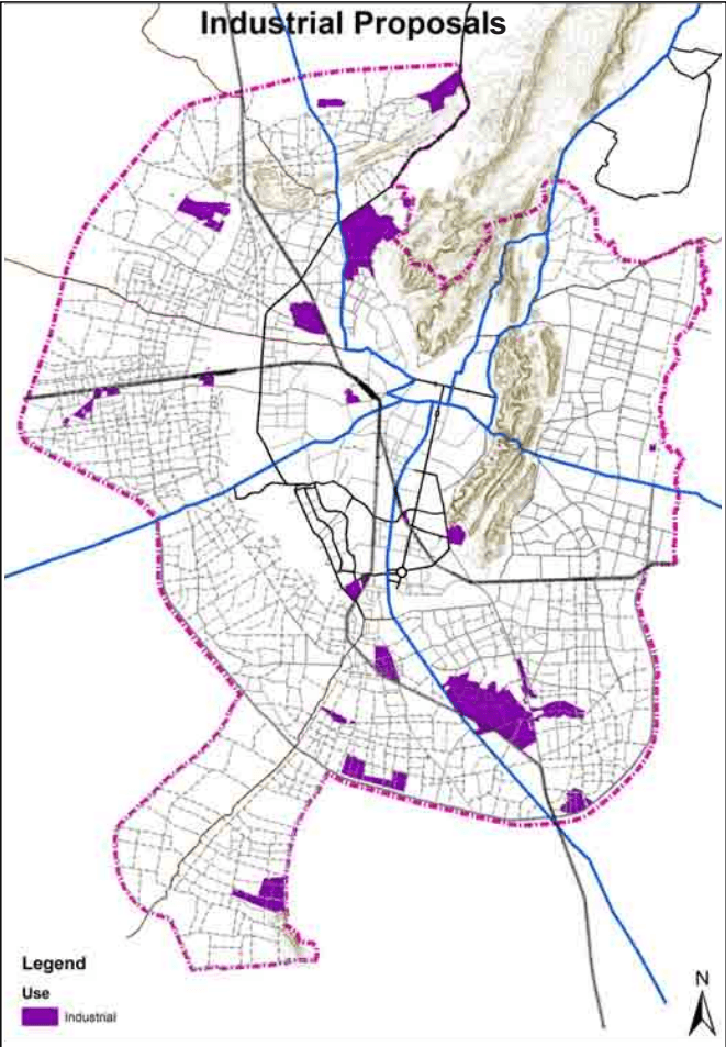
Adequate proposals of industries attended in the U-1 areas
The RIICO need to work out further modalities in realizing them.
Besides the above the general rules applicable for sitting of industries along with the necessary EIA and other pre requisites as stipulated by the State and the Central Government from time to time need to be met.
In furtherance there of, the following principle directives also need to be met out for any new industrial proposals:
- Jaipur being a heritage city, its environment comprising of its rich built heritage needs to be protected at all costs. Hence no air polluting industry would be permitted within a radial distance of 10 kms from any heritage/structure of National/State or local significance.
- Jaipur Region having limited water resources, extensive water consuming industries are not to be promoted within the region. Accordingly water polluting industries are not to be permitted within a distance of 10 kms from a natural water channel/water body. In other areas wherein water polluting industries are permitted, adequate measures need to be undertaken for the discharge of its effluents after treatment.
- No air polluting industrial areas to be set up within a radial distance of 10 kms from airports and to be totally avoided within the air funnel.
- Re-thinking is to be given to liberal conversion of Industries within 1 km. of existing industrial area.
- Polluting textile industry within the residential areas of Sanganer need to be shifted.
Village Industries
The village/ House hold industries share most of the workforce and they are being given inputs in this plan. Accordingly judicious permission HH/Village industries are encouraged in urbanisable area.
Cluster Industries
Table 1-11List of Clusters in Jaipur Region
S.No.
Tehsil/panchayat simiti
Village
Type of Handicrafts
1
Dudu
Mahela
Blue Pottery
2
Sanganer
NevtaBagruSanganer
Blue PotteryHand block printingHand block printing
All such category of industries, listed as green category may be permitted, though with permission from RSPCB. In order to promote Household industries, it may be treated as part of any use zone other than G-1, G-2 and G-3 zones.
Since the carrying capacity of the environment is limited and some areas or ecosystems are more susceptible to adverse environmental impacts than others, the unplanned and haphazard location of industries might substantially increase the risk to the environment. Due to increasing awareness, environmental considerations are becoming important. Hence a detailed study is essential to judge that the industries are well sited within the city/region. Guidelines for the same have been developed as a “Zoning Atlas” project for siting of industries at the National level prepared by the CPCB. These guidelines are eventually being legalized and incorporated for directing future industrialization. The same incorporated at the broader level would be a step towards achieving the goal of eco-friendly and sustainable industrialization.
Non polluting/ small/ cottage industries are permitted within 1.5 km of village abadi in Ecological / Rural/U2/U3 areas as per revenue / industries department rules.
1.6.3Minerals and Mining
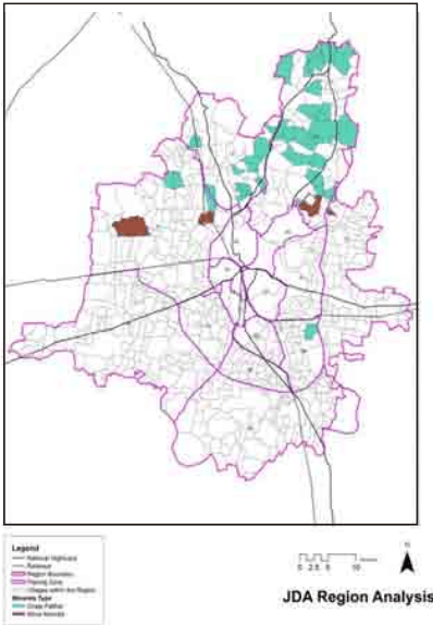
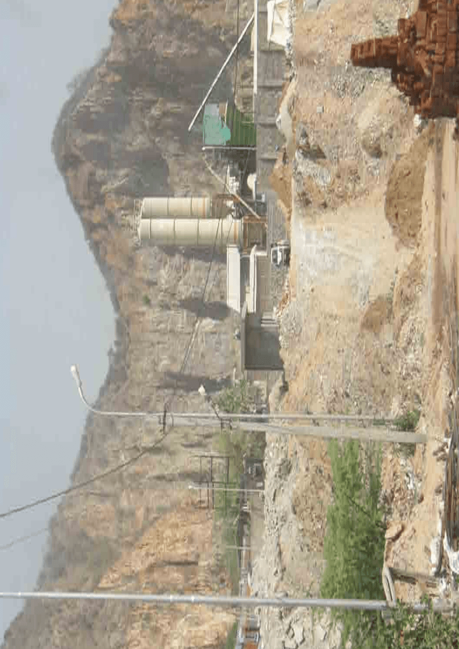
All hills hillocks have been taken under G1 category a few of them may not be coming under RF/PF category in the Region. In order to ensure supply of building material as well as grit material for roads, quarrying need to be permitted. Accordingly it is proposed
Mining and quarrying shall not be permitted in green zone (G-1) and green zone (G-2) and U-1, U-2 & U-3.
The mining department guidelines for mining and quarrying to be adopted in the rest of the area.
The hills and hillocks which are not in the ownership of forest may be permitted for quarrying only after clearance from PCB.
The few mining areas falling within the urban area (U-1) of 2025 need to be relocated as
Stone crushers, Brick kilns/ Lime kilns permission may only be allowed/permitted subject to Rules made under Land Revenue Act/RSPCB norms.
Existing mining/quarrying areas running in U1, U2, U3 & G1, and G2 needs relocation after working out effective modalities.
Map 1-6 Minerals Mining areas within the Jaipur Region
1.7 Heritage and Tourism
The natural and built heritage resources of Jaipur have immense potential in the development and growth of the city. It is important to understand the following aspects that may be associated with the city's heritage:
Renewal/ Regeneration/ Decongestion
Certain historic areas of Jaipur specifically the Walled City of Jaipur have the highest density in the city. This increased density is an additional load on the historic infrastructure and services in the area impacting the overall quality of life in such areas. These areas are rich in urban historic structures that require special conservation and regeneration plans.
Tourism and Recreational Use
The economy of Jaipur depends largely on Tourism and the heritage resources of Jaipur (both built and natural) play a significant role in the promotion of tourism in the city. Since the inception of Jaipur, it has been an international tourist destination and its unique planning has fascinated many researchers, academicians and urban planners. Tourism has increasingly put pressure for the conservation and sustenance of this historic city. Hence, it is crucial that the heritage resources/areas in the city be judiciously selected for promoting sustainable tourism.
As per the gaps identified in the Land use Plan 2025, there is an increasing need of recreational zones to be developed in the city by 2025. To meet the required target, it is feasible to evaluate existing natural and cultural heritage areas in the city such as Ghat ki Guni and Jamwa Ramgarh that can be developed into recreational nodes for the city.
Crafts based Small Scale Industries
Jaipur walled city and its surrounding towns such as Bagru and Sanganer are well known for local crafts and serve as important locations for expansion of small scale craft industries. Wherever possible, aspects such as crafts development should be integrated in the planning.
1.7.1 Conservation Strategy and Heritage Management Plans
The conservation strategy for the identified heritage zones and areas in the city needs to be evolved as per their natural, historic, architectural, archeological, scientific, social and economic significance. Hence, a comprehensive documentation, listing and assessment of significance is a prerequisite for evolving any development plan for the natural and built heritage zones identified in the Master Plan and outlined in the Zonal Plans. Based on the heritage characteristics and the potential for development, each heritage zone should have either one or more of the following plans for development:
■ Environmental Impact Assessment/ Management Plan
■ Special Zone Regeneration/Renewal/Decongestion Plan
■ Heritage Management Plan/ Conservation Plan
■ Heritage Tourism Development Plan
Such plans and their subsequent influence zone need to be detailed at Zonal level and beyond that. The Master Plan only provides an outline of planning work to be carried out at the zonal level.
1.7.2Heritage Zones
This section briefly outlines a strategy for the development of 9 heritage zones identified in the Master Plan of Jaipur. Out of these Zones 2 Zones viz'Jaipur walled city Zone including Jantar mantar and special Zone including Amber fort and Ghat ki Guni falls in U1 area while rest of the rest 7 zones falls Outside U1 area in the region.
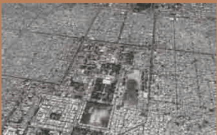
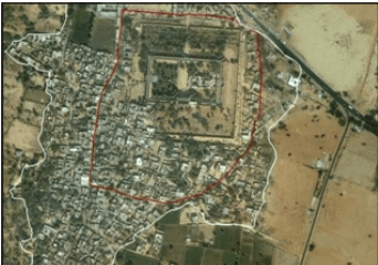
Walled City Jaipur as seen from Google Maps
Table 1-12Proposed Heritage Zones in Jaipur region
Zone No.
Heritage Zone
1
Walled City Zone
2
Special area Zone
3
Jamwa Ramgarh
4
Sanganer
5
Bagru
6
Pachar and Kalwar
7
Chomu and Morija
8
Kukas/ Achrol/ Manoharpura
9
Bassi and Kanota
U1 area Zones are detailed out in the U-1 part in Heritage & tourism. Rests of the zones are detailed as below:
Walled City Zone : detailed in U1 Part
Special area Zone : Detailed in U1 part
Jamwa Ramgarh
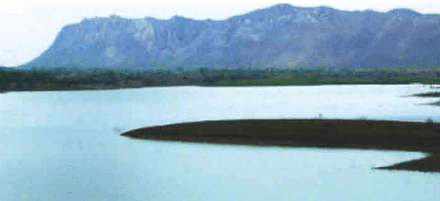
A comprehensive conservation plan with focus on the Ramgarh lake and natural heritage, ecotourism and integration of fort and protected temples on the tourist trail should be prepared. A comprehensive eco tourism project functioning as a recreational zone with lake, resorts and polo grounds shall help in reviving the economy of the place.
4. Sanganer
Sanganer has important craft industries (mainly textile printing and handmade paper) besides the ruined palaces, broken city walls, triple gateways and havelis. Large and small units of block and screen printers produce some of the finest hand-printed textiles in the country which are also exported across the world.
A special heritage tourism development plan for this circuit can be developed linking Sanganer as the textile heritage town with nearby Chaksu having heritage haveli hotels. With its history, textiles and strategic location, Sanganer can function as an important tourist town that caters to the influx of Jaipur tourists. Local incentives for conservation and reuse of structures for tourist facilities should be promoted.
5. Bagru
The prime attraction of Bagru is its hand printed textiles. This small town on the outskirts of Jaipur has its individual significance with textiles, heritage structures of havelis and temples, small fortresses etc.
6. Pachar and Kalwar
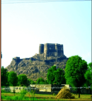
The towns of Pachar and Kalwar has important heritage monuments such as Pachar Castle and the Kalwar Fort can act as tourism magnets to trigger development in these towns.
The environmental and archaeological significance of surrounding places like Sambhar can be linked with adjoining built heritage structures in Jobner, Pachar and Kalwar to the handicrafts hub at nearby Naraina at Bagru, areas to present an integrated tourist
circuit for this area accessed from Jaipur - Ajmer highway. Increased tourism revenue, conservation of natural and built heritage and revival of economy in these towns should be emphasized.
7. Chomu and Morija
It is important that listing of significant heritage structures be carried out and heritage tourism proposal for the Chomu - Samode circuit be realized. It can enhance the already existing tourism in the area with heritage tourism as a tool for rural economic regeneration.
8. Kukas/ Achrol/ Manoharpura
As the earlier thikanas, areas of Achrol and Manoharpura have some interesting fortresses and havelis. The strategy outlined for this heritage zone is:
- Develop a heritage tourism plan along with ensuring conservation of remaining heritage. It should focus on the highway tourists and Jaipur tourists staying in the newly
developed hotels in Kukas. The tourist experience on NH-8 can be further enhanced by developing new heritage sites that shall generate employment for the nearby villages.
9. Bassi and Kanota
The small town of Bassi has some important heritage structures that need to
be protected along with further development of the area. Off the Agra road and 40 Kms away on the Bassi Lalsot road, is a palace where one of the historic battles between the Jaipur forces and the Marathas was fought, called Tunga. It commands an enviable landscape with fort of
Madhogarh nestled amidst orchards of mangoes. This zone needs to be protected as a natural and built heritage area and integrated with the growth of the town.
The heritage of nearby town of Kanota can also be suitably addressed on this tourist circuit that locates Bassi and Kanota on the Jaipur- Agra Highway.
Proposed Plans beyond Zonal Level
Some plans would be proposed beyond zonal level. These plans are as follows:-
• Environmental Management Plan
- Eco-tourism Plan including conservation aspects
• Heritage Tourism Development Plan
- Heritage Tourism Development Plan addressing built and natural heritage of Sanganer
- Conservation and Tourism Development Plan for Madhogarh and surroundings
- Conservation and Tourism Development Plan for Kanota Castle and surroundings
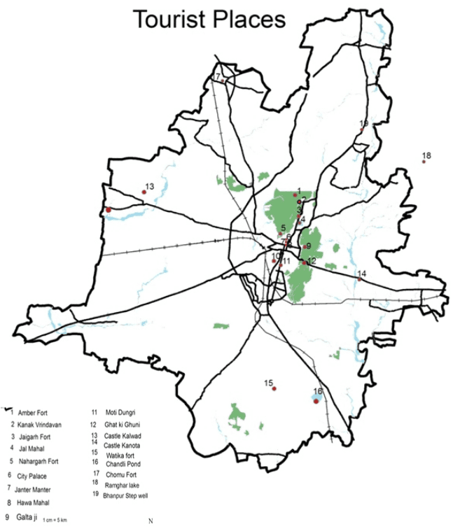
Map 1-7 Potential Tourism sites in the Jaipur Region
1.7.3Tourism Zone
In Regard to potential tourism sites in region, a tourism zone has been identified in the region for the promotion and encouragement. All tourism and allied activities would be housed with better level of infrastructure and eco-friendly concept.
Handicraft Tourism: As Jaipur and as such Rajasthan is famous for its handicrafts, tourism oriented toward the development of such crafts villages wherein people can watch the craftsmen at work need to be developed.
Rural Resorts- More over the Region is rural in nature, tourism needs to venture out into these areas. However this needs to be promoted in harmony with nature. Rural resorts may be promoted in such areas in the master plan. There needs to be a policy formulated to indicate the type of structures, area, etc which is permissible in the same.
Rural tourism- Identifies villages; certain villages may be identified in the region for being developed on the concept of Raj Gramya, a Government scheme to promote rural tourism. Though there are such areas within the district, location of such within the region would enable more visits and frequency by the tourists coming to the city.
Besides the following new approaches may be explored to attract more domestic tourists in the city:
(i) Active Tourism (ii) Adventure Tourism
These places can be develop as small tourist circuit to encourage tourism potential and increase revenues in Jaipur region viz; Amber fort-Kanak vrindavan- Jaigarh fort- Nahargarh fort and City palace-Jantar Mantar-Hawamahal- Galtaji- and Rambagh-Moti Doongri -Ghat ki Guni - castel Kanota and Chandlai Pond-Watika fort etc.
1.7.4Heritage Policies and Legislation
The evaluation of the Built Heritage of Jaipur leads to outlining major issues and concerns linked to heritage conservation works that can formulate guidelines for heritage policies and actions. The laws, legislation and policies for protection and conservation of heritage structures in the city of Jaipur.
Currently, the Rajasthan Conservation and Heritage Byelaws, 1961 guides the conservation of the cultural properties. Besides this, there are building byelaws that restrict or control building activities in walled city and heritage buildings. The byelaws include:
- No permission for erection, re-erection, addition or alternations of any building without sanction from the competent Authority;
Prohibit construction of buildings in open spaces or over tanks;
- Regulate building line, corners buildings, drainage, plinth, chimneys, services, minimum areas for rooms, height of rooms and the building, etc.
Heritage cell created by Government which is in the process of revising and strengthening these byelaws for the listed heritage zone, precincts and structures.
The protected monuments in Jaipur area fall under the jurisdiction of ASI or State Department of Archaeology and hence are protected as per The Ancient Monuments and Archaeological Sites and Remains Act, 1958 or Rajasthan Monuments, Sites and. Antiquities Act 1961 respectively.
The Tourism Policy of the Government of Rajasthan highlights the conservation of heritage buildings. The policy points linked to heritage conservation include:
- Proposes consolidation of facilities to make fairs and festivals more attractive;
- State Archaeology Department, Devasthan Department, Waqf Board etc. to support efforts at revival of traditional building arts, to offer to private individual or firms or voluntary organizations interested in preservation of individual monuments on settled terms and conditions, and
- To carry out studies to assess the carrying capacity of popular tourist destinations with a view to regulate tourist traffic in them.
- The natural heritage of Jaipur is protected under the central Acts enforced by the Ministry of Environment and Forest such as the EPAAct (1986).
1.8 Social Infrastructure
In the U1 area about 5.5% of land use is dedicated to public and semi public facilities other than this residential use zone further have provision for public and semi public facilities. Social infrastructure at various levels viz; neighbourhood level, sector level, Zonal level etc., shall be provided as per standards. Zonal Development plan will further describe the public facilities and other social infrastructure in detail.
Satellite towns also have provision for adequate public & semi public facilities. MDP 2025 have provision for required social infrastructure viz' health, education, banking, post & telegraph and recreation etc., for satellite towns as well as villages falling in Jaipur region.
In the Chonp town app. 75% of land use is dedicated to public/semi public purposes, the town is dominated by Institutional use. The institutional use is attempted to make the growth center as institutional destined settlement. The North-East area of Chonp settlement is reserved for Knowledge city.
On the same line Achrol also acts as an institutional destination, A major portion of the land use falls under JDA's science tech city which boasts of becoming premier educational Hub on Delhi road. All the public semi public use in the town in interwined with provision of large recreational areas and suitable connectivity.
1.8.1Safety
Disaster Management
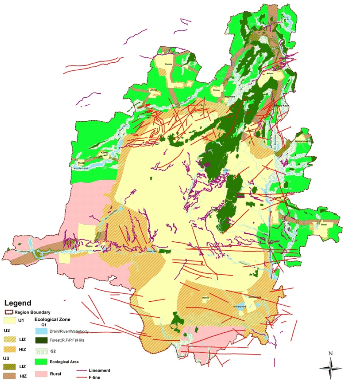
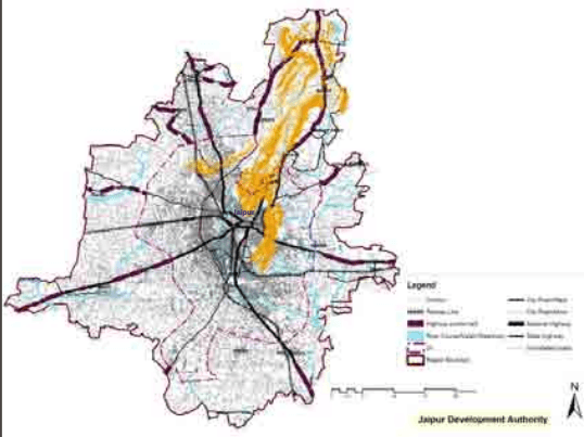
Land utilization map is shown, overlaid with all the fault line and linaments. It is a suggestive way to guide the developer that as and when constructions are made, suitable measures are to be taken with respect to earth quake resistance so as to avoid any loss of life and property.
Map 1-8 Fault lines and lineaments in Jaipur Region
1.9 Physical Infrastructure
1.9.1 Water Supply
At present ground water is the main source of water supply in the villages of region. In the city, water is supplied through tubewells. Overall water requirement for Jaipur region for year 2025 is as follows:
Water Su pply
Population (Lakh)
Requirment LPCD
Total Requirment MLD
Water requirement -Jaipur region
Approx.
(a)
Jaipur city-U1 area
64.95
180
1170
(b)
Satellite towns/Growth centers
3.68
70
26
(c)
Rest of the Area/villages
6.99
40
28
Total (a+b+c)
75.62
1224 MLD
Total water requirment MLD
There are two major source of water supply in Jaipur region other than ground water;
• Ramgarh dam
- Bisalpur dam
Till last decade Jamwa Ramgarh Lake was the main source of water supply to Jaipur city. With the expansion of Jaipur city in leaps & bounds, the other sources like Bisalpur has been explored for water supply. In order to keep it as source of water supply, it is suggested that the catchment area of Ramgarh Lake need to be protected from encroachment. A detailed catchment area plan proposed to be drawn for Ramgarh Lake by the district authorities as part of down stream project.
Efforts are being made by PHED for augmentating water from Isarda dam. Rest of the demand for water supply in Jaipur region shall be met by Isarda dam and Chambal dam for which detailed study is being done by PHED. Further additional water requirement will be taken care of by PHED at times.
The Bisalpur water supply project cell has identified the villages en route for drinking water supply. These villages in the immediate future would have tapped water facility. However, the other critical areas need to be brought in to the umbrella of piped water supply.
Water Management
As per PHED, dependability on Bisalpur & Isarda has been considered to the extent of 795 MLD. However net yield from Bisalpur dam has gone down considerably and therefore its dependibility has also reduced substantially.as per the original design an average supply of 890 MLD water was assumed from Bisalpur with 75% dependability. By observing the hydrology of last 10 years and ebhaviour during this year dependability on bisalpur dam has become a question mark altogether. Similarly the yield of Isarda would be much lower than assumed and it may altogether not be able to provide any water to Jaipur. Approximately 4000 cusecs of water is being used in the agriculture using water drawn from kota barrage & chambal. The irrigation efficiency is as low as 20%. Following measures are proposed to be implemented for water management
Lining of canal & drip irrigation: Substantial quantities of water can be saved by lining of canal and by using sprinkler/drip; practicing barabandi etc. the water saved for irrigation use could be considered for diversion to Jaipur & other deficit areas.
Policies to raise financial resources: JDA, UDH has to develop & implement appropriate policies for raising financial resources for funding the water supply infrastructure for 2025 population estimated. Water supply to outer colonies is also to be funded & implemented by JDA/UDH.
Devolution of water distribution: the issue of devolution water distribution management to city level company responsible to ULB has already been supported in the water policy. Similarly water policy has also recommended cost recovery of O&M through rationalization of tariff.
Cloud seeding: Cloud seeding in the catchment areas of Bisalpur and Isarda dam has been proposed. The technology is in experimental stage in India and may be carried out for a trial. More funds per year would be required on its successful implementation.
The JDA building byelaws-2010 envisaged water recycling and water harvesting system and it shall be applicable in entire Jaipur Region. The exploitation of ground water should be discouraged.
Table 1-13Water demand under various projects-2025
Name of village/Town
Tehsil / Town
Population
LPC D
Water Demand in KL
Raw Water Demand assuming losses @ 20 %
2001
2011
2021
2025
2001
2011
2021
2025
2001
2011
2021
2025
From Bisalpur Dam
Jaipur Bisalpur Project
1.9.2Sewerage
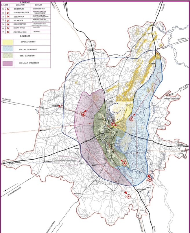
As a result of feasibility study it was analysed that Sewage treatment plant may be allowed in all use zones in the land utilization plan subject to availability of land and suitability of Location. As per information given by PHED the total designed water supply in the region is around 1224 MLD out of which only 80% water (979 MLD) reaches to consumers due to transmission losses. As per standards the sewage generation is 80% of water supply to consumers therefore in Jaipur region sewage generation for year 2025 is 783 MLD.
Projected water requirement for 2025 (MLD)
1224 MLD
Water supply after transmission losses (80%)
979 MLD
Sewerage @80% of water supply (MLD) for Year 2025
783 MLD
Following STPs already exist in city area for treatment of sewage, which uses conventional treatment technology.
• 1 STP of 62.5MLD capacity at villages delawas
• 1 STP at Brahmpuri of 27 MLD capacity
But since these are not sufficient even for the city area few more locations are marked for proposed city level Sewage treatment plants in Jaipur region for the treatment of sewage
• 1 more STP of 62.5MLD capacity at villages Delawas
• 1 STP at Jaisingh pura khor of 50MLD capacity
• 1 STP of 30 MLD capacity at village Relawata
• 1 STP of 20 MLD capacity at village Girdharipura
• 30 MLD STP under Phase-I JDA
• 30 MLD STP under Phase-II JDA
All the above STP supposed to treat 317 MLD of Sewage. It is proposed to channelize this treated sewage towards east at Bandi River. There is a proposal to channelize the sewage generated from the western part as per the natural slope to south near chandalai dam. The sewage generated from north and eastern part can be taken near kanota dam through pumping and the final disposal can be done at Dhund River. Further requirement of sewage treatment plant will be met as the development and expansion of city takes place. Detailed study will be done for sewerage network in the region. The satellite towns falling in Jaipur region to be provided with proper sewerage network and also it is necessary to develop a mechanism to connect all the villages in region with sewerage network system is future.
Map 1-9 Sewerage system: Existing and proposed
1.9.3 Drainage
The detailed study is required to be done for the preparation of drainage plan. River front development is proposed along Amanishah nalah and Dhund River with removal of encroachment and plantation. The study is to be taken as down stream project.
1.9.4Solid waste Management
Jaipur Municipal corporation is committed to achieve new heights for developing efficient solid waste management system. The corporation has taken various steps to improve the waste management process.
- To effectively implement 'Cleaning friendly scheme' institutions like Regional/resident welfare association, NGOs/CBOs etc are involved in waste management.
- For scientific disposal of waste, four more waste processing plants are proposed to establish around city. These plants are proposed to establish in all four directions of city for easy excess.
- A compost plant also exists on landfill site at village sevapura for making of compost from solid waste. This plant is on BOT mode with a capacity of 250 MT. This plant may generate fund for Nigam by CDM process.
- A sanitary landfill site and processing plant is already proposed at village langadiyawas. In this plant pallets will be made with Solid waste and rejected waste from sevapura plant.
- For treatment of Bio-medical waste a Plant is established on BOT mode at village Khora-roophari. Another Similar plant is also proposed to establish in same village. This plant will treat the biomedical waste generated in 150 kilometre of perimeter along with Jaipur.
Use of Solid Waste Landfill Gas for Energy generation
At present, the most common method used by Municipal Corporations for disposal is dumping of the collected waste at open dumpsites. The waste at these dumpsites consists of rich organic content, which produces landfill gas over time by anaerobic digestion. Landfill gas is rich in methane (40-50%) and carbon dioxide. Gases such as nitrogen, hydrogen and oxygen are also produced in the process in insignificant quantities. The collected gas from large landfills can be effectively utilized as a clean fuel for power generation and gas collected from smaller landfills can be supplied to appropriate industries located in the vicinity of the site for direct use of gas in boilers or other equipment.
Feasibility Studies on Methane Emissions: To estimate the feasibility of any landfill gas to energy project, a crucial step would be to conduct a feasibility study to estimate the potential of methane emissions. This in turn would assist in planning and design for the management of the dumpsite after closure
1.10
Transportation
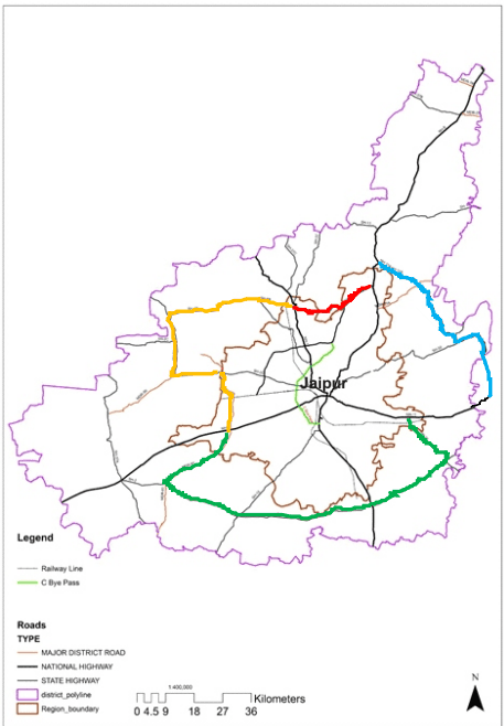
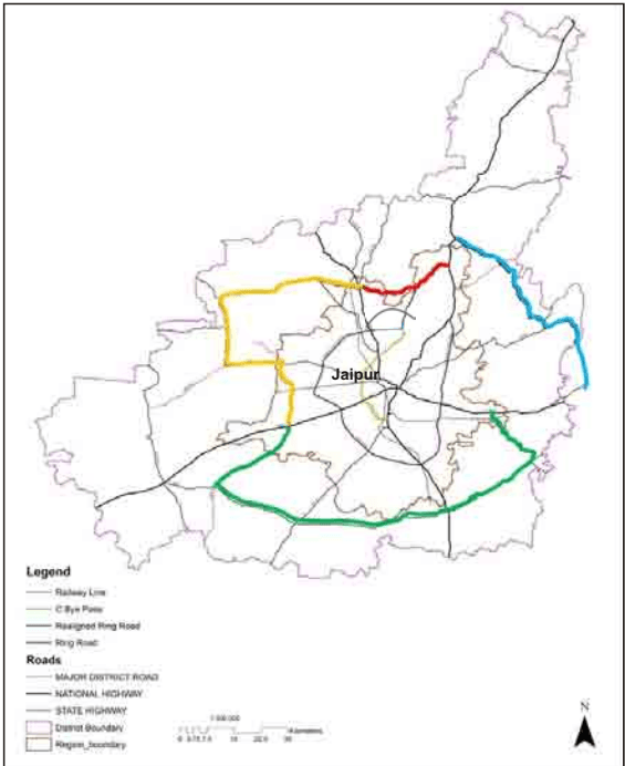
A regional byepass is proposed to serve Jaipur Region and its hinter land Jaipur District. It is ideal to have a 30 km. road for Regional byepass. However due to physical constraints it had to be stretched to 38 km. as shown below
Map 1-10 Regional Byepass
However a 38 km. circular development with a length of 238 km. is utopian by using the network parts of MDR /SH /NH in and around 238 km. on approach has been worked out and the following provision emerged for development of regional bypass.
The regional roads account for the (a) Regional byepass and (b) Ring Road for the region. This would cater to the needs of traffic in the Jaipur Region.
Map 1-11 Provisions for development of regional byepass
NH-11 – NH-8 : SH-24, SH-2 up to the junction of MDR 81 and along the MDR 81 up to NH-8
The U-2 area is proposed with the following hierarchy of road network:
• 60 Meter
• 48 Meter
• 30 Meter
Other roads of the Region:
The U-1 area and the U-2 area is proposed with a definite road network to accommodate various development proposals. The development proposed sector level roads and regional roads when compared with existing village road network the development was at snail space. In order to avoid no growth situation in case of non development of sector road the following proposals have been worked out.
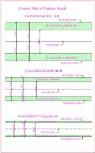
Instead of giving a definite road width creation of building line is emphasized. This pave way for the conversion of compatible uses from agricultural land to non-agriculture purposes by adhering to the building line. More over a definite time capsule cannot be given for the development of the rural area which may take at least 30 years from now. In order to attend to such proposals, which are compatible to the land utilization of the rural area. The following table gives the building line that to be adopted on the following category of roads.
Table 1-14Building line to be adopted on the category of roads
SI
Type of Road
The Building line
The plantation corridor within the control belt
1.
State High Way
75 mt. from the centre line of the road.
30 mt. on either side
2.
MDR (Major District Road)
45 mt. from the centre line of the road.
15 mt. on either side
3.
Other roads
30 mt. from the centre line of the road.
6 mt. either side
The proposed regional byepass and ring road coupled with U-2 area road network serve majority of Satellite towns and growth centers provided in the development plan.
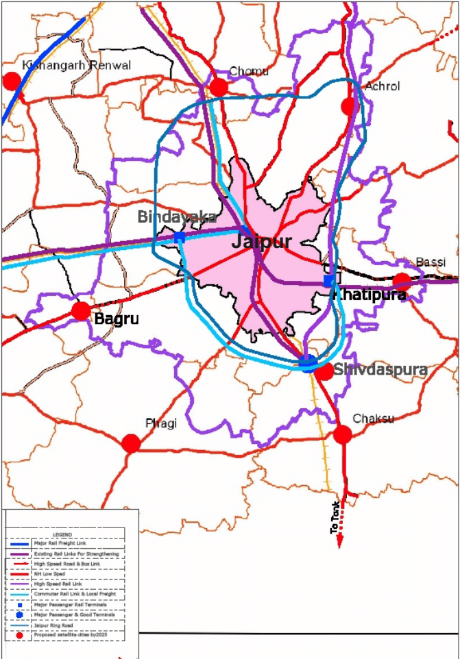
Finally the best substitute of the proposed ring road is to strengthen the existing connectivity of connecting all the growth nodes of the region. The map depicts the alternative routes acting as ring road. The present existing network of the region has already a good surface transport option. This option works out as an outer ring road concept, which is almost parallel to the existing ring road and connect all the potential towns of the region.
1.10.2Ring Road:
The Ring road development corridor has been taken up with a visionary approach to create infrastructure in advance to meet the growing needs of rapid urbanisation of the region. BRTS provision is incorporated as part of its 90 mt. ROW. The development Zone along the road corridor is envisaged. The length of the proposed corridor is 125 Km.
The southern portion i.e. from Agra Road to Ajmer Road the acquisition of the land is complete however the northern portion of the Ring Road is proposed to be developed on top priority.
Table 1-15Proposed Ring Road Alignment
West and North
Ajmer Road to Sikar Road
32.58 km.
Sikar Road to Delhi Road NH-8 (Kukas)
21.39km.
East
Agra Road-Jamwa Ramgarh road
12.47 km.
Jamwaram Garh road – Delhi NH
11.68 km.
Map 1-13 Proposed Ring Road Alignment
The original alignment (Southern alignment) of earlier ring road retained up to Ajmer Railway line and the northern alignment has proposed to link Ajmer road to Sikar road. (32.58 k.m). The proposed northern alignment has changed between Ajmer road to Kalwar road.
Sikar road (NH-11) to Delhi road (NH-8) up to north of satellite town Bhanpur Kalan. This changed alignment of Ring road has reduced 37.70 km length which was existed from Daulatpura Kotra to Chandwaji but this part of road passing through a hill so one tunnel (750 m) will come in this part of ring road.
The project will serve a dual purpose of providing improved access to areas that are developed, for bye-passing the city and will serve as an impetus to growth of underdeveloped areas.
The final alignment of northern portion of Ring road shall be further detailed out while implementing the proposals.
1.10.3Highway control belt regulation
The Master plan proposals of MDP 2011 retained and the village abadi areas as per revenue record are exempted.
Table 1-16The roads as per 2001 notification of highway control belt regulation
SI
Highway
Details
1
Sikar Highway
Chandwaji by pass road junction on Sikar highway, near village Udaipur, to boundary of Jaipur region, barring Chomu urban area boundary.
2
Delhi Highway
Amer Kunda to the boundary of Jaipur Region barring Achrol urban area.
3
Agra Highway
Goner Road Junction to boundary of Jaipur Region excluding the revenue limit of Kanota & Bassi village
4
Ajmer Highway
From Gajsinghpur Road Junction near of Bhakrota village to boundary of Jaipur Region but excluding the settlement limit of Bagru Municipal its abadi
5
Kota Highway
From Bambala Bridge to the boundary of Jaipur Region
6
Kalwar Highway
From Western boundary of Village Govindpura to the boundary of Jaipur Region excluding Kalwar and Pachar Master Plan area.
7
Diggi Malpura Highway
From Village Balawala to the boundary of Jaipur Region
The control belt regulations for other roads have also been envisaged. The area coming under R.O.W. do not subscribe to land conversion, however the plantation corridor area shall remain with the owner. The plantation corridor area in a way act as front set back with the prescribed building line. While doing so the village abadi areas as per revenue record and Master Plan urban areas are exempted.
Map 1-14 Highway control belt in Jaipur region
1.10.4Suburban Transport System:
City of Jaipur is already facing an acute pressure of transport services due to the growing suburban traffic. Railways have been upgrading the tracks on Jaipur-Dausa section as well as on Jaipur-Phulera section, Jaipur-Chomu and Jaipur-Chaksu sections.
These routes proposed to be developed as integrated transport routes along with the proposed ring road and there is a need to plan interchange stations where they cross over to allow people options of movement into the city. Accordingly priority is given to the interchange movement to dispersal of their movement in to the city by using both rail and road. The ring road with proper feeder link can enhance transport services.
A detailed project is envisaged to be taken up is consultations with Railways.
Map 1-15 Proposed suburban transport system
1.11 Urbanisable Area
Assuming Population density @ 8000* persons per sq.km, area required = Thus either ways, Urbanisable extent of Master Plan-2025 works out to be =
It is observed that there are deviation in the development area of each previous master plans therefore it is necessary to consider the deviations due to various reasons, while planning the development area
Urbanisable area is the unit which caters to the concentrated form of urban activities required for the town. Previous deviations and collating of commitment need to be considered to give a proper shape to arrive at planned development pockets, and proposed ring road.
1.11.1Arriving at the Urbanisable Area of 2025
The Standard density for a town like Jaipur is about 12,500 persons per sq.km. The area with density above this is walled city with highest density (avg. 6000 persons per sq.km) and planned areas of Malviya Nagar, Adarsh Nagar and unplanned areas of Barkat Nagar and Jhotwara. The rest of the city (within the developed area of the city) exhibits a population density between 4000-12500. The peripheral area exhibits a low density of less than 4000 persons per sq.km.
Urbanizable area 2025
Census 2001 Density
MDP 2011 Ward Population
MDP 2011 Ward Area
MDP 2011 Density
Wards Area (As per GIS map 2009)
Projected Ward Population
Density
4742 Person per sq.km
- 35 lakhs
Projected Urban Population -2025 (Ward+new area of U1+ migration)
- 326 sq.km
10736 Person per sq.km
- 535 sq.km
- 55 lakhs
10280 persons per sq.km
- 65 lakhs
Additional area requirement for 10 lakhs population is as follows.-
Assuming density of peripheral area @ 4000 persons per sq.km
Area required
250 sq.km
Thus total area
535+ 250= 785 sq.km
800 sq.km
813 sq.km.
development pattern.
*The density is assumed based on study of Cities of similar size and
However in Jaipur region the commitments have gone beyond the proposed 800 sqkm. Accordingly it was revisited and U1 extension proposed up to ring road and sector 57. Ring road has been proposed with a development corridor, change in land uses has been proposed in many villages in immediate proximity to urban areas, plenty of new townships have come up.
As per Assumptions, the total area required would be around 800 sq.km which is an additional area of 474 sq.km as per 2011 Master plan. However, going by the trends, commitments and the future development corridor works out to be around 852 Sqkm, in virtual sense substantially the area under hills, nallah and other physical barrier and the area available for urban development.
Note :
* The urbanisable area in Jaipur is 945 Sqkm. However, the ecological area including hills/ Reserve forest /protected forest comes out to be around 93 Sqkm. Therefore the actual developable area remains (945-93 =852 Sqkm)
* The urbanizable Area-1 of Satellite towns works out to be 102 Sqkm. Therefore the total urbanizable area in Jaipur region is (852+102 =954Sqkm)
The urbanisable area works out to be 954 sqkm*. The density attempts envisaged at 8000 persons per sq. km. Its concentration shall be high in the core area and move to 2000 persons per sq. km in the periphery by 2025 by ushering town density around 6850 per Sqkm. This is a new paradigm, with cities being structured as boundary less due to rapid urbanization. U2 and U3 accommodate the commitments and new areas under township policy 2010 or any other policy relevant to the Master Development Plan.
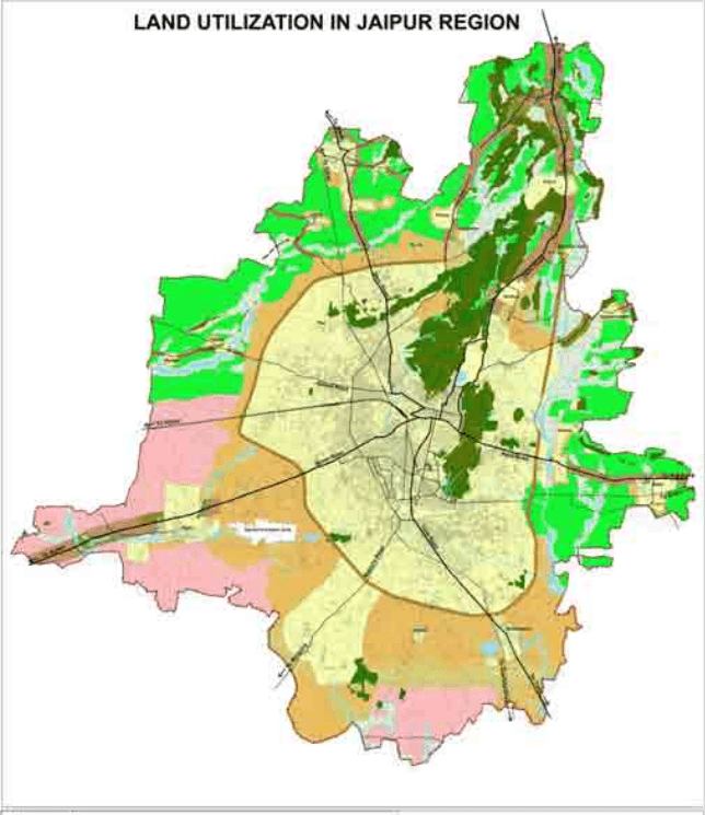
1.12Land Utilization
The approach and concept for development of Jaipur region is evolved considering each and every component viz; urban, rural and ecological zone so as to make it an efficient and sustainable region.
Land is the basic resource of human society. Its utilization shows a reciprocal relationship between the prevailing ecological conditions of a particular region and man. The term 'Land Utilization' is also used for varied utilization of land and soil surveys, e.g., land under cultivation, pasture barren, orchard, fallows, waste, culturable waste, settlements, forests, waterbodies etc.
The study of land utilization is of immense value in tracing out the past use of land and its future trend.
The rapid urbanization of the growth of boundary less cities are a new paradigm of the growing cities and Jaipur is no exception. Areas abutting the planned areas always remain under pressure for new avenues due to close proximity and easy accessibility taking in to account the environmental consideration, physiographic existing development, directions of growth, requirement of land to accommodate the expected increase of population development already taken palace and other activities. Thus the Master Development Plan-2025 has been drawn up with reference to the following five policy zone.
• Urban area 1 -U1
• Urban area 2 -U2
• Urban area 3 -U3
• Ecological Zone
• Rural area
With an objective of development of Jaipur region and attract investment opportunities new concept for development of Jaipur region is drawn as mentioned above. It would help Jaipur to become a national hub of economic activities and a mega city generator of economic momentum for global exchange and which further place the capital city to a position as globally competitive.
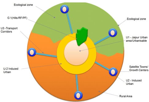
- U1 is the compact urban area placed as a nuclide of development and U2 will be the immediate influenced area on periphery of U1 area. The U3 will be the continuum to U1 and U2 area on either side of Major roads.
- G1 is the Eco-sensitive area which includes Rivers, ponds, reserve/protected forest, hills etc. G2 is the Continuum to G1 area acting as buffer to G1, Ecological area includes rest of the eco-sensitive zone.
- The rest of the area is divided in to Rural. Based on the study the land utilization is discussed in following section.
The concept of U1, U2 and U3 areas in Master development plan-2025 is explicated here.
Chart 1-1 Concept of Urbanisable areas
U1 - Urbanisable Area
U2 - Immediate influence area of U1 and satellite towns
U3 - Influence area of NH, SH, Ring Road, Bye passes, Industrial corridors and other important corridors
Ecological Zone - It includes all the bio-diverse and incompatible use
G1 (Green Zone -1) - To conserve natural features
G2 (Green Zone -2) - A buffer to G1
However there is a conflict of U-2, U3 areas with G-2 and it is not reflected when looked on ground (this is due to earmarking areas based on geological considerations). In order to usher an equal footing for all the land in continuum, addressed the following proposals.
• Conflict of G2 with U2 is made as low intensity U2 Zone LIZ
• Conflict of G2 with U3 is made as low intensity U3 Zone LIZ
In the low intensity zone the activities as permitted as per U2/U3 however the FAR is restricted up to standard FAR only. Further increase with respect to permissible FAR is not permitted.
(i.) Urban area (U1)
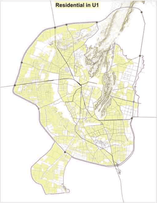
U1 is based on Population projections, the existing city, urbanisable area of 2011, and the existing satellite towns. It honours the commitments/projects. The total projected U1 area is 945 sq km. but after the extraction of G1 and some part of ecological zone (94 sqkm; which falls under U1 boundary) it remains 852 sq. km. because it can not be used for any type of land use in future. The projected U1 area of satellite towns is 102 sq. km. thus the total urban area (Jaipur region + satellite towns) is 954 sq. km. (852+102 sq.km). The urbanisable area proposed was increased by another 99Sq.Km. to accommodate commitments in the south west of Jaipur around Diggi-Malpura Road and area between Ring road and proposed development area in the North-West.
(ii.) Urban area (U2)
The immediate influence area of the U1 and the Satellite towns is the U2 area. This is generally created as buffer to U1/nearest physical boundary, accommodating commitments + special area projects- SEZ, and other developments.
The U-2 area is divided into Low Intensity Zone (LIZ) and High Intensity Zone (HIZ) i.e.; the U2 area overlapping with G2 is considered as Low intensity Zone (116 sqkm) while the rest of the U2 area falls under High intensity Zone(391 sqkm).
In the U2 LIZ area, Low impact development (LID) techniques shall be used for land development by Conservation of drainage, trees & vegetation. Development impacts in this area shall be minimized by low intensity development. Proposals supplement the land use plan of U1 area.
(iii) Urban area-3 (U-3) Transportation/development area
U3 is the Influence area of National Highways, State Highways, Ring Road, Bye passes, Industrial corridors and other important corridors. This is generally 1000 meter buffer on either side on NH and 500 meter on either side of the SH excluding road right of way.
Table 1-17Buffer details on either side of Highways
Category
Rural area
Agriculture area
National Highway
1000 m
500m *
State Highway
500m
250m
* All National Highways in Ecological area shall have 500 m Buffer on either side except Jaipur Delhi Highway (NH-8) where buffer shall of 1000m to draw economic inputs.
As already enumerated Ecological Area needs protection. Though the Rural area delineated in the land utilisation caters to it, a separate zone needed delineation and accordingly the vast Ecological area on north and east were protected and delineated separately. In the said zone the U-3 boundary has been redefined with 500 mtr. on either side of NH and 250 mtr. on either side of State Highway.
The U-3 area is divided in to Low intensity Zone and High Intensity Zone i.e.; the U3 area overlapping with G2 shall be considered as Low intensity Zone while the rest of the U3 area shall fall under High intensity Zone. The projected U3 area 2025 under HIZ is 96 sq km. and under LIZ is 39 sq km.
In the U3 LIZ area, Low impact development (LID) techniques shall be used for land development by Conservation of drainage, trees & vegetation. Development impacts in this area to be minimized by encouraging low intensity development.
(iv.) Ecological zone
This would include all the bio-diverse and incompatible use areas like Reserved forests, protected forests, flora fauna areas, wetlands, flood prone areas, water recharge areas, water bodies, heritage conservation areas, animal rescue centres, water sheds, habitats of migratory birds, National Parks, sanctuaries, closed areas, significant local areas and other areas, resource areas(like mining, quarrying, etc). In this endeavourer the eco-sensitive area is categorized as green zone zone-1 and Green zone 2.
The Green zone G1: G1 is primarily a zone where the principal aim is to conserve the natural features such as hills, river, nallah, water bodies and forests flora fauna, at any cost. The zone is strictly reserved and to be protected from any development. The area need to cater to the respective use.
For Example: if it is a water channel, it has to be maintained accordingly and no development activity addressed. Likewise if it is reserve Forest/Protected forest it has to be maintained and preserved. The uses that can be ventured in to these areas are circulation ventures/public utilities/recreational ventures/heritage protection projects. The other activities and ventures are to be discouraged. Green Zone-2 is described further. The G1 area 2025 is 224 sq km. It is classified here in case G1 is indicated and the ownership is not with Forest Department, G2 provisions may apply with the approval of statutory committee.
Green Zone 2 (G-2): G-2 is primarily the area abutting G-1; this is developed as a buffer to promote a continuum to G-1.
Ecological Area: This area includes the area which is suitable for agriculture and other eco sensitive purposes.
Activities like eco-friendly housing, biotech parks Motel, resorts are permitted in this use zone. Here "Pulses villages", "Oil Palm", Vegetable clusters and Mega food parks may be proposed. Other uses are to be discouraged in the G-2 and Ecological area.
The competent committee may arrive at any other activity if in the interest of general public, with environmental impact assessment. However, such use adhere to the basic principle of low intensity development.
- All the activities are to affront a minimum of a village road and the building line is placed at 30mt from the central line. Other Master Plan roads like NH/SH/Major roads applicability shall be as per norms.
- The green zone-3 is primarily the use shown as recreational with hierarchy in the land use plan. Separate lists of activities are identified in the development controls.
The growth foci, focal villages and service villages falling in ecological zone are provided with 500 mt radius from the existing abadi to accommodate growing needs of the settlement. The use is designated as mixed use. The Development control and promotion regulations (DPRC) enumerate the use premises that to be accommodate in ecological zone.
Area falling in the six villages of tehsil Bassi namely Ramsinghpura, Hingonia, Bhatesari, Bhurthal, Kanharwas and Sindoli having an area of 26.30 sq km have been earmarked as Ecological zone in MDP-2011 and it has decided to be selected as Ecological zone in this plan. In the same way land falling in the villages Malpura chowd, Malpur doongri further earmarked for ecological zone and it is retained accordingly.
(viii.) Rural area
This would be the rural area, essentially the whole area minus the area which is not covered by the urbanisable area (U1, U2, U3) and ecological zone is Rural Area. This would have more uses permissible as compared to the other rural areas of the district with certain requirement for permissions like EIA, etc., to boost this hinterland.
The growth foci, focal villages and service villages falling in rural area are provided with 500 mt radius from the existing village abadi to accommodate growing needs of the settlement. The use is designated as mixed use.
The rural area caters to the predominantly agriculture based rural economy. The various settlements falling in this area will have scope for expansion for their natural growth and their related economic function. The rural area is strengthened with an effective road network to stimulate the growth and provide accessibility to the main city. The development promotion and control regulations further indicate the use premises.
The land utilization for Jaipur region worked out to cater to the
• Urban development
- Protection of agricultural zone and eco-sensitive areas
• Balanced distribution of investment opportunities
Table 1-18Land utilization as per MDP-2011 and MDP-2025
Land utilization
Use
Master Plan 2011
MDP-2025
Area (Sq.Km)
Percentage
Area (Sq.Km)
Percentage
Urbanisable Area
391
19.94
1596
54.30
Ecological Area
481
24.55
894
30.40
Rural Area
1087
55.51
450
15.31
Total
1959
100%
2940
100%
Table 1-19 Land Utilization of Jaipur Region
In 2011 the Urbanisable area was 391 SqKm while it increased to 1596 SqKm with further subdivision into U1, U2, and U3 area
Jaipur Master plan 2025 Area
Area Category
Zone
Area Sqkm
Area Sqkm
% Area
Urban area(Jaipur region +Satellite towns)
U1
954
1596
54.30%
1.13Important Settlements
1.13.1 Important Settlements by the Year-2025
Based on the land utilization the U1 area envelops 351 villages:
• 40 Villages of Amber urban area
• 117 Villages of Jaipur urban area
• 162 Villages of Sanganer urban area
• 2 Villages of Bassi urban area
• 5 Villages of Chaksu urban area
• 14 Villages of Jamwa Ramgarh urban area
• 11 Villages of Phagi urban area
The detail profiles and Land use Plan for these 15 settlements are enumerated in the Volume -III of Master Development Plan -2025 of Jaipur Region.
Note: As the revenue maps of villages are not Geo-referenced, hence the above shall be further detailed out in Zonal Development Plans and to be verified by the Competent Authority.
Map 1-17 Growth Foci within Jaipur Region
GROWTH FOCI VILLAGES WITHIN JAIPUR REGION
Map 1-18 Focal Villages within Jaipur Region
Focal Villages Within Jaipur Region
Map 1-19 Service Villages within Jaipur Region
1.14 Development Plans
1.14.1 Zonal Development Plans
(i.) Zoning of Region
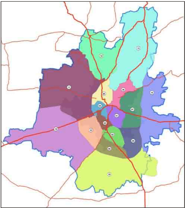
In order to effect detailed physical planning of the Region and the area within, 16 Planning Zones have been formulated. The area of the region has been subdivided into zones which would enable each zone to have a certain character and also emphasize on the self-sufficiency of the particular zone. Detailed development plans of all Zones shall be prepared to achieve equitable distribution of social and physical infrastructure. Self contained zones will be formed along with interdependency of various facilities by bridging existing gaps amongst planning zones, including already developed areas. Development control will be formed to further strengthen the use premises interpretation in the Zonal development plans.
The salient features of Zonal Development plans are:
- The region is divided into 16 sustainable and self sufficient planning zones based on its special characteristics and taking major roads/river as physical boundaries
- 16 Planning Zones have been delineated for the purpose of preparation of Zonal Plans.
- For the areas within the city, the wards are the units based on which the zoning is done.
- Walled city shall act as a separate zone as its character and type of zoning regulations would vary from other parts of the city.
- For the zones outside the city, Ring road is generally taken as boundary in South and Dhund River in the East, bye pass in North and south West and Sector boundary in the ring road is the boundary.
- In case of any changes in planning zone boundary section 21(3) of JDA act 1982 shall apply.
Map 1-20 Planning zones-Jaipur region
JDA Region Analysis
A
Table 1-20Planning zone boundary details
Zone
Wards in Zone
Boundary North
Boundary South
Boundary East
Boundary West
01
6,16,18,26,27,28(50%),29,30,31,32,33,34 & 35
Boundary of walled city and Agra byepass
Zone boundary no 2 & 8
Zone boundary no 7
Railway line Jaipur to Agra
1.1
22, 23, 24 (30%) & 28(20%).
Agra Railway Line, Zone boundary no 3
Zone boundary no 8,9
Zone boundary no 8
Zone boundary no 9,10
03
23,24,25,26,27,28,36,37 & 40
Zone boundary no 4
Zone boundary no 2
Agra railway Line
Zone boundary no 10
04
11,13,14,19
Railway line Delhi, Ajmer & Zone boundary no 5
Zone boundary no 3
Jaipur, Agra railway line
Zone boundary no 11
05
1,2,3,4,5,6,7,8,10,15,16,17,19,66,67,68 & 69
Zone boundary no 11,12,13
Railway line Delhi, Ajmer & Zone boundary no 4
Note : The Master plan proposals and provisions shall require further detailing and accordingly Various commitments and 90B conversions are to be adjusted to the extent possible, while preparing detailed Zonal development plans
1.14.2Village Development Plans (VDP)
During the preparation of MDP-2025, the issue of rural development has become focus of attention among public representatives from panchyat level to Parliament level. Rural development is one of the important missions for transforming Jaipur region into balanced development of region.
There is gap between the urban and rural area of Jaipur region in terms of basic civic amenities and employment structured planning procedure is required to be addressed so that the development activities and infrastructure facilities are available as a continuum between urban and rural area. Accordingly PURA (Provision of Urban Amenities in Rural Area) provisions shall be attended to.
The villages as per population, size and perimeters have been divided into Growth center, Growth foci, Focal
Villages, and Service villages. These are to be planned in the present context. Village development plans for the Ecological zone, rural area need to be prepared on top priority. The Village Development Plan shall address
Provision of utilities and facilities
Provision of storage facilities of the crop produce like cold storage and grain godowns.
In order to attend to various Issues, the solution mainly lies with the preparation of village development plan.
The main aim of this study is to prepare Village Development Plan for development of Villages. Enable click information about Village. The development plan provides rich database the Villages. This study shall also focus on the sustainable development in the study area. To achieve the target, proper planning is required using a conceptual model. In order to address these considerations, it is necessary to integrate a large amount of spatial information and knowledge from several disciplines. Advances in Geographic Information Systems (GIS), multiple objective decision making and physical simulation make it possible to develop user-friendly, interactive, decision support systems for rural development planning and management.
(i.) Methodology:
Village development plan will comprise in three phases, Phase I will comprise of Survey of Villages and Phase II will comprise of Geo-referencing, Digitization, and Database creation of Villages and Phase III will comprise objection suggestion, submission of VDP. Data collected through research, case studies and satellite imageries.
Phase I:
• Survey of village
• Khasra Map, jamabandi collection from talukas
• Data collation.(Social & Economical)
Phase II:
- Geo-spatial work to create Database, Map.
• Analysis of villages, data.
• Proposals for Draft VDP with consultations of local panchayats
• Preparation of Draft Village Development Plan
Phase III:
• Submission of Draft final village development plan.
- Compilation and analysis of objection & Suggestion and preparation of Final plan.
- Adoption of the plan with the approval of local panchayat.
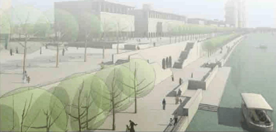
1.14.3River Front Development
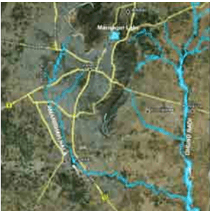
Younger flood plains of ephemeral rivers viz; The Dhund, Jhalana Nadi, Amanishah nalla, Ratanganga, Sedriya Nadi and Bandi Nadi are flowing through the Kanauta Jaipur Kalwar segments of Jaipur region. These areas are prone to flash flooding during heavy or persistent rains in their catchment's region. In these Dhund river and Amanishah Nallah covers major part of region. The Dhund River flows east of Jaipur urban area and is controlled by north-south neotectonic lineament and has unpaired fluvial terraces, preserved mostly on and along the left bank of the river. These terraces are presently cultivated. At present there is no urban encroachment on the Dhund River channel and its flood plain.
The Amanishah nalla flows in the central part of the Jaipur region. It originates from north of Mahalbag in the Amer reserve forest area. It has about 50 km long stretch from Mahalbag to about 250 m east of Relawate where it meets in the Dhund River. It has
witnessed encroachments on its flood plain
from its originating upper catchment area to its confluence with the Dhund River, SE of Goner. It has been shifting its course east and westwards, this delineated vulnerable zone may be considered as threat zone at times of flash floods.
The upper segment of Amanisha nallah is characterized by semicircular path with intense gully erosion and 15 m to 22 m bluff section along its right bank. The upper and middle segments of the nallah from 250 m south of Sejoriya to south of Sanganer have witnessed maximum encroachment from
residential and industrial settlements and cultivation of seasonal vegetables and cash crops in the nallah bed. However, a small segment of nallah from north of Dehar Ka Balajee to NW of Jaipur Railway Station, which passes through Military cantonment area, is free from encroachments.
Few morphological changes have been observed in the flow path of the nalla from the year 1868 to 2008 AD. These morphological changes are in the form of increase in sinuosity, marginal increase in length of the flow path and at places straightening of the nalla course. These changes may be attributed to silting of nalla bed and human/ urban encroachments in the younger flood plain of the river. Amanishah nallah was the lifeline of Jaipur and was a perennial water flow, which was greatly reduced during summer months. Now there is hardly any water in this except in a few stretches.
The river is ephemeral and shrunk to a small nallah at many places due to encroachments in its younger flood plain. Amanishah nallah passes through densely populated part of Jaipur region. Surface run-off from severely degraded Amer reserve forest and intense gully erosion of areas in upper catchment of Amanisha nallah bring silt in the Amanishah nalla. Besides the silt from eroded/degraded hills, the nallah also receives municipal waste, sewage, garbage and untreated industrial effluents from Vishva Karma Industrial (VKI) area; Jhotwara Industrial area, Baisgodam Industrial area, Sanganer textiles tie and dye industries, etc. Encroachments by residential units, marriage gardens and industrial activities have severely damaged the ecology of once Perennial River. At places the width of channel is barely 12 to 15 m. This possesses severe threat to life and public property in the form of large scale encroachment and flash floods.
Hence, for removal of encroachments on river sides and develops the river front it is required to take various measures.
- Removal of encroachment to take various measures to develop, detailed project shall be prepared.
- Complete ban on disposal of untreated waste in the river should be imposed.
- Planned efforts to be made to check the accelerated run-off and movement of silt from surrounding degraded hills and gully erosion prone areas.
- Further encroachments of younger flood plain of river should not be allowed by putting a wire fence and construction of training parapet wall with a service lane (traverse road) and green belt of plantations all along.
- The gully erosion areas in Amer hills need to be revegetated and existing dams and reservoirs along the river be revived/ desilted and few more dams/reservoirs be made by constructing dykes / small dams / reservoirs.
- Shifting of textile tie and dye industry from Sanganer to other appropriate site as per PCB norms.
- Water harvesting through abandoned dug wells, dug cum bore wells and bore wells to revive and rejuvenate the river system.
- Green belt plantations of trees and green recreation walkways need to be developed on both sides of the rivers to protect it from encroachments. This will ensure prevention of loss of life, property and groundwater contamination by industrial and sewage waste disposal.
- Controlled agricultural activity in the form of growing vegetables/ cash crops and flowers may also be allowed in the nallah bed to meet the growing demand of these commodities and depleting ground water table.
- Water carrying channel be kept free from any obstruction/ encroachment. Direct disposal of untreated effluents/ solid waste in the channel should be discouraged/ banned.
- Amanisha Nala from area west of Kishenbag, and South-East of Sanganer, passes through city area and is densely populated. It is vulnerable track for consequent damages of seasonal and rare flash flooding. The active channel course in this segment of Amanishah nala must be cleaned from any human encroachments and frequent desiltation of Nala should be carried out for natural unobstructed flow of drainage water.
These measures would ensure free flow of clean water in the river with increase green cover and it will also add to scenic beauty, provide fresh air to its citizens and will augment ground water recharge in the region. It is also likely to act as added tourist attraction and vibrant lifeline for Jaipur Region.
CHAPTER
Development Plan for U-1 Area
2.1
Following planning policies and principles have been adopted while preparing the land use plan-2025 to Develop Jaipur as World Class City.
2.1.1Environmental measures
To protect and conserve natural and built heritage
To conserve hills in and around region and strictly be controlled from encroachments
Afforestation of surrounding barren hills with measures to control soil Erosion
Conservation of Nadi/Nallah/Water bodies and control on encroachment
Plantation along all Nadi/Nallah to be given top priority
Conservation and protection of all Existing Water Bodies and Creation of New Water Bodies for Environmental improvement and water harvesting
Regeneration of old water bodies and conservation of water catchment area for effective water shed management
A proper drainage plan to be worked out looking to the natural drainage, without disturbing natural flow for the existing city and the future growth areas.
To develop areas of ecological importance as tourist destinations and major recreational facilities.
All the proposed parks /Open spaces /playgrounds to be developed and prevented from encroachment
To protect good Agricultural Lands against indiscriminate urbanization.
To conserve Historical Monuments and develop places of tourist interest and cultural significance.
To reduce Green house gas emission by taking various measures and to plan & implement projects of energy generation from renewable sources.
2.1.2 Special area measures
To take up detailed development plans for concern areas like Amanisha ka Nalah, Sanganer unorganised Industrial area on Muhana road.
To decongest the walled city, by relocating the wholesale business activities outside.
Special area plan envisaged as a downstream job by JNN
To arrive at land suitability based on the study of Geological survey of India and integrate it with the proposed land use plan.
2.1.3Land use measures
To rationalize the generalized residential densities based on a scientific method
To attract national and international investment in promoting the service sector. Work-centers identified besides the main functions with a proper public transportation access.
To relocate the activities of Regional context from Jaipur City to outer areas and activities of National, State & Regional level proposed to be located in Satellite towns and outer area.
Hierarchy of commercial centres be worked out in view of the decentralization of commercial activities
To locate all future industrial activities including industrial estates and large scale industries at the periphery and provision of policy for relocation and accommodation of suitable uses in brown field industrial areas.
To continue the Mixed Land Use characteristics in specified areas to the extent and scale that is congruous to the surrounding area and parking requirements. It is proposed to attend with development controls.
2.1.4 Transportation measures
Flexibility in development promotion in fringe areas
To treat informal sector as priority area for integration at the Zonal level.
To prepare detailed Zonal Development Plans for various Zones on priority.
Regional transport corridors to be strengthened to enhance economic development within the region
To develop efficient Mass Rapid Transit System. Like BRTS, MRTS.
A traffic Management Plan should be worked out keeping in view the master plan provision along with parking area in the congested areas.
2.1.5Other Measures
To develop rural settlements with work centres and provision of utility services and community facilities.
Planning and Development to be controlled through regulation. The proposed public semi public, commercial centers and recreational areas to be protected.
To review, Rules and Regulations within Jaipur Region that are contradictory to planned development and promote efficient management of the Jaipur Region.
2.2 Demography
2.2.1 Population estimates at five year intervals
Estimated population for the Jaipur city at five year intervals is as follows:
Table 2-1: Five Yearly Estimates of Projected Population
Year
Population(in Lakh)
2001
23.23
2006
28.81
2011
36.02
2016
44.51
2021
55.19
2025*
64.95
*As the horizon year for the Jaipur master plan is 2025, hence the interval taken is of 4 years
Source: Census of India and population projections
It is important to take in consideration the change in population at every five years so that the master plan physical infrastructure requirements may be phased in the similar manner.
2.2.2Work Force Projections-2025
The total workforce participation for 2025 is expected to reach 35%, having total workers 2275000.
Table 2-2: Jaipur - UA workforce trend 1981-2025
Jaipur is an economically vibrant city. It does not have a single economic base but is a multifunctional city. Trade and commerce, Industry and tourism are the key strengths of the city. It is therefore, considered important to assess the economic profile of the city with due emphasis on the above mentioned sectors.
2.3 Housing
The Master Development Plan 2011 in its implementation has witnessed a surge in the Residential development in the whole of Jaipur Region. The conversion demand spread across the region. The increase and concentration of actual development can be seen only within 227 sq. km, however the applications for Residential conversion are beyond the urbanisable area of MDP 2011. It requires and continues to require restrictions on the use and occupation of land. The housing shortage is expected to reach 2,78,412 by 2025.
Table 2-3Housing Shortage Jaipur 2011-2025
Year
Population
Houses
D.G.R (%)
House hold
D.G.R. (%)
House hold size
House Shortage (%)
2011
3602000
543780
45
654909
60.17
5.5
-
2021
5419208
815670
50
1022492
56.13
5.3
-
2025
6495000
995117
55 (22.00)
1273529
61.38 (24.55)
5.1
278412 (21.86)
Source: Derived from Census of India
The New residential schemes proposed to reduce the housing shortage in the U1 area. The 457.46 sq km area proposed for residential to accommodate the future population. Residential schemes will be permitted in U1, U2 and U3. The New Township policy being envisaged to address the basic needs of urban poor by allocating land under EWS / LIG / MIG categories.
The socio economic composition of the population spells out policy for urban poor and economically weaker section and it has already been enumerated in the earlier chapters of existing profile. The Affordable Housing Policy attends to the requirement. The role of the Authority is to be both as a provider and facilitator. The Affordable policy is broadly catered in the existing and new urban areas and to give further boost the Affordable policy projects are considered to be part of any use zone except G-1.
The housing strategy actually works out in this direction, the new housing areas which have been enumerated in the urban area is governed by township policy. The Authority while approving the Master Development Plan 2025 enumerated the following provisions to be added in the township policy.
मास्टर विकास योजना 2025 जयपुर रीजन मे प्रस्तावित रिकेशनल भू उपयोग हेतु निजी भूमि पर पार्क प्रस्तावित करने के स्थान पर 2 हेक्टेयर से 10 हेक्टेयर की योजनाओं मे 5 प्रतिशत एवं 10 हेक्टेयर से बडी टाउनशिप योजनाओ मे दस प्रतिशत भूमि पार्क, ओपन स्पेस हेतु आरक्षित रखी जाए एवं इस प्रकार की टाउनशिप योजनाओ में यथासंभव लैंड पूलिंग के आधार पर सेन्ट्रल पार्क / रीजनल पार्क रखे जावे।
The Development Promotion Control Regulation further enumerates plotted and group housing in the existing as well as proposed areas. The Prithvi Raj Nagar area, Green City and Heritage city of new Jaipur are mainly residential scheme areas and a detailed development plans have been envisaged for these schemes.
The unauthorised colonies are governed by the State policy of regularisation. The present method of regularisation of unauthorised colonies is by the provision of basic infrastructure to improve the quality of life. The unauthorised colonies, whether situated in private or public land, regularisation should be done as per the Government orders issued time to time. While doing the regularisation it must be ensured that improvement of physical and social infrastructure, the minimum necessary / feasible level of services and community facility are to be provided for.
Relocation of slums:
The Kacchi Basti as are spread over urban area. In cases of rehabilitation in-situ provisions by way of upgradation by providing minimum built up accommodation with common areas and facilities are to be ensured. In the relocation matters, affordable housing policy provisions to be followed. The slum development policy under public private participation further attends to these areas. The details of the same are enumerated in chapter-4.
In general the housing policy is to give the qualitative neighbourhood planning to the public at large for serene living. The inner core of neighbourhood to be ensured with primary residential areas and the secondary activities to be limited to the peripheral 18 mtr. and above roads.
Map 2-1 Residential in U-1 Area -2025
2.4.1Commercial
Walled City:
The walled city still acts as CBD (Central Business District). The walled city gives a contrast picture of multiple commercial activities ranging from wholesale business to local shopping needs. Trading and commercial activities are getting concentrated in walled city area. Efforts are needed to decentralize the wholesale business activities of the walled city to usher a serene atmosphere. Efforts are also to be made to attend to various aspects of the walled city since it is as a hub of architectural grandeur. All these aspects coupled with traffic and transportation issues, it is imperative that this area is to be treated as a special area. Accordingly, as was already enumerated, walled city area is a special area and detailed plans to this effect shall be prepared by the J.N.N. In this endeavour the Master Plan proposals 2011 has been retained, for the present with respect to all uses. Walled city area is proposed to be detailed out separately.
The Master Plan 2011 proposals not come up in right places as envisaged and to the extent it this has prompted rethinking into redefining the uses for Master Development Plan-2025. The map indicate the spatial analysis of the influence zone of the district centres. Most of the city is deficient to this hierarchy.
The growing city shall have a platform to meet the requirement of commercial use which triggers the economy of the city region and beyond an accordingly hierarchy of land use have been assigned under the following heads.
Sub-City Centre
District Centre
General Commercial 4. Mixed use 5. Wholesale
Retail Commercial Business
Development Plan 2011 proposals of 1161 ha. is marred with coming up of ribbon development of commercial activities than what was envisaged. Under this head the hierarchical system is envisaged again to change the mind set of people for commercial destination.
Sub-City Centre: One Sub-City Centres proposed for the south of the city.
One Sub-City Centre in the southern portion of Sanganer area is provided with an area of 49.9 ha. and this would eventually cater to the needs of residents of the area.
District Centres: The existing city District Centres namely Lal Kothi and Subhash Nagar continue to perform its retail business.
There are 9 district centres have been proposed for the rest of the urbanisable area.
West of Sikar Road, 15.2 ha.
North of Niwaru Road, 70.5 ha.
North of Ajmer Railway Line and to West of Prithvi Raj Nagar, 102.8 ha.
Abutting the junction of Ring Road with Diggi Malpura Road, 100.4 ha.
East of Diggi Malpura Road, (Sector 57) 85.13 ha.
West of Tonk Road and North of Ring Road, 39.73 ha.
Small district centre in Pratap Nagar, Housing Board, 9.49 ha.
The existing Suraj Pole Anaz Mandi area by shifting the wholesale activities, 25.89 ha.
North of Agra Road, 172.41 Ha.
The above said proposals may contain commitment with development proposals / 90 B etc. While detailing the Zonal Development Plans, the same may be adjusted to the extent.
Map 2-2 Commercial Proposals for U1 area
General Commercial
The earlier Master Plan 2011 had commercial land use spread within the existing city to a greater extent notably the Mansarover, Housing Board, the Jagatpura Central Spine, Vidhyadhar Nagar Central Spine. In addition commercial activities has been proposed in the new areas for development of commercial activities for concentration of varied commercial activities. The road side commercial as prepared along the major sector roads 36, 37, 50, 51, 52, 53, 54, 55, 57, 58, 59, 60 and 61 retains as commercial. The future requirement of the same is attached by the use.
The following roads are proposed for Commercial activities:
• Tonk Road
• Diggi Road
• Ajmer Road
• Sikar Road
• Kalwar Road
• Agra Road
• Amber Road
• New Sanganer Road (Sodala to Sanganer)
• Queens Road
• Gopalpura Byepass
• J.L.N Marg (Part)
• Govind Marg (Part)
• Moti Doongri Road (Part)
• Sahkar Marg (Part)
• 200 feet wide road (In south of Airport)
• 200 feet wide road (Jawahar Circle to Airport Terminal)
• 160 feet wide road (Jawahar Circle to Jagatpura Road upto North boundary of Airport)
• Ramgarh link Road (Ajmer Road to Delhi Byepass Junction)
• Dashahra Kothi Road (Amber Road to Dashahra Kothi Road)
• Sardar Patel Marg (22 Godam Circle to Jamnalal Bajaj Marg)
Table : 2-4 Five-Tier System of Commercial Areas
Tier
I
II
III
IV
V
Population
About 5 lakhs
About 1 lakhs
About 10,000
About 5,000
Sub City Centre
District Centre
Sector level Centre
Local Shopping Centre
Convenience Shopping Centre
Activities permitted
Retail shopping stockists and dealers of medicines and drugs, commercial and offices of local bodies, PSUs, Cinema, Cineplex, Hotels, Restaurants, Banquet Halls, Socio-Cultural activities/Recreational Club, Service Appts, Coaching Centres / Training Institutes, Police Post, fire Post, Tel. Exchange, Post & Telegraph Office, Petrol Pump/CNG Station, Bus Terminal, Informal Trade.
Retail Shopping, Stockists and dealers of medicines and drugs, Commercial and Offices of local bodies, PSUs, Cinema, Cineplex, Hotels, Restaurants, Banquet halls, Socio - Cultural activities/Recreational Club, Service Appts, Coaching Centres / Training Institutes, Police Post, Fire Post, Tel. Exchange, Post & Telegraph Office, Petrol Pump/ CNG Stn. Bus Terminal, Repair / Services, Bank, ATM, Guest House, Nursing Home, Informal Trade.
2.5Industry
The industrial proposal for 2025 is worked out on the basic principle that, RIICO continues to develop the planned industrial estates.
There are many live industries and have come amidst of developed area. The brown field areas are to be properly integrated with nearby developed area.
• The existing Sitapura Industrial area, Malvia Nagar Industrial area, VKIA and the developed Mansarovar Industrial area retained for industrial use special care should be taken by RIICO for human safety.
• Additional Industrial use area provided for
• Isolated industrial pockets shown as special area.
सघन क्षेत्रों में विकसित / कार्यरत औद्योगिक इकाईयो को स्थानान्तरित किया जावे। इस हेतु राज्य सरकार द्वारा अलग से नीति निर्धारण कर भूमि के उपयोग बाबत प्रक्रिया अपनाई जाएगी। जिसे मास्टर प्लान के प्रस्तावों में समायोजित माना जाएगा। मास्टर विकास योजना 2025 के भू उपयोग मानचित्र में ऐसे क्षेत्रों को स्पेशल एरिया दर्शाया जावे।
Towards vision 2025 the following proposals have been worked out with inputs from RIICO by earmarking two additional areas.
(i) East of Diggi Malpura Road adjacent to Ring Road - 177 Ha. (Sector 60)
(ii) East of Diggi Malpura Road in the Sector 57-206 Ha.
(iii) An industrial area provided north of the city in proximity to C bypass and transport nagar with an area of 170 ha.
- The earlier MDP 2011 envisaged large chunk of Industrial area south of Sanganer, however uses other than Industrial have come up and efforts have not been made to develop it. In view of this the industrial proposal reduced to 107 Ha. in this plan.
- The industrial areas developed / in pipeline by RIICO have been reserved accordingly and in Sarana Dungar case the area expanded to make it to 207 Ha.
- The existing industrial areas like Sudarshanpura, 22 godown have, outlived its utility and slowly getting converted in to non-industrial uses. These areas have been reserved for special area along with certain isolated industrial units/pockets. Suitable plans for developmental inputs after the approval of State Govt to be drawn.
- Two unorganized Industrial areas have been earmarked as special areas for detailed redevelopment plan by RIICO.
I- Ind. area north of Muhana Road (61.4Ha.)
II- Ind. area situated next to open jail at Sanganer 26.50 Ha.
Both the above need to be properly redeveloped and proposed to be brought in to mainstream of organised industrial area.
Map 2-4 Industrial Proposals for Jaipur U 1 Area-2025
2.4.4Informal sector
The National vendor policy has two main postulates creation of vending zones and licensing (photo identification). Though the survey of vendors in Jaipur is done as a step of initiation however, merely a survey of not more than 1,000 vendors that has been done in a haphazard manner. Lack of
space in the city is major challenge in implementation of the policy. The space is available only in far off areas and if vendors are to be relocated the apprahension fabiet to last of the vendors is a substantial amount of business by moving away from present place of operation.
In this background it is suggested:
(i) Proper planning with space management to accommodate these vendors while maintaining a healthy and hygienic environment.
(ii) Hawker's zone needs to be provided at scheme level while planning.
(iii) Adherence to the new township policy provision for space for Kiosk in each scheme.
(iv) The State Govt. policy to be executed in letter and spirit, such accommodations to be construed as provisions of Master plan.
2.4.2Mixed Use Regulations
The mixed use is as a policy being acknowledged with a view to attend the nuance of its need in the Residential Areas.
80 feet and above road of existing area (Where the clear ROW is available) and where commercial activities have come up are being earmarked for mixed use.
There are certain roads having less than 80 feet wide, engulfed with commercial activities however it is not being attended to now and will be detailed out at the Zonal level plans subject to State Govt. Policy and as per decision taken by honourable Rajasthan High Court.
Map 2-3 Mixed Residential Roads
Mixed Use Roads
Table 2-5List of Road on Which Mixed Landuse is Permitted
SI
Sector No.
Road
ROW
1.
Sector 1
Durgapura Railway crossing to Mahaveer Nagar 60' Sector Road Junction.
100</td></tr><tr><td>2.</td><td>Sector 2 & 3</td><td>Gandhi Path (queens road to Zone 'C' Bye pass)</td><td>100'</td></tr><tr><td>3.</td><td>Sector 2 & 3</td><td>Prince road- Ajmer road to Queens's road (15% to 20%)</td><td>100
4.
Sector 2 & 3
Amarpali Marg Queens road to Zone 'C' Bye pass (Banning Commercial Land use as per Master plan)
80</td></tr><tr><td>5.</td><td>Sector 2 & 3</td><td>Vaishali Marg - Queens road to zone 'C' Bye Pass (b anning commercial land use as per Master Plan)</td><td>80'</td></tr><tr><td>6.</td><td>Sector 2 & 3</td><td>Gautam Marg -Gandhi Path to Sirsi Road (banning commercial as per master Plan)</td><td>80'</td></tr><tr><td>7.</td><td>Sector 2 & 3</td><td>Sirsi road Queen's road Junction to Nimeda</td><td>160
8.
Sector 2 & 3
Neel Sarovar Marg- Gandhi path to Tagore Circle
80'
9.
Sector 2 & 3
80' Sector road Prince Road junction to Zone 'C' bye pass
80</td></tr><tr><td>11.</td><td>Sector 5</td><td>160' Sector road (sector 5) from Gopalpura bye pass Junction to Janpath crossing</td><td>160
12.
Sector 7
Hawa Sarak - Civil lines circle to Sodala junction (mixed use with 15 mt height)
100`
13.
Sector 8
Hatwara Road- Ajmer Road to NBC Road
80'
14.
Sector 8
NBC Road- Jacob road junction (South side) to Hatwara road junction
100'
15.
Sector 9
Guru Nanak Path from ROB to Calgari circle.
100'
16.
Sector 9
Shivanand marg from gurunank path junction to pradhan marg junction
80'
17.
Sector 9
Parveenji Marg
80'
18.
Sector 9
Acharya Tulsi Marg from railway line to parveenji marg junction
80'
19.
Sector 9
Pardhan marg from Gurunank path junction to B2 bye pass junction 80'
80'
20.
Sector 9 II
Jagatpura road from calgiri circle to B2 Bye pass Junction (both side) and from B2 bye pass junction to jagatpura ROB starting point west side)
200'
21.
Sector 10
Income Tax Colony road Tonk road junction to JLN Marg junction
100'
22.
Sector 13 & 14
Viswamitra Marg, Sirsi Road to 100' Road Junction
100'
23.
Sector 13 & 14
100' Road of Sector 13&14 Parallel to Ajmer Railway line form khatipura road Junction to Express Highway.
100'
24.
Sector 15
Khirni Phatak Road- Kalwar Road to Ajmer Rly. line
80'
25.
Sector 15
100' Sector Road (Sector 15) Parallel to Ajmer Railway from Khatipura Road Junction to Zone 'C' bye pass.
100'
26.
Sector 16
200' Sector road (Sector 16) from Zone 'C' Bye Pass to 80' Road junction
200'
27.
Sector 16
Niwaroo Road from zone 'c' bye pass junction to Jhotwara Industrial area
160'
28.
Sector 16
80' Road Extension of Khrnipath road from Kalwar road to 200' road junction.
80'
29.
Sector 19
Murlipura 200' Sikar Road junction to Kadiya Palace
Court decision 200'
30.
Sector 31
100' Sector road from 'C' Bye pass to loha mandi scheme crossing.
100'
31
Sector 41
160' road linking Govindpura scheme from Gular canal junction to 160' sector road junction (link of Govindpura scheme)
160'
32.
Shastri Nagar
Nirman Marg Junction to Amanisha Pulaya Dhargha Junction
100'
33.
'C' Scheme
'C' Scheme Prithviraj marg- Tilak marg Junction to Chomu house circle
120'
34
Mansarover
Mansarover Madhyam Marg.
80'
35
Mansarover
Swaran Path Mansarover
80'
36.
Mansarover
V.T. Road Mansarover
150'
37.
Mansarover
Vijay Path Mansarover
80'
38.
Mansarover
Patel Marg Mansarover
100'
39.
Mansarover
Shipra Path Mansarover Gopalpura bye pass Junction to Dwarkadas Path Junction (West Side ) and to Mansarovar Industrial Area (Both Sides)
100'
40.
Govind Marg
Bhagat Singh Park to JLN Marg Junction
100'
41.
Moti Doongari Road
Jain Nasiya (Anandpuri Scheme) to JLN Marg Junction
100'
Note: The above list enumerates in the present context and the list can be further enhanced with the permission of the Authority or in consideration by in Zonal Development Plan during the plan period.
- All plots situated at major junctions on these roads and all plots/houses situated on either side of flyovers/ROB are barred from Mixed Landuse permission. Details of such proposals enumerated in the chapter-2.
Mixed Use Zone.
Permissible and non permissible uses in mixed land use Zone.
2 Any trade or activity involving any kind of obnoxious, hazardous, inflammable, non compatible and polluting substance or process shall not be permitted.
3 Commercial activity in the form of retail shops as per 2.4.1 shall be permitted in Plots abutting notified mixed land use. Retail shops shall be permitted on plots abutting streets notified for mixed Use only on the ground floor up to the maximum permissible ground floor coverage with standard FAR and height as per building regulations 2010.
4 Shops operating from basement on such streets may continue, subject to relevant provisions of building byelaws, structural safety and fire safety clearance. The following activities shall not be allowed under mixed use such as:
Retail shop of building materials timber products (excluding furniture) marble, iron and steel, (gravel, cement and sand) etc.
5 The small shops of maximum 20 sq.mtr. area trading in or dealing with the following items or activities may be allowed on ground floor only, in residential premises as listed below.
i. Vegetables / fruits / flowers.
ii. Bakery items / confectionary items.
iii. Kirana / General store / Departmental store.
iv. Dairy product.
v. Stationary/books/gifts/book binding.
vi. Photo state /Fax / STD/ PCO.
vii. Cyber cafe / Phone call booths.
viii. LPG booking office / Showroom without LPG cylinders.
Any other activity with the permission of the respective authority, which do not disturb the serenity of Residential area as per Rajasthan State Pollution Control Board Norms.
Note:
a. The above mentioned activities shall also be subject to any other specific terms and conditions as may be prescribed in the relevant acts / rules applicable to them.
b. The conversion charges shall be as per commercial conversion rates.
c. It shall be the responsibility of the plot owner to make arrangement for parking as per the bylaws so that the parking does not encroach / spill over on public land.
d. No encroachment shall be permitted on street or public land.
e. Development control norms as per building byelaws applicable for the particular residential use will continue if the plot owner wants to retain Residential character/use.
f. If the notified street is a master plan road, and if a service road is available or provided for by local bodies, then the mixed use premises should be approached from such service road and not directly from the main carriageway.
g. If any commercial activity is proposed on plotted development, front set back should not have boundary wall so that it can be used for additional parking.
h. Common parking areas would be earmarked on notified mixed use streets taking it to an account that the additional load on traffic and parking consequent's up on notification of the street under mixed use policy.
i. Where there is only one dwelling unit in a residential plot there can be only one type of mixed use (i.e. retail shop as per or professional activity or one of the other activities listed in other activities.
j. Where there are more than one dwelling units in a residential plot, each of the dwelling units will be permitted to have only one type of mixed use activity i.e. (either retail shop or professional activity or any one of the other activity as listed in other activities.
k. In group housing only professional activities and small shops as listed in other activities shall be permissible. Retail shops specifically provided in the layout plan of group housing shall be permissible.
The case of mixed use within the plot, the building regulations may specify and to that extent the above shall be treated as modified.
m. The building permission is required in all such cases.
n. The moment the requisite permitted use is discontinued, the plot holder requires to get the intended use as registered.
o All such cases shall be issued with USER PERMITS and shall be renewed every year or as decided by the local Authority.
p Any complaint with respect to nuisance to Residents, complaint to be lodged with the Pollution Control Board and the decision of the Board will be binding on the Local Authority and the plot holder.
q. The first can be put to residential/commercial offices/ any other item/activity, if, notified by the State Government.
2.6Government Offices
The Govt. offices are included under public semi public use head. Its proposals and development control regulation will be as per the public semi public proposals & development control regulations.
2.6.1 Army Area (Govt. Reserved)
The extensive cantonment area situated in the heart of the city in a way, act as barrier in the inter connectivity of the expended urban areas. It may not be appropriate to get in to the Army area for development, however, public utilities and circulation related issues which benefit both defence and people at large may be tackled and efforts may be made to allow connectivity is these area for public utilities and circulation. Modalities are required to be made with defence and the local authority in this direction at least while developing public Transportation System like MRTS and BRTS in future. Buildings coming up in the surrounding area of Army, shall be governed by Army regulation for safety and security purposes.
2.7
2.4.3Wholesale Trade
The wholesale business activities are presently concentrated in the city area are proposed to be shifted wholesale market area are earmarked in the peripheries.
a. A wholesale market having an area of 68.9 ha, is reserved for this purpose in the North of Transport Nagar, East of Sikar Road.
b. A wholesale business centre with an area of 31.4 ha, is proposed South of Niwaru Road.
c. Another wholesale business to serve the growing industrial and to meet the demand of Sirsi Bindayaka area a small wholesale business centre having an area of 17.57 ha. near Nimera.
d. The Diggi Malpura Road is growing with lots of industrial activities and other commercial establishments all along and accordingly 114.2 ha of land on this road is earmarked exclusively for this purpose to meet the demands of the southern area. It stretches from the confluence of the Ring Road.
e. The existing Muhana Mandi and grain mandi with an area of 128.45 ha, Sikar road with an area of 24.18 ha have been retained as wholesale business centres in this plan.
In addition to the above mixed land use is proposed on either side of Ring Road to accommodate the future needs.
2.7.1Natural Features
Environment
Amanishah Nala
The Hon'ble High Court has passed an interim decision about the width of Amanisha nallah in the matter of P.N. Mendola V/s State Govt. and other on 16.9.09. It was directed by the Court to maintain the width of nallah from 150 ft.(47mtr.) to 210 ft. (about 70 mtr.). In compliance of the Court's decision Committee recommends to have the minimum width of nallah as 47 mtr. and to a maximum as per actual width available or as per revenue record. Amanisha Nallah development is taken up as a project by JDA, and while implementing the project if there is any discrepancy in the DMDP 2025 land use map and in the project regarding the alignment and land use, the project plan shall be finalised. The construction in Amanishah Nallah should be shifted in order to maintain course of nallah.
Amanishah Nallah area shown in the Master plan (G1 + G3) is to be treated as Special Area. As and when the detailed plan is prepared, the plan proposals would be treaded as part of this plan.
2.7.2Green / Recreational Areas (Green Zone)
The urbanisable area (VI) imbibes green zone but namely: G1,G2 and G3. The rivers, nallahs, water bodies, reserve forest, protected forest. Area in green zone 1 and green zone 2 which is earmarked around these areas to give a continuum. The development control code further enumerates the activities and the uses permissible in these two zones.
The green zone 3 is primarily the use indicated for meeting the needs of the growing urbanisable area namely U-1. The recreational component of the city is one which was mostly affected while realising earlier the Master Plans. The D.M.D.P has proposed regional Parks, District Parks and Sectoral Parks on private land. It is decided to earmarked private land area to G3. The G3 zone accounts for 62.99 ha area and the DPCR further enumerate the use premises that can be accommodate in the use zone. This use zone is low intensity development area shall also act as destination to the resident population.
The U-1 area provides with the following hierarchy of recreational uses other than the forest area of Jhalana hills. The present Forest land facing amidst the U1 area taken a call to meet the growing requirement of the Recreational uses. In this endeavor the hierarchical system of Green Recreational areas provided on Forest land/Govt. land.
The hierarchical parks provided are as under:
1 Central Park - 6
2 District Park - 1
+34.75
3662
+1.67
4370
+19.33
7342
+30.00
Kukas
1534
+44.04
2216
+44.46
2947
+32.99
7186
+44.00
Jahota
3716
+36.17
4983
+34.10
4996
+0.26
10380
+35.00
Bagwara
2485
+29.02
3177
+27.85
4190
+31.89
8235
+32.0
Chonp
2600
+39.26
3602
+38.54
4909
+36.29
10867
+38.5
Shivdaspura & Chandlai
5981
+30.16
6779
+13.34
8837
+30.36
11534
+11.47
Kanota & Heerawala
5026
+24.47
6968
+38.64
8838
+26.84
11705
+12.20
Watika
6448
+41.28
6537
+1.38
8292
+26.85
10785
+10.68
* Decadal Growth Rate
From the above it is observed that the maximum growth in the towns is anticipated in Bagru. This is because of the growth of industrial activities, better connectivity to the Jaipur city and expansion of the Jaipur city towards this town in addition to
employment opportunities available in the town.
1.2 Infrastructure Projections
For the purpose of arriving at the infrastructure requirements, the projected population of the Region for the horizon year 2025 has been used as 75.62 lakhs. The UDPFI (Urban Development Plan Formulation and Implementation) guidelines for urban areas has been used. It may be noted that 7.00 lakh population out of this would be in the villages. However, due to unavailability of standards for rural areas, the same have been assumed for the rural component of the JDA Region. The Requirements of the towns have not been covered because in addition to Bagru, Chomu and the earlier proposed towns, new towns would come up by 2025 which have been dealt separately.
Table 1-6Population standards as per UDPFI guidelines for MDP-2025
Projected Population
75,61,604
Assumed HH Size
5
Therefore total Households
15,12,320
Workforce
Workforce participation @33% of total population
24,95,329
Table 1-7Required Physical Infrastructure as per UDPFI standards for MDP-2025
Physical Infrastructure
-1
Water Supply
LPCD
(a)
Domestic requirement @200lpcd
1512320800
(b)
Public Purpose @35lpcd
264656140
(c)
Fire fighting @1% of total demand
17769769.4
-2
Sewerage
LPCD
Sewerage @80% of water supply
1421581552
-3
Electricity
KW
(a)
consumption@ 2KW per household
3024640
Total sub-stations required
(b)
One Electric substation @ 11KV for 15000 Population
504
-4
Solid Waste
generation @0.5kg per capita
3780802
Table 1-8Required Social Infrastructure as per UDPFI standards for MDP-2025
Social Infrastructure
-1
Educational Facilities
Requirement
Facility
No.
Area(Ha)
(a)
Pre-primary nursery school 1 for 2500 population
3025
Area for school@0.08 hectare
242
(b)
Primary School (I to V) 1 for 5000 population
1512
Area for school @ 0.04 Hectare
60
(c)
Senior secondary school(VI to XII) 1 for 7500 population
1008
Area for school @ 1.6 Hectare
1613
(d)
Integrated school without hostel facility (class I to XI) 1 for 100000 population
76
Area for School@3.5 hectare
265
(e)
Integrated school with hostel facility 1 for 100000 population
76
Area of School @3.9 hectare
295
(f)
School for handicap 1 for 45000 population
168
Area of school @0.5 hectare
84
(g)
College 1 for 1.25 lakh population
60
area@ 4hectare
242
(h)
Technical education centre (A) 1 for 10 lakh population
8
area @ 4 hectare per centre
30
area @ 1.6 hectare per ITI
12
area @ 2.4 hectare for polytechnic
18
(i)
Technical education centre (A) 1 for 10 lakh population
8
area @ 4 hectare per centre
30
area @ 2.1 hectare per technical centre
16
area @ 1.4 hectare per ITI
11
area @ 0.3 hectare for coaching centre
2
A
Sub-total (Ha)
2921
2
Health Care Facilities
Requirement
Facility
No.
Area(Ha)
(a)
General Hospital 1 for 2.5 lakh population
30
area of Hospital @ 6 hectare
181
(b)
Intermediate Hospital(Category -A) One hospital for 1 Lakh population
76
Area @3.7 hectare
280
(c)
Intermediate Hospital (Category- B) One hospital for 1 Lakh population
76
Area @1 hectare
76
(d)
Polyclinic with some observation beds One for 1 lakh population
76
area@ 0.3 hectare
23
B
Sub-total (Ha)
560
Total Area (A+B) required (Ha)
3480
There are other infrastructure and other facilities which are required like police station, community halls, etc but are quantitatively insignificant at the Region level and to be attended at the city level with spatial proposals. Hence these have not been considered at the Region level.
11
Kukas
Kukas
This is a lower order settlement but as it is located in between the Urban area and Achrol which is at quite a distance, this settlement by virtue of its developments in MDP-2011, the changing scene shall be addressed separately.
Jaipur Region Urbanisable area
Balawala
This town would form part of the Urbanisable Area by 2025.
Bilwa
This has become part of the U-1 area.
Sinwar
This has become part of the U-1 area.
Bankrota
This has become part of the U-1 area.
Goner
Goner
This would form part of the U-1 Area of Jaipur by the year 2025. Hence separate plans are not prepared.
Bagrana
-
Bagrana, form part of U-1 and U-2 no separate plans were drawn.
Akedadoongar
-
This form part of the U-1 Area by 2025.
Growth Centers
1
Chonp
-
This is at least 2 kms away from the bypass. Independent development envisaged.
2
Bagwara
-
This is at least 2 kms away from the bypass. Independent development envisaged.
3
Pachar
-
This is at least 2 kms away from the bypass. Independent development envisaged.
4
Chandlai
Chandlai
This would form part of the U-2 area under Aerotropolis zone. Till detailed plan preparation of Aerotropolis the proposals of MDP 2011 in retained.
Shivdaspura
Shivdaspura
The above table enumerate the settlements for which separate plans are to be drawn. In all 11 Satellite towns and 4 Growth centres identified.
The volume 3 Provides the development plans details for satellite towns and growth centres.
Map 1-4 Settlements in Jaipur Region by 2025
JDA Region Analysis
Jaipur City
2322000
3693227
5327262
6500000
150
348300
553984.05
799089.3
975000
417960
664780.0
958907.16
1170000
From Isarda Dam
Chomu Town
Town
50708
64906
83080
92385
70
3549.56
4543.44
5815.60
6466.95
4259.47
5452.12
6978.72
7760.34
Bagru Town
Town
22092
28278
36196
40249
70
1546.44
1979.44
2533.69
2817.46
1855.73
2375.33
3040.42
3380.95
Detail of villages of Jaipur District not taken in Bisalpur Dudu Project
Morija
Chomu
11363
14545
18617
20702
40
454.52
581.79
744.69
828.09
545.42
698.14
893.62
993.71
Jaitpura
Chomu
5679
7269
9304
10347
40
227.16
290.76
372.18
413.86
272.59
348.92
446.61
496.64
Anatpura
Chomu
5044
6456
8264
9190
40
201.76
258.25
330.56
367.59
242.11
309.90
396.68
441.10
Pachar
Jaipur
4444
5688
7281
8097
40
177.76
227.53
291.24
323.86
213.31
273.04
349.49
388.63
Kalwar
Jaipur
6478
8292
10614
11802
40
259.12
331.67
424.54
472.09
310.94
398.01
509.45
566.51
Jahota
Amber
4996
6395
8185
9102
40
199.84
255.80
327.42
364.09
239.81
306.95
392.90
436.91
Chonp
Amber
4909
6284
8043
8944
40
196.36
251.34
321.72
357.75
235.63
301.61
386.06
429.30
Bagwada
Amber
4190
5363
6865
7634
40
167.60
214.53
274.60
305.35
201.12
257.43
329.52
366.42
Bhanpur Kalan
Jamwa Ramgarh
4370
5594
7160
7962
40
174.80
223.74
286.39
318.47
209.76
268.49
343.67
382.16
* The Ecological zone which need to be protected in the Jaipur region is now stands at 30.40%, with an area of 894 Sqkm.
U2
HIZ
391
LIZ
116
U3
HIZ
96
LIZ
39
Ecological Zone
G1
RF/PF/Hills
224
894
30.40%
Drain/ River/ Waterbody
57
G2
Buffer to G1
196
Ecological Area
417
Rural Area
450
450
15.31%
Total
2940
2940
100.00%
Map 1-16 Land Utilization of Jaipur Region-2025
13
-
Jaipur region boundary
Zone boundary no 5,6,7
Jaipur region boundary
Zone boundary no 12,5
14
-
Jaipur region boundary
Jaipur region boundary, Zone-boundar-y 15
Jaipur region boundary
Jaipur ring road
15
-
Jaipur ring road & Zone boundary 8,9
Jaipur region boundary
Jaipur region boundary & Zone boundary 14
Zone boundary 16
16
-
Railway Line Delhi - Ajmer
Jaipur region boundary & zone boundary 15
Jaipur ring road
Jaipur region boundary
Retail Shopping, Stockists and dealers of medicines and drugs, Commercial and Offices of local bodies, PSUs, Cinema, Cineplex, Hotels, Service Appts, Restaurants, halls, Guest House, Nursing Home, Dispensary, Clinical Lab. Clinic & Poly Clinic, Coaching Centres / Training Institutes, Police Post, Post Office, Petrol Pump/ CNG Station, Repair / Services, Bank, ATM, Informal Trade, Multi level parking.
Retail Shopping, Stockists and dealers of medicines and drugs, Commercial Offices, Clinical Laboratory, Clinic & Poly Clinic, Repair / Services, Bank, ATM, Guest House, Informal Trade, Coaching centres / Training Institutes, Restaurant.
Retail Shopping, Local level service activities, Bank, ATM, Informal Trade, Restaurant.