Notes:
-
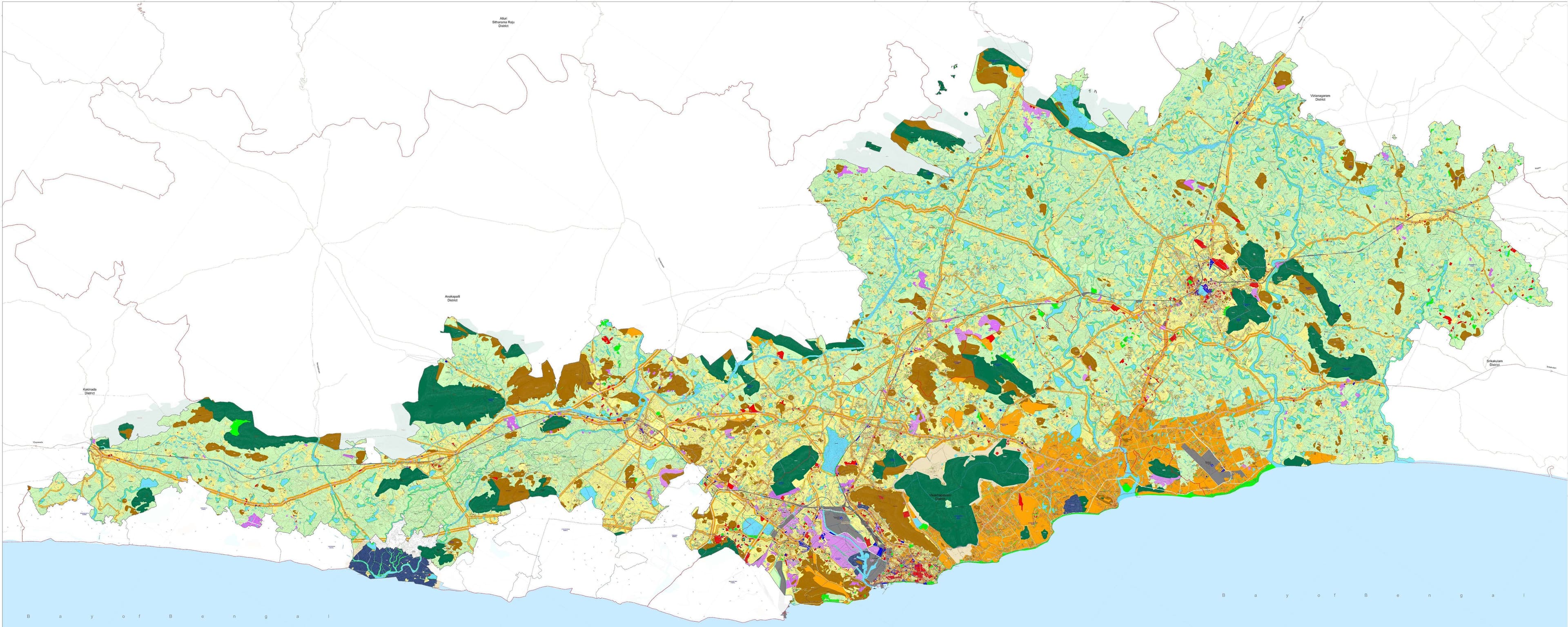
The Master Plan Sanctioned vide G.O. M.s. No. 136 MA & UD, Dt. 08-11-2021 is revised as per the Govt. Memo. no. 1455449/M2/2021 Dt. 16-01-2025
-
This Master Plan for VMR (2041) was prepared in conformity with the Perspective Plan for VMR (2051), as per the provisions of APMR&UDA
-
Land Use indicated in the plan is "Proposed Land Use" and does not confer any authorisation of land ownership.
-
Survey/Cadastral records along with boundary and corresponding survey numbers shown in the Master Plan are as per available revenue records. In case of any discrepancy, the records available with the Revenue department/
Urban Local Body/Concerned Authority shall be considered final for granting development permissions (Buildings/Layouts).
-
Waterbody buffers shall be applicable as per the provisions of "Andhra Pradesh Building Rules and AP Land Development (Layout) Rules" and their subsequent amendments.
-
In case of any discrepancy with regard to boundaries of water bodies (Rivers, Canals/Channels, Streams, Ponds/Tanks/Lakes/Kuntas), records available with the Revenue Department Irrigation Department/
Concerned Authority shall be considered as final.
-
In case of any discrepancy regarding boundaries of forest lands, sanctuaries, hills, records available with the Revenue/Forest Department/Concerned Authority shall be considered as final
-
Actual alignment of roads, rail, metro rail, metrolite, tram, and BRTS shall be as per the detailed design/final alignment of the same on the ground.
-
Existing roads shown in the plans are for indicative purpose only. Actual road alignment and its Right of Way (RoW) shall be reckoned based on the ground position and as per records at the time of granting development permissions.
-
Proposed road alignments shown outside the VMRDA boundary, if any, are indicative only.
-
Coastal Regulation Zone (CRZ) Regulations shall be applicable, as the case may be, and respective zones will be as per the notified/applicable Coastal Regulation Zone Management Plan (CRZMP).
-
Kambalakonda Eco-sensitive Zone is shown, as per A.P. Extraordinary Gazette Dt. 02-08-2017 and the Gazette of India Dt. 28-04-2017 of MoEF&CC.
-
The alignment of the Coastal Corridor is incorporated as received from NHAI on 16-04-2026 subject to further scrutiny and revision by NHAI(GOl) which can be appropriately amended.
-
This Plan should be read along with the "Zoning Regulations" document, which is the same as the 'Common Zoning Regulations, as per G.O. M.S. No. 216, dated 22.10.2025.